This page lists census-designated places (CDPs) in the U.S. state of Kentucky . As of 2022, there were a total of 135 census-designated places in Kentucky.
This page lists census-designated places (CDPs) in the U.S. state of Kentucky . As of 2022, there were a total of 135 census-designated places in Kentucky.
Laurel may refer to:

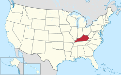
Jefferson County is located in the north central portion of the U.S. state of Kentucky. As of the 2020 census, the population was 782,969. It is the most populous county in the commonwealth.

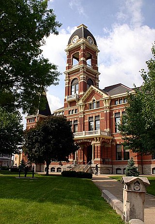
Fleming County is a county located in the U.S. state of Kentucky. As of the 2010 census, the population was 14,348. Its county seat is Flemingsburg. The county was formed in 1798 and named for Colonel John Fleming, an Indian fighter and early settler. It is a moist county. In 1998, the Kentucky General Assembly designated Fleming County as the Covered Bridge Capital of Kentucky.
Campbell County is a county located in the northern part of the U.S. state of Kentucky. As of the 2020 census, the population was 93,076. Its county seats are Alexandria and Newport. The county was formed on December 17, 1794, from sections of Scott, Harrison, and Mason Counties and was named for Colonel John Campbell (1735–1799), a Revolutionary War soldier and Kentucky legislator. Campbell County, with Boone and Kenton Counties, is part of the Northern Kentucky metro community, and the Cincinnati-Middletown, OH-KY-IN Metropolitan Statistical Area.
A census-designated place (CDP) is a concentration of population defined by the United States Census Bureau for statistical purposes only.

Oneida is an unincorporated community and census-designated place (CDP) in Clay County, Kentucky, United States. Its population was 410 at the 2010 census. It is the home of Oneida Baptist Institute. Goose Creek, the Red Bird River, and Bullskin Creek confluence to form the South Fork of the Kentucky River a few hundred yards from the center of the town.

This is a list of official neighborhoods in Louisville, Kentucky. Like many older American cities, Louisville has well-defined neighborhoods, many with well over a century of history as a neighborhood.

The Charleston Metropolitan Statistical Area, as defined by the United States Census Bureau, is an area consisting of three counties in West Virginia, anchored by the city of Charleston. It is the largest metropolitan area entirely within the state of West Virginia. While the Huntington Metro Area is more populous, it spans three states, and the core county of the Charleston area, Kanawha County, is more populous than the West Virginia portion of the Huntington area.
The following is a set–index article, providing a list of lists, for the cities, towns and villages within the jurisdictional United States. It is divided, alphabetically, according to the state, territory, or district name in which they are located.
Jeff is a census-designated place and coal town in Perry County, Kentucky, United States. Its population was 323 as of the 2010 census.
The Huntington–Ashland metropolitan area is a metropolitan area in the Appalachian Plateau region of the United States. Referred to locally as the “Tri-State area”, and colloquially as "Kyova", the region spans seven counties in the three states of West Virginia, Kentucky, and Ohio. With a population of 361,580, the Tri-State area is nestled along the banks of the Ohio River. The region offers a diverse range of outdoor activities.

The Knoxville metropolitan area, commonly known as Greater Knoxville, is a metropolitan statistical area centered on Knoxville, Tennessee, the third largest city in Tennessee and the largest city in East Tennessee. It is the third largest metropolitan area in Tennessee. In 2020, the metro area had a population of 879,773. The Knoxville–Morristown–Sevierville Combined Statistical Area had a population of 1,156,861 according to the census bureau in 2020.

Breaks is a small unincorporated community and census-designated place (CDP) mostly in Buchanan County, Virginia, United States. A small portion of the CDP is in Dickenson County. Breaks is located very close to the Kentucky border and is east of Breaks Interstate Park. Breaks gets its name in reference to the "break" in Pine Mountain, a mountain range that spans along the Kentucky-Virginia border and ends near the community of Breaks. It was first listed as a CDP in the 2020 census with a population of 144.
The Paducah, KY-IL Micropolitan Statistical Area, as defined by the United States Census Bureau, is an area consisting of five counties – three in the Jackson Purchase region of Kentucky, a fourth Kentucky county bordering the Purchase, and one in southern Illinois – anchored by the city of Paducah, Kentucky.
McDowell is an unincorporated community and census-designated place (CDP) in Floyd County, Kentucky, United States.
Ages is an unincorporated coal town and census-designated place (CDP) in Harlan County, Kentucky, United States.
Coxton is an unincorporated coal town and census-designated place (CDP) in Harlan County, Kentucky, United States. Their post office is closed. The community was listed as a CDP in 2014, so no population figures are available from the 2010 census.
Pleasant Ridge is an unincorporated community and census-designated place (CDP) in Daviess and Ohio counties, Kentucky, United States.