Louisville metropolitan area

Last updated

Louisville Metropolitan Area
Louisville Skyline 2021 (3).jpg
Louisville metropolitan area
Louisville/Jefferson County–Elizabethtown, KY–IN CSA
Country Flag of the United States.svg United States
States Flag of Kentucky.svg Kentucky
Flag of Indiana.svg Indiana
Principal city Louisville
Area
  Urban
477.2 sq mi (1,236 km2)
   MSA 4,135.4 sq mi (10,711 km2)
Population
 (2020)
   Urban
974,397 [1] (US: 48th)
  Urban density2,147.9/sq mi (829.3/km2)
  MSA
1,362,180 [2] (US: 43rd [lower-alpha 1] )
  CSA
1,512,133 [2] (US: 38th)
GDP
[3]
  MSA$90.836 billion (2022)
Time zone UTC−5 (EST)
  Summer (DST) UTC−4 (EDT)

The Louisville metropolitan area is the 43rd largest [lower-alpha 1] metropolitan statistical area (MSA) in the United States. It had a population of 1,395,855 in 2020 according to the latest official census, and its principal city is Louisville, Kentucky.

Contents

The metropolitan area was originally formed by the United States Census Bureau in 1950 and consisted of the Kentucky county of Jefferson and the Indiana counties of Clark and Floyd. As surrounding counties saw an increase in their population densities and the number of their residents employed within Jefferson County, they met Census criteria to be added to the MSA. Jefferson County, Kentucky, plus eleven outlying counties seven in Kentucky and four in Southern Indiana  are now a part of this MSA. Two other counties, one each in Kentucky and Indiana, were part of the MSA in the 2000 and 2010 U.S. Censuses, but were spun off by the Census Bureau into their own Micropolitan Statistical Areas (μSA) in 2013 and 2018 respectively.

The formal name given to the area by the Census Bureau is the Louisville/Jefferson County, Kentucky–Indiana, metropolitan statistical area, though it is regularly referred to as Kentuckiana. It is now the primary MSA of the Louisville/Jefferson County–Elizabethtown, KY-IN Combined Statistical Area, as defined by the United States Bureau of the Census in 2000 and recently redefined in 2018. The combined statistical area (CSA) adds the counties of Hardin County, Kentucky and LaRue County, Kentucky. [4] In 2020, the Census Bureau measured the combined statistical area's population at 1,601,309.

Before the 2023 definitions were released, the CSA had two additional micropolitan statistical areas, Bardstown, KY μSA and Scottsburg, IN μSA. In 2023, the Bardstown μSA was dissolved with Nelson County being added to the Louisville MSA and Scottsburg, IN μSA was dissolved, no longer considered a statistical area by the OMB. [4] In addition, Meade County, which was part of the Elizabethtown MSA, was detached and added to the Louisville MSA. Trimble County, on the northeastern edge of the Louisville MSA, was detached in 2023. [4]

Definitions

As of 2023, the U.S. Office of Management and Budget defines the Louisville–Jefferson County MSA as including Bullitt, Henry, Jefferson, Meade, Nelson, Oldham, and Shelby Counties in Kentucky and Clark, Floyd, Harrison, and Washington Counties in Indiana. The larger Louisville/Jefferson County–Elizabethtown CSA adds the Elizabethtown, Kentucky, MSA, consisting of Hardin and LaRue Counties.

Counties

Louisville–Jefferson County MSA

Elizabethtown–Fort Knox, Kentucky MSA

Municipalities

Principal city

In 2003, the Jefferson County government merged with that of its largest city and county seat, Louisville, forming a new entity, the Louisville–Jefferson County Metro Government (official long form) or Louisville Metro (official short form). All small cities within Jefferson County became part of the new Louisville Metro government while retaining their city governments. For statistical and ranking purposes, the United States Census Bureau uses the statistical entity Louisville–Jefferson County metro government (balance), Kentucky, to represent the portion of the consolidated city-county of Louisville–Jefferson County that does not include any of the 83 separate incorporated places (municipalities) located within the city and county.

Louisville Metro (771,158)
Louisville–Jefferson County (balance) (621,349)

Municipalities with more than 25,000 people

Municipalities with 10,000 to 25,000 people

Municipalities with less than 10,000 people

  • Anchorage*
  • Audubon Park*
  • Bancroft*
  • Barbourmeade*
  • Beechwood Village*
  • Bellemeade*
  • Bellewood*
  • Blue Ridge Manor*
  • Borden
  • Brandenburg
  • Briarwood*
  • Broeck Pointe*
  • Brownsboro Farm*
  • Brownsboro Village*
  • Cambridge*
  • Campbellsburg
  • Charlestown
  • Clarksville
  • Coldstream*
  • Corydon
  • Crandall
  • Creekside*
  • Crestwood
  • Crossgate*
  • Douglass Hills*
  • Druid Hills*
  • Ekron
  • Elizabeth
  • Eminence
  • Fincastle*
  • Forest Hills*
  • Fox Chase
  • Fredericksburg
  • Georgetown
  • Glenview Hills*
  • Glenview Manor*
  • Glenview*
  • Goose Creek*
  • Goshen
  • Graymoor-Devondale*
  • Green Spring*
  • Greenville
  • Hardinsburg
  • Hebron Estates
  • Heritage Creek*
  • Hickory Hill*
  • Hills and Dales*
  • Hillview
  • Hollow Creek*
  • Hollyvilla*
  • Houston Acres*
  • Hunters Hollow
  • Hurstbourne Acres*
  • Hurstbourne*
  • Indian Hills*
  • Kingsley*
  • La Grange
  • Laconia
  • Lanesville
  • Langdon Place*
  • Lebanon Junction
  • Lincolnshire*
  • Little York
  • Livonia
  • Lynnview*
  • Manor Creek*
  • Maryhill Estates*
  • Mauckport
  • Meadow Vale*
  • Meadowbrook Farm*
  • Meadowview Estates*
  • Middletown*
  • Milltown
  • Mockingbird Valley*
  • Moorland*
  • Muldraugh
  • Murray Hill*
  • New Amsterdam
  • New Castle
  • New Middletown
  • New Pekin
  • Norbourne Estates*
  • Northfield*
  • Norwood*
  • Old Brownsboro Place*
  • Orchard Grass Hills
  • Palmyra
  • Parkway Village*
  • Pewee Valley
  • Pioneer Village
  • Plantation*
  • Pleasureville
  • Poplar Hills*
  • Prospect*‡
  • Richlawn*
  • River Bluff
  • Riverwood*
  • Rolling Fields*
  • Rolling Hills*
  • Saltillo
  • Sellersburg
  • Seneca Gardens*
  • Simpsonville
  • Smithfield
  • South Park View*
  • Spring Mill*
  • Spring Valley*
  • St. Regis Park*
  • Strathmoor Manor*
  • Strathmoor Village*
  • Sycamore*
  • Taylorsville
  • Ten Broeck*
  • Thornhill*
  • Utica
  • Vine Grove
  • Watterson Park*
  • Wellington*
  • West Buechel*
  • West Point
  • Westwood*
  • Wildwood*
  • Windy Hills*
  • Woodland Hills*
  • Woodlawn Park*
  • Worthington Hills*

*Part of Louisville Metro
‡Prospect lies in both Jefferson and Oldham Counties. The portion within Jefferson County is part of Louisville Metro.

Historical statistics

Metropolitan statistical area

Geographic area 2020 Census 2010 Census 2000 Census 1990 Census 1980 Census 1970 Census 1960 Census 1950 Census
Louisville–Jefferson County, Kentucky–Indiana, MSA [m 1] 1,395,8551,307,6471,161,975962,851906,152826,553725,139576,900
Clark County, Indiana 121,093110,23296,47287,77788,83875,87662,79548,330
Floyd County, Indiana 80,48474,47870,82364,40461,16955,62251,39743,955
Harrison County, Indiana 39,65439,36434,32529,89027,276 [m 2] 20,423 [m 2] 19,207 [m 2] 17,858 [m 2]
Scott County, Indiana 24,384 [m 2] 24,181 [m 2] 22,96020,991 [m 2] 20,422 [m 2] 17,144 [m 2] 14,463 [m 2] 11,519 [m 2]
Washington County, Indiana 28,18228,26227,22323,717 [m 2] 21,932 [m 2] 19,278 [m 2] 17,819 [m 2] 16,520 [m 2]
Bullitt County, Kentucky 82,21774,31961,23647,56743,34626,090 [m 2] 15,726 [m 2] 11,349 [m 2]
Henry County, Kentucky 15,67815,41615,06012,823 [m 2] 12,740 [m 2] 10,910 [m 2] 10,987 [m 2] 11,394 [m 2]
Jefferson County, Kentucky 782,969741,096693,604664,937685,004695,055610,947484,615
Meade County, Kentucky 30,00328,60226,34924,170 [m 2] 22,854 [m 2] 17,796 [m 2] 18,898 [m 2] 9,422 [m 2]
Nelson County, Kentucky [m 3] 46,738 [m 2] 43,43737,47729,710 [m 2] 27,584 [m 2] 23,477 [m 2] 22,168 [m 2] 19,521 [m 2]
Oldham County, Kentucky 67,60760,31646,17843,45527,79514,687 [m 2] 13,388 [m 2] 11,018 [m 2]
Shelby County, Kentucky 49,02442,07433,33724,82423,328 [m 2] 18,999 [m 2] 18,493 [m 2] 17,912 [m 2]
Spencer County, Kentucky 19,35117,06111,7666,801 [m 2] 5,929 [m 2] 5,488 [m 2] 5,680 [m 2] 6,157 [m 2]
Trimble County, Kentucky 8,4718,8098,1256,090 [m 2] 6,253 [m 2] 5,349 [m 2] 5,102 [m 2] 5,148 [m 2]

Notes

  1. Named Louisville, KY-IN Standard Metropolitan Area (SMA) in 1950, Louisville, KY-IN Standard Metropolitan Statistical Area (SMSA) from 1960 to 1981, and Louisville, KY-IN Metropolitan Statistical Area (MSA) from 1983 to 2003.
  2. 1 2 3 4 5 6 7 8 9 10 11 12 13 14 15 16 17 18 19 20 21 22 23 24 25 26 27 28 29 30 31 32 33 34 35 36 37 38 39 40 41 42 43 44 45 46 47 48 49 50 51 52 County was not a part of Louisville, KY-IN MSA at the time of this Census and the county's population is not included in MSA total.
  3. County is no longer included in the MSA as of 2016.

Combined statistical area

Geographic Area 2020 Census 2010 Census 2000 Census 1990 Census
Louisville/Jefferson County–Elizabethtown–Madison, Kentucky–Indiana CSA [c 1] 1,601,3091,451,5641,292,4821,177,883 [c 2]
Louisville/Jefferson County, Kentucky–Indiana, MSA1,395,8551,307,6471,161,975952,662
Clark County, Indiana 121,093110,23296,47287,777
Floyd County, Indiana 80,48474,47870,82364,404
Harrison County, Indiana 39,65439,36434,32529,890
Washington County, Indiana 28,18228,26227,22323,717 [c 3]
Bullitt County, Kentucky 82,21774,31961,23647,567
Henry County, Kentucky 15,67815,41615,06012,823 [c 3]
Jefferson County, Kentucky 782,969741,096693,604664,937
Meade County, Kentucky 30,00328,60226,34924,170 [c 3]
Oldham County, Kentucky 67,60760,31646,17833,263
Shelby County, Kentucky 48,06542,07433,33724,824
Spencer County, Kentucky 19,49017,06111,7666,801 [c 3]
Trimble County, Kentucky 8,4748,8098,1256,090 [c 3]
Elizabethtown–Fort Knox, KY MSA [c 4] 125,569119,736107,547100,919 [c 2]
Hardin County, Kentucky 110,702105,54394,17489,240
LaRue County, Kentucky 14,86714,19313,37311,679
Bardstown, KY μSA46,73843,43737,47729,710 [c 3]
Nelson County, Kentucky 46,73843,437 [c 5] 37,477 [c 5] 29,710 [c 3]
Madison, IN μSA33,14732,45832,428 [c 2] 32,000 [c 2]
Jefferson County, Indiana 33,14732,45832,42832,000

Notes

  1. Named Louisville–Elizabethtown–Scottsburg, KY-IN CSA from 2000 to 2003, and Louisville/Jefferson County–Elizabethtown–Scottsburg, KY-IN CSA from 2003 to 2013.
  2. 1 2 3 4 Census defined area did not exist during this Census. Population totals are for counties included in 2000 Census MSA or CSA estimates. Population is shown for comparison purposes only and should not be used as a reference.
  3. 1 2 3 4 5 6 7 County was not a part of Louisville, KY-IN MSA at the time of this Census and the county's population is not included in MSA total.
  4. Named Elizabethtown, KY MSA from 2000 to 2013.
  5. 1 2 This county was part of the Louisville MSA in the 2000 and 2010 Censuses, but has since been spun off into its own statistical area. Its population is included in the MSA total for those censuses only.

See also

Notes

  1. 1 2 The United States MSA table excludes the San Juan, Puerto Rico MSA which has a higher population than Louisville.

Related Research Articles

<span class="mw-page-title-main">Jefferson County, Kentucky</span> County in Kentucky, United States

Jefferson County is located in the north central portion of the U.S. state of Kentucky. As of the 2020 census, the population was 782,969. It is the most populous county in the commonwealth.

<span class="mw-page-title-main">Scottsburg, Indiana</span> City in Indiana, United States

Scottsburg is a city within Vienna Township and the county seat of Scott County, in the U.S. state of Indiana, about 30 miles (48 km) north of Louisville, Kentucky. The population of Scottsburg was 7,345 at the 2020 census.

Combined statistical area (CSA) is a United States Office of Management and Budget (OMB) term for a combination of adjacent metropolitan (MSA) and micropolitan statistical areas (μSA) across the 50 U.S. states and the territory of Puerto Rico that can demonstrate economic or social linkage. CSAs were first designated in 2003. OMB defines a CSA by various combinations of adjacent metropolitan and micropolitan areas with economic ties measured by commuting patterns. CSAs retain their own designations as metropolitan or micropolitan statistical areas in their respective larger combined statistical areas.

<span class="mw-page-title-main">Geography of Louisville, Kentucky</span>

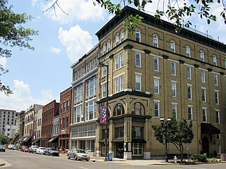
Louisville is a city in Jefferson County, in the U.S. state of Kentucky. It is located at the Falls of the Ohio River.

<span class="mw-page-title-main">Tallahassee metropolitan area</span> Metropolitan area in the United States

The Tallahassee Metropolitan Statistical area is the metropolitan area centered on Tallahassee, Florida.

<span class="mw-page-title-main">Lexington–Fayette–Richmond–Frankfort combined statistical area</span> Metropolitan Statistical Area in Kentucky, United States

The Lexington-Fayette–Richmond–Frankfort combined statistical area, created by the United States Bureau of the Census in 2020, is the 71st largest Combined Statistical Area (CSA) of the United States. It consists of the Lexington-Fayette Metropolitan Statistical Area (MSA) and the Micropolitan Statistical Areas of Frankfort, Kentucky, Mount Sterling, and Richmond-Berea.

The Charleston Metropolitan Statistical Area, as defined by the United States Census Bureau, is an area consisting of three counties in West Virginia, anchored by the city of Charleston. It is the largest metropolitan area entirely within the state of West Virginia. The Huntington Metro Area adds to the Charleston–Huntington, WV-OH-KY CSA and spans three states, while the core county of the Charleston area, Kanawha County, is more populous than the West Virginia portion of the Huntington area.

<span class="mw-page-title-main">Knoxville metropolitan area</span> Metropolitan area in Tennessee, United States

The Knoxville metropolitan area, commonly known as Greater Knoxville, is a metropolitan statistical area (MSA) centered on Knoxville, Tennessee, the third largest city in Tennessee and the largest city in East Tennessee. It is the third largest metropolitan area in Tennessee. In 2020, the Knoxville metro area had a population of 879,773, and a population of 903,300 including Grainger County. The Knoxville–Morristown–Sevierville Combined Statistical Area (CSA) had a population of 1,156,861 according to the census bureau in 2020.

<span class="mw-page-title-main">Bowling Green metropolitan area, Kentucky</span> Metropolitan Statistical Area in Kentucky, United States

The Bowling Green Metropolitan Statistical Area, as defined by the United States Census Bureau, is an area consisting of four counties in Kentucky, anchored by the city of Bowling Green. As of 2014, the MSA had an estimated population of 165,732.

<span class="mw-page-title-main">Paducah metropolitan area</span> Metropolitan Area in Western Kentucky

The Paducah, KY–IL Metropolitan Statistical Area, as defined by the United States Census Bureau, is an area consisting of five counties – three in the Jackson Purchase region of Kentucky, a fourth Kentucky county bordering the Purchase, and one in Southern Illinois – anchored by the city of Paducah, Kentucky. The Paducah KY-IL Micropolitan Statistical Area was upgraded to Metropolitan Statistical Area (MSA) status on July 21, 2023, by the Office of Management and Budget.. Carlisle County, Kentucky, was added to the area following the 2020 Census of the Population. The total MSA population from the 2020 United States Census was 103,486.

<span class="mw-page-title-main">Elizabethtown metropolitan area</span> Metropolitan Statistical Area in Kentucky, United States

The Elizabethtown–Fort Knox Metropolitan Statistical Area, as defined by the United States Census Bureau, is an area consisting of two counties in Kentucky, anchored by the city of Elizabethtown and the nearby Fort Knox Army post. As of the 2020 census, the MSA had a population of 155,572.

<span class="mw-page-title-main">Dothan–Enterprise–Ozark Combined Statistical Area</span> Combined Statistical Area in Alabama, United States

The Dothan–Enterprise–Ozark Combined Statistical Area was a CSA made up of five counties in the southeastern corner of the U.S. state of Alabama. The once statistical area includes one metropolitan area and originally one micropolitan area which then was split off as two. As of the 2010 census, the CSA had a population of 245,838. Currently an updated area called the Dothan-Ozark Combined Statistical area is used instead and Enterprise micropolitan area is now split as its own statistical area.

<span class="mw-page-title-main">South Bend–Mishawaka metropolitan area</span> Combined Statistical Area in the United States

The South Bend–Mishawaka Metropolitan Statistical Area, sometimes referred to as Michiana, as defined by the United States Census Bureau, is an area consisting of two counties – one in northern Indiana and one in southwest Michigan (Cass), anchored by the cities of South Bend and Mishawaka in Indiana. As of the 2010 census, the MSA had a population of 319,224.

<span class="mw-page-title-main">Reno metropolitan area, Nevada</span> Combined Statistical Area in the United States

The Reno–Sparks Metropolitan Statistical Area, as defined by the United States Census Bureau, is an area consisting of two counties in Western Nevada, anchored by the cities of Reno and Sparks. As of the 2020 census, the MSA had a population of 490,596.

<span class="mw-page-title-main">Lafayette metropolitan area, Indiana</span> Metropolitan Area in Indiana, United States

The Lafayette-West Lafayette, Indiana Metropolitan Statistical Area, as defined by the United States Census Bureau, is an area consisting of three counties in Indiana, anchored by the cities of Lafayette and West Lafayette. As of the July 1, 2021, the MSA had an estimated population of 224,709. Metro area population in 2021 is 237,130 and was 235,066 in 2020, a growth of 16% over 2010. In 2010, the Lafayette, Indiana, metro area population was 210,297.

The Kokomo Metropolitan Statistical Area, as defined by the United States Census Bureau, is an area consisting of Howard County in Indiana. Howard County had a population estimate of 83,831 in 2023. Kokomo is also the principal city of the area known as North Central Indiana, the area around Kokomo with economic ties. The six county area including Cass, Clinton, Fulton, Howard, Miami, and Tipton counties had population of 228,331 people in 2010.

<span class="mw-page-title-main">Corbin, Kentucky micropolitan area</span> Micropolitan area in Eastern Kentucky

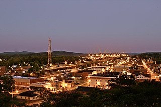
The Corbin, Kentucky Micropolitan Area Micropolitan Area (μSA) is made up of four counties in the Eastern Coalfield region of Kentucky. Before 2013, the area was officially known as the Corbin–London, KY Combined Statistical Area, and consisted of the Corbin Micropolitan Statistical Area and the London Micropolitan Statistical Area. The Corbin micropolitan area consisted of Whitley County, and the London micropolitan area consisted of Laurel County.

<span class="mw-page-title-main">Cincinnati metropolitan area</span> Metropolitan Statistical Area in the United States

The Cincinnati metropolitan area is a metropolitan area with its core in Ohio and Kentucky. Its largest city is Cincinnati and includes surrounding counties in the U.S. states of Ohio, Kentucky, and Indiana.

References

  1. "Urban and Rural: List of 2020 Census Urban Areas". United States Census Bureau . Retrieved September 30, 2023.
  2. 1 2 "2020 Population and Housing State Data". United States Census Bureau, Population Division. May 18, 2023. Archived from the original on June 29, 2022. Retrieved September 30, 2023.
  3. "Total Gross Domestic Product for Louisville/Jefferson County, KY-IN (MSA)". Federal Reserve Economic Data . Federal Reserve Bank of St. Louis.
  4. 1 2 3 "OMB Bulletin No. 23-01" (PDF). www.whitehouse.gov. July 21, 2023. pp. 59, 138. Retrieved April 1, 2024.

Further reading

38°13′44″N85°44′58″W / 38.22889°N 85.74944°W / 38.22889; -85.74944