
Kansas is a state located in the Midwestern United States that is divided into 105 counties and contains 44 census-designated places (CDPs). [1] All population data is based on the 2010 census.
Kansas is a state located in the Midwestern United States that is divided into 105 counties and contains 44 census-designated places (CDPs). [1] All population data is based on the 2010 census.


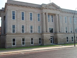
Wilson County is a county located in Southeast Kansas. Its county seat is Fredonia. As of the 2020 census, the county population was 8,624. The county was named after Hiero Wilson, a colonel in the American Civil War.

Rooks County is a county located in the U.S. state of Kansas. Its county seat is Stockton, and its largest city is Plainville. As of the 2020 census, the county population was 4,919. The county was named for John Rooks, a private in Company I of the 11th Kansas Cavalry Regiment, who died at the Battle of Prairie Grove during the American Civil War.

Phillips County is a county located in the U.S. state of Kansas. Its county seat and largest city is Phillipsburg. As of the 2020 census, the county population was 4,981. The county was named after William Phillips, a free-state abolition journalist and colonel in the American Civil War.

Nemaha County is a county located in the northeastern part of the U.S. state of Kansas. Its county seat is Seneca. As of the 2020 census, the county population was 10,273. The county was named for the Nemaha River.

Mitchell County is a county located in the U.S. state of Kansas. Its county seat and largest city is Beloit. As of the 2020 census, the county population was 5,796. The county was named for William Mitchell.

Linn County is a county in the U.S. state of Kansas, located in along the eastern edge of Kansas, and is part of the Kansas City metropolitan area. Its county seat is Mound City, and its most populous city is Pleasanton. As of the 2020 census, the county population was 9,591. The county was named for Lewis Linn, a U.S. Senator from Missouri.

Lane County is a county located in the U.S. state of Kansas. Its county seat is Dighton, the only incorporated city in the county. As of the 2020 census, the county population was 1,574, making it the third-least populous county in Kansas. The county was named after James Lane, a leader of the Jayhawker abolitionist movement and served as one of the first U.S. senators from Kansas.

Labette County is a county located in Southeast Kansas. Its county seat is Oswego, and its most populous city is Parsons. As of the 2020 census, the county population was 20,184. The county was named after LaBette creek, the second-largest creek in the county, which runs roughly NNW-SSE from near Parsons to Chetopa. The creek in turn was named after French-Canadian fur trapper Pierre LaBette who had moved to the area, living along the Neosho River, and marrying into the Osage tribe in the 1830s and 1840s.

Kingman County is a county located in the U.S. state of Kansas. Its county seat and largest city is Kingman. As of the 2020 census, the county population was 7,470. The county was named for Samuel Kingman, a chief justice of the Kansas Supreme Court during the 1860s and 1870s.
Greenwood County is a county located in the southeast portion of the U.S. state of Kansas. Its county seat and most populous city is Eureka. As of the 2020 census, the county population was 6,016. The county was named for Alfred Greenwood, a U.S. congressman from Arkansas that advocated Kansas statehood.

Geary County is a county located in the U.S. state of Kansas. Its county seat and most populous city is Junction City. As of the 2020 census, the county population was 36,739. The county is named in honor of John Geary, the first mayor of San Francisco, a governor of the Kansas Territory, and the 16th governor of Pennsylvania.
Ford County is a county located in the U.S. state of Kansas. Its county seat and most populous city is Dodge City. As of the 2020 census, its population was 34,287. The county was named in honor of James Ford, a brevet brigadier general during the American Civil War.

Finney County is a county located in the U.S. state of Kansas. Its county seat and most populous city is Garden City. As of the 2020 census, the county population was 38,470. The county was named for David Finney, the Lieutenant Governor of Kansas from 1881 and 1885. In 2020, 51.4 percent of the population in the county was Hispanic, one of a few counties in Kansas with a Hispanic majority population.

Cloud County is a county located in the U.S. state of Kansas. Its county seat and most populous city is Concordia. As of the 2020 census, the county population was 9,032. The county was named after William Cloud, an officer in the American Civil War.

Cherokee County is a U.S. county located in Southeast Kansas. Its county seat is Columbus, and its most populous city is Baxter Springs. As of the 2020 census, the county population was 19,362. The county was named for the Cherokee tribe.

Bourbon County is a county located in Southeast Kansas. Its county seat and most populous city is Fort Scott. As of the 2020 census, the county population was 14,360. The county was named after Bourbon County, Kentucky, the former home of many early settlers.

Anderson County is a county located in East Central Kansas, in the Central United States. Its county seat and most populous city is Garnett. As of the 2020 census, the county population was 7,836. The county was named for Joseph C. Anderson, a Kansas territorial legislator and border ruffian during the "Bleeding Kansas" era.