Scott County, Kansas

Last updated

Scott County
Battle Canyon (Scott Co KS) monument 2.JPG
Map of Kansas highlighting Scott County.svg
Location within the U.S. state of Kansas
Kansas in United States.svg
Kansas's location within the U.S.
Coordinates: 38°28′00″N100°54′00″W / 38.4667°N 100.9°W / 38.4667; -100.9
CountryFlag of the United States.svg United States
StateFlag of Kansas.svg  Kansas
FoundedMarch 20, 1873
Named for Winfield Scott [1]
Seat Scott City
Largest cityScott City
Area
  Total718 sq mi (1,860 km2)
  Land718 sq mi (1,860 km2)
  Water0.1 sq mi (0.3 km2)  0.02%
Population
 (2020) [2]
  Total5,151
  Density7.2/sq mi (2.8/km2)
Time zone UTC−6 (Central)
  Summer (DST) UTC−5 (CDT)
Congressional district 1st
Website County Website

Scott County is a county located in the U.S. state of Kansas. Its county seat is Scott City, [3] the only incorporated city in the county. As of the 2020 census, the county population was 5,151. [2] The county was named after Winfield Scott, a general in the United States Army from 1814 to 1861.

Contents

History

Early history

For many millennia, the Great Plains of North America was inhabited by nomadic Native Americans. From the 16th century to 18th century, the Kingdom of France claimed ownership of large parts of North America. In 1762, after the French and Indian War, France secretly ceded New France to Spain, per the Treaty of Fontainebleau.

19th century

In 1802, Spain returned most of the land to France, but keeping title to about 7,500 square miles. In 1803, most of the land for modern day Kansas was acquired by the United States from France as part of the 828,000 square mile Louisiana Purchase for 2.83 cents per acre.

In 1854, the Kansas Territory was organized, then in 1861 Kansas became the 34th U.S. state. In 1873, Scott County was established.

Geography

According to the U.S. Census Bureau, the county has a total area of 718 square miles (1,860 km2), of which 718 square miles (1,860 km2) is land and 0.1 square miles (0.26 km2) (0.02%) is water. [4]

Adjacent counties

Demographics

Population pyramid based on 2000 census age data USA Scott County, Kansas age pyramid.svg
Population pyramid based on 2000 census age data
Historical population
CensusPop.Note
1880 43
1890 1,2622,834.9%
1900 1,098−13.0%
1910 3,047177.5%
1920 3,1212.4%
1930 3,97627.4%
1940 3,773−5.1%
1950 4,92130.4%
1960 5,2286.2%
1970 5,6067.2%
1980 5,7823.1%
1990 5,289−8.5%
2000 5,120−3.2%
2010 4,936−3.6%
2020 5,1514.4%
2023 (est.)4,922 [5] −4.4%
U.S. Decennial Census [6]
1790-1960 [7] 1900-1990 [8]
1990-2000 [9] 2010-2020 [2]

As of the census [10] of 2000, there were 5,120 people, 2,045 households, and 1,435 families residing in the county. The population density was 7 people per square mile (2.7 people/km2). There were 2,291 housing units at an average density of 3 per square mile (1.2/km2). The racial makeup of the county was 95.47% White, 0.10% Black or African American, 0.55% Native American, 0.12% Asian, 2.75% from other races, and 1.02% from two or more races. 6.31% of the population were Hispanic or Latino of any race.

There were 2,045 households, out of which 33.30% had children under the age of 18 living with them, 61.00% were married couples living together, 6.70% had a female householder with no husband present, and 29.80% were non-families. 27.30% of all households were made up of individuals, and 13.60% had someone living alone who was 65 years of age or older. The average household size was 2.46 and the average family size was 3.01.

In the county, the population was spread out, with 27.10% under the age of 18, 6.60% from 18 to 24, 25.30% from 25 to 44, 24.40% from 45 to 64, and 16.50% who were 65 years of age or older. The median age was 39 years. For every 100 females there were 97.10 males. For every 100 females age 18 and over, there were 94.40 males.

The median income for a household in the county was $40,534, and the median income for a family was $50,549. Males had a median income of $32,166 versus $20,221 for females. The per capita income for the county was $20,443. About 2.10% of families and 5.10% of the population were below the poverty line, including 6.00% of those under age 18 and 8.10% of those age 65 or over.

Government

Presidential elections

Prior to 1940, Scott County was a swing county, voting for the national winner in every presidential election from 1904 to 1936. From 1940 on, it has become one of the most Republican counties in the entire nation, with Barry Goldwater in 1964 being the lone Republican candidate since then to be held to single-digit margin of victory in the county. In addition, each of the last six presidential elections have resulted in the Republican candidate winning over 70 percent of the county's vote & the Democratic candidate being held under 20 percent.

Presidential election results
United States presidential election results for Scott County, Kansas [11]
Year Republican Democratic Third party
No.%No.%No.%
2020 2,01485.56%29912.70%411.74%
2016 1,86584.70%23610.72%1014.59%
2012 1,72884.21%27713.50%472.29%
2008 1,82383.66%32114.73%351.61%
2004 1,92483.69%34715.09%281.22%
2000 1,81178.64%41818.15%743.21%
1996 1,75073.41%45819.21%1767.38%
1992 1,42656.27%48018.94%62824.78%
1988 1,59066.95%71730.19%682.86%
1984 2,01781.13%42717.18%421.69%
1980 1,82975.64%45618.86%1335.50%
1976 1,19554.74%91942.10%693.16%
1972 1,54774.30%44921.57%864.13%
1968 1,37466.25%50024.11%2009.64%
1964 1,14352.50%1,01646.67%180.83%
1960 1,51471.28%59828.15%120.56%
1956 1,37675.11%45124.62%50.27%
1952 1,68178.33%44320.64%221.03%
1948 1,04056.86%73940.40%502.73%
1944 90360.93%56538.12%140.94%
1940 98857.24%71741.54%211.22%
1936 62536.25%1,09663.57%30.17%
1932 59534.04%1,09262.47%613.49%
1928 88665.78%45033.41%110.82%
1924 73450.87%44530.84%26418.30%
1920 63658.51%37934.87%726.62%
1916 41633.15%68454.50%15512.35%
1912 569.24%24740.76%30350.00%
1908 32447.09%29442.73%7010.17%
1904 27562.64%7918.00%8519.36%
1900 12844.14%15954.83%31.03%
1896 9135.97%16163.64%10.40%
1892 14245.95%00.00%16754.05%
1888 29454.65%18233.83%6211.52%

Laws

Although the Kansas Constitution was amended in 1986 to allow the sale of alcoholic liquor by the individual drink with the approval of voters, Scott County has remained a prohibition, or "dry", county, [12] with 3.2% cereal-malt beverages available in grocery stores.

Education

Unified school districts

Library

The Scott County Public Library is located at 110 West 8th in Scott City. The Scott County Library was the first free county public library in the state of Kansas. It was started in September 1923 with the five members of the library committee each checking out a book for herself and one for her husband thus the library checked out ten books on the first day that it was open. Two rooms on the second floor of the Cretcher Lumber Company office building were made available for the library. L. W. Cretcher, owner of the lumber yard, gave the library a boost by painting the rooms, furnishing a stove, shelves, cupboards, lights, and free rent. In November 1924 a proposal was placed on the ballot for the library to be a county funded entity. A room was set aside in the basement of the newly built courthouse for the library, which at that time possessed 861 books. The library in the courthouse was opened to the public in July 1925. The library remained in the basement of the Scott County Courthouse until a separate library building was constructed at 110 West 8th Street in 1964. This building was 4,150 square feet (386 m2) with a 660-square-foot (61 m2) meeting room available to the public. In 2004, the Scott County Library Board began a fundraising effort for a Library Building expansion of 7,350 feet (2,240 m). The Library expansion and remodel to 12,160 square feet (1,130 m2) was completed in May 2009. [13]

Communities

2005 map of Scott County (map legend) Map of Scott Co, Ks, USA.png
2005 map of Scott County (map legend)

List of townships / incorporated cities / unincorporated communities / extinct former communities within Scott County. [14]
† means a community is designated a Census-Designated Place (CDP) by the United States Census Bureau.

Cities

Unincorporated communities

Townships

Scott County is divided into seven townships. Scott City is considered governmentally independent and is excluded from the census figures for the townships. In the following table, the population center is the largest city (or cities) included in that township's population total, if it is of a significant size.

Sources: 2000 U.S. Gazetteer from the U.S. Census Bureau.
Township FIPS Population
center
PopulationPopulation
density
/km2 (/sq mi)
Land area
km2 (sq mi)
Water area
km2 (sq mi)
Water %Geographic coordinates
Beaver051753021 (3)309 (119)0 (0)0.10% 38°37′11″N100°59′58″W / 38.61972°N 100.99944°W / 38.61972; -100.99944
Isbel345751101 (1)206 (80)0 (0)0% 38°28′52″N101°2′52″W / 38.48111°N 101.04778°W / 38.48111; -101.04778
Keystone366001061 (1)206 (80)0 (0)0% 38°30′17″N100°45′4″W / 38.50472°N 100.75111°W / 38.50472; -100.75111
Lake37850950 (1)311 (120)0 (0)0% 38°20′23″N100°49′39″W / 38.33972°N 100.82750°W / 38.33972; -100.82750
Michigan46175880 (1)308 (119)0 (0)0% 38°36′23″N100°48′23″W / 38.60639°N 100.80639°W / 38.60639; -100.80639
Scott635753092 (4)202 (78)0 (0)0% 38°29′31″N100°55′0″W / 38.49194°N 100.91667°W / 38.49194; -100.91667
Valley731252551 (2)311 (120)0 (0)0% 38°21′6″N100°58′13″W / 38.35167°N 100.97028°W / 38.35167; -100.97028

See also

Community information for Kansas

Related Research Articles

<span class="mw-page-title-main">Wichita County, Kansas</span> County in Kansas, United States

Wichita County is a county located in the U.S. state of Kansas. Its county seat is Leoti. As of the 2020 census, the county population was 2,152. The county was named after the Wichita tribe.

<span class="mw-page-title-main">Trego County, Kansas</span> County in Kansas, United States

Trego County is a county located in the U.S. state of Kansas. Its county seat and largest city is WaKeeney. As of the 2020 census, the county population was 2,808. The county was named for Edgar Trego.

<span class="mw-page-title-main">Sheridan County, Kansas</span> County in Kansas, United States

Sheridan County is a county located in the U.S. state of Kansas. Its county seat is Hoxie. As of the 2020 census, the county population was 2,447. The county was named in honor of Phillip Sheridan, a general during the American Civil War.

<span class="mw-page-title-main">Rush County, Kansas</span> County in Kansas, United States

Rush County is a county located in the U.S. state of Kansas. Its county seat and largest city is La Crosse. As of the 2020 census, the county population was 2,956. The county was named for Alexander Rush.

<span class="mw-page-title-main">Rawlins County, Kansas</span> County in Kansas, United States

Rawlins County is a county located in the U.S. state of Kansas. Its county seat and largest city is Atwood. As of the 2020 census, the county population was 2,561. It was named after John Rawlins, a general in the American Civil War.

<span class="mw-page-title-main">Pottawatomie County, Kansas</span> County in Kansas, United States

Pottawatomie County is a county located in the U.S. state of Kansas. Its county seat is Westmoreland. As of the 2020 census, the county population was 25,348. The county was named for the Potawatomi tribe.

<span class="mw-page-title-main">Ottawa County, Kansas</span> County in Kansas, United States

Ottawa County is a county located in the U.S. state of Kansas. Its county seat and largest city is Minneapolis. As of the 2020 census, the county population was 5,735. The county was named after the Odawa tribe.

<span class="mw-page-title-main">Ness County, Kansas</span> County in Kansas, United States

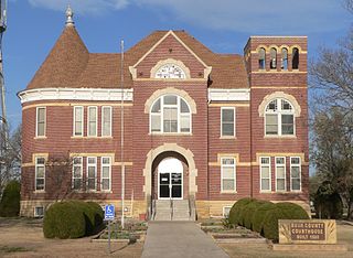
Ness County is a county located in the U.S. state of Kansas. Its county seat and largest city is Ness City. As of the 2020 census, the county population was 2,687. The county was named for Noah Ness, a corporal of the 7th Kansas Cavalry.

<span class="mw-page-title-main">Nemaha County, Kansas</span> County in Kansas, United States

Nemaha County is a county located in the northeastern part of the U.S. state of Kansas. Its county seat is Seneca. As of the 2020 census, the county population was 10,273. The county was named for the Nemaha River.

<span class="mw-page-title-main">Mitchell County, Kansas</span> County in Kansas, United States

Mitchell County is a county located in the U.S. state of Kansas. Its county seat and largest city is Beloit. As of the 2020 census, the county population was 5,796. The county was named for William Mitchell.

<span class="mw-page-title-main">Lincoln County, Kansas</span> County in Kansas, United States

Lincoln County is a county located in the U.S. state of Kansas. Its county seat and largest city is Lincoln Center. As of the 2020 census, the county population was 2,939. The county was named after Abraham Lincoln, the 16th president of the United States.

<span class="mw-page-title-main">Lane County, Kansas</span> County in Kansas, United States

Lane County is a county located in the U.S. state of Kansas. Its county seat is Dighton, the only incorporated city in the county. As of the 2020 census, the county population was 1,574, making it the third-least populous county in Kansas. The county was named after James Lane, a leader of the Jayhawker abolitionist movement and served as one of the first U.S. senators from Kansas.

<span class="mw-page-title-main">Jewell County, Kansas</span> County in Kansas, United States

Jewell County is a county located in the U.S. state of Kansas. Its county seat and most populous city is Mankato. As of the 2020 census, the county population was 2,932. The county was named for Lewis Jewell, a lieutenant colonel of the 6th Regiment Kansas Volunteer Cavalry.

<span class="mw-page-title-main">Hodgeman County, Kansas</span> County in Kansas, United States

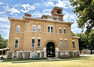
Hodgeman County is a county located in the U.S. state of Kansas. Its county seat and most populous city is Jetmore. As of the 2020 census, the county population was 1,723. It was named for Amos Hodgman, a member of the 7th Regiment Kansas Volunteer Cavalry.

<span class="mw-page-title-main">Gray County, Kansas</span> County in Kansas, United States

Gray County is a county located in the U.S. state of Kansas. Its county seat and most populous city is Cimarron. As of the 2020 census, the county population was 5,653. The county was named after Alfred Gray, a 19th century Kansas politician.

<span class="mw-page-title-main">Grant County, Kansas</span> County in Kansas, United States

Grant County is a county located in the U.S. state of Kansas. Its county seat and only city is Ulysses. As of the 2020 census, the county population was 7,352. Both the county and its seat are named after Ulysses Grant, the 18th President of the United States.

<span class="mw-page-title-main">Finney County, Kansas</span> County in Kansas, United States

Finney County is a county located in the U.S. state of Kansas. Its county seat and most populous city is Garden City. As of the 2020 census, the county population was 38,470. The county was named for David Finney, the Lieutenant Governor of Kansas from 1881 and 1885. In 2020, 51.4 percent of the population in the county was Hispanic, one of a few counties in Kansas with a Hispanic majority population.

<span class="mw-page-title-main">Elk County, Kansas</span> County in Kansas, United States

Elk County is a county located in the U.S. state of Kansas. Its county seat and most populous city is Howard. As of the 2020 census, the county population was 2,483. The county was named for the Elk River.

<span class="mw-page-title-main">Comanche County, Kansas</span> County in Kansas, United States

Comanche County is a county located in the U.S. state of Kansas. Its county seat and most populous city is Coldwater. As of the 2020 census, the county population was 1,689. The county was named after the Comanche tribe.

<span class="mw-page-title-main">Anderson County, Kansas</span> County in Kansas, United States

Anderson County is a county located in East Central Kansas, in the Central United States. Its county seat and most populous city is Garnett. As of the 2020 census, the county population was 7,836. The county was named for Joseph C. Anderson, a Kansas territorial legislator and border ruffian during the "Bleeding Kansas" era.

References

  1. "Welcome to the Scott County website". Scott County, Kansas. Retrieved November 4, 2012.
  2. 1 2 3 "QuickFacts; Scott County, Kansas; Population, Census, 2020 & 2010". United States Census Bureau. Archived from the original on August 19, 2021. Retrieved August 19, 2021.
  3. "Find a County". National Association of Counties. Retrieved June 7, 2011.
  4. "US Gazetteer files: 2010, 2000, and 1990". United States Census Bureau. February 12, 2011. Retrieved April 23, 2011.
  5. "Annual Estimates of the Resident Population for Counties: April 1, 2020 to July 1, 2023". United States Census Bureau. Retrieved April 3, 2024.
  6. "U.S. Decennial Census". United States Census Bureau. Retrieved July 29, 2014.
  7. "Historical Census Browser". University of Virginia Library. Retrieved July 29, 2014.
  8. "Population of Counties by Decennial Census: 1900 to 1990". United States Census Bureau. Retrieved July 29, 2014.
  9. "Census 2000 PHC-T-4. Ranking Tables for Counties: 1990 and 2000" (PDF). United States Census Bureau. Archived (PDF) from the original on March 27, 2010. Retrieved July 29, 2014.
  10. "U.S. Census website". United States Census Bureau . Retrieved January 31, 2008.
  11. "Dave Leip's Atlas of U.S. Presidential Elections".
  12. "Map of Wet and Dry Counties". Alcoholic Beverage Control, Kansas Department of Revenue. November 2004. Archived from the original on October 8, 2007. Retrieved January 21, 2007.
  13. History of Early Scott County, Scott County Historical Society, 1977. pp. 306-307.
  14. 1 2 "General Highway Map of Scott County, Kansas" (PDF). Kansas Department of Transportation (KDOT). November 2009. Archived (PDF) from the original on July 27, 2023.
Notes

    Further reading

    County
    Other
    Maps

    38°28′N100°54′W / 38.467°N 100.900°W / 38.467; -100.900