Jefferson County, Kansas

Last updated

Jefferson County
Jefferson county courthouse kansas.jpg
Jefferson County Courthouse in Oskaloosa (1971)
Map of Kansas highlighting Jefferson County.svg
Location within the U.S. state of Kansas
Kansas in United States.svg
Kansas's location within the U.S.
Coordinates: 39°13′N95°24′W / 39.217°N 95.400°W / 39.217; -95.400
CountryFlag of the United States.svg United States
StateFlag of Kansas.svg  Kansas
FoundedAugust 25, 1855
Named for Thomas Jefferson
Seat Oskaloosa
Largest city Valley Falls
Area
  Total557 sq mi (1,440 km2)
  Land533 sq mi (1,380 km2)
  Water24 sq mi (60 km2)  4.3%
Population
 (2020) [1]
  Total18,368
  Estimate 
(2021) [2]
18,411
  Density34.5/sq mi (13.3/km2)
Time zone UTC−6 (Central)
  Summer (DST) UTC−5 (CDT)
Congressional district 1st
Website jfcountyks.com

Jefferson County is a county located in the U.S. state of Kansas. Its county seat and most populous city is Oskaloosa. [3] As of the 2020 census, the county population was 18,368. [1] The county was named after Thomas Jefferson, the 3rd president of the United States.

Contents

History

Early history

For many millennia, the Great Plains of North America was inhabited by nomadic Native Americans. From the 16th century to 18th century, the Kingdom of France claimed ownership of large parts of North America. In 1762, after the French and Indian War, France secretly ceded New France to Spain, per the Treaty of Fontainebleau.

19th century

In 1802, Spain returned most of the land to France, but keeping title to about 7,500 square miles. In 1803, most of the land for modern day Kansas was acquired by the United States from France as part of the 828,000 square mile Louisiana Purchase for 2.83 cents per acre.

In 1854, the Kansas Territory was organized, then in 1861 Kansas became the 34th U.S. state. In 1855, Jefferson County was established, and was named for President Thomas Jefferson. [4] Settlement of the county was slowed by events prior to and during the Civil War, but the present day unincorporated community of Thompsonville (3 miles northwest of Perry on the Delaware River) was the first established in 1851 by Mormon settlers who initially refused to accompany the main group led by Brigham Young to the Salt Lake Valley. The settlement was first abandoned due to the violence resulting from the border wars, but was re-established when the Civil War ended.[ citation needed ]

Geography

According to the U.S. Census Bureau, the county has a total area of 557 square miles (1,440 km2), of which 533 square miles (1,380 km2) is land and 2.4 square miles (6.2 km2) (4.3%) is water. [5]

Adjacent counties

Demographics

Population pyramid based on 2000 census age data USA Jefferson County, Kansas age pyramid.svg
Population pyramid based on 2000 census age data
Historical population
CensusPop.Note
1860 4,459
1870 12,526180.9%
1880 15,56324.2%
1890 16,6206.8%
1900 17,5335.5%
1910 15,826−9.7%
1920 14,750−6.8%
1930 14,129−4.2%
1940 12,718−10.0%
1950 11,084−12.8%
1960 11,2521.5%
1970 11,9456.2%
1980 15,20727.3%
1990 15,9054.6%
2000 18,42615.9%
2010 19,1263.8%
2020 18,368−4.0%
2023 (est.)18,327 [6] −0.2%
U.S. Decennial Census [7]
1790-1960 [8] 1900-1990 [9]
1990-2000 [10] 2010-2020 [1]

Jefferson County is included in the Topeka, KS Metropolitan Statistical Area.

At the 2000 Census, there were 18,426 people, 6,830 households and 5,190 families residing in the county. The population density was 34 inhabitants per square mile (13/km2). There were 7,491 housing units at an average density of 14 per square mile (5.4/km2). The racial makeup of the county was 96.70% White, 0.92% Native American, 0.37% Black or African American, 0.17% Asian, 0.01% Pacific Islander, 0.42% from other races, and 1.41% from two or more races. Hispanic or Latino of any race were 1.28% of the population.

There were 6,830 households, of which 35.70% had children under the age of 18 living with them, 65.20% were married couples living together, 7.00% had a female householder with no husband present, and 24.00% were non-families. 20.10% of all households were made up of individuals, and 9.30% had someone living alone who was 65 years of age or older. The average household size was 2.66 and the average family size was 3.07.

27.40% of the population were under the age of 18, 7.00% from 18 to 24, 28.00% from 25 to 44, 24.90% from 45 to 64, and 12.80% who were 65 years of age or older. The median age was 38 years. For every 100 females, there were 102.60 males. For every 100 females age 18 and over, there were 98.90 males.

The median household income was $45,535 and the median family income was $50,557. Males had a median income of $36,174 compared with $25,468 for females. The per capita income for the county was $19,373. About 5.30% of families and 6.70% of the population were below the poverty line, including 6.90% of those under age 18 and 7.70% of those age 65 or over.

Government

Presidential elections

Presidential election results
United States presidential election results for Jefferson County, Kansas [11]
Year Republican Democratic Third party
No.%No.%No.%
2020 6,33464.75%3,19432.65%2542.60%
2016 5,21361.77%2,51829.83%7098.40%
2012 4,82760.24%2,97737.15%2092.61%
2008 5,22058.32%3,54239.58%1882.10%
2004 5,40861.50%3,25337.00%1321.50%
2000 4,42356.15%3,00038.09%4545.76%
1996 3,78149.31%2,75735.95%1,13014.74%
1992 2,56933.02%2,53832.62%2,67334.36%
1988 3,60555.53%2,81043.28%771.19%
1984 4,52468.93%1,99030.32%490.75%
1980 4,04664.60%1,77628.36%4417.04%
1976 3,22555.12%2,47042.22%1562.67%
1972 3,67972.69%1,23724.44%1452.87%
1968 2,78156.58%1,35527.57%77915.85%
1964 2,38053.07%2,06646.06%390.87%
1960 3,35365.73%1,73934.09%90.18%
1956 3,67770.24%1,53629.34%220.42%
1952 3,98073.47%1,41126.05%260.48%
1948 2,98659.04%2,01039.74%621.23%
1944 3,50468.73%1,57530.89%190.37%
1940 4,33065.81%2,21233.62%380.58%
1936 3,71154.25%3,10545.39%250.37%
1932 2,97447.42%3,18550.79%1121.79%
1928 4,81074.77%1,60124.89%220.34%
1924 4,42272.71%1,32021.70%3405.59%
1920 3,46368.86%1,53530.52%310.62%
1916 3,17450.49%2,91946.44%1933.07%
1912 1,15529.75%1,53739.59%1,19030.65%
1908 2,27055.57%1,72042.11%952.33%
1904 2,56865.26%1,19930.47%1684.27%
1900 2,37454.66%1,91244.02%571.31%
1896 2,32249.99%2,27649.00%471.01%
1892 2,02649.95%00.00%2,03050.05%
1888 2,26857.00%1,60140.24%1102.76%

Like all of Kansas outside the eastern cities, Jefferson County is a Republican stronghold, having not been won by a Democrat since Franklin D. Roosevelt’s 1932 landslide – although it was one of three Kansas counties to give a plurality to Ross Perot in 1992.

Laws

Jefferson County was a prohibition, or "dry", county until the Kansas Constitution was amended in 1986 and voters approved the sale of alcoholic liquor by the individual drink with a 30% food sales requirement. [12]

The county voted "No" on the 2022 Kansas Value Them Both Amendment, an anti-abortion ballot measure, by 55% to 45% despite backing Donald Trump with 65% of the vote to Joe Biden's 33% in the 2020 presidential election. [13]

Media

Jefferson County has two newspapers which are still in operation, The Oskaloosa Independent and The Valley Falls Vindicator. Both of which are owned by Davis Publications. [14] Together, the two papers cover the happenings of Jefferson County and its townships. The editor for both papers is Holly Allen.

Education

Unified school districts

Communities

2005 KDOT Map of Jefferson County (map legend) Map of Jefferson Co, Ks, USA.png
2005 KDOT Map of Jefferson County (map legend)

† means a community is designated a Census-Designated Place (CDP) by the United States Census Bureau.

Cities

Unincorporated communities

Townships

Jefferson County is divided into twelve townships. None of the cities within the county are considered governmentally independent, and all figures for the townships include those of the cities. In the following table, the population center is the largest city (or cities) included in that township's population total, if it is of a significant size.

Township FIPS Population
center
PopulationPopulation
density
/km2 (/sq mi)
Land area
km2 (sq mi)
Water area
km2 (sq mi)
Water %Geographic coordinates
Delaware 17425 Valley Falls 2,0349 (23)229 (88)0 (0)0.11% 39°21′6″N95°28′31″W / 39.35167°N 95.47528°W / 39.35167; -95.47528
Fairview 22525Rural Ozawkie1,51022 (56)70 (27)20 (8)22.20% 39°10′49″N95°26′50″W / 39.18028°N 95.44722°W / 39.18028; -95.44722
Jefferson 35250 Winchester 1,2408 (21)151 (58)0 (0)0.24% 39°19′37″N95°16′11″W / 39.32694°N 95.26972°W / 39.32694; -95.26972
Kaw 36125 Grantville 1,40916 (43)86 (33)2 (1)1.78% 39°5′41″N95°32′55″W / 39.09472°N 95.54861°W / 39.09472; -95.54861
Kentucky 36575 Perry 1,57617 (44)93 (36)14 (5)13.18% 39°5′18″N95°24′42″W / 39.08833°N 95.41167°W / 39.08833; -95.41167
Norton 51475 Nortonville 9559 (25)101 (39)0 (0)0.30% 39°24′13″N95°18′47″W / 39.40361°N 95.31306°W / 39.40361; -95.31306
Oskaloosa 53400 Oskaloosa 2,14214 (37)149 (58)0 (0)0.17% 39°13′12″N95°18′58″W / 39.22000°N 95.31611°W / 39.22000; -95.31611
Ozawkie 53950 Ozawkie 1,40815 (38)97 (37)14 (5)12.74% 39°14′32″N95°26′3″W / 39.24222°N 95.43417°W / 39.24222; -95.43417
Rock Creek 60575 Meriden 2,71819 (50)140 (54)1 (1)0.92% 39°12′52″N95°32′58″W / 39.21444°N 95.54944°W / 39.21444; -95.54944
Rural 61700 Williamstown 80410 (25)82 (32)1 (0)1.14% 39°4′31″N95°18′52″W / 39.07528°N 95.31444°W / 39.07528; -95.31444
Sarcoxie 63100Rural Lawrence95812 (31)80 (31)0 (0)0.45% 39°5′13″N95°14′50″W / 39.08694°N 95.24722°W / 39.08694; -95.24722
Union 72150 McLouth 1,67215 (39)111 (43)0 (0)0.30% 39°12′41″N95°12′26″W / 39.21139°N 95.20722°W / 39.21139; -95.20722
Sources: "Census 2000 U.S. Gazetteer Files". U.S. Census Bureau, Geography Division. Archived from the original on August 2, 2002.

Notable people

See also

Community information for Kansas

Related Research Articles

<span class="mw-page-title-main">Montgomery County, Kansas</span> County in Kansas, United States

Montgomery County is a county located in Southeast Kansas. Its county seat is Independence, and its most populous city is Coffeyville. As of the 2020 census, the county population was 31,486. The county was named after Richard Montgomery, a major general during the American Revolutionary War.

<span class="mw-page-title-main">Wilson County, Kansas</span> County in Kansas, United States

Wilson County is a county located in Southeast Kansas. Its county seat is Fredonia. As of the 2020 census, the county population was 8,624. The county was named after Hiero Wilson, a colonel in the American Civil War.

<span class="mw-page-title-main">Washington County, Kansas</span> County in Kansas, United States

Washington County is a county located in the U.S. state of Kansas. Its county seat and largest city is Washington. As of the 2020 census, the county population was 5,530. The county was named for George Washington, the 1st president of the United States.

<span class="mw-page-title-main">Thomas County, Kansas</span> County in Kansas, United States

Thomas County is a county located in the U.S. state of Kansas. Its county seat is Colby. As of the 2020 census, the county population was 7,930. The county was named after George Thomas, a general during the American Civil War.

<span class="mw-page-title-main">Pottawatomie County, Kansas</span> County in Kansas, United States

Pottawatomie County is a county located in the U.S. state of Kansas. Its county seat is Westmoreland. As of the 2020 census, the county population was 25,348. The county was named for the Potawatomi tribe.

<span class="mw-page-title-main">Phillips County, Kansas</span> County in Kansas, United States

Phillips County is a county located in the U.S. state of Kansas. Its county seat and largest city is Phillipsburg. As of the 2020 census, the county population was 4,981. The county was named after William Phillips, a free-state abolition journalist and colonel in the American Civil War.

<span class="mw-page-title-main">Osage County, Kansas</span> County in Kansas, United States

Osage County is a county located in the U.S. state of Kansas. Its county seat is Lyndon, and its most populous city is Osage City. As of the 2020 census, the county population was 15,766. The county was originally organized in 1855 as Weller County, then renamed in 1859 after the Osage tribe.

<span class="mw-page-title-main">Neosho County, Kansas</span> County in Kansas, United States

Neosho County is a county located in Southeast Kansas. Its county seat is Erie. As of the 2020 census, the county population was 15,904. The county was named for the Neosho River, which passes through the county.

<span class="mw-page-title-main">Nemaha County, Kansas</span> County in Kansas, United States

Nemaha County is a county located in the northeastern part of the U.S. state of Kansas. Its county seat is Seneca. As of the 2020 census, the county population was 10,273. The county was named for the Nemaha River.

<span class="mw-page-title-main">Linn County, Kansas</span> County in Kansas, United States

Linn County is a county in the U.S. state of Kansas, located in along the eastern edge of Kansas, and is part of the Kansas City metropolitan area. Its county seat is Mound City, and its most populous city is Pleasanton. As of the 2020 census, the county population was 9,591. The county was named for Lewis Linn, a U.S. Senator from Missouri.

<span class="mw-page-title-main">Leavenworth County, Kansas</span> County in Kansas, United States

Leavenworth County is located in the U.S. state of Kansas and is part of the Kansas City metropolitan area. Its county seat and most populous city is Leavenworth. As of the 2020 census, the county population was 81,881. The county was named after Henry Leavenworth, a general in the Indian Wars who established Fort Leavenworth.

<span class="mw-page-title-main">Lane County, Kansas</span> County in Kansas, United States

Lane County is a county located in the U.S. state of Kansas. Its county seat is Dighton, the only incorporated city in the county. As of the 2020 census, the county population was 1,574, making it the third-least populous county in Kansas. The county was named after James Lane, a leader of the Jayhawker abolitionist movement and served as one of the first U.S. senators from Kansas.

<span class="mw-page-title-main">Jackson County, Kansas</span> County in Kansas, United States

Jackson County is a county in the U.S. state of Kansas. Its county seat and most populous city is Holton. As of the 2020 census, the county population was 13,232. The county, first named Calhoun County for pro-slavery South Carolina Senator John C. Calhoun, was renamed in 1859 for President Andrew Jackson. The Prairie Band Potawatomi Indian Reservation, near the center of the county, comprises about 18.5% of the county's area.

<span class="mw-page-title-main">Greenwood County, Kansas</span> County in Kansas, United States

Greenwood County is a county located in the southeast portion of the U.S. state of Kansas. Its county seat and most populous city is Eureka. As of the 2020 census, the county population was 6,016. The county was named for Alfred Greenwood, a U.S. congressman from Arkansas that advocated Kansas statehood.

<span class="mw-page-title-main">Gray County, Kansas</span> County in Kansas, United States

Gray County is a county located in the U.S. state of Kansas. Its county seat and most populous city is Cimarron. As of the 2020 census, the county population was 5,653. The county was named after Alfred Gray, a 19th century Kansas politician.

<span class="mw-page-title-main">Gove County, Kansas</span> County in Kansas, United States

Gove County is a county in the U.S. state of Kansas. Its county seat is Gove City, and its most populous city is Quinter. As of the 2020 census, the county population was 2,718. The county was named for Granville Gove, a captain of Company G of the 11th Kansas Cavalry Regiment Volunteer Cavalry, who died from battle wounds during the American Civil War.

<span class="mw-page-title-main">Coffey County, Kansas</span> County in Kansas, United States

Coffey County is a county located in Eastern Kansas. Its county seat and most populous city is Burlington. As of the 2020 census, the county population was 8,360. It was named after A.M. Coffey, a territorial legislator and Free-Stater during Bleeding Kansas era.

<span class="mw-page-title-main">Clark County, Kansas</span> County in Kansas, United States

Clark County is a county located in the U.S. state of Kansas. Its county seat and most populous city is Ashland. As of the 2020 census, the county population was 1,991. The county was named after Charles Clarke.

<span class="mw-page-title-main">Atchison County, Kansas</span> County in Kansas, United States

Atchison County is a county located in the northeast portion of the U.S. state of Kansas. Its county seat and most populous city is Atchison. As of the 2020 census, the county population was 16,348. The county was named in honor of David Atchison, a U.S. Senator from Missouri and border ruffian during the "Bleeding Kansas" era.

<span class="mw-page-title-main">Oskaloosa, Kansas</span> City and County seat in Kansas, United States

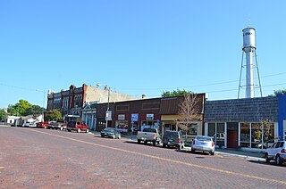
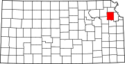
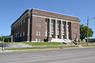
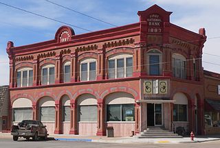
Oskaloosa is a city in and the county seat of Jefferson County, Kansas, United States. As of the 2020 census, the population of the city was 1,110.

References

  1. 1 2 3 "QuickFacts; Jefferson County, Kansas; Population, Census, 2020 & 2010". United States Census Bureau. Archived from the original on August 17, 2021. Retrieved August 16, 2021.
  2. "County Population Totals: 2020-2021". United States Census Bureau. March 24, 2022. Retrieved June 3, 2022.
  3. "Find a County". National Association of Counties. Archived from the original on May 31, 2011. Retrieved June 7, 2011.
  4. Gannett, Henry (1905). The Origin of Certain Place Names in the United States. Govt. Print. Off. pp.  168.
  5. "US Gazetteer files: 2010, 2000, and 1990". United States Census Bureau. February 12, 2011. Archived from the original on May 27, 2002. Retrieved April 23, 2011.
  6. "Annual Estimates of the Resident Population for Counties: April 1, 2020 to July 1, 2023". United States Census Bureau. Retrieved April 3, 2024.
  7. "U.S. Decennial Census". United States Census Bureau. Archived from the original on April 26, 2015. Retrieved July 26, 2014.
  8. "Historical Census Browser". University of Virginia Library. Retrieved July 26, 2014.
  9. "Population of Counties by Decennial Census: 1900 to 1990". United States Census Bureau. Retrieved July 26, 2014.
  10. "Census 2000 PHC-T-4. Ranking Tables for Counties: 1990 and 2000" (PDF). United States Census Bureau. Archived (PDF) from the original on March 27, 2010. Retrieved July 26, 2014.
  11. "Dave Leip's Atlas of U.S. Presidential Elections".
  12. "Map of Wet and Dry Counties". Alcoholic Beverage Control, Kansas Department of Revenue. November 2006. Archived from the original on October 8, 2007. Retrieved December 28, 2007.
  13. Panetta, Grace (August 3, 2022). "14 of the 19 Kansas counties that rejected an anti-abortion amendment voted for Trump in 2020". Business Insider. Retrieved August 3, 2022.
  14. "Contact Us – JeffCountyNews.com" . Retrieved November 1, 2022.
Notes

    Further reading

    County
    Maps