Morton County, Kansas

Last updated

Morton County
MortonCoCH.jpg
Morton County Courthouse in Elkhart (2009)
Map of Kansas highlighting Morton County.svg
Location within the U.S. state of Kansas
Kansas in United States.svg
Kansas's location within the U.S.
Coordinates: 37°12′N101°48′W / 37.200°N 101.800°W / 37.200; -101.800
CountryFlag of the United States.svg United States
StateFlag of Kansas.svg  Kansas
FoundedFebruary 20, 1886
Named for Oliver Morton
Seat Elkhart
Largest cityElkhart
Area
  Total730 sq mi (1,900 km2)
  Land730 sq mi (1,900 km2)
  Water0.2 sq mi (0.5 km2)  0.03%
Population
 (2020) [1]
  Total2,701
  Density3.7/sq mi (1.4/km2)
Time zone UTC−6 (Central)
  Summer (DST) UTC−5 (CDT)
Area code 620
Congressional district 1st
Website mtcoks.com

Morton County is a county in the southwestern corner of the U.S. state of Kansas. Its county seat and largest city is Elkhart. [2] As of the 2020 census, the county population was 2,701. [1] The county was named after Oliver Morton, the 14th governor of the state of Indiana.

Contents

History

Early history

For many millennia, the Great Plains of North America was inhabited by nomadic Native Americans. From the 16th century to 18th century, the Kingdom of France claimed ownership of large parts of North America. In 1762, after the French and Indian War, France secretly ceded New France to Spain, per the Treaty of Fontainebleau.

19th century

In 1802, Spain returned most of the land to France, but keeping title to about 7,500 square miles. In 1803, most of the land for modern day Kansas was acquired by the United States from France as part of the 828,000 square mile Louisiana Purchase for 2.83 cents per acre.

In 1848, after the Mexican–American War, the territorial gain in the Treaty of Guadalupe Hidalgo with Mexico brought into the United States all or part of land for ten future states, including southwest Kansas.

From 1821 to late 1860s, the Santa Fe Trail was active across Morton County.

In 1854, the Kansas Territory was organized, then in 1861 Kansas became the 34th U.S. state. In 1886, Morton County was established, and named for Oliver Morton, who was a United States senator from Indiana from 1867 to 1877. [3] In 1886, the community of Richfield was established as the county seat. [4]

20th century

Dust storm in Rolla on May 6, 1935 Dust Storm in Rolla, Kansas, "05-06-35, Dear Mr. Roosevelt, Darkness came when it hit us. Picture taken from water... - NARA - 195691.tif
Dust storm in Rolla on May 6, 1935
Area affected by 1930s Dust Bowl Map of states and counties affected by the Dust Bowl, sourced from US federal government dept. (NRCS SSRA-RAD).svg
Area affected by 1930s Dust Bowl

In the 1930s, the prosperity of the area was severely affected by its location within the Dust Bowl. This catastrophe intensified the economic impact of the Great Depression in the region. Morton County was the most devastated county in the Dust Bowl and lost almost one-half of its population in the 1930s. The U.S. government purchased some of the impacted and abandoned land and eventually incorporated it into the Comanche National Grassland. [5]

In 1961, the county seat was moved from Richfield to Elkhart. [4]

Geography

According to the U.S. Census Bureau, the county has a total area of 730 square miles (1,900 km2), of which 730 square miles (1,900 km2) is land and 0.2 square miles (0.52 km2) (0.03%) is water. [6] The county is the location of the 8 Mile Corner tripoint, where Kansas borders Colorado and Oklahoma.

Major highways

Adjacent counties

National protected area

Demographics

Population pyramid based on 2000 census age data USA Morton County, Kansas age pyramid.svg
Population pyramid based on 2000 census age data
Historical population
CensusPop.Note
1890 724
1900 304−58.0%
1910 1,333338.5%
1920 3,177138.3%
1930 4,09228.8%
1940 2,186−46.6%
1950 2,61019.4%
1960 3,35428.5%
1970 3,5766.6%
1980 3,454−3.4%
1990 3,4800.8%
2000 3,4960.5%
2010 3,233−7.5%
2020 2,701−16.5%
2023 (est.)2,580 [7] −4.5%
U.S. Decennial Census [8]
1790-1960 [9] 1900-1990 [10]
1990-2000 [11] 2010-2020 [1]

As of the census [12] of 2000, there were 3,496 people, 1,306 households, and 961 families residing in the county. The population density was 5 people per square mile (1.9 people/km2). There were 1,519 housing units at an average density of 2 per square mile (0.77/km2). The racial makeup of the county was 88.39% White, 0.20% Black or African American, 1.14% Native American, 1.06% Asian, 7.52% from other races, and 1.69% from two or more races. 14.10% of the population were Hispanic or Latino of any race.

There were 1,306 households, out of which 36.60% had children under the age of 18 living with them, 64.20% were married couples living together, 6.80% had a female householder with no husband present, and 26.40% were non-families. 24.30% of all households were made up of individuals, and 9.20% had someone living alone who was 65 years of age or older. The average household size was 2.63 and the average family size was 3.15.

In the county, the population was spread out, with 29.30% under the age of 18, 8.00% from 18 to 24, 27.20% from 25 to 44, 21.50% from 45 to 64, and 13.90% who were 65 years of age or older. The median age was 36 years. For every 100 females there were 94.40 males. For every 100 females age 18 and over, there were 93.70 males.

The median income for a household in the county was $37,232, and the median income for a family was $43,494. Males had a median income of $31,875 versus $19,474 for females. The per capita income for the county was $17,076. About 8.50% of families and 10.50% of the population were below the poverty line, including 14.00% of those under age 18 and 5.20% of those age 65 or over.

Government

Morton County is usually won by the Republican candidate for president. Jimmy Carter almost carried the county in 1976, but Gerald Ford eventually won by .2%. The last time a Democrat won Morton County was Lyndon B. Johnson in 1964.

Presidential elections

Presidential election results
United States presidential election results for Morton County, Kansas [13]
Year Republican Democratic Third party
No.%No.%No.%
2020 1,03486.31%15012.52%141.17%
2016 99582.92%14712.25%584.83%
2012 1,07283.88%18914.79%171.33%
2008 1,15382.24%22916.33%201.43%
2004 1,28781.66%27617.51%130.82%
2000 1,20377.26%32120.62%332.12%
1996 1,07367.87%37623.78%1328.35%
1992 91554.79%39823.83%35721.38%
1988 1,07464.35%56934.09%261.56%
1984 1,53381.80%32217.18%191.01%
1980 1,15769.61%41424.91%915.48%
1976 73848.91%73548.71%362.39%
1972 1,16572.68%36322.65%754.68%
1968 77051.03%47531.48%26417.50%
1964 60939.01%93860.09%140.90%
1960 91860.67%58638.73%90.59%
1956 81464.76%43634.69%70.56%
1952 89369.93%36228.35%221.72%
1948 62452.61%54545.95%171.43%
1944 61762.51%36737.18%30.30%
1940 64355.72%50343.59%80.69%
1936 63641.81%87657.59%90.59%
1932 62134.63%1,09360.96%794.41%
1928 1,01078.78%25920.20%131.01%
1924 66955.02%28623.52%26121.46%
1920 78372.97%26624.79%242.24%
1916 40542.41%45747.85%939.74%
1912 12033.99%14440.79%8925.21%
1908 15450.49%14045.90%113.61%
1904 5354.08%4444.90%11.02%
1900 5160.00%3440.00%00.00%
1896 5258.43%3640.45%11.12%
1892 10657.61%00.00%7842.39%
1888 33358.01%20535.71%366.27%

Laws

The Kansas Constitution was amended in 1986 to allow the sale of alcoholic liquor by the individual drink with the approval of voters, either with or without a minimum of 30% of sales coming from food. Morton County is one of 35 counties in the state that allows for the sale of liquor by the drink without the minimum food sales stipulation. [14]

Education

Unified school districts

Communities

2005 map of Morton County (map legend) Map of Morton Co, Ks, USA.png
2005 map of Morton County (map legend)

List of townships / incorporated cities / unincorporated communities / extinct former communities within Morton County. [15]

Cities

Unincorporated community

Townships

Morton County is divided into six townships. None of the cities within the county are considered governmentally independent, and all figures for the townships include those of the cities. In the following table, the population center is the largest city (or cities) included in that township's population total, if it is of a significant size.

Sources: 2000 U.S. Gazetteer from the U.S. Census Bureau.
Township FIPS Population
center
PopulationPopulation
density
/km2 (/sq mi)
Land area
km2 (sq mi)
Water area
km2 (sq mi)
Water %Geographic coordinates
Cimarron13350670 (1)173 (67)0 (0)0% 37°4′11″N101°46′45″W / 37.06972°N 101.77917°W / 37.06972; -101.77917
Jones35650170 (0)140 (54)0 (0)0% 37°1′4″N101°56′56″W / 37.01778°N 101.94889°W / 37.01778; -101.94889
Richfield592252180 (1)649 (251)0 (0)0% 37°14′37″N101°42′36″W / 37.24361°N 101.71000°W / 37.24361; -101.71000
Rolla60925 Rolla 6502 (5)373 (144)0 (0)0% 37°6′46″N101°37′42″W / 37.11278°N 101.62833°W / 37.11278; -101.62833
Taloga69975 Elkhart 2,43717 (44)142 (55)0 (0)0% 37°0′22″N101°53′42″W / 37.00611°N 101.89500°W / 37.00611; -101.89500
Westola772251070 (1)412 (159)0 (0)0.01% 37°14′19″N101°58′40″W / 37.23861°N 101.97778°W / 37.23861; -101.97778

See also

Community information for Kansas

Related Research Articles

<span class="mw-page-title-main">Cimarron County, Oklahoma</span> County in Oklahoma, United States

Cimarron County is the westernmost county in the U.S. state of Oklahoma. Its county seat is Boise City. As of the 2020 census, its population was 2,296, making it the least-populous county in Oklahoma; and indeed, throughout most of its history, it has had both the smallest population and the lowest population density of any county in Oklahoma. Located in the Oklahoma Panhandle, Cimarron County contains the only community in the state (Kenton) that observes the Mountain Time Zone. Black Mesa, the highest point in the state, is in the northwest corner of the county. The Cimarron County community of Regnier has the distinction of being the driest spot in Oklahoma ranked by lowest annual average precipitation, at just 15.62 inches; at the same time, Boise City is the snowiest location in Oklahoma ranked by highest annual average snowfall, at 31.6 inches.

<span class="mw-page-title-main">Wilson County, Kansas</span> County in Kansas, United States

Wilson County is a county located in Southeast Kansas. Its county seat is Fredonia. As of the 2020 census, the county population was 8,624. The county was named after Hiero Wilson, a colonel in the American Civil War.

<span class="mw-page-title-main">Thomas County, Kansas</span> County in Kansas, United States

Thomas County is a county located in the U.S. state of Kansas. Its county seat is Colby. As of the 2020 census, the county population was 7,930. The county was named after George Thomas, a general during the American Civil War.

<span class="mw-page-title-main">Stevens County, Kansas</span> County in Kansas, United States

Stevens County is a county located in the U.S. state of Kansas. Its county seat is Hugoton. As of the 2020 census, the county population was 5,250. The county is named for Thaddeus Stevens, a Reconstruction era Pennsylvania politician.

<span class="mw-page-title-main">Stanton County, Kansas</span> County in Kansas, United States

Stanton County is a county located in the U.S. state of Kansas. Its county seat is Johnson City. As of the 2020 census, the county population was 2,084. It was named for Edwin Stanton, the U.S. Secretary of War during most of the American Civil War.

<span class="mw-page-title-main">Seward County, Kansas</span> County in Kansas, United States

Seward County is a county of the U.S. state of Kansas. Its county seat and largest city is Liberal. As of the 2020 census, the county population was 21,964. The county was formed on March 20, 1873, and named after William Seward, a politician and Secretary of State under Abraham Lincoln and Andrew Johnson.

<span class="mw-page-title-main">Rush County, Kansas</span> County in Kansas, United States

Rush County is a county located in the U.S. state of Kansas. Its county seat and largest city is La Crosse. As of the 2020 census, the county population was 2,956. The county was named for Alexander Rush.

<span class="mw-page-title-main">Rawlins County, Kansas</span> County in Kansas, United States

Rawlins County is a county located in the U.S. state of Kansas. Its county seat and largest city is Atwood. As of the 2020 census, the county population was 2,561. It was named after John Rawlins, a general in the American Civil War.

<span class="mw-page-title-main">Phillips County, Kansas</span> County in Kansas, United States

Phillips County is a county located in the U.S. state of Kansas. Its county seat and largest city is Phillipsburg. As of the 2020 census, the county population was 4,981. The county was named after William Phillips, a free-state abolition journalist and colonel in the American Civil War.

<span class="mw-page-title-main">Pawnee County, Kansas</span> County in Kansas, United States

Pawnee County is a county located in the U.S. state of Kansas. Its county seat and largest city is Larned. As of the 2020 census, the county population was 6,253. The county is named after the Pawnee tribe.

<span class="mw-page-title-main">Osage County, Kansas</span> County in Kansas, United States

Osage County is a county located in the U.S. state of Kansas. Its county seat is Lyndon, and its most populous city is Osage City. As of the 2020 census, the county population was 15,766. The county was originally organized in 1855 as Weller County, then renamed in 1859 after the Osage tribe.

<span class="mw-page-title-main">Labette County, Kansas</span> County in Kansas, United States

Labette County is a county located in Southeast Kansas. Its county seat is Oswego, and its most populous city is Parsons. As of the 2020 census, the county population was 20,184. The county was named after LaBette creek, the second-largest creek in the county, which runs roughly NNW-SSE from near Parsons to Chetopa. The creek in turn was named after French-Canadian fur trapper Pierre LaBette who had moved to the area, living along the Neosho River, and marrying into the Osage tribe in the 1830s and 1840s.

<span class="mw-page-title-main">Jackson County, Kansas</span> County in Kansas, United States

Jackson County is a county in the U.S. state of Kansas. Its county seat and most populous city is Holton. As of the 2020 census, the county population was 13,232. The county, first named Calhoun County for pro-slavery South Carolina Senator John C. Calhoun, was renamed in 1859 for President Andrew Jackson. The Prairie Band Potawatomi Indian Reservation, near the center of the county, comprises about 18.5% of the county's area.

<span class="mw-page-title-main">Hamilton County, Kansas</span> County in Kansas, United States

Hamilton County is a county located in the U.S. state of Kansas. Its county seat and most populous city is Syracuse. As of the 2020 census, the county population was 2,518. The county was founded in 1873 and named for Alexander Hamilton, a founding father of the United States.

<span class="mw-page-title-main">Gray County, Kansas</span> County in Kansas, United States

Gray County is a county located in the U.S. state of Kansas. Its county seat and most populous city is Cimarron. As of the 2020 census, the county population was 5,653. The county was named after Alfred Gray, a 19th century Kansas politician.

<span class="mw-page-title-main">Edwards County, Kansas</span> County in Kansas, United States

Edwards County is a county located in the U.S. states of Kansas. Its county seat and most populous city is Kinsley. As of the 2020 census, the county population was 2,907, The county was founded in 1874 and named for W. C. Edwards, of Hutchinson, a pioneer settler who owned much land in the area.

<span class="mw-page-title-main">Comanche County, Kansas</span> County in Kansas, United States

Comanche County is a county located in the U.S. state of Kansas. Its county seat and most populous city is Coldwater. As of the 2020 census, the county population was 1,689. The county was named after the Comanche tribe.

<span class="mw-page-title-main">Chautauqua County, Kansas</span> County in Kansas, United States

Chautauqua County is a county located in Southeast Kansas, United States. Its county seat and most populous city is Sedan. As of the 2020 census, the county population was 3,379. The county is named for Chautauqua County, New York, the birthplace of Edward Jaquins, a Kansas politician who was instrumental in getting the county established.

<span class="mw-page-title-main">Elkhart, Kansas</span> City in Morton County, Kansas

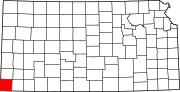
Elkhart is a city in and the county seat of Morton County, Kansas, United States. As of the 2020 census, the population of the city was 1,888. The south edge of the city is the Kansas-Oklahoma state border, and the city is 8.5 miles (13.7 km) from the Kansas-Colorado border.

<span class="mw-page-title-main">Richfield, Kansas</span> City in Morton County, Kansas

Richfield is a city in Morton County, Kansas, United States. As of the 2020 census, the population of the city was 30.

References

  1. 1 2 3 "QuickFacts; Morton County, Kansas; Population, Census, 2020 & 2010". United States Census Bureau. Archived from the original on August 18, 2021. Retrieved August 17, 2021.
  2. "Find a County". National Association of Counties. Retrieved June 7, 2011.
  3. "Kansas Newspapers History by County". Archived from the original on November 21, 2008. Retrieved April 17, 2010.
  4. 1 2 Morton County Facts; mtcoks.com
  5. "Cimarron National Grassland". Natural Kansas. Retrieved July 15, 2023.
  6. "US Gazetteer files: 2010, 2000, and 1990". United States Census Bureau. February 12, 2011. Retrieved April 23, 2011.
  7. "Annual Estimates of the Resident Population for Counties: April 1, 2020 to July 1, 2023". United States Census Bureau. Retrieved April 3, 2024.
  8. "U.S. Decennial Census". United States Census Bureau. Retrieved July 27, 2014.
  9. "Historical Census Browser". University of Virginia Library. Retrieved July 27, 2014.
  10. "Population of Counties by Decennial Census: 1900 to 1990". United States Census Bureau. Retrieved July 27, 2014.
  11. "Census 2000 PHC-T-4. Ranking Tables for Counties: 1990 and 2000" (PDF). United States Census Bureau. Archived (PDF) from the original on March 27, 2010. Retrieved July 27, 2014.
  12. "U.S. Census website". United States Census Bureau . Retrieved January 31, 2008.
  13. "Dave Leip's Atlas of U.S. Presidential Elections".
  14. "Map of Wet and Dry Counties" (PDF). Kansas Department of Revenue Alcoholic Beverage Control. December 30, 2019. Archived (PDF) from the original on November 4, 2020. Retrieved November 4, 2020.
  15. 1 2 "General Highway Map of Morton County, Kansas" (PDF). Kansas Department of Transportation (KDOT). June 2009. Archived (PDF) from the original on December 30, 2023.

Further reading

County
Maps