Elk County, Kansas

Last updated

Elk County
Elk County, KS Courthouse.jpg
Elk County Courthouse in Howard (2023)
Map of Kansas highlighting Elk County.svg
Location within the U.S. state of Kansas
Kansas in United States.svg
Kansas's location within the U.S.
Coordinates: 37°27′N96°14′W / 37.450°N 96.233°W / 37.450; -96.233
CountryFlag of the United States.svg United States
StateFlag of Kansas.svg  Kansas
FoundedMarch 25, 1875
Named for Elk River
Seat Howard
Largest cityHoward
Area
  Total650 sq mi (1,700 km2)
  Land644 sq mi (1,670 km2)
  Water6.2 sq mi (16 km2)  1.0%
Population
 (2020) [1]
  Total2,483
  Density3.9/sq mi (1.5/km2)
Time zone UTC−6 (Central)
  Summer (DST) UTC−5 (CDT)
Area code 620
Congressional district 4th
Website elkcountyks.org

Elk County is a county located in the U.S. state of Kansas. Its county seat and most populous city is Howard. [2] As of the 2020 census, the county population was 2,483. [1] The county was named for the Elk River.

Contents

History

Early history

For many millennia, the Great Plains of North America was inhabited by nomadic Native Americans. From the 16th century to 18th century, the Kingdom of France claimed ownership of large parts of North America. In 1762, after the French and Indian War, France secretly ceded New France to Spain, per the Treaty of Fontainebleau.

19th century

In 1802, Spain returned most of the land to France, but keeping title to about 7,500 square miles. In 1803, most of the land for modern day Kansas was acquired by the United States from France as part of the 828,000 square mile Louisiana Purchase for 2.83 cents per acre.

In 1854, after first serving as an area to relocate Native American tribes from the east, the United States organized Kansas Territory. In 1861, Kansas was admitted as the 34th U.S. state. The area that today is Elk County was, for a brief period, reserved to the Osage Indians as hunting grounds for buffalo and other game. In 1867, when Howard County was formed, it encompassed both present day Elk and Chautauqua counties. Disputes over county seats caused a division. [3] In 1875, Elk County was established, named for the Elk River. [4]

The first railroad in Elk County was built in 1879. [5] It connected cattle ranches and farms to eastern markets.

Geography

According to the U.S. Census Bureau, the county has a total area of 650 square miles (1,700 km2), of which 644 square miles (1,670 km2) is land and 6.2 square miles (16 km2) (1.0%) is water. [6]

Adjacent counties

Demographics

Population pyramid based on 2000 census age data USA Elk County, Kansas age pyramid.svg
Population pyramid based on 2000 census age data
Historical population
CensusPop.Note
1880 10,623
1890 12,21615.0%
1900 11,443−6.3%
1910 10,128−11.5%
1920 9,034−10.8%
1930 9,2101.9%
1940 8,180−11.2%
1950 6,679−18.3%
1960 5,048−24.4%
1970 3,858−23.6%
1980 3,9181.6%
1990 3,327−15.1%
2000 3,261−2.0%
2010 2,882−11.6%
2020 2,483−13.8%
2023 (est.)2,467 [7] −0.6%
U.S. Decennial Census [8]
1790-1960 [9] 1900-1990 [10]
1990-2000 [11] 2010-2020 [1]

As of the 2000 census, [12] there were 3,261 people, 1,412 households, and 923 families residing in the county. The population density was 5 people per square mile (1.9 people/km2). There were 1,860 housing units at an average density of 3 per square mile (1.2/km2). The racial makeup of the county was 95.06% White, 0.21% Black or African American, 0.95% Native American, 0.18% Asian, 0.06% Pacific Islander, 1.20% from other races, and 2.33% from two or more races. Hispanic or Latino of any race were 2.18% of the population.

There were 1,412 households, out of which 24.40% had children under the age of 18 living with them, 56.00% were married couples living together, 6.10% had a female householder with no husband present, and 34.60% were non-families. 32.90% of all households were made up of individuals, and 18.60% had someone living alone who was 65 years of age or older. The average household size was 2.25 and the average family size was 2.84.

In the county, the population was spread out, with 22.50% under the age of 18, 5.80% from 18 to 24, 20.00% from 25 to 44, 26.50% from 45 to 64, and 25.30% who were 65 years of age or older. The median age was 46 years. For every 100 females there were 91.50 males. For every 100 females age 18 and over, there were 91.70 males.

The median income for a household in the county was $27,267, and the median income for a family was $34,148. Males had a median income of $28,580 versus $16,219 for females. The per capita income for the county was $16,066. About 9.20% of families and 13.80% of the population were below the poverty line, including 18.80% of those under age 18 and 15.00% of those age 65 or over.

Government

Presidential elections

Presidential election results
United States presidential election results for Elk County, Kansas [13]
Year Republican Democratic Third party
No.%No.%No.%
2020 1,14083.76%19514.33%261.91%
2016 1,04883.24%16012.71%514.05%
2012 1,04976.63%28120.53%392.85%
2008 1,04272.66%36325.31%292.02%
2004 1,11973.86%36924.36%271.78%
2000 1,08069.68%40225.94%684.39%
1996 93356.79%48829.70%22213.51%
1992 74842.94%48527.84%50929.22%
1988 1,07563.01%60835.64%231.35%
1984 1,30172.89%45225.32%321.79%
1980 1,28069.68%48226.24%754.08%
1976 1,08754.84%86543.64%301.51%
1972 1,52276.02%42821.38%522.60%
1968 1,32764.64%50324.50%22310.86%
1964 1,26755.74%99443.73%120.53%
1960 1,83068.46%82330.79%200.75%
1956 1,90969.90%81229.73%100.37%
1952 2,38076.38%71723.01%190.61%
1948 1,96263.80%1,08735.35%260.85%
1944 2,28370.33%95429.39%90.28%
1940 2,77464.77%1,47834.51%310.72%
1936 2,35553.24%2,05946.55%90.20%
1932 1,74643.04%2,23955.19%721.77%
1928 3,00777.50%83121.42%421.08%
1924 2,44364.26%1,10429.04%2556.71%
1920 2,25365.27%1,11032.16%892.58%
1916 1,76943.94%2,05350.99%2045.07%
1912 60524.09%97138.67%93537.24%
1908 1,45454.11%1,18744.18%461.71%
1904 1,71367.47%70627.81%1204.73%
1900 1,63255.21%1,31144.35%130.44%
1896 1,33947.57%1,46452.01%120.43%
1892 1,23547.19%00.00%1,38252.81%
1888 1,56653.70%69623.87%65422.43%

Laws

The Kansas Constitution was amended in 1986 to allow the sale of alcoholic liquor by the individual drink, with approval by voters. Elk County voters have chosen to remain a prohibition, or "dry", county. [14]

Education

Unified school districts

Communities

2005 map of Elk County (map legend) Map of Elk Co, Ks, USA.png
2005 map of Elk County (map legend)

List of townships / incorporated cities / unincorporated communities / extinct former communities within Elk County. [16]

Cities

Unincorporated communities

Ghost towns

Townships

Elk County is divided into ten townships. None of the cities within the county is designated as governmentally independent. All population figures for the townships include those of the cities. In the following table, the population center is the largest city (or cities) included in that township's population total, if it is of a significant size.

Township FIPS Population
center
PopulationPopulation
density
/km2 (/sq mi)
Land area
km2 (sq mi)
Water area
km2 (sq mi)
Water %Geographic coordinates
Elk Falls203251961 (3)152 (59)0 (0)0.19% 37°22′17″N96°12′26″W / 37.37139°N 96.20722°W / 37.37139; -96.20722
Greenfield285503212 (5)171 (66)1 (0)0.62% 37°21′8″N96°27′5″W / 37.35222°N 96.45139°W / 37.35222; -96.45139
Howard33275 Howard 1,0066 (16)166 (64)1 (1)0.86% 37°28′3″N96°15′14″W / 37.46750°N 96.25389°W / 37.46750; -96.25389
Liberty400251171 (2)154 (59)0 (0)0.19% 37°34′22″N96°1′55″W / 37.57278°N 96.03194°W / 37.57278; -96.03194
Longton426755305 (12)116 (45)0 (0)0.11% 37°22′38″N96°5′27″W / 37.37722°N 96.09083°W / 37.37722; -96.09083
Oak Valley519501541 (3)116 (45)0 (0)0.24% 37°21′59″N96°1′14″W / 37.36639°N 96.02056°W / 37.36639; -96.02056
Painterhood54075680 (1)154 (59)1 (0)0.37% 37°27′35″N96°2′37″W / 37.45972°N 96.04361°W / 37.45972; -96.04361
Paw Paw549251161 (2)141 (54)0 (0)0.24% 37°33′19″N96°13′46″W / 37.55528°N 96.22944°W / 37.55528; -96.22944
Union Center725001160 (1)371 (143)2 (1)0.46% 37°31′44″N96°23′31″W / 37.52889°N 96.39194°W / 37.52889; -96.39194
Wildcat791506375 (12)135 (52)2 (1)1.35% 37°21′33″N96°19′10″W / 37.35917°N 96.31944°W / 37.35917; -96.31944
Sources: "Census 2000 U.S. Gazetteer Files". U.S. Census Bureau, Geography Division. Archived from the original on August 2, 2002.

See also

Community information for Kansas

Related Research Articles

<span class="mw-page-title-main">Montgomery County, Kansas</span> County in Kansas, United States

Montgomery County is a county located in Southeast Kansas. Its county seat is Independence, and its most populous city is Coffeyville. As of the 2020 census, the county population was 31,486. The county was named after Richard Montgomery, a major general during the American Revolutionary War.

<span class="mw-page-title-main">Wilson County, Kansas</span> County in Kansas, United States

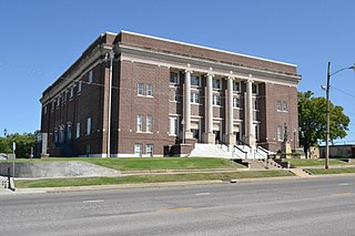
Wilson County is a county located in Southeast Kansas. Its county seat is Fredonia. As of the 2020 census, the county population was 8,624. The county was named after Hiero Wilson, a colonel in the American Civil War.

<span class="mw-page-title-main">Trego County, Kansas</span> County in Kansas, United States

Trego County is a county located in the U.S. state of Kansas. Its county seat and largest city is WaKeeney. As of the 2020 census, the county population was 2,808. The county was named for Edgar Trego.

<span class="mw-page-title-main">Thomas County, Kansas</span> County in Kansas, United States

Thomas County is a county located in the U.S. state of Kansas. Its county seat is Colby. As of the 2020 census, the county population was 7,930. The county was named after George Thomas, a general during the American Civil War.

<span class="mw-page-title-main">Pottawatomie County, Kansas</span> County in Kansas, United States

Pottawatomie County is a county located in the U.S. state of Kansas. Its county seat is Westmoreland. As of the 2020 census, the county population was 25,348. The county was named for the Potawatomi tribe.

<span class="mw-page-title-main">Phillips County, Kansas</span> County in Kansas, United States

Phillips County is a county located in the U.S. state of Kansas. Its county seat and largest city is Phillipsburg. As of the 2020 census, the county population was 4,981. The county was named after William Phillips, a free-state abolition journalist and colonel in the American Civil War.

<span class="mw-page-title-main">Neosho County, Kansas</span> County in Kansas, United States

Neosho County is a county located in Southeast Kansas. Its county seat is Erie. As of the 2020 census, the county population was 15,904. The county was named for the Neosho River, which passes through the county.

<span class="mw-page-title-main">Nemaha County, Kansas</span> County in Kansas, United States

Nemaha County is a county located in the northeastern part of the U.S. state of Kansas. Its county seat is Seneca. As of the 2020 census, the county population was 10,273. The county was named for the Nemaha River.

<span class="mw-page-title-main">Linn County, Kansas</span> County in Kansas, United States

Linn County is a county in the U.S. state of Kansas, located in along the eastern edge of Kansas, and is part of the Kansas City metropolitan area. Its county seat is Mound City, and its most populous city is Pleasanton. As of the 2020 census, the county population was 9,591. The county was named for Lewis Linn, a U.S. Senator from Missouri.

<span class="mw-page-title-main">Lane County, Kansas</span> County in Kansas, United States

Lane County is a county located in the U.S. state of Kansas. Its county seat is Dighton, the only incorporated city in the county. As of the 2020 census, the county population was 1,574, making it the third-least populous county in Kansas. The county was named after James Lane, a leader of the Jayhawker abolitionist movement and served as one of the first U.S. senators from Kansas.

<span class="mw-page-title-main">Kingman County, Kansas</span> County in Kansas, United States

Kingman County is a county located in the U.S. state of Kansas. Its county seat and largest city is Kingman. As of the 2020 census, the county population was 7,470. The county was named for Samuel Kingman, a chief justice of the Kansas Supreme Court during the 1860s and 1870s.

<span class="mw-page-title-main">Harvey County, Kansas</span> County in Kansas, United States

Harvey County is a county located in the U.S. state of Kansas. Its county seat and most populous city is Newton. As of the 2020 census, the county population was 34,024. The county was named for James Harvey, a U.S. senator and 5th governor of Kansas.

<span class="mw-page-title-main">Greenwood County, Kansas</span> County in Kansas, United States

Greenwood County is a county located in the southeast portion of the U.S. state of Kansas. Its county seat and most populous city is Eureka. As of the 2020 census, the county population was 6,016. The county was named for Alfred Greenwood, a U.S. congressman from Arkansas that advocated Kansas statehood.

<span class="mw-page-title-main">Gray County, Kansas</span> County in Kansas, United States

Gray County is a county located in the U.S. state of Kansas. Its county seat and most populous city is Cimarron. As of the 2020 census, the county population was 5,653. The county was named after Alfred Gray, a 19th century Kansas politician.

<span class="mw-page-title-main">Franklin County, Kansas</span> County in Kansas, United States

Franklin County is a county located in the eastern portion of the U.S. state of Kansas. Its county seat and most populous city is Ottawa. As of the 2020 census, the county population was 25,996. The county was named for Benjamin Franklin, a founding father of the United States. Formerly it was considered part of the Kansas City metropolitan area, but was removed in 2013.

<span class="mw-page-title-main">Cowley County, Kansas</span> County in Kansas, United States

Cowley County is a county located in the U.S. state of Kansas. Its county seat is Winfield, and its most populous city is Arkansas City. As of the 2020 census, the county population was 34,549. The county was named after Matthew Cowley, first lieutenant in Company I, 9th Kansas Cavalry, who died during the American Civil War.

<span class="mw-page-title-main">Coffey County, Kansas</span> County in Kansas, United States

Coffey County is a county located in Eastern Kansas. Its county seat and most populous city is Burlington. As of the 2020 census, the county population was 8,360. It was named after A.M. Coffey, a territorial legislator and Free-Stater during Bleeding Kansas era.

<span class="mw-page-title-main">Chautauqua County, Kansas</span> County in Kansas, United States

Chautauqua County is a county located in Southeast Kansas, United States. Its county seat and most populous city is Sedan. As of the 2020 census, the county population was 3,379. The county is named for Chautauqua County, New York, the birthplace of Edward Jaquins, a Kansas politician who was instrumental in getting the county established.

<span class="mw-page-title-main">Brown County, Kansas</span> County in Kansas, United States

Brown County is a county located in the northeast portion of the U.S. state of Kansas. Its county seat and most populous city is Hiawatha. As of the 2020 census, the county population was 9,508. The county was named after Albert G. Brown, a U.S. Senator from Mississippi and Kansas statehood advocate. The Kickapoo Indian Reservation of Kansas, the majority of the Sac and Fox Reservation, and the majority of the Iowa Reservation of Kansas and Nebraska are located within the county.

<span class="mw-page-title-main">Chautauqua, Kansas</span> City in Chautauqua County, Kansas

Chautauqua is a city in Chautauqua County, Kansas, United States. As of the 2020 census, the population of the city was 108.

References

  1. 1 2 3 "QuickFacts; Elk County, Kansas; Population, Census, 2020 & 2010". United States Census Bureau. Archived from the original on August 16, 2021. Retrieved August 16, 2021.
  2. "Find a County". National Association of Counties. Archived from the original on May 31, 2011. Retrieved June 7, 2011.
  3. "Elk County". June 16, 2022.
  4. "Elk County, Kansas". Kansas Historical Society. Retrieved March 20, 2014.
  5. Blackmar, Frank Wilson (1912). Kansas: A Cyclopedia of State History, Embracing Events, Institutions, Industries, Counties, Cities, Towns, Prominent Persons, Etc. Standard Publishing Company. pp.  573–574.
  6. "US Gazetteer files: 2010, 2000, and 1990". United States Census Bureau. February 12, 2011. Retrieved April 23, 2011.
  7. "Annual Estimates of the Resident Population for Counties: April 1, 2020 to July 1, 2023". United States Census Bureau. Retrieved April 3, 2024.
  8. "U.S. Decennial Census". United States Census Bureau. Retrieved July 24, 2014.
  9. "Historical Census Browser". University of Virginia Library. Retrieved July 24, 2014.
  10. "Population of Counties by Decennial Census: 1900 to 1990". United States Census Bureau. Retrieved July 24, 2014.
  11. "Census 2000 PHC-T-4. Ranking Tables for Counties: 1990 and 2000" (PDF). United States Census Bureau. Archived (PDF) from the original on March 27, 2010. Retrieved July 24, 2014.
  12. "U.S. Census website". United States Census Bureau . Retrieved January 31, 2008.
  13. "Dave Leip's Atlas of U.S. Presidential Elections".
  14. "Map of Wet and Dry Counties". Alcoholic Beverage Control, Kansas Department of Revenue. November 2004. Archived from the original on October 8, 2007. Retrieved January 21, 2007.
  15. Elk Valley USD 283
  16. 1 2 "General Highway Map of Elk County, Kansas" (PDF). Kansas Department of Transportation (KDOT). August 2007. Archived (PDF) from the original on November 14, 2023.

Further reading

County
Maps