Barnet, Vermont

Last updated

Barnet, Vermont
Barnet VT Post Office.jpg
Barnet's post office
Barnet vt highlight.png
Barnet, Vermont
Usa edcp location map.svg
Red pog.svg
Barnet, Vermont
Location in the United States
Coordinates: 44°18′29″N72°5′0″W / 44.30806°N 72.08333°W / 44.30806; -72.08333
Country United States
State Vermont
County Caledonia
Communities Barnet
Barnet Center
East Barnet
McIndoe Falls
Mosquitoville
Passumpsic
West Barnet
Area
  Total43.6 sq mi (112.9 km2)
  Land42.2 sq mi (109.4 km2)
  Water1.3 sq mi (3.4 km2)
Elevation
1,083 ft (330 m)
Population
 (2020)
  Total1,663
  Density39/sq mi (15.2/km2)
Time zone UTC-5 (Eastern (EST))
  Summer (DST) UTC-4 (EDT)
ZIP code
05050 (McIndoe Falls), 05821, 05861 (Passumpsic)
Area code 802
FIPS code 50-02875 [1]
GNIS feature ID1462034 [2]
Website www.barnetvermont.org

Barnet is a town in Caledonia County, Vermont, United States. The population was 1,663 at the 2020 census. [3] Barnet contains the locations of Barnet Center, East Barnet, McIndoe Falls, Mosquitoville, Passumpsic and West Barnet. The main settlement of Barnet is recorded as a census-designated place by the U.S. Census Bureau, with a population of 127 at the 2020 census. [4]

Contents

History

Erastus Fairbanks Erastus Fairbanks.jpg
Erastus Fairbanks

The town of Barnet, Vermont, originally took its name from the town of Barnet, England. [5]

On September 16, 1763, the town received its charter from the royal governor of New Hampshire, Benning Wentworth.

The first European descendants to work the land and stay in the town were three brothers, Daniel, Jacob, and Elijah Hall, along with Jonathan Fowler. Their homestead was built along the Connecticut River and to the north near McIndoe Falls. Elijah Hall built the first house in Caledonia County in Barnet, near the base of Stevens Falls. [6] Colonel Alexander Harvey came from Dundee, Scotland, for those in the town who wished to find new land in the American colonies. Despite losing contact with almost all of them after the American Revolution broke out, he decided to stay, claiming 7,000 acres (28 km2) of land and a lake, now known as Harvey's Lake. [7]

The five early villages within the town of Barnet were: [8]

Additional hamlets that have arisen within the town are:

The main settlement of Barnet village has grown in population and is often referred to as "the town", yet the town itself includes the populated places listed above.

Horace Fairbanks Horace Fairbanks.jpg
Horace Fairbanks

Two governors of the state of Vermont were from Barnet: Erastus Fairbanks, who served two terms from 1852–1853 and 1860–1861, and his son, Horace Fairbanks, who served from 1876 to 1878. The Fairbanks family left Barnet for nearby St. Johnsbury, where they were known for manufacturing the first platform scale. [10]

Ocean explorer and scuba inventor Jacques Cousteau [11] had influential experiences on Harvey's Lake as a young boy in the early 1920s. While attending a summer camp he experimented with staying underwater by breathing through hollow reeds found in the lake shallows. Though he could not yet swim well, this allowed him to stay underwater for extended periods.

Religion

Christianity

On January 24, 1784, the town of Barnet voted unanimously to make the Presbyterian denomination the official one of the town, as it was "founded on the word of God as expressed in the Confession of Faith, Catechisms Longer and Shorter, with the form of church government agreed upon by the Assembly of Divines at Westminster, and practiced by the Church of Scotland."[ citation needed ]

The Passumpsic Calvinistic Baptist church was first created by a council of neighboring churches on July 1, 1812. The village of Passumpsic was chosen due to its centralized location.

Formerly Barnet Congregational Church, now Barnet Village Church. Barnet Village Church 100 Church Street downtown Barnet VT September 2021.jpg
Formerly Barnet Congregational Church, now Barnet Village Church.

The First Congregational Church of Barnet was created by Reverend David Sutherland in September 1829 after a new brick church had been built. Its first permanent minister was the Reverend Henry Fairbanks. The church which stands now was constructed in 1854.

The earliest Reformed Presbyterian Church in Vermont was organized in Ryegate in October 1798. In the early part of the nineteenth century, a group of members in Barnet built a new meeting house on the land formerly owned by Walter Harvey, and the property has gone by that name since then. The longest-tenured minister was Daniel C. Faris, who served the congregation from 1873 until 1923. [12] The congregation's Barnet branch became a separate congregation on July 9, 1872, [13] and it continued until disorganization in 1970. [14]

Buddhism

In 1970, upon his arrival in North America, Chögyam Trungpa established the teaching center "Tail of the Tiger" (now Karmê Chöling). It was consolidated with others in Colorado in 1973. [15]

Geography

Fall foliage in early October Fall Foliage in Barnet Vermont.jpg
Fall foliage in early October

According to the United States Census Bureau, the town has a total area of 43.6 square miles (112.9 km2), of which 42.2 square miles (109.4 km2) is land and 1.3 square miles (3.4 km2), or 3.04%, is water. [16] The Barnet CDP, comprising the town center, has a total area of 0.64 square miles (1.66 km2), of which 0.62 square miles (1.61 km2) is land and 0.019 square miles (0.05 km2), or 2.96%, is water. [17]

The eastern border of the town is the Connecticut River, which is also the boundary between Vermont and New Hampshire. The Passumpsic River enters the Connecticut at East Barnet. Neighboring communities are Ryegate to the south, Groton to the southwest, Peacham to the west, Danville to the northwest, St. Johnsbury to the north, and Waterford, Vermont, to the northeast. Across the Connecticut River is the New Hampshire town of Monroe.

Barnet is traversed from north to south by Interstate 91, with access to the town at Exit 18, West Barnet Road. U.S. Route 5, a two-lane highway, parallels I-91 and passes through the town center.

The highest point in town is 2,103-foot (641 m) Roy Mountain in the southern part of town, east of Harvey Lake.

Climate

This climatic region is typified by large seasonal temperature differences, with warm to hot summers and cold winters. According to the Köppen Climate Classification system, Barnet has a humid continental climate, abbreviated "Dfb" on climate maps. [18]

Climate data for Barnet, Vermont
MonthJanFebMarAprMayJunJulAugSepOctNovDecYear
Average high °C−3.2−2.13.910.718.924.427.025.921.815.36.6−1.312.3
Daily mean °C−9.9−9.2−2.54.611.817.420.219.115.08.71.7−6.75.8
Average low °C−16.6−16.4−9.0−1.54.610.313.312.38.32.1−3.2−12.1−0.7
Average precipitation mm51485728384988983788662888
Average snowfall cm43.946.529.57.40.20.213.237.9179.1
Average high °F26.228.239.051.366.075.980.678.671.259.543.929.754.1
Daily mean °F14.215.427.540.353.263.368.466.459.047.735.119.942.4
Average low °F2.12.515.829.340.350.555.954.146.935.826.210.230.7
Average precipitation inches2.01.90.22.83.33.33.93.53.33.13.42.435.0
Average snowfall inches17.318.311.62.90.10.15.214.970.5
Average precipitation days131212131313121111111413148
Source: [18]

Demographics

Historical population
CensusPop.Note
1790 477
1800 85879.9%
1810 1,30151.6%
1820 1,48814.4%
1830 1,76418.5%
1840 2,03015.1%
1850 2,52124.2%
1860 1,994−20.9%
1870 1,945−2.5%
1880 1,907−2.0%
1890 1,897−0.5%
1900 1,763−7.1%
1910 1,707−3.2%
1920 1,685−1.3%
1930 2,60454.5%
1940 1,596−38.7%
1950 1,425−10.7%
1960 1,4451.4%
1970 1,342−7.1%
1980 1,338−0.3%
1990 1,4155.8%
2000 1,69019.4%
2010 1,7081.1%
2020 1,663−2.6%
U.S. Decennial Census [19]

As of the census [1] of 2000, there were 1,690 people, 638 households, and 440 families residing in the town. The population density was 39.9 people per square mile (15.4/km2). There were 831 housing units at an average density of 19.6 per square mile (7.6/km2). The racial makeup of the town was 96.75% White, 0.71% African American, 1.01% Native American, 0.47% Asian, 0.06% from other races, and 1.01% from two or more races. Hispanic or Latino of any race were 0.36% of the population.

There were 638 households, out of which 32.4% had children under the age of 18 living with them, 58.5% were married couples living together, 7.7% had a female householder with no husband present, and 30.9% were non-families. 26.0% of all households were made up of individuals, and 12.5% had someone living alone who was 65 years of age or older. The average household size was 2.57 and the average family size was 3.11.

In the town, the population was spread out, with 26.7% under the age of 18, 6.5% from 18 to 24, 25.2% from 25 to 44, 27.5% from 45 to 64, and 14.0% who were 65 years of age or older. The median age was 40 years. For every 100 females, there were 100.0 males. For every 100 females age 18 and over, there were 97.1 males.

The median income for a household in the town was $36,089, and the median income for a family was $43,403. Males had a median income of $32,768 versus $23,173 for females. The per capita income for the town was $17,690. About 7.0% of families and 12.1% of the population were below the poverty line, including 17.4% of those under age 18 and 11.2% of those age 65 or over.

Notable people

Related Research Articles

<span class="mw-page-title-main">Caledonia County, Vermont</span> County in Vermont, United States

Caledonia County is a county located in the northeastern part of the U.S. state of Vermont. As of the 2020 census, the population was 30,233. Its shire town is the town of St. Johnsbury. The county was created in 1792 and organized in 1796. It was given the Latin name for Scotland, in honor of the many settlers who claimed ancestry there.

<span class="mw-page-title-main">Burke, Vermont</span> Town in Vermont, United States

Burke is a town in Caledonia County, Vermont, United States. The population was 1,651 at the 2020 census. The town contains the villages of East Burke, West Burke and Burke Hollow. The town is home to Burke Mountain and Burke Mountain Academy.

<span class="mw-page-title-main">Danville, Vermont</span> Town in Vermont, United States

Danville is a town in Caledonia County, Vermont, United States. The population was 2,335 at the 2020 census. The primary settlement in town is recorded as the Danville census-designated place (CDP) and had a population of 385 at the 2020 census.

<span class="mw-page-title-main">Lyndon, Vermont</span> Town in Vermont, United States

Lyndon is a town in Caledonia County, Vermont, United States. As of the 2020 census, the population was 5,491. Lyndon is the home of Lyndon State College. The town contains one incorporated village, Lyndonville, and four unincorporated villages: Lyndon Corner in the south, Lyndon Center in the center of town on the west side of Lyndonville, Little Egypt in the north, and East Lyndon in the southeast.

<span class="mw-page-title-main">Peacham, Vermont</span> Town in Vermont, United States

Peacham is a town in Caledonia County, Vermont, United States. The population was 715 at the 2020 census.

<span class="mw-page-title-main">Ryegate, Vermont</span> Town in Vermont, United States

Ryegate is a town in Caledonia County, Vermont, United States. The population was 1,165 at the 2020 census. The town contains the villages of South Ryegate, East Ryegate, and Ryegate Corner.

<span class="mw-page-title-main">Stannard, Vermont</span> Town in Vermont, United States

Stannard is a town in Caledonia County, Vermont. The population was 208 at the 2020 census. The town has no paved roads.

<span class="mw-page-title-main">Waterford, Vermont</span> Town in Vermont, United States

Waterford is a town in Caledonia County, Vermont, United States. The population was 1,268 at the 2020 census.

West Burke is a village in the town of Burke, Caledonia County, Vermont, United States. The population was 281 at the 2020 census.

<span class="mw-page-title-main">Wheelock, Vermont</span> Town in Vermont, United States

Wheelock is a town in Caledonia County, Vermont, United States. The population was 759 at the 2020 census.

<span class="mw-page-title-main">Brighton, Vermont</span> Town in Vermont, United States

Brighton is a town in Essex County, Vermont, United States. The population was 1,157 at the 2020 census. The town was named "Gilead" in its original grant in 1780. The town was sold to a group consisting primarily of soldiers commanded by Colonel Joseph Nightingale and subsequently named "Random". The town's name was finally changed by the legislature to "Brighton" in 1832. The Brighton village of Island Pond gets its name from the Abenaki word Menanbawk, which literally means island pond.

<span class="mw-page-title-main">Rockingham, Vermont</span> Town in Vermont, United States

Rockingham is a town along the Connecticut River in Windham County, Vermont, United States. As of the 2020 census, the population was 4,832. Rockingham includes the incorporated villages of Bellows Falls and Saxtons River, as well as a large rural area west of Interstate 91.

<span class="mw-page-title-main">St. Johnsbury, Vermont</span> Town in Vermont, United States

St. Johnsbury is the shire town of Caledonia County, Vermont, United States. As of the 2020 census, the population was 7,364. St. Johnsbury is situated on the Passumpsic River and is located approximately six miles northwest of the Connecticut River and 48 miles (77 km) south of the Canada–U.S. border.

<span class="mw-page-title-main">Vermont Route 114</span> State highway in northeastern Vermont, US

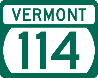
Vermont Route 114 (VT 114) is a 53.094-mile-long (85.447 km) north–south state highway in northeastern Vermont in the United States. It runs northward from U.S. Route 5 (US 5) in Lyndon until nearing the Canada–United States border in the town of Norton; thereafter, the road continues east to the New Hampshire state line in Canaan. The vast majority of VT 114 is situated within Essex County; however, the route also passes through small, isolated portions of Caledonia and Orleans Counties.

<span class="mw-page-title-main">Passumpsic River</span> River in Vermont, United States

The Passumpsic River is a 22.7-mile-long (36.5 km) tributary of the Connecticut River, in Vermont. Though primarily a Caledonia County river, it is the only river to flow through all three counties of the Northeast Kingdom.

<span class="mw-page-title-main">Harvey's Lake (Vermont)</span> Lake in Barnet, Vermont, US

Parameters Harvey Lake, locally known as Harvey's Lake, is a lake in the town of Barnet, Vermont in Caledonia County in the northeast section of Vermont, United States. It was named after one of the original settlers of Barnet, Vermont, Colonel Alexander Harvey. Although locally it is known as "Harvey's Lake", it is officially named "Harvey Lake" by the federal Board on Geographic Names, as genitive apostrophes are rarely allowed in the names of natural features.

<span class="mw-page-title-main">U.S. Route 5 in Vermont</span>

U.S. Route 5 (US 5) is a part of the United States Numbered Highway System that runs from New Haven, Connecticut, to the Canada–United States border at Derby Line, Vermont. In Vermont, the road runs south–north from the Massachusetts state line near Guilford to the international border. The 192.317 miles (309.504 km) that lie in Vermont are maintained by the Vermont Agency of Transportation (VTrans) and run largely parallel to Interstate 91 (I-91). US 5 also follows the path of the Connecticut River from the Massachusetts border to St. Johnsbury, where the river turns northeast while US 5 continues north. The highway serves the major towns of Brattleboro, Hartford, and St. Johnsbury, along with the city of Newport near the Canadian border.

McIndoe Falls is an unincorporated community within the town of Barnet, Vermont, in the United States. It is located in the southeastern corner of Barnet, along the Connecticut River, the state boundary with New Hampshire. A dam on the Connecticut River at the village forms the McIndoes Reservoir, which extends upstream to the village of Barnet.

<span class="mw-page-title-main">Vermont Route 122</span> State highway in Vermont, US

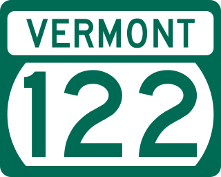
Vermont Route 122 (VT 122) is a state highway in the U.S. state of Vermont. The highway runs 15.215 miles (24.486 km) from U.S. Route 5 and VT 114 in Lyndon north to VT 16 in Glover. VT 122 connects Lynch and the towns of Wheelock and Sheffield in Caledonia County with Glover in Orleans County. The highway has an alternate route in Lyndon that provides access to Lyndon State College.

Sheffield is the primary village and a census-designated place (CDP) in the town of Sheffield, Caledonia County, Vermont, United States. It was first listed as a CDP prior to the 2020 census.

References

  1. 1 2 "U.S. Census website". United States Census Bureau . Retrieved January 31, 2008.
  2. "US Board on Geographic Names". United States Geological Survey. October 25, 2007. Retrieved January 31, 2008.
  3. "Census - Geography Profile: Barnet town, Caledonia County, Vermont". United States Census Bureau . Retrieved December 28, 2021.
  4. "Census - Geography Profile: Barnet CDP, Vermont". United States Census Bureau . Retrieved December 28, 2021.
  5. Jones-Baker, Doris (2004). Hertfordshire in History: Papers Presented to Lionel Munby. University of Hertfordshire Press. p. 127.
  6. Federal Writers Project, WPA for the State of Vermont (1937). Vermont: A Guide to the Green Mountain State. Boston: The Riverside Press. p. 177.
  7. Child, Hamilton (1887). Gazetteer of Caledonia and Essex Counties, VT: 1764–1887. Hamilton Child. pp. 133–151.
  8. Early Barnet. Chapter I. Pages 1-6. History of Barnet, Vermont, From the Outbreak of the French and Indian War to Present Time With Genealogical Records of Many Families. By Frederic Palmer Wells. Barnet History Association, Burlington, Vermont, Free Press Printing Co., 1923. Transcribed for Genealogy Trails by Nancy Piper. Accessed March 2021.
  9. Barnet, West Barnet, Norrisville, and McIndoes Falls Villages, Vermont 1875. Source Map - County Atlas of Caledonia, Vermont 1875 by F.W. Beers. Old Town Map Reprint. Accessed 20 March 2021.
  10. Fairbanks, Lorenzo Sayles (1897). Genealogy of the Fairbanks Family in America 1633–1897. Boston: American Printing and Engraving Company.
  11. Cousteau, Jean-Michel (March 26, 2018). My Father, the Captain: My Life with Jacques Cousteau. National Geographic Society. p. 21. ISBN   9781426206832 via Google Books.
  12. http://www.rootsweb.ancestry.com/~vtcbarne/barnet_churches.htm#WH Ecclesiastical History of the town of Barnet, Vermont
  13. Glasgow, W. Melancthon. A History of the Reformed Presbyterian Church in America Archived 2008-08-27 at the Wayback Machine , part 8. Baltimore: Hill and Harvey, 1888, p. 400. Accessed on 2008-04-24.
  14. McBurney, Charles and Beth. Reformed Presbyterian Ministers 1950–1993. Pittsburgh: Crown and Covenant, 1994, p. 225.
  15. "Born in Tibet, Again: The Exile of the 12th Trungpa Tulku, by Charles Carreon". www.american-buddha.com. Retrieved January 10, 2021.
  16. "Geographic Identifiers: 2010 Demographic Profile Data (G001): Barnet town, Caledonia County, Vermont". U.S. Census Bureau, American Factfinder. Archived from the original on February 12, 2020. Retrieved February 4, 2013.
  17. "Geographic Identifiers: 2010 Demographic Profile Data (G001): Barnet CDP, Vermont". U.S. Census Bureau, American Factfinder. Archived from the original on February 12, 2020. Retrieved February 6, 2013.
  18. 1 2 "Climate summary of Barnet, Vermont" . Retrieved May 15, 2015.
  19. "U.S. Decennial Census". United States Census Bureau. Retrieved May 16, 2015.
  20. Boyko, Janice (2010). "Barnet Business Directory, 1939". nekg-vt.com. Simsbury, CT: NEKG: Northeast Kingdom Genealogy. Retrieved May 25, 2010.
  21. Mapes, Jillian (May 3, 2018). "Neko Case on Her New Album, Her House Burning Down, and Her Futuristic Feminism". Pitchfork Music Festival. Chicago, IL: Condé Nast.
  22. Hohler, Bob (March 15, 2005). "Vt. town hangs on hero's every move: Coppenrath one of a kind". Boston Globe. Boston, MA.
  23. "Explorer Jacques Cousteau, who now spends his time searching the ocean's depths, has pledged $13,500 to protect the small Vermont lake where he got his start many years ago". UPI Archives. Boca Raton, FL. United Press International. September 1, 1982. Retrieved May 25, 2018.
  24. Strickland, Ron (1998). Vermonters: Oral Histories from Down Country to the Northeast Kingdom. Hanover, NH: University Press of New England. p. 30. ISBN   9780874518672.
  25. Walker, William T. (2011). McCarthyism and the Red Scare: A Reference Guide. Santa Barbara, CA: ABC-CLIO. p. 109. ISBN   978-1-59884-437-5.
  26. Berumen, Frank Javier Garcia (2014). Latino Image Makers in Hollywood . Jefferson, NC: McFarland & Company. p.  306. ISBN   978-0-7864-7432-5.
  27. Bemis, W. A., Town Clerk (October 10, 1956). "Vermont Birth Records, 1909-2008 for Christopher Lynn Hedges" . Ancestry.com. Provo, UT: Ancestry, LLC. Retrieved May 25, 2018.
  28. "Biography, Henry Clay Ide". The Vermonter. Vol. 9. St. Albans, VT: C. S. Forbes. 1903. p. 62.
  29. Wheeler, Scott (June 2010). "Search for /Charles Lindbergh's Kidnapped Son comes to Vermont". Vermont's Northland Journal. 9 (3): 14–15.
  30. 'Wisconsin Blue Book 1875,' Biographical Sketch of Harvey Thomas More, p. 312
  31. Fenn, George Manville (1903). Memoir of Benjamin Franklin Stevens. London, England: Chiswick Press. p. 1.
  32. Memoir of Benjamin Franklin Stevens, p. 3.