Benicia is a waterside city in Solano County, California, located in the North Bay region of the San Francisco Bay Area. It served as the capital of California for nearly thirteen months from 1853 to 1854. The population was 26,997 at the 2010 United States Census. The city is located along the north bank of the Carquinez Strait. Benicia is just east of Vallejo and across the strait from Martinez. Steve Young, elected in November 2020, is the mayor.
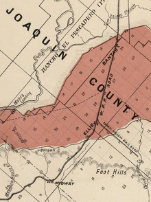
San Joaquin County, officially the County of San Joaquin, is a county in the U.S. state of California. As of the 2020 census, the population was 779,233. The county seat is Stockton.
Lathrop is a city located 9 miles (14 km) south of Stockton in San Joaquin County, California, United States. The 2020 United States Census reported that Lathrop's population was 28,701. The city is located in the San Joaquin Valley in Northern California at the intersection of Interstate 5 and California State Route 120.

Tracy is the second most populated city in San Joaquin County, California, United States. The population was 93,000 at the 2020 census. Tracy is located inside a geographic triangle formed by Interstate 205 on the north side of the city, Interstate 5 to the east, and Interstate 580 to the southwest.

San Pablo Bay is a tidal estuary that forms the northern extension of San Francisco Bay in the East Bay and North Bay regions of the San Francisco Bay Area in northern California.

The Carquinez Strait is a narrow tidal strait in Northern California. It is part of the tidal estuary of the Sacramento and the San Joaquin rivers as they drain into the San Francisco Bay. The strait is eight miles (13 km) long and connects Suisun Bay, which receives the waters of the combined rivers, with San Pablo Bay, a northern extension of the San Francisco Bay.

The Altamont Corridor Express is a commuter rail service in California, connecting Stockton and San Jose during peak hours only. ACE is named for the Altamont Pass, through which it runs. Service is managed by the San Joaquin Regional Rail Commission, and operations are contracted to Herzog Transit Services. The 86-mile (138 km) route includes ten stops, with travel time about 2 hours and 12 minutes end-to-end. In 2021, the line had a ridership of 227,900, or about 6,200 per weekday as of the fourth quarter of 2021. ACE uses Bombardier BiLevel Coaches, MPI F40PH-3C locomotives, and Siemens Charger locomotives.
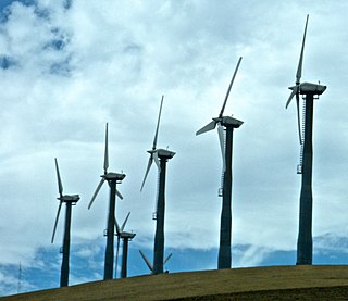
Altamont Pass, formerly Livermore Pass, is a low mountain pass in the Diablo Range of Northern California between Livermore in the Livermore Valley and Tracy in the San Joaquin Valley. The name is actually applied to two distinct but nearby crossings of the range. The lower of the two, at an elevation of 741 ft (226 m), carries two railroad rights-of-way (ROWs) and Altamont Pass Road, part of the old Lincoln Highway and the original alignment of US 50 before it was bypassed c. 1937. The bypass route travels over the higher summit, at 1,009 ft (308 m), and now carries Interstate 580, a major regional highway heavily congested by Central Valley suburbanization.

Interstate 205 (I-205) is an east–west auxiliary Interstate Highway in the San Joaquin Valley in Northern California. It runs from I-5 west to I-580. Along with those highways, I-205 forms the north side of a triangle around the city of Tracy. The route provides access from the San Francisco Bay Area to the northern San Joaquin Valley.

Niles Canyon is a canyon in the San Francisco Bay Area formed by Alameda Creek, known for its heritage railroad and silent movie history. The canyon is largely in an unincorporated area of Alameda County, while the western portion of the canyon lies within the city limits of Fremont and Union City. The stretch of State Route 84 known as Niles Canyon Road traverses the length of the canyon from the Niles district of Fremont to the unincorporated town of Sunol. Two railroads also follow the same route down the canyon from Sunol to Niles: the old Southern Pacific track along the north side, now the Niles Canyon Railway, and the newer Union Pacific track a little to the south. At the west end of the canyon are the ruins of the Vallejo Flour Mill, which dates to 1853.

U.S. Route 48 was a route in Central California near the San Francisco Bay Area. Assigned in 1926, it ran from San Jose to French Camp. It was the first US highway to be deleted in California and was one of the first few US highways to be deleted in the US.

The San Joaquin Valley Railroad is one of several short line railroad companies and is part of the Pacific Region Division of Genesee & Wyoming Inc. It operates about 297 miles (478 km) of track primarily on several lines in California's Central Valley/San Joaquin Valley outside Fresno, California and Bakersfield, California. The SJVR has trackage rights over Union Pacific from Fresno - Goshen Jct - Famoso - Bakersfield - Algoso. The SJVR also operated for the Tulare Valley Railroad (TVRR) from Calwa to Corcoran and Famoso.

The California Pacific Railroad Company was incorporated in 1865 at San Francisco, California as the California Pacific Rail Road Company. It was renamed the California Pacific Railroad Extension Company in the spring of 1869, then renamed the California Pacific Railroad later that same year. Its main railroad from Vallejo to Sacramento was completed six months prior to the May 1869 golden spike ceremony of the Central Pacific/Union Pacific Transcontinental Railway.

The Solano was a large railroad ferry, built as a reinforced paddle steamer with independently powered sidewheels by the Central Pacific Railroad, that carried entire trains across the Carquinez Strait between Benicia and Port Costa in California, daily for 51 years from 1879 to 1930. When launched, the Solano was the largest ferry of its kind in the world, a record held for 35 years until 1914 when she was joined by her sister ship, the Contra Costa, which was 13 feet longer.

Martinez station is an Amtrak passenger train station in Martinez, California, United States. Located at the west end of downtown Martinez, the station has one side platform and one island platform, which serve three of the four tracks of the Union Pacific Railroad Martinez Subdivision. It is served by the daily California Zephyr and Coast Starlight long-distance trains, five daily round trips of the San Joaquin corridor service, and fifteen daily round trips of the Capitol Corridor service. Martinez is also served by Amtrak Thruway Motorcoach intercity buses plus County Connection, WestCAT, and Tri-Delta Transit local buses.
The Western Pacific Railroad (1862-1870) was formed in 1862 to build a railroad from Sacramento, California, to the San Francisco Bay, the westernmost portion of the First Transcontinental Railroad. After the completion of the railroad from Sacramento to Alameda Terminal on September 6, 1869, and then the Oakland Pier on November 8, 1869, which was the Pacific coast terminus of the transcontinental railroad, the Western Pacific Railroad was absorbed in 1870 into the Central Pacific Railroad.
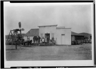
Mountain House was a historic waystop for forty-niners halfway from San Francisco to the Sierra Nevada gold country. Today it is an unincorporated community in Alameda County, California, United States. It is located 12 miles (19 km) east-northeast of Livermore, and 6 miles (9.7 km) east of the Altamont Pass, historically the Livermore Pass, at an altitude of 207 feet (63 m), between the California Aqueduct and the Delta-Mendota Canal. San Joaquin County's Mountain House borrowed the name of the historic Mountain House and is located two miles (3 km) to the northeast further downstream on Mountain House Creek.
There are 45 routes assigned to the "J" zone of the California Route Marker Program, which designates county routes in California. The "J" zone includes county highways in Alameda, Calaveras, Contra Costa, Fresno, Kern, Inyo, Mariposa, Merced, Sacramento, San Benito, San Joaquin, Stanislaus, and Tulare counties.

The Tri-Valley-San Joaquin Valley Regional Rail Authority is a special-purpose district body formed for the sole purpose of providing a public transit connection, known as Valley Link, between broad-gauge Bay Area Rapid Transit (BART) and standard-gauge Altamont Corridor Express (ACE) services, in Northern California.

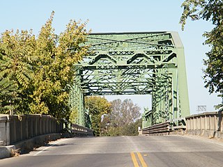
The Benicia Southern Pacific Railroad Passenger Depot is a former train station in Benicia, California.