Victor, California

Last updated

Victor
USA California location map.svg
Red pog.svg
Victor
Position in California.
Coordinates: 38°08′19″N121°11′56″W / 38.13861°N 121.19889°W / 38.13861; -121.19889 Coordinates: 38°08′19″N121°11′56″W / 38.13861°N 121.19889°W / 38.13861; -121.19889
CountryUS
StateFlag of California.svg  California
County San Joaquin
Area
[1]
  Total1.255 sq mi (3.251 km2)
  Land1.255 sq mi (3.251 km2)
  Water0 sq mi (0 km2)  0%
Elevation
[2]
79 ft (24 m)
Population
 (2020)
  Total215
  Density170/sq mi (66/km2)
Time zone UTC-8 (Pacific (PST))
  Summer (DST) UTC-7 (PDT)
ZIP code
95253
Area code(s) 209
GNIS feature ID2583176
U.S. Geological Survey Geographic Names Information System: Victor, California

Victor is a census-designated place and community in San Joaquin County, California, United States. [2] The population was 215 at the 2020 census, which is lower than 293 at the 2010 census.

Contents

The ZIP Code is 95253, and the settlement is inside area code 209.

Geography

According to the United States Census Bureau, the CDP covers an area of 1.3 square miles (3.3 km2), all of it land.

Demographics

The 2010 United States Census [3] reported that Victor had a population of 293. The population density was 233.4 inhabitants per square mile (90.1/km2). The racial makeup of Victor was 177 (60.4%) White, 0 (0.0%) African American, 7 (2.4%) Native American, 19 (6.5%) Asian, 0 (0.0%) Pacific Islander, 79 (27.0%) from other races, and 11 (3.8%) from two or more races. Hispanic or Latino of any race were 150 persons (51.2%).

The Census reported that 293 people (100% of the population) lived in households, 0 (0%) lived in non-institutionalized group quarters, and 0 (0%) were institutionalized.

There were 98 households, out of which 37 (37.8%) had children under the age of 18 living in them, 57 (58.2%) were opposite-sex married couples living together, 12 (12.2%) had a female householder with no husband present, 9 (9.2%) had a male householder with no wife present. There were 8 (8.2%) unmarried opposite-sex partnerships, and 0 (0%) same-sex married couples or partnerships. 16 households (16.3%) were made up of individuals, and 8 (8.2%) had someone living alone who was 65 years of age or older. The average household size was 2.99. There were 78 families (79.6% of all households); the average family size was 3.33.

The population was spread out, with 88 people (30.0%) under the age of 18, 22 people (7.5%) aged 18 to 24, 70 people (23.9%) aged 25 to 44, 71 people (24.2%) aged 45 to 64, and 42 people (14.3%) who were 65 years of age or older. The median age was 32.5 years. For every 100 females, there were 92.8 males. For every 100 females age 18 and over, there were 107.1 males.

There were 114 housing units at an average density of 90.8 per square mile (35.1/km2), of which 64 (65.3%) were owner-occupied, and 34 (34.7%) were occupied by renters. The homeowner vacancy rate was 3.0%; the rental vacancy rate was 10.5%. 149 people (50.9% of the population) lived in owner-occupied housing units and 144 people (49.1%) lived in rental housing units.

Politics

In the state legislature, Victor is in the 5th Senate District, represented by Democratic Cathleen Galgiani, and in the 12th Assembly District, represented by Republican Kristin Olsen.

Federally, Victor is in California's 9th congressional district , represented by Democrat Jerry McNerney. [4]

Related Research Articles

Bayview, Humboldt County, California Census-designated place in California, United States

Bayview is a census-designated place (CDP) located adjacent to the City of Eureka in Humboldt County, California, United States. Its population is 2,619 as of the 2020 census, up from 2,510 from the 2010 census. Many locals consider this area as part of "Pine Hill."

<span class="mw-page-title-main">Wilkerson, California</span> Census-designated place in California, United States

Wilkerson is a census-designated place (CDP) in Inyo County, California, United States. The population was 563 at the 2010 census, up from 562 at the 2000 census.

Las Lomas, California Census-designated place in California, United States

Las Lomas is a census-designated place (CDP) in Monterey County, California, United States. Las Lomas is located 7 miles (11 km) north-northwest of Prunedale. The elevation is 43 feet. The population was 3,024 at the 2010 census, down from 3,078 at the 2000 census.

Tobin, California Census-designated place in California, United States

Tobin is a census-designated place (CDP) in Plumas County, California, United States. The population was 12 at the 2010 census, up from 11 at the 2000 census.

<span class="mw-page-title-main">Vineyard, California</span> Census-designated place in California, United States

Vineyard is a census-designated place (CDP) in Sacramento County, California, United States. It is part of the Sacramento–Arden-Arcade–Roseville Metropolitan Statistical Area. The population was 24,836 at the 2010 census, up from 10,109 at the 2000 census. Along with more than doubling its population in just one decade, Vineyard also grew to become one of Greater Sacramento's most racially diverse suburbs.

Mountain View Acres, California Census-designated place in California, United States

Mountain View Acres is a census-designated place (CDP) in the Victor Valley of the Mojave Desert, within San Bernardino County, California.

Crest, California Census-designated place in California, United States

Crest is an unincorporated community in San Diego County, California. The Crest census-designated place (CDP) had a population of 2,593 at the 2010 census, down from 2,716 at the 2000 census.

Garden Acres, California Census-designated place in California, United States

Garden Acres is a census-designated place (CDP) in San Joaquin County, California, United States. The population was 10,648 at the 2010 census, up from 9,747 at the 2000 census. It is the most populous CDP in San Joaquin County.

<span class="mw-page-title-main">Toro Canyon, California</span> Census-designated place in California, United States

Toro Canyon is a census-designated place (CDP) in Santa Barbara County, California, United States. The population was 1,835 at the 2020 census, up from 1,508 at the 2010 census.

Bret Harte is a census-designated place (CDP) in Stanislaus County, California, United States. The population was 5,152 at the 2010 census, down from 5,161 at the 2000 census. It is part of the Modesto Metropolitan Statistical Area. It is named for the American poet and short story writer, Bret Harte, best known for his writings about the California Gold Rush.

<span class="mw-page-title-main">Riverdale Park, California</span> Census-designated place in California, United States

Riverdale Park is a census-designated place (CDP) in Stanislaus County, California, United States. The population was 1,128 at the 2010 census, up from 1,094 at the 2000 census. It is part of the Modesto Metropolitan Statistical Area.

Jamestown, California Census-designated place in California, United States

Jamestown is a census-designated place (CDP) in Tuolumne County, California, United States. The population was 3,433 at the 2010 census, up from 3,017 at the 2000 census. Formerly a California Gold Rush town, Jamestown is now a California Historical Landmark. Jamestown is the home of Railtown 1897 State Historic Park and the Sierra Railway, which operates steam passenger trains.

Linda, California Census-designated place in California, United States

Linda is a census-designated place (CDP) in Yuba County, California, United States. The population was 17,773 at the 2010 census, up from 13,474 at the 2000 census. Linda is located 2 miles (3.2 km) north-northwest of Olivehurst.

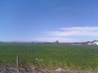
Yolo is an unincorporated community and census-designated place in Yolo County, California. It is located 4.9 miles northwest of the county seat, Woodland and 24 miles northwest of the state capital of Sacramento. Yolo's ZIP Code is 95697 and its area code 530. It lies at an elevation of 82 feet. The population was 452 at the 2010 census.

Oak Hills is a census-designated place in the Victor Valley of the Mojave Desert, within San Bernardino County, California.

Freeport, California Census-designated place in California, United States

Freeport, California is a census-designated place located approximately 7.5 miles (12.1 km) south of downtown Sacramento on California State Route 160. Freeport lies on the eastern banks of the Sacramento River in Sacramento County. The population was 58 at the 2020 census.

El Sobrante is a census-designated place in Riverside County, California. El Sobrante sits at an elevation of 1,283 feet (391 m). The 2010 United States census reported El Sobrante's population was 12,723.

Gold Mountain, California Place in California, United States

Gold Mountain is an unincorporated community in Plumas County, California. Gold Mountain sits at an elevation of 5,341 feet (1,628 m). The 2010 United States census reported Gold Mountain's population was 80. For statistical purposes, the United States Census Bureau has defined Gold Mountain as a census-designated place (CDP).

Mountain Gate is a census-designated place (CDP) in Shasta County, California, United States. Mountain Gate sits at an elevation of 915 feet (279 m). The Its population is 815 as of the 2020 census, down from 943 from the 2010 census.

Idlewild is a census-designated place (CDP) in Tulare County, California. Idlewild sits at an elevation of 3,766 feet (1,148 m). The 2010 United States census reported Idlewild's population was 43.

References

  1. "U.S. Census". Archived from the original on February 20, 2011. Retrieved November 25, 2012.
  2. 1 2 U.S. Geological Survey Geographic Names Information System: Victor, California
  3. "2010 Census Interactive Population Search: CA – Victor CDP". U.S. Census Bureau. Archived from the original on July 15, 2014. Retrieved July 12, 2014.
  4. "California's 9th Congressional District - Representatives & District Map". Civic Impulse, LLC. Retrieved March 12, 2013.