South Woodbridge, California

Last updated
South Woodbridge
CAMap-doton-South Woodbridge.png
Location of South Woodbridge, California
Coordinates: 38°9′15″N121°18′22″W / 38.15417°N 121.30611°W / 38.15417; -121.30611 Coordinates: 38°9′15″N121°18′22″W / 38.15417°N 121.30611°W / 38.15417; -121.30611
Country Flag of the United States.svg  United States
State Flag of California.svg  California
County San Joaquin
Government
   Senate Tom Berryhill (R)
   Assembly Alan Nakanishi (R)
   U. S. Congress Jerry McNerney (D) [1]
Area
  Total1.0 km2 (0.4 sq mi)
  Land1.0 km2 (0.4 sq mi)
  Water0.0 km2 (0.0 sq mi)
Population
 (2000)
  Total2,825
  Density2,963.4/km2 (7,675.1/sq mi)
Time zone UTC-8 (PST)
  Summer (DST) UTC-7 (PDT)
ZIP code
95258
Area code(s) 209
FIPS code 06-73461

South Woodbridge was a former census-designated place (CDP) in San Joaquin County, California, United States. The population was 2,825 at the 2000 census. For the 2010 census, the CDP's of South Woodbridge and North Woodbridge were merged into Woodbridge.

Contents

Geography

South Woodbridge is located at 38°9′15″N121°18′22″W / 38.15417°N 121.30611°W / 38.15417; -121.30611 (38.154118, -121.306008). [2]

According to the United States Census Bureau, the CDP had a total area of 0.4 square miles (1.0 km2), of which, 0.4 square miles (1.0 km2) of it was land and 2.63% was water.

Demographics

As of the census [3] of 2000, there were 2,825 people, 891 households, and 733 families residing in the CDP. The population density was 7,675.2 inhabitants per square mile (2,963.4/km2). There were 914 housing units at an average density of 2,483.2 per square mile (958.8/km2). The racial makeup of the CDP was 76.21% White, 0.14% African American, 0.99% Native American, 4.85% Asian, 0.04% Pacific Islander, 13.73% from other races, and 4.04% from two or more races. Hispanic or Latino of any race were 27.40% of the population.

There were 891 households, out of which 47.9% had children under the age of 18 living with them, 64.4% were married couples living together, 12.9% had a female householder with no husband present, and 17.7% were non-families. 13.8% of all households were made up of individuals, and 3.9% had someone living alone who was 65 years of age or older. The average household size was 3.15 and the average family size was 3.46.

In the CDP, the population was spread out, with 33.5% under the age of 18, 7.5% from 18 to 24, 29.6% from 25 to 44, 22.1% from 45 to 64, and 7.3% who were 65 years of age or older. The median age was 33 years. For every 100 females, there were 103.8 males. For every 100 females age 18 and over, there were 98.3 males.

The median income for a household in the CDP was $48,476, and the median income for a family was $51,810. Males had a median income of $40,427 versus $31,354 for females. The per capita income for the CDP was $19,067. About 4.5% of families and 7.1% of the population were below the poverty line, including 11.5% of those under age 18 and none of those age 65 or over.

Related Research Articles

<span class="mw-page-title-main">Tamalpais-Homestead Valley, California</span> Census-designated place in California, United States

Tamalpais-Homestead Valley is a census-designated place (CDP) in Marin County, California, United States. The population was 11,492 at the 2020 census.

North Auburn, California Census-designated place in California, United States

North Auburn is a census-designated place (CDP) in Placer County, California, United States. It is part of the Sacramento–Arden-Arcade–Roseville Metropolitan Statistical Area. The population was 13,022 at the 2010 census, up from 11,847 at the 2000 census.

North Highlands, California Census-designated place in California, United States

North Highlands is a census-designated place (CDP) in Sacramento County, California, United States. It is part of the Sacramento–Arden-Arcade–Roseville Metropolitan Statistical Area. The population was 42,694 at the 2010 census, down from 44,187 at the 2000 census.

Camp Pendleton Mainside, California Census-designated place in California, United States

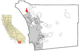
Camp Pendleton Mainside is a census-designated place (CDP) in San Diego County, California, located at the southeast corner of the Marine Corps Base Camp Pendleton. Per the 2020 census, the population was 9,683. It was formerly known as Camp Pendleton North, but its name was changed for the 2020 Census. Along with Camp Pendleton South, it is one of two CDPs located on the base.

Morada, California Census-designated place in California, United States

Morada is a census-designated place (CDP) in San Joaquin County, California, United States. The population was 3,166 at the 2020 census, down from 3,828 at the 2010 census.

Buena Vista, San Jose Neighborhood of San Jose in Santa Clara, California, United States

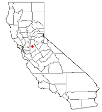
Buena Vista is a former census-designated place (CDP) in Santa Clara County, California, United States. The population was 1,704 at the 2000 census. The area is now part of the city of San Jose.

Freedom, California Census-designated place in California, United States

Freedom is a census-designated place (CDP) in Santa Cruz County, California, United States. The population was 3,070 at the 2010 census.

Cumberland Center, Maine Census-designated place in Maine, United States

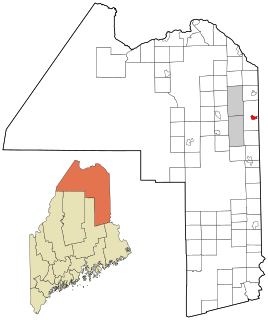
Cumberland Center is a census-designated place (CDP) within the town of Cumberland in Cumberland County, Maine, United States. The population was 2,499 at the 2010 census. It is part of the Portland – South Portland – Biddeford, Maine, Metropolitan Statistical Area.

North Woodbridge, California Former census-designated place in California, United States

North Woodbridge was a former census-designated place (CDP) in San Joaquin County, California, United States. The population was 1,320 at the 2000 census. For the 2010 census, the CDP's of South Woodbridge and North Woodbridge were merged into Woodbridge.

Woodbridge (CDP), New Jersey Census-designated place in New Jersey, United States

Woodbridge is an unincorporated community and census-designated place (CDP) within Woodbridge Township, in Middlesex County, New Jersey, United States. As of the 2010 United States Census, the CDP's population was 19,265. Despite the similarity in the name of the CDP and the township, the two are not coextensive; the CDP occupies 15.7% of the township's 24.51 square miles (63.5 km2).

Brewster Hill, New York Census-designated place in New York, United States

Brewster Hill is a hamlet located in the town of Southeast in Putnam County, New York, United States. As of the 2010 census, the population was 2,089.

Aquebogue, New York Hamlet and census-designated place in New York, United States

Aquebogue is a census-designated place (CDP) roughly corresponding to the hamlet by the same name in the Town of Riverhead in Suffolk County, on Long Island, in New York, United States. The CDP's population was 2,438 at the 2010 census.

Lake Katrine, New York CDP in New York, United States

Lake Katrine is a hamlet in Ulster County, New York, United States. The population was 2,397 at the 2010 census.

Ames Lake, Washington Census-designated place in Washington, United States

Ames Lake is an unincorporated community and census-designated place (CDP) in King County, Washington, United States. The population was 1,486 at the 2010 census.

Baring, Washington Census-designated place in Washington, United States

Baring is an unincorporated community and census-designated place (CDP) in King County, Washington, United States. The population was 220 at the 2010 United States Census. It is located on U.S. Highway 2 about 23 miles (37 km) west of Stevens Pass, along a very flat and straight three-mile section of highway that has been dubbed the "Baring Straight", since US-2 is otherwise hilly and curvy through the mountains. The settlement was first known as "Salmon", but by 1909 it was known as Baring.

Riverpoint, Washington Census-designated place in Washington, United States

Riverpoint is an unincorporated community and census-designated place (CDP) in east King County, Washington, United States. As of the 2020 census, it had a population of 774. At the 2010 census, the area was listed as the Tanner CDP and had a population of 1,018 over a larger area.

Prairie Ridge, Washington CDP in Washington, United States

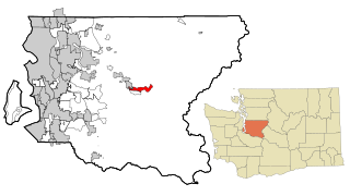
Prairie Ridge is a census-designated place (CDP) in Pierce County, Washington, United States. The population was 12,288 at the 2020 census.

Canyon Creek, Washington CDP in Washington, United States

Canyon Creek is a census-designated place (CDP) in Snohomish County, Washington, United States. The population was 3,200 at the 2010 census. Prior to the 2010 census, the CDP was known as Jordan Road-Canyon Creek.

Jefferson Valley, New York Census-designated place in New York, United States

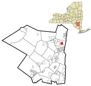
Jefferson Valley-Yorktown, commonly known as Jefferson Valley, is a census-designated place (CDP) located in the town of Yorktown in Westchester County, New York, United States. The population was 14,142 at the 2010 census. It is a hot spot for local shoppers, due to its Jefferson Valley Mall.

Fort Fairfield (CDP), Maine Census-designated place in Maine, United States

Fort Fairfield is a census-designated place (CDP) comprising the main village within the town of Fort Fairfield in Aroostook County, Maine, United States. The population of the CDP was 1,825 at the 2010 census, out of a population of 3,496 for the entire town.

References

  1. "California's 9th Congressional District - Representatives & District Map". Civic Impulse, LLC. Retrieved March 12, 2013.
  2. "US Gazetteer files: 2010, 2000, and 1990". United States Census Bureau. 2011-02-12. Retrieved 2011-04-23.
  3. "U.S. Census website". United States Census Bureau . Retrieved 2008-01-31.