Bellefonte is a town in New Castle County, Delaware, United States. According to the 2010 Census, the population of the town is 1,193.
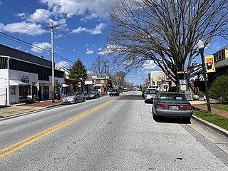
Claymont is a census-designated place (CDP) in New Castle County, Delaware, United States. As of the 2020 U.S. census, the population of Claymont was 9,895.

Hockessin is a census-designated place (CDP) in New Castle County, Delaware, United States. The population was 13,478 at the 2020 Census.
Newport is a town in New Castle County, Delaware, United States. It is on the Christina River. It is best known for being the home of colonial inventor Oliver Evans. The population was 1,055 at the 2010 census. Four limited access highways, I-95, I-295, I-495, and Delaware Route 141 intersect within one mile (1.6 km) of the town.

Brandywine Creek is a tributary of the Christina River in southeastern Pennsylvania and northern Delaware in the United States. The Lower Brandywine is 20.4 miles (32.8 km) long and is a designated Pennsylvania Scenic River with several tributary streams. The East Branch and West Branch of the creek originate within 2 miles (3 km) of each other on the slopes of Welsh Mountain in Honey Brook Township, Pennsylvania, about 20 miles (32 km) northwest of their confluence.

Chadds Ford Township is an affluent township in Delaware County, Pennsylvania, United States. It is located about 25 miles (40 km) southwest of Philadelphia.
Brandywine Hundred is an unincorporated subdivision of New Castle County, Delaware, United States. It is located to the north and northeast of the city of Wilmington. Hundreds were once used as a basis for representation in the Delaware General Assembly. Brandywine Hundred and North Wilmington are commonly used colloquial names for this area. However, while their names still appear on all real estate transactions, all other hundreds in Delaware presently have no meaningful use or purpose except as a geographical point of reference. In the 2010 census, Brandywine had 77,182 people.
Christiana Hundred is an unincorporated subdivision of New Castle County, Delaware. Hundreds were once used as a basis for representation in the Delaware General Assembly, and while their names still appear on all real estate transactions, they presently have no meaningful use or purpose except as a geographical point of reference.

Pennsylvania Route 52 is a 11.8-mile-long (19.0 km) state highway located in southeast Pennsylvania. The southern terminus of the route is at the Pennsylvania-Delaware state line near Kennett Square, where the road continues as Delaware Route 52. The northern terminus is at U.S. Route 322 Business in West Chester. Near the Kennett Township community of Longwood, it has about a 1-mile (1.6 km) wrong-way concurrency with US 1. PA 52 passes through suburban and rural areas along its route.

Chadds Ford is a census-designated place (CDP) in Delaware and Chester counties, Pennsylvania, United States, comprising the unincorporated communities of Chadds Ford and Chadds Ford Knoll. It was first listed as a CDP prior to the 2020 census.

Delaware Route 82 (DE 82) is a state highway in the northwest suburbs of Wilmington in New Castle County, Delaware. The route, which is signed north-south, runs 5.49 miles (8.84 km) from DE 52 near Greenville northwest to the Pennsylvania state line near Yorklyn, where the road continues into that state as Pennsylvania Route 82 (PA 82). The route runs through areas of woods and fields in northern New Castle County, with much of the route paralleling the Red Clay Creek. The entire route is a part of the Red Clay Scenic Byway, created in 2005. DE 82 was first numbered by 1952 on its current alignment. In 2010, the Delaware Department of Transportation (DelDOT) proposed eliminating the route number, but the plan fell through due to public opposition.
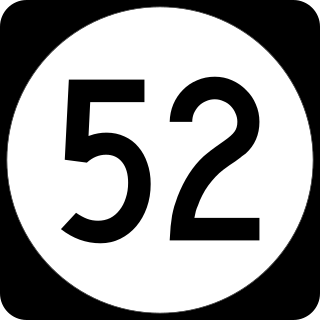
Delaware Route 52 (DE 52) is a state highway in New Castle County, Delaware. The route runs from U.S. Route 13 Business in downtown Wilmington north to Pennsylvania Route 52 (PA 52) at the Pennsylvania border near Centerville. DE 52 runs through the city of Wilmington and passes through areas of the Brandywine Valley north of Wilmington. DE 52 intersects Interstate 95 (I-95)/US 202 and DE 2 in Wilmington and DE 100/DE 141 and DE 82 in Greenville. The entire route is designated as part of the Brandywine Valley National Scenic Byway, a National Scenic Byway and Delaware Byway, while most of the route is also designated as part of the Harriet Tubman Underground Railroad Byway of the Delaware Byways system. The road was built as the Kennett Pike, a turnpike, between 1811 and 1813. The Kennett Pike was bought by Pierre S. du Pont in 1919 and was widened and paved before being sold to the State of Delaware for $1. The road received the DE 52 designation by 1936.

Delaware Route 100 (DE 100) is a state highway in New Castle County, Delaware. The route runs from DE 4 near Elsmere to the Pennsylvania border near Montchanin, where it continues into Pennsylvania as State Route 3100. The road runs through suburban areas of northern New Castle County. The route intersects DE 2 in Elsmere before forming separate concurrencies with DE 48 and DE 141 from west of Wilmington north to Greenville. In Greenville, there is an interchange with DE 52. North of Greenville, DE 100 continues by itself to the Pennsylvania border, intersecting DE 92 in Montchanin. DE 100 was first designated in the 1930s to run from DE 52 to the Pennsylvania border, where it connected to Pennsylvania Route 100 (PA 100) until the southern terminus of that route was truncated away from the state line in 2003. By the 1970s, it was extended south to DE 4. The route was realigned to follow parts of DE 48 and DE 141 by 1990.

U.S. Route 13 Business is an 8.19-mile (13.18 km) business route of US 13 that runs through the heart of the city of Wilmington in New Castle County, Delaware, where US 13 bypasses downtown Wilmington to the east, running near Interstate 495 (I-495) and the Delaware River. US 13 Bus. begins at I-495 and US 13 at the southern border of Wilmington and heads north toward the downtown area, where it splits into a one-way pair. Past downtown, the business route heads through the northeastern part of the city on North Market Street before continuing through suburban Brandywine Hundred on Philadelphia Pike. US 13 Bus. reaches its northern terminus at US 13 in Claymont. US 13 Bus. is a four-lane road for much of its length.

Rodney Square is the public square and historic district in downtown Wilmington, Delaware, United States, named after American Revolutionary leader Caesar Rodney. A large equestrian statue of Rodney by James E. Kelly formerly stood in the front of the square until it was removed in 2020. The square was created in the early 20th century by John Jacob Raskob, who worked for Pierre S. du Pont. The City Beautiful movement served as the inspiration for the effort.

Fairville, Pennsylvania is an unincorporated area in southern Chester County which developed in the early nineteenth century about a mile north of the Pennsylvania-Delaware border. It is a linear village along the Kennett Pike that runs between Kennett Square, Pennsylvania and Wilmington, Delaware. Businesses along the road served both travelers on the road and residents of nearby farms. The village or hamlet extends about 500 yards along both sides of Kennett Pike from Fairville Road to Hickory Hill Road.
Brandywine Village was an early center of U.S. industrialization located on the Brandywine River in what is now Wilmington, Delaware.


