
Bear is a census-designated place (CDP) in New Castle County, Delaware, United States. The population was 19,371 at the 2010 census.

Elsmere is a town in New Castle County, Delaware, United States, bordering the city of Wilmington along Wilmington's western border. According to the 2010 Census, the population of the town is 6,131.

Hockessin is a census-designated place (CDP) in New Castle County, Delaware, United States. The population was 13,527 at the 2010 census.

Newark is a city in New Castle County, Delaware, United States. It is located 12 miles (19 km) west-southwest of Wilmington. According to the 2010 Census, the population of the city is 31,454. Newark is home to the University of Delaware.
Newport is a town in New Castle County, Delaware, United States. It is on the Christina River. It is best known for being the home of colonial inventor Oliver Evans. The population was 1,055 at the 2010 census. Four limited access highways, I-95, I-295, I-495, and Delaware Route 141 intersect within one mile (1.6 km) of the town.

Pike Creek is a census-designated place (CDP) in New Castle County, Delaware and is part of the Philadelphia-Camden-Wilmington, PA-NJ-DE-MD Metropolitan statistical area. In 2007, CNN's Money Magazine ranked Pike Creek number 79 on its list of the 100 Best Places to Live in the United States. Pike Creek was the only community in Delaware to appear on the list. The population was 7,898 at the 2010 census. Local attractions include Middle Run Natural Area, White Clay Creek State Park, Carousel Farm Park & Equestrian Center, Golf and Restaurants. Pike Creek is approximately 5 miles from downtown Newark, Delaware which contains the University of Delaware. Pike Creek is connected to the University of Delaware campus and the Newark, Delaware downtown area by several bike trails. Pike Creek is approximately 10 miles west of the state's largest city, Wilmington, Delaware which is a national financial center.
Red Clay Creek is a 12.7-mile-long (20.4 km) tributary of White Clay Creek, running through southeastern Pennsylvania and northern Delaware in the United States. As of 2000, portions of the creek are under wildlife habitat protection.
Christiana Hundred is an unincorporated subdivision of New Castle County, Delaware. Hundreds were once used as a basis for representation in the Delaware General Assembly, and while their names still appear on all real estate transactions, they presently have no meaningful use or purpose except as a geographical point of reference.
Mill Creek Hundred is an unincorporated subdivision of New Castle County, Delaware. Hundreds were once used as a basis for representation in the Delaware General Assembly, and while their names still appear on all real estate transactions, they presently have no meaningful use or purpose except as a geographical point of reference.
White Clay Creek Hundred is an unincorporated subdivision of New Castle County, Delaware. Hundreds were once used as a basis for representation in the Delaware General Assembly, and while their names still appear on all real estate transactions, they presently have no meaningful use or purpose except as a geographical point of reference.
Red Clay Consolidated School District is a public school district in northern New Castle County, Delaware. Founded in 1981, Red Clay serves a portion of the city of Wilmington, as well as its northwestern suburbs.
The John Dickinson School, previously known as John Dickinson High School, is a public high school in the Pike Creek area of Wilmington, Delaware. It is one of five high schools in the Red Clay Consolidated School District and serves parts of Newport, Stanton, Hockessin, Wilmington, North Star, Pike Creek, Pike Creek Valley, Baynard Boulevard, and Brandywine Village.
Delaware Route 2 (DE 2) is a 10.81-mile-long (17.40 km) east–west state highway located in the northern part of New Castle County in the U.S. state of Delaware. It runs from DE 72 and DE 273 on the eastern edge of Newark east to DE 52 in Wilmington. Between Newark and Wilmington, the route is a four- to six-lane divided highway called Capitol Trail and Kirkwood Highway that passes through suburban areas, running through Marshallton, Prices Corner, and Elsmere. In Wilmington, DE 2 is routed along the one-way pair of Lincoln Street eastbound and Union Street westbound, passing through urban areas.

Delaware Route 7 (DE 7) is a two- to four-lane north–south highway in New Castle County, Delaware that connects U.S. Route 13 (US 13) and DE 72 in Wrangle Hill north to the Pennsylvania border near Hockessin, where the road continues into Pennsylvania as State Route 3013 (SR 3013), intersecting Pennsylvania Route 41 (PA 41) at an interchange. Between Wrangle Hill and Christiana, DE 7 runs parallel to the west of the DE 1 freeway through suburban areas, passing through Bear. DE 7 joins the DE 1 freeway next to the Christiana Mall and comes to an interchange with Interstate 95 (I-95), where DE 1 reaches its northern terminus, before the freeway ends at the DE 58 interchange. After the freeway segment, DE 7 continues north as an at-grade road concurrent with DE 4 through Stanton. From Stanton to the Pennsylvania border, DE 7 heads northwest through suburban areas, passing through Pike Creek.

The Christina School District is a Delaware public school district located primarily in the Newark area and a non-contiguous portion of Wilmington. The district office is located in the Drew Educational Support Center in Wilmington, with Dan Shelton as the current superintendent.
Delaware Route 4 (DE 4) is a state highway in New Castle County, Delaware. The route runs from DE 279 and DE 896 in Newark east to DE 48 in downtown Wilmington. The route passes through suburban areas in northern New Castle County between Newark and Wilmington, intersecting DE 72 in the eastern part of Newark, DE 273 in Ogletown, DE 58 in Christiana, DE 7 in Stanton, DE 141 in Newport, DE 62 and DE 100 between Newport and Wilmington, and Interstate 95 (I-95)/U.S. Route 202 (US 202) in Wilmington. DE 4 is a four-lane road for much of its length.

Pike Creek Valley is a census-designated place in New Castle County, Delaware, United States. Its population was 11,217 as of the 2010 census.
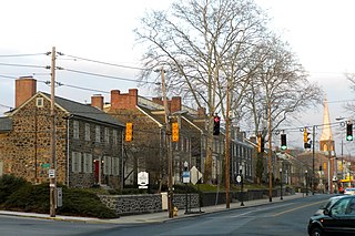
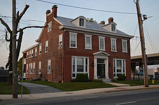
Brandywine Village Historic District is a national historic district located along Brandywine Creek at Wilmington, New Castle County, Delaware. It encompasses 12 contributing buildings, 7 contributing sites, and 2 contributing structures. Brandywine Village developed in the late-18th century as a group of flour mills, the homes of prosperous millers, mill workers, shop keepers and artisans. Located in the district are a set of mill owner built homes of granite. Notable buildings include the Gothic Revival style St. John's Episcopal Church (1857-1858) designed by noted Philadelphia architect John Notman, Brandywine Methodist Episcopal Church (1857), and Brandywine Academy (1798). In 1788, Brandywine Village was the site of the first mechanized mill designed by Oliver Evans.

The Christiana Mall Park & Ride is a park and ride lot and bus terminal located at the Christiana Mall in the unincorporated community of Christiana between Wilmington and Newark in New Castle County, Delaware. The park and ride serves DART First State buses, with service provided by 9 local bus routes serving New Castle County and two inter-county bus routes that provide service to Dover and seasonal service to Lewes and Rehoboth Beach.

The Newark Transit Hub is a bus terminal located in the city of Newark in New Castle County, Delaware. The transit hub serves DART First State buses, with service provided by five local bus routes serving New Castle County. In addition to DART First State buses, the Newark Transit Hub also serves Cecil Transit buses providing service to Elkton, Maryland along with UNICITY buses that serve as a community circulator around Newark. The transit hub opened in 2008.


