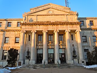
Delaware County, colloquially referred to as Delco, is a county located in the U.S. state of Pennsylvania that borders Philadelphia. With a population of 566,747, it is the fifth most populous county in Pennsylvania, and the third smallest in area. The county was created on September 26, 1789, from part of Chester County, and named for the Delaware River.

Chester Heights is a borough in Delaware County, Pennsylvania, United States. The population was 2,531 at the 2010 census. Most of the borough lies south of U.S. 1, about a mile southwest of Wawa.

Cornwells Heights is a census-designated place located in Bensalem Township in Bucks County, Pennsylvania. The community was formerly part of Cornwells Heights-Eddington, but was split into two separate CDP's. As of the 2010 census, the population was 1,391. The Cornwells Heights station is located in the community and serves SEPTA Regional Rail's Trenton Line and Amtrak's Keystone Service and Northeast Regional services along the Northeast Corridor. The train station also has a park-and-ride with access from Interstate 95.

The Treaty of Fort Pitt, also known as the Treaty With the Delawares, the Delaware Treaty, or the Fourth Treaty of Pittsburgh, was signed on September 17, 1778, and was the first written treaty between the new United States of America and any American Indians, in this case the Lenape. Although many informal treaties were held with Native Americans during the American Revolution from 1775 to 1783, the only one that resulted in a formal document was signed at Fort Pitt, Pennsylvania, now the site of Downtown Pittsburgh. It was essentially a formal treaty of alliance.
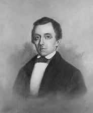
Daniel Rodney was an American merchant and politician from Lewes in Sussex County, Delaware. He was a member of the Federalist Party, and later the National Republican Party, who served as Governor of Delaware, U. S. Representative from Delaware and U.S. Senator from Delaware.
The Dean of the United States Senate is an informal term for the senator with the longest continuous service, regardless of party affiliation. This is not an official position within the Senate, although customarily the longest-serving member of the majority party serves as president pro tempore.
Daniel Rogers was an American miller and politician from Milford, in Sussex County, Delaware. He was a member of the Federalist Party, who served in the Delaware General Assembly and as Governor of Delaware.

The Evansville Vanderburgh School Corporation (EVSC) is a public school corporation serving Evansville, Indiana and Vanderburgh County. It is the third largest school district in the state of Indiana, behind Indianapolis Public Schools and Fort Wayne Community Schools and the largest in Southern Indiana. The headquarters are located on Walnut Street in downtown Evansville. The school district serves nearly 23,000 students educated by more than 1,600 teachers.

Yorklyn is an unincorporated community in northern New Castle County, Delaware, United States. It lies along Delaware Route 82 northwest of the city of Wilmington, the county seat of New Castle County. Its elevation is 174 feet (53 m). It has a post office with the ZIP code 19736.

Edward Green Bradford II was a United States District Judge of the United States District Court for the District of Delaware.

Silverside Heights is an unincorporated community in New Castle County, Delaware, United States. Silverside Heights is located north of the intersection of U.S. Route 13 Business and Silverside Road northeast of Wilmington and southwest of Claymont.
Phillips Heights is an unincorporated community in New Castle County, Delaware, United States. Phillips Heights is located east of the intersection of U.S. Route 13 Business and Marsh Road northeast of Wilmington.
Cleland Heights is an unincorporated community in New Castle County, Delaware, United States. It was established in 1952 and consists of about 450 houses.
Events from the year 1776 in the United States. This year is celebrated in the United States as the official beginning of the nation, with the Declaration of Independence issued on July 4.

The 2016 Delaware gubernatorial election took take place on November 8, 2016, to elect the Governor of Delaware, concurrently with the 2016 U.S. presidential election, as well as elections to the United States Senate in other states and elections to the United States House of Representatives and various state and local elections.

Auburn Valley State Park is a state park, located in Yorklyn, Delaware, United States. The park, which is around 360 acres, preserves the former home and estate of the Marshall family as well as portions of the family's former mills alongside the Red Clay Creek and additional land purchased by the state. The preserve contains several miles of trails open to walking, biking, and antique cars, and the state owns conservation easements on 160 acres of privately owned land adjacent to the park to help maintain the park's rural character.

The 1798 Delaware gubernatorial election was held on October 2, 1798.

The 1810 Delaware gubernatorial election was held on October 2, 1810.

The 1816 Delaware gubernatorial election was held on October 1, 1816. Incumbent Federalist Governor Daniel Rodney was unable to seek re-election due to term limits. Former State Representative John Clark ran as the Federalist nominee, and narrowly defeated Democratic-Republican nominee Manaen Bull to hold the office for his party.


