
Sudbury is a market town in the south west of Suffolk, England, on the River Stour near the Essex border, 60 miles (97 km) north-east of London. At the 2011 census, it had a population of 13,063. It is the largest town in the Babergh local government district and part of the South Suffolk constituency.

Langley, also known as Langley Marish, is an area of Slough in Berkshire, South East England. It is two miles (3 km) east of Slough town centre and 18 miles (29 km) west of Charing Cross in Central London. It was a separate civil parish and village until the 1930s, when the built-up part of Langley was incorporated into Slough. Langley was in the historic county of Buckinghamshire, being transferred to the administrative county of Berkshire in 1974.

Great Dunmow is a historic market town and civil parish in the Uttlesford district of Essex, England. It lies to the north of the A120 road, approximately midway between Bishop's Stortford and Braintree, 5 mi (8 km) east of London Stansted Airport.

Sawbridgeworth is a town and civil parish in Hertfordshire, England, close to the border with Essex. It is 12 miles (19 km) east of Hertford and 9 miles (14 km) north of Epping. It is the northernmost part of the Greater London Built-up Area.

Clare is a market town on the north bank of the River Stour in Suffolk, England. Clare is in southwest Suffolk, 14 miles (23 km) from Bury St Edmunds and 9 miles (14 km) from Sudbury. Clare won Village of the Year in 2010 and Anglia in Bloom award for Best Large Village 2011 for its floral displays in 2011. In March 2015, The Sunday Times and Zoopla placed Clare amongst the top 50 UK rural locations, having "period properties and rich history without the chocolate-box perfection – and the coach trips".

Boreham is a village and civil parish in Essex, England. The parish is in the City of Chelmsford and Chelmsford Parliament constituency. The village is approximately 3.7 miles (6.0 km) northeast of the county town of Chelmsford.

Lavenham is a village, civil parish and electoral ward in the Babergh district, in the county of Suffolk, England. It is noted for its Guildhall, Little Hall, 15th-century church, half-timbered medieval cottages and circular walks. In the medieval period it was among the twenty wealthiest settlements in England. In 2011 the parish had a population of 1722.

Rufford is a village in West Lancashire, England, where the Leeds and Liverpool Canal, Liverpool, Ormskirk and Preston Railway, the A59 and the River Douglas meet.
Bassingbourn cum Kneesworth is a civil parish in the South Cambridgeshire district of Cambridgeshire, England, 14 miles south-west of Cambridge and just north of Royston, Hertfordshire. Since the 1960s the parish contains the villages of Bassingbourn and Kneesworth.

Shelton and Hardwick is a civil parish in South Norfolk, England, made up of the villages of Shelton and Hardwick. It lies about 3 km south-east of Long Stratton, about 6 km north of Harleston and 10 km west of Bungay. It covers an area of 8.90 km2 (3.44 sq mi) and had a population of 283 in 107 households at the 2001 census, increasing the population at the 2011 Census to 298.

Chalgrove is a village and civil parish in South Oxfordshire about 10 miles (16 km) southeast of Oxford. The parish includes the hamlet of Rofford and the former parish of Warpsgrove with which it merged in 1932. The 2011 Census recorded the parish population as 2,830. Chalgrove is the site of a small Civil War battle in 1643, the Battle of Chalgrove Field. The Parliamentarian John Hampden was wounded in the battle, and died of his wounds six days later.

Royal Air Force Sudbury or more simply RAF Sudbury is a former Royal Air Force station located 2 miles (3.2 km) north-east of Sudbury, Suffolk, England.

Upavon is a rural village and civil parish in the county of Wiltshire, England. As its name suggests, it is on the upper portion of the River Avon which runs from north to south through the village. It is on the north edge of Salisbury Plain about 4 miles (6.4 km) south of Pewsey, 10 miles (16 km) southeast of the market town of Devizes, and 20 miles (32 km) north of the cathedral city of Salisbury. The A345 and A342 roads run through the village.

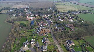
Great Waldingfield is a village and civil parish in the Babergh district of Suffolk, England about two miles (3 km) north-east of Sudbury and two miles (3 km) south-west of its sister village, Little Waldingfield. The village is split into two separate parts; the older and smaller part around the St. Lawrence Church, and the newer and larger section along the B1115 road between Sudbury and Lavenham. Most of the houses in the newer section were built after World War II, including much council housing. The parish also includes the hamlets of Upsher Green and part of Washmere Green. The population is estimated to be 1,460, reducing to 1,431 at the 2011 Census.

Andreas or Kirk Andreas is a village on the Isle of Man, lying in the north of the island, 5 km from the island's second town, Ramsey. There is a large, and nowadays little used, airfield in the vicinity.

Raydon is a village and civil parish in Suffolk, England. Located around two miles south-east of Hadleigh, it is part of Babergh district. The parish also includes the hamlets of Lower Raydon (west) and The Woodlands (east). It was recorded in Domesday as "Reindune" or "Reinduna" and appears on John Speed's 1610 map as "Roydon".

Clopton is a village and civil parish in Suffolk. It is located between Ipswich and Debenham two kilometres north of Grundisburgh on the River Lark. The village is no larger than a series of houses either side of the B1078, surrounded by farm land. The village itself has no clear centre; houses and other buildings are concentrated around the four manors of Kingshall, Brendhall, Rousehall and Wascolies, all of which are mentioned in the Domesday Book of 1086.
Westley is a village and civil parish in the West Suffolk district of Suffolk in eastern England. It is located south of Junction 42 of the A14 providing primary access to adjacent market towns Bury St Edmunds (East) and Newmarket (West). The village consists of two central roads: Fornham Lane and Hill Road running north and south through the parish, with adjoining roads accommodating Westley's total population of 183.

St Mary's Church is a redundant Church of England parish church in the civil parish of Chilton, Suffolk, England. It is a Grade I listed building, and is in the care of the Churches Conservation Trust.

Thurleigh is a village and civil parish in the Borough of Bedford, north Bedfordshire, England, situated around 5 miles (8.0 km) north of Bedford town centre.

