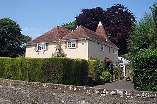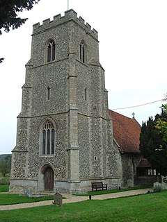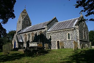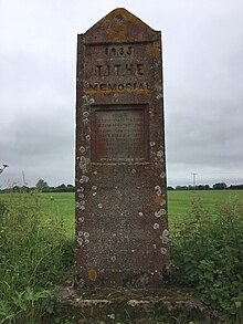
Detling is a village and civil parish in the Borough of Maidstone in Kent, England. The parish is located on the slope of the North Downs, 4 miles (6.4 km) north east of Maidstone, and on the Pilgrims' Way.

Upper Heyford is a village and civil parish about 6 miles (10 km) northwest of Bicester in Oxfordshire, England. The 2011 Census recorded the parish's population as 1,295. The village is just east of the River Cherwell. "Upper" distinguishes it from Lower Heyford which is about 1 mile (1.6 km) "lower", downstream along the Cherwell valley. The parish measures about 2+1⁄2 miles (4 km) east–west and almost 2 miles (3 km) north–south. In 1959 it covered 1,628 acres (659 ha). The parish's western boundary is just west of the river. Chilgrove Drive, a continuation of Aves ditch, forms part of the parish's eastern boundary. Field boundaries bound the parish on the south. In the north the boundary crosses the former RAF Upper Heyford airfield, following the course of former field boundaries.

Stoke-by-Nayland is a village and civil parish in the Babergh district, in the county of Suffolk, England, close to the border with Essex. The parish includes the village of Withermarsh Green and the hamlets of Thorington Street and Scotland Street. The village has many cottages and timber-framed houses and all surround a recreation field. Possibly once the site of a monastery, the population of the civil parish at the 2001 census was 703, falling to 682 at the Census 2011.

Long Melford, colloquially and historically also referred to as Melford, is a large village and civil parish in the Babergh district, in the county of Suffolk, England. It is on Suffolk's border with Essex, which is marked by the River Stour, 3 miles (4.8 km) from Sudbury, approximately 16 miles (26 km) from Colchester and 14 miles (23 km) from Bury St Edmunds. It is one of Suffolk's "wool towns" and is a former market town. The parish also includes the hamlets of Bridge Street and Cuckoo Tye.

Alpheton is a village and civil parish in the Babergh district of Suffolk, England. Located on the A134 road about six miles north of Sudbury, in 2005 it had a population of 260, reducing to 256 at the 2011 Census. According to Eilert Ekwall the meaning of the village name is the homestead of Aelfled.

Sotterley, originally Southern-lea from its situation south of the river, is a village and civil parish in the East Suffolk district, in the English county of Suffolk, located approximately 4 miles (6 km) south-east of Beccles and 1.5 miles (2 km) east of Willingham St Mary and Shadingfield. The parish is primarily agricultural with a dispersed population of 113 at the 2011 census. The parish council operates to administer jointly the parishes of Shadingfield, Willingham St Mary, Sotterley and Ellough.

Wormingford is a village and civil parish in Essex, England.

Denham is a village and civil parish in northern Suffolk. Located approximately 3 miles east of Eye, it is within the district of Mid Suffolk. It shares its name with Denham, another Suffolk village.

Brettenham is a village and civil parish in the Babergh district of Suffolk, England. In 2005 it had a population of 270, increasing to 353 at the 2011 Census.

Newton, also known as Newton Green to distinguish it from Nowton near Bury St Edmunds, and Old Newton near Stowmarket, is a small village and civil parish in Suffolk, England. Part of Babergh district, it is located on the A134 between Sudbury and Colchester, around three miles from the former.

Thorpe Morieux is a small village and civil parish in Suffolk, England. It is 10 miles south-east of Bury St Edmunds and 10 miles north east of Sudbury.

Lawshall is a village and civil parish in Suffolk, England. Located around a mile off the A134 between Bury St Edmunds and Sudbury, it is part of Babergh district. The parish has nine settlements comprising the three main settlements of The Street, Lambs Lane and Bury Road along with the six small hamlets of Audley End, Hanningfield Green, Harrow Green, Hart's Green, Hibb's Green and Lawshall Green.

Whatfield is a village and civil parish in Suffolk, England. Located around 2 miles (3.2 km) north of Hadleigh, it is part of Babergh district.

Raydon is a village and civil parish in Suffolk, England. Located around two miles south-east of Hadleigh, it is part of Babergh district. The parish also includes the hamlets of Lower Raydon (west) and The Woodlands (east). It was recorded in Domesday as "Reindune" or "Reinduna" and appears on John Speed's 1610 map as "Roydon".

Ixworth is a village and civil parish in the West Suffolk district of the English county of Suffolk. It is 6 miles (9.7 km) north-east of Bury St Edmunds on the A143 road to Diss and 9 miles (14 km) south-east of Thetford. The parish has a population of 2,177, increasing to 2,365 at the 2011 Census. The south end of High Street and town may also be historically listed as Ixworth St Mary.

Flixton is a village and civil parish located in the north of the English county of Suffolk. It is around 2 miles (3.2 km) south-west of Bungay in the East Suffolk district and is one of the villages around Bungay which make up the area known as The Saints. The A143 road runs just to the north of the parish border linking Bungay with Harleston and Diss.

Nowton is a small village and civil parish in the West Suffolk district of Suffolk in eastern England. Located on the southern edge of Bury St Edmunds, in 2005 its population was estimated to be 140. At the 2011 census 163 people were recorded as living in the village.

Great Bricett Priory was a medieval monastic house in Great Bricett in Suffolk, England, the chapel of which is now in use as the Church of England parish church of St Mary and St Lawrence. Ralph FitzBrian and Emma his wife, about the year 1110, founded a priory for Austin canons at Bricett, which was dedicated to the honour of St Leonard. The foundation charter endowed the priory with the tithes of Bricett and of 'Losa' with its chapel, a moiety of the church of 'Stepla,' and the associated church of Stangate, Essex, in addition to various plots of land in the vicinity. The founder also gave to the canons a large garden on the south of the monastery and a smaller one on the east, and he ordained that whenever he was in Suffolk the canons were to act as his chaplains and to receive a tithe of his bread and beer. The priory of Bricett was claimed, early in the thirteenth century, as pertaining to the monastery of Nobiliac, in the diocese of Limoges and the Duchy of Berry. This claim was resisted, but in 1295 an agreement was arrived at favourable to the foreign house, whereby Bricett became an alien priory; this composition was renewed and confirmed by the Bishop of Norwich in the chapter house of Bricett, on 16 July 1310. In a long list of royal protections to religious houses in 1295, in return for bestowing on the king a tithe of their income, the priory of Bricett is described as a cell to the priory of 'Noblac in Lymoche's'.

North Cove is a village and civil parish in the north of the English county of Suffolk. It is part of the East Suffolk district, located around 3 miles (4.8 km) east of Beccles and 5 miles (8.0 km) west of Lowestoft. It merges with the village of Barnby and the villages share some resources, although the two parishes retain separate parish councils.
Jade Abigail Holland Cooper is a British fashion designer.


