
Hadleigh is an ancient market town and civil parish in South Suffolk, East Anglia, situated, next to the River Brett, between the larger towns of Sudbury and Ipswich. It had a population of 8,253 at the 2011 census. The headquarters of Babergh District Council were located in the town until 2017.

Long Melford, colloquially and historically also referred to as Melford, is a large village and civil parish in the Babergh district, in the county of Suffolk, England. It is on Suffolk's border with Essex, which is marked by the River Stour, 3 miles (4.8 km) from Sudbury, approximately 16 miles (26 km) from Colchester and 14 miles (23 km) from Bury St Edmunds. It is one of Suffolk's "wool towns" and is a former market town. The parish also includes the hamlets of Bridge Street and Cuckoo Tye.

Alpheton is a village and civil parish in the Babergh district of Suffolk, England. Located on the A134 road about six miles north of Sudbury, in 2005 it had a population of 260, reducing to 256 at the 2011 Census. According to Eilert Ekwall the meaning of the village name is the homestead of Aelfled.

Hartest is a small village and civil parish in the Babergh district of the English county of Suffolk. It is located halfway between Bury St. Edmunds and Sudbury on the B1066 road in the Glem valley. Brockley is two miles north.

Kersey is a village and civil parish in the Babergh district in Suffolk, in the east of England. The main street has a ford across a stream. Its principal claim to fame is that a coarse woollen cloth called Kersey cloth takes its name from it. The cloth was presumably originally made there, but later in many other places too.
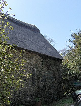
Lindsey is a small village and a civil parish, located in mid-to-south Suffolk, under the purview of Babergh District Council.

Brent Eleigh is a village and civil parish in the Babergh district of Suffolk, England. Located between Hadleigh and Lavenham, in 2005 it had a population of 180 reducing to 174 at the 2011 census.

Polstead is a village and civil parish in the Babergh district of Suffolk, England. The village lies 3 miles (4.8 km) northeast of Nayland, 5 miles (8 km) southwest of Hadleigh and 9 miles (14 km) north of Colchester. It is situated on a small tributary stream of the River Stour.

Edwardstone is a village and civil parish in the Babergh district, in the county of Suffolk, England. The parish contains the hamlets of Mill Green, Priory Green, Round Maple and Sherbourne Street, and Edwardstone Woods, a Site of Special Scientific Interest. The parish touches Boxford, Great Waldingfield, Groton, Little Waldingfield, Milden and Newton.
Preston St Mary is a village and civil parish in Suffolk, England. Located to the north-east of Lavenham, it is part of the Babergh district. The parish includes the hamlets of Rooksey Green and Whelp Street.

Semer is a small village and civil parish in Suffolk, England. Located adjacent to a bridge over the River Brett on the B1115 between Hadleigh and Stowmarket, it is part of Babergh district. The parish also contains the hamlets of Ash Street and Drakestone Green.

Thorpe Morieux is a small village and civil parish in Suffolk, England. It is 10 miles south-east of Bury St Edmunds and 10 miles north east of Sudbury.

Lawshall is a village and civil parish in Suffolk, England. Located around a mile off the A134 between Bury St Edmunds and Sudbury, it is part of Babergh district. The parish has nine settlements comprising the three main settlements of The Street, Lambs Lane and Bury Road along with the six small hamlets of Audley End, Hanningfield Green, Harrow Green, Hart's Green, Hibb's Green and Lawshall Green.

Groton is a village and civil parish in the Babergh district, Suffolk, England, located around a mile north of the A1071 between Hadleigh and Sudbury. In 2011 the parish had a population of 288.

Burstall is a village and civil parish in Suffolk, England. Located around 4 miles (6 km) west of Ipswich, it is part of Babergh district. The parish includes the hamlet of Burstallhill. Recorded in the Domesday Book as Burgestala / Burghestala. It is in the Belstead Brook electoral division of Suffolk County Council.
Hawkedon is a village and civil parish in the West Suffolk district of Suffolk in eastern England. Located around 7 miles (11 km) south-south-west of Bury St Edmunds, the parish also contains the hamlet of Thurston End, and in 2005 had a population of 120. The majority of the village is classed as a conservation area.

Nedging is a village and former civil parish on the B1115 road, now in the parish of Nedging-with-Naughton, in the Babergh district, in the county of Suffolk, England. The nearest town is Hadleigh, there is also the hamlet of Nedging Tye nearby. In 1931 the civil parish had a population of 155. On 1 April 1935 it was merged with Naughton to create Nedging-with-Naughton.

Hart's Green is a hamlet in the civil parish of Lawshall in the Babergh District in the county of Suffolk, England. It is located between Stanningfield and Hanningfield Green and is just over a mile off the A134 between Bury St Edmunds and Sudbury. The road that serves Hart's Green is known as Donkey Lane.

Cosford Rural District was a rural district in the county of West Suffolk, England. It was created in 1894 out of the earlier Cosford rural sanitary district, except for Hadleigh parish which was made a separate urban district. Only minor adjustments were made to its boundary in the reorganisation of 1935. It was named after the historic hundred of Cosford, although the rural district covered a significantly larger area that included most of Cosford hundred and part of the neighbouring hundred of Babergh.


