
Capel St. Mary – commonly known as Capel – is a village in Suffolk, England. It is about 6 miles (10 km) south-west of Ipswich and 2 miles (3 km) from Dedham Vale, which is a designated Area of Outstanding Natural Beauty.
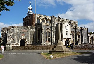
East Bergholt is a village in the Babergh District of Suffolk, England, just north of the Essex border.
Boxted is a village and civil parish in Essex, England. It is located approximately 5 miles (8 km) north of Colchester and 24 miles (39 km) northeast of the county city of Chelmsford. The village is in the borough of Colchester and in the parliamentary constituency of North Essex. There is a Parish council. The village was the site of a series of skirmishes between Parliamentary and Royalist troops in July 1648, known as the Battle of Boxted Heath.

Alpheton is a village and civil parish in the Babergh district of Suffolk, England. Located on the A134 road about six miles north of Sudbury, in 2005 it had a population of 260, reducing to 256 at the 2011 Census. According to Eilert Ekwall the meaning of the village name is the homestead of Aelfled.

Belstead is a village and civil parish in the Babergh district of the English county of Suffolk. Located on the southern edge of Ipswich, around 3 miles (5 km) south-west of Ipswich town centre. It had a population of 202 according to the 2011 census. Belstead has amenities such as a village hall, St Mary's the Virgin Church, The bridge school for children with learning difficulties and Belstead Brook Hotel and Spa. It is in the Belstead Brook electoral division of Suffolk County Council.

Mollington is a village and civil parish in the unitary authority of Cheshire West and Chester and the ceremonial county of Cheshire, England. It is located two miles north of the city of Chester, with approximate boundaries formed by the A41 Liverpool-Chester trunk road and Shropshire Union Canal to the east and southeast, the A540 Wirral Peninsula trunk road to the south and west and the A5117 Dunkirk link road to the north.

Holbrook is a village situated close to the northern shore of the estuary of the River Stour, in Suffolk, England. It is located on the Shotley Peninsula in Babergh district, around 5 miles (8.0 km) south of Ipswich.
Shotley is a village and civil parish 8 miles (13 km) south-east of Ipswich in the English county of Suffolk. It is in the Babergh district and gives its name to the Shotley peninsula between the Rivers Stour and Orwell. The parish includes the village of Shotley and the settlements of Shotley Gate and Church End. In 2011 civil parish had a population of 2,342.
Pinewood is a civil parish and electoral ward in the Babergh district of the English county of Suffolk. Whilst not part of the borough, it forms part of the town of Ipswich although part of the parish is separated from it by Belstead Brook, a tributary of the River Orwell. The parish was formed on 1 April 1994 from parts of Washbrook, Belstead and Wherstead. It is in the Belstead Brook electoral division of Suffolk County Council.

Tattingstone is a village and civil parish in Suffolk, England on the Shotley peninsula about 5 miles (8 km) south of Ipswich. The 2011 Census recorded the population as 540.

Monk Fryston is a small village and civil parish in the Selby district of North Yorkshire, England.

Polstead is a village and civil parish in the Babergh district of Suffolk, England. The village lies 3 miles (4.8 km) northeast of Nayland, 5 miles (8 km) southwest of Hadleigh and 9 miles (14 km) north of Colchester. It is situated on a small tributary stream of the River Stour.

Stanstead is a village and civil parish in Suffolk, England. The name Stanstead comes from the Old English for "Stony place". Located off the B1066, it is around 4 miles (6 km) from Sudbury, and is part of Babergh district. It is about 2 kilometres (1 mi) from Glemsford, 12 miles (19 km) from Hadleigh, and 4 miles (6 km) from Lavenham.
Thorpe Morieux is a small village and civil parish in Suffolk, England. It is 10 miles south-east of Bury St Edmunds and 10 miles north east of Sudbury.
Copdock and Washbrook is a civil parish in the Babergh district in the county of Suffolk, England. It covers the villages of Copdock and Washbrook, as well as the hamlets of Coles Green, Mace Green and Washbrook Street.

Harkstead is a village and civil parish in the county of Suffolk, England. The village is located on the northern bank of the River Stour estuary at Holbrook Bay, and is situated on the Shotley peninsula, around 7 miles (11 km) south of Ipswich. It is part of Babergh local government district.

Woolverstone is a small village and civil parish in Suffolk, England located on the Shotley peninsula. It is situated about 6.4 km (4.0 mi) south of Ipswich, near the southern shore of the River Orwell. In 2005 it had a population of 240, increasing to 265 at the 2011 census.
Ringshall is a village and civil parish in the Mid Suffolk district of Suffolk in eastern England. Located around four miles south of Stowmarket, and 13 miles north west of Ipswich.

Butler Green is a residential area in the town of Chadderton in the Metropolitan Borough of Oldham, Greater Manchester. The area is also commonly known as Washbrook.
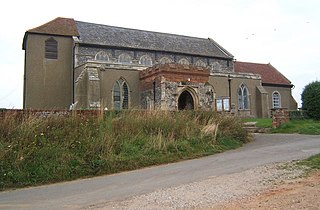
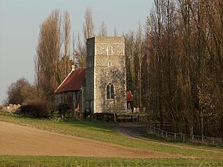
Washbrook is a village and former civil parish 3 miles (4.8 km) south west of Ipswich, now in the parish of Copdock and Washbrook, in the Babergh district, in the county of Suffolk, England. In 2011 the built-up area had a population of 517. In 1961 the parish had a population of 368. As of 1958 Washbrook Street was a secondary settlement for Washbrook.

