
Frodsham is a market town, civil parish and electoral ward in the unitary authority of Cheshire West and Chester and the ceremonial county of Cheshire, England. Its population was 8,982 in 2001, increasing to 9,077 at the 2011 Census. It is approximately 3 miles (5 km) south of Runcorn, 16 miles (26 km) south of Liverpool, and 28 miles (45 km) southwest of Manchester. The River Weaver runs to its northeast and on the west it overlooks the estuary of the River Mersey. The A56 road and the Chester–Manchester railway line pass through the town, and the M56 motorway passes to the northwest.

Waverton is a village and civil parish on the outskirts of Chester in the unitary authority of Cheshire West and Chester and the ceremonial county of Cheshire, England. It lies about 3 miles (4.8 km) south-east of Chester High Cross, 19 miles (31 km) south of Liverpool and 33 miles (53 km) south west of Manchester. It is almost continuous with the village of Rowton to the north west and that in turn is almost continuous with Christleton. According to the 2011 Census, the population of the parish was 1,587.Waverton is a very rural area with lots of fields and farms

Barrow is a civil parish containing the villages of Great Barrow, Little Barrow and Stamford Bridge. It is situated about 4.5 miles east-north-east of Chester, 6 miles north-west of Tarporley, and 6 miles south of Frodsham.

Bostock is a village and civil parish in the unitary authority of Cheshire West and Chester and the ceremonial county of Cheshire, England. According to the 2001 census it had a population of 229, reducing slightly to 225 at the 2011 Census. The village is situated between the towns of Winsford and Northwich.

Buerton is a former civil parish, now in the parish of Aldford and Saighton, in the unitary authority of Cheshire West and Chester and the ceremonial county of Cheshire, England. According to the 2001 census it had a population of 22. The civil parish was abolished in 2015 to form Aldford and Saighton.

Edge is a former civil parish, now in the parishes of No Man's Heath and District and Malpas, in Cheshire, England, The parish included Edge Hall and Edge Green. The population at the 2011 census was 247. The civil parish was abolished in 2015 to form No Man's Heath and District, part of it also went to Malpas.
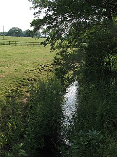
The River Croco is a small river in Cheshire in England. It starts as lowland field drainage west of Congleton, flows along the south edge of Holmes Chapel, and joins the River Dane at Middlewich. It is about 8 miles (13 km) long.
Puddington is a village and civil parish on the Wirral Peninsula, in the unitary authority of Cheshire West and Chester and the ceremonial county of Cheshire, England, located close to the border with Wales. In the 2001 census the village of Puddington had 325 inhabitants, increasing to 381 at the 2011 census.

Shotwick is a small village and former civil parish, now in the parish of Puddington, on the southern end of the Wirral Peninsula in the unitary authority of Cheshire West and Chester and the ceremonial county of Cheshire, England. The village is close to the county of Flintshire on the England–Wales border. The village was located on the River Dee until it was canalised in 1736 after which the reclaimed land has since developed into the neighbouring Deeside Industrial Park. The civil parish was abolished in 2015 and merged into Puddington.

Wincham is a civil parish and village in the unitary authority of Cheshire West and Chester and the ceremonial county of Cheshire, England. It is about three miles north of Northwich in the Cheshire Plain. The Trent and Mersey Canal runs through the parish.

Delamere is a village and former civil parish, now in the parish of Delamere and Oakmere, in the county of Cheshire, England. It is approximately 7 miles (11 km) west of Northwich, within the unitary authority of Cheshire West and Chester. The population of the civil parish taken at the 2011 census was 1,025. The name of the village comes from the French de la mere "of the sea". The civil parish was abolished in 2015 to form Delamere and Oakmere; parts also went to Kelsall, Utkinton and Cotebrook and Willington.
Burton is a small village and former civil parish, now in the parish of Duddon and Burton, in the unitary authority of Cheshire West and Chester and the ceremonial county of Cheshire, England. In the 2001 Census, the parish had a population of 50.

Cymau is a small village situated in the community of Llanfynydd, Flintshire on the edge of the mountains of north-east Wales. Its name is derived from the Welsh word cymau, an old form of the plural for cwm, "valley" or "hollow".

Abbot's Meads is a suburb of Chester in Cheshire, England. Abbot's Meads is north-west of Chester city centre. The Countess of Chester Hospital is nearby. The population as taken in the 2011 census can be found under Chester.

Wardle is a village and civil parish in the unitary authority of Cheshire East and the ceremonial county of Cheshire, England. The village lies on the Shropshire Union Canal, north west of Barbridge Junction, and is 4 miles to the north west of Nantwich, and the parish also includes part of the small settlement of Wardle Bank. The total population is around 250. RAF Calveley was a flight-training station during the Second World War, and the Mark III radio telescope stood on the airfield site in 1966–96. The modern civil parish includes Wardle Industrial Estate and is otherwise largely agricultural. Nearby villages include Barbridge, Calveley and Haughton.
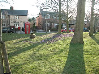
Barrets Green is a small settlement in the unitary authority of Cheshire East and the ceremonial county of Cheshire, England. It lies on the A51 at SJ59075925, by the junction with Long Lane, at an elevation of 56 metres. Local farms include Barrets Green Farm and The Grange. For administrative purposes, Barrets Green falls mainly within the civil parish of Alpraham, with a small part in Calveley; it is approximately 1⁄4 miles from each of these two villages.

Coddington is a hamlet and civil parish in eastern Herefordshire, England, about 3 miles (4.8 km) north of Ledbury. The west side of the parish covers part of the Malvern Hills, an official Area of Outstanding Natural Beauty. Coddington shares a parish council with neighbouring Bosbury.

The Marches Way is a partially waymarked long distance footpath in the United Kingdom. It runs 351 kilometres / 218 miles through the Welsh–English borderlands, traditionally known as the Welsh Marches and links the cities of Chester in the north and Cardiff in the south.

St Mary's Church is in the civil parish of Coddington, Cheshire, England. The church is recorded in the National Heritage List for England as a designated Grade II listed building. It is an active Anglican parish church in the diocese of Chester, the archdeaconry of Chester and the deanery of Malpas. Its benefice is combined with that of St Chad's, Farndon.

The North Cheshire Way is a 71-mile (114 km) long-distance footpath in Cheshire, England. It runs approximately eastwards from Hooton railway station on the Wirral peninsula to Disley railway station on the edge of the Peak District, where it connects with the Gritstone Trail. There is a 6-mile (9.7 km) spur from Chester to Croughton.

