
Upton-by-Chester is a civil parish and a large suburb on the outskirts of Chester, in the unitary authority of Cheshire West and Chester and the ceremonial county of Cheshire, England. It includes the villages of Upton and Upton Heath.

Guilden Sutton is a civil parish and village in the unitary authority of Cheshire West and Chester and the ceremonial county of Cheshire, England. The village lies approximately 3 miles (5 km) to the east of Chester and is south of the village of Mickle Trafford. The community consists of a church, a primary school, a post office, a pub, a village hall and several local businesses.

Dunham-on-the-Hill is a village and former civil parish, now in the parish of Dunham-on-the-Hill and Hapsford, in the unitary authority of Cheshire West and Chester, and the ceremonial county of Cheshire, England. It is on the A56 road, approximately 2.3 miles (3.7 km) from Helsby and 6 miles (9.7 km) from Chester. The village is 120 feet (37 m) above sea level, south west of Helsby Hill.
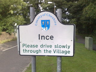
Ince is a village and civil parish in the unitary authority of Cheshire West and Chester and the ceremonial county of Cheshire, England. It is situated immediately to the east of the Stanlow Oil Refinery. It shares Ince & Elton railway station with the village of Elton, which it runs into.

Antrobus is a civil parish and village in Cheshire, England, about 7 mi (11 km) south of Warrington. It lies within the unitary authority of Cheshire West and Chester, and had a population of 832, reducing to 791 at the 2011 Census, and to 767 in the 2021 Census. The parish is the most northeasterly point of Cheshire West and Chester, and as such borders both Warrington and Cheshire East. As well as Antrobus village centre itself, the parish includes other large hamlets at Frandley, about 1 mi (1.6 km) south-west from the main village, and Crowley, about 2 mi (3.2 km) to the north-east.

Austerson is a civil parish in the unitary authority of Cheshire East and the ceremonial county of Cheshire, England, lying immediately south of the town of Nantwich and north of the village of Audlem. Predominantly rural with scattered farms, the civil parish includes the small settlement of Old Hall Austerson at SJ656493, about two miles south of Nantwich centre. In 2001, the total population was a little under 150, increasing to 194 at the 2011 Census. Nearby villages include Broomhall Green, Hack Green, Hankelow, Sound Heath and Stapeley.

Aston is a village and civil parish in the unitary authority of Cheshire West and Chester and the ceremonial county of Cheshire, England. According to the 2001 census it had a population of 111, reducing slightly to 106 at the 2011 census. The village is just outside the Runcorn urban area.
Blakenhall is a small village and former civil parish, now in the parish of Doddington and District, in the unitary authority area of Cheshire East and the ceremonial county of Cheshire, England, about 7 miles (11 km) south-east of Nantwich. It lies on the county boundary with Staffordshire. The parish has an area of 654 hectares and also includes the small settlements of The Den and Gonsley Green, with a total population of 125 in 2001. Nearby villages include Wybunbury in Cheshire and Betley and Wrinehill in Staffordshire. Blakenhall was first recorded in the Domesday survey as Blachenhale, and the parish had one of Cheshire's early ironworks in the 17th and 18th centuries. The area is rural and predominantly agricultural, with small areas of ancient woodland and the nature reserve of Blakenhall Moss, a rejuvenating lowland raised bog. The Crewe-to-Stafford railway line runs through the parish and it is on the proposed route of HS2.

Tushingham cum Grindley is a former civil parish, now in the parish of Tushingham-cum-Grindley, Macefen and Bradley, in the unitary authority of Cheshire West and Chester and the ceremonial county of Cheshire, England. The parish contained the village of Tushingham and the hamlet of Bell o' th' Hill. According to the 2001 UK census, the total population of the civil parish was 166, rising to 187 at the 2011 Census. The civil parish was abolished in 2015 to form Tushingham-cum-Grindley, Macefen and Bradley.

Tarporley is a large village and civil parish in Cheshire, England. The civil parish also contains the village of Rhuddall Heath. Tarporley is bypassed by the A49 and A51 roads.

Christleton is a village and civil parish on the outskirts of Chester, in the unitary authority of Cheshire West and Chester and the ceremonial county of Cheshire, England. The Shropshire Union Canal passes through the village.
Puddington is a village and civil parish on the Wirral Peninsula, in the unitary authority of Cheshire West and Chester and the ceremonial county of Cheshire, England. It is located to the south east of the town of Neston and close to the border with Wales.

Willington is a village and civil parish 9 miles (14 km) from Chester in Cheshire, England. At the 2011 census, the population was 277.

Sutton Weaver is a village and civil parish in the unitary authority of Cheshire West and Chester, in the ceremonial county of Cheshire, England. It is 2 miles (3.2 km) northeast of Frodsham and 2.5 miles south of Runcorn. According to the United Kingdom Census 2011, it had a population of 495 and a total land area of 3,198 sq metres (m2) (thousands). The village has 206 Households with some of the main industries of the village being Wholesale and Retail Trade, Human Health and Social Work Activities and Manufacturing; These three sectors alone account for 36.5% of Occupational Share.

Little Stanney is a suburban village and civil parish in the unitary authority of Cheshire West and Chester and the ceremonial county of Cheshire, England. It is located on the Wirral Peninsula between Chester and Ellesmere Port.

Handley is a village and civil parish in the unitary authority of Cheshire West and Chester and the ceremonial county of Cheshire, England. It is part of the local government ward of Tattenhall, a larger settlement approximately 2 miles (3.2 km) to the east. The hamlet of Milton Green is to the north west of the village. The A41 road, which previously passed through the village now bypasses it, having been re-routed further to the east.

Lower Kinnerton is a village and former civil parish, now in the parish of Dodleston, in the unitary authority of Cheshire West and Chester and the ceremonial county of Cheshire, England, close to the England–Wales border. The neighbouring village of Higher Kinnerton is across the border in Flintshire. Lower Kinnerton is south of Broughton and to the north west of the village of Dodleston. It is a small agricultural community, which is also home to a local kennel and cattery business.

Wimbolds Trafford is a hamlet and former civil parish, now in the parish of Mickle Trafford and District, in the unitary authority area of Cheshire West and Chester and the ceremonial county of Cheshire, England. The hamlet lies on the B5132 road, approximately 5 miles (8 km) to the north east of Chester and north of the village of Mickle Trafford.

Chowley is a hamlet and civil parish in the Borough of Cheshire West and Chester and the ceremonial county of Cheshire, England. It is approximately 9.5 miles (15.3 km) south east of Chester and about 1.3 miles (2.1 km) south west of Tattenhall.

Hatton is a former civil parish, now in the parishes of Hargrave and Huxley, Golborne David and Tattenhall and District, in the unitary authority of Cheshire West and Chester and ceremonial county of Cheshire, England. The parish included most of the village of Hatton Heath, which is approximately 6 miles (9.7 km) south east of Chester and 4 miles (6.4 km) north-west of Tattenhall. The civil parish was abolished in 2015 and became part of Hargrave and Huxley, Golborne David and Tattenhall and District.

