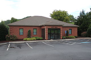
East Ellijay is a city in Gilmer County, Georgia, United States. The population was 546 at the 2010 census, down from 707 in 2000.
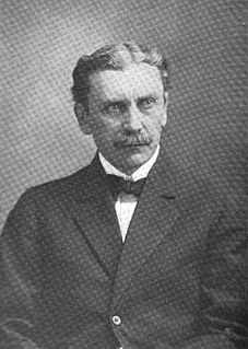
James Mooney was an American ethnographer who lived for several years among the Cherokee. Known as "The Indian Man", he conducted major studies of Southeastern Indians, as well as of tribes on the Great Plains. He did ethnographic studies of the Ghost Dance, a spiritual movement among various Native American culture groups, after Sitting Bull's death in 1890. His works on the Cherokee include The Sacred Formulas of the Cherokees (1891), and Myths of the Cherokee (1900). All were published by the US Bureau of American Ethnology, within the Smithsonian Institution.

Brasstown Bald is the highest point in the U.S. state of Georgia. It is located in the northeastern part of the state in the Blue Ridge Mountains on the border between Towns and Union counties south of the city of Hiawassee. The mountain is known to the native Cherokee people as Enotah.

The French Broad River is a river in the U.S. states of North Carolina and Tennessee. It flows 218 miles (351 km) from near the town of Rosman in Transylvania County, North Carolina, into Tennessee, where its confluence with the Holston River at Knoxville forms the beginning of the Tennessee River. The river flows through the counties of Transylvania, Buncombe, Henderson, and Madison in North Carolina, and Cocke, Jefferson, Sevier, and Knox in Tennessee. It drains large portions of the Pisgah National Forest and the Cherokee National Forest.
The Tellico River is a river in the Blue Ridge Mountains of western North Carolina and eastern Tennessee. It rises in the westernmost mountains of North Carolina, and then flows through Monroe County, Tennessee, before joining the Little Tennessee River under the Tellico Reservoir. With a length of 52.8 miles (85.0 km), it is a major tributary of the Little Tennessee River, and is one of the primary streams draining the Unicoi Mountains.

Clingmans Dome is a mountain in the Great Smoky Mountains of Tennessee and North Carolina in the southeastern United States. Its name in Cherokee is Kuwahi or ᎫᏩᎯ, meaning "mulberry place." At an elevation of 6,643 feet (2,025 m), it is the highest mountain in the Great Smoky Mountains National Park, the highest point in the state of Tennessee, and the highest point along the 2,192-mile (3,528 km) Appalachian Trail. It is also the third highest point in mainland Eastern North America, after Mount Mitchell and Mount Craig.

The Nolichucky River is a 115-mile (185 km) river that flows through Western North Carolina and East Tennessee, in the southeastern United States. Traversing the Pisgah National Forest and the Cherokee National Forest in the Blue Ridge Mountains, the river's watershed is home to some of the highest mountains in the Appalachians, including Mount Mitchell in North Carolina, the highest point in the eastern United States. The river is a tributary of the French Broad River, and is impounded by Nolichucky Dam near Greeneville, Tennessee.

Tanasi was a historic Overhill settlement site in present-day Monroe County, Tennessee, in the southeastern United States. The village became the namesake for the state of Tennessee. It was abandoned by the Cherokee in the 19th century for a rising town whose chief was more powerful. Tanasi served as the de facto capital of the Overhill Cherokee from as early as 1721 until 1730, when the capital shifted to Great Tellico.
The Unaka Range is a mountain range on the border of Tennessee and North Carolina, in the southeastern United States. It is a subrange of the Appalachian Mountains and is part of the Blue Ridge Mountains physiographic province. The Unakas stretch approximately from the Nolichucky River in the south to the Watauga River in the north.
Tsul'Kalu, also known as the Cherokee Devil, is a legendary figure of Cherokee mythology who plays the role of "the great lord of the game", and as such is frequently invoked in hunting rites and rituals.

Roan Mountain is a 6,285 ft (1,916 m) mountain straddling the North Carolina/Tennessee border in the Unaka Range of the Southern Appalachian Mountains in the Southeastern United States. The range's highpoint, Roan is clad in a dense stand of Southern Appalachian spruce-fir forest, and includes the world's largest natural rhododendron garden, and the longest stretch of grassy bald in the Appalachian range. The Cherokee National Forest and Pisgah National Forest converge atop the mountain, with Roan Mountain State Park located near its northern base. The Appalachian Trail traverses most of the Roan's crest. The Roan High Knob Shelter is the highest back-country shelter on the entire 2,174-mile (3,499 km) trail.

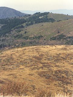
Gregory Bald is a mountain in the Great Smoky Mountains. It has an elevation of 4,949 feet above sea level. The mountain's majestic summit makes it a popular hiking destination. Another feature that attracts many visitors are the flame azaleas that bloom over the bald every summer. The azaleas reach peak bloom around mid-to-late June.

Chimney Tops is a mountain in the central Great Smoky Mountains in Tennessee. It is 4,724 feet (1,440 m) above sea level. Chimney Tops is a double-capstone knob on the eastern slope of the Sugarland Mountain massif, which stretches north-south across the north-central section of the Smokies. Mount Le Conte resides east of Chimney Tops, and Mt. Mingus southeast of Chimney Tops. Thus, while the view from the summit is 360 degrees, Chimney Tops is practically "walled in" on three sides.
The Art Loeb Trail is a 30.1-mile (48.4 km) trail located in Pisgah National Forest in Western North Carolina. The northern terminus is at the Daniel Boone Boy Scout Camp in Haywood County, while the trail's southern terminus is located near the Davidson River Campground, near Brevard, in Transylvania County. Along the way, the trail traverses several significant peaks, including Black Balsam Knob (6,214 ft), Tennent Mountain (6040 ft) and Pilot Mountain (5095 ft). The trail also passes the base of Cold Mountain, made famous by the novel and film.

Whiteside Mountain is a mountain in Jackson County, North Carolina between Cashiers, Highlands, North Carolina, and the Georgia border. Whiteside Mountain can boast the highest cliffs in Eastern North America. It also has a feature called Devil's Courthouse, not to be confused with the Devil's Courthouse 20 miles away in Transylvania County, NC.

Tanasee Bald, also called Tennessee Bald, is a mountain near the Blue Ridge Parkway in western North Carolina, on the Haywood/Transylvania border. It is 5561 feet high. It is in the Great Balsam Mountains within the Blue Ridge Mountains, which is part of the Appalachian Mountains
Shining Rock is a mountain in western North Carolina. The mountain is one of the Great Balsam Mountains which are a part of the Blue Ridge Mountains within the Appalachian Mountains. It is the 38th tallest mountain in the eastern United States.

Oconaluftee Archeological District is within the eponymous river valley in the Great Smoky Mountains of North Carolina, located in the Southeastern United States. Formerly a historic Cherokee village, followed by an Appalachian community, were located at this site along the Oconaluftee River. Now the site serves as the main entrance to the North Carolina side of the Great Smoky Mountains National Park.

Chilhowee was a prehistoric and historic Native American site in present-day Blount and Monroe counties in Tennessee, in what were the Southeastern Woodlands. Although now submerged by the Chilhowee Lake impoundment of the Little Tennessee River, the Chilhowee site was home to a substantial 18th-century Overhill Cherokee town. It may have been the site of the older Creek village "Chalahume" visited by Spanish explorer Juan Pardo in 1567. The Cherokee later pushed the Muscogee Creek out of this area.

The Snake Den Ridge Trail is an American hiking trail in the Great Smoky Mountains National Park of Cocke County, Tennessee. Winding its way up the backbone-like crest of Snake Den Ridge, the trail connects the Cosby Campground to the Appalachian Trail and provides the quickest access to the high peaks of the Eastern Smokies. The trail passes through three forest types— a mixed deciduous forest at its lower elevations, a substantial stand of heath bald on the more narrow sections of the ridge crest, and an old growth northern-style coniferous forest at its higher elevations.

