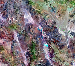
Geology of Austria

Last updated

The geology of Austria consists of Precambrian rocks and minerals together with younger marine sedimentary rocks uplifted by the Alpine orogeny. [1]

Contents

Geologic history

Precambrian granodioritic gneiss (about 614+-10 million years old) of the Bohemian Massif at Spitz, northeast Austria Spitzer Granodioritgneis sl4.jpg
Precambrian granodioritic gneiss (about 614±10 million years old) of the Bohemian Massif at Spitz, northeast Austria

Most of Austria's rocks formed in the last 540 million years, during the Phanerozoic explosion of life. Small zircon crystals, eroded out of three billion year old granites are among the few remnants of the Precambrian. Dobra Gneiss, at 1.38 billion years old, is the oldest rock in Austria within the Moldanubian Superunit in the Waldviertel region. Mica schist and phyllite were deposited between 900 and 500 million years ago.

Cambrian

In the Cadomian Event, fragments of continental crust such as the Bohemian Massif and the Alps joined the margin of the supercontinent Gondwana. Igneous activity occurred, in connection with small ocean basins opening. The Maissau granite, dated to 570 million years ago, in the eastern edge of the Bohemian Massif is a remnant of this igneous activity. The Austrian crustal components of Gondwana drifted into the southern hemisphere in the early Cambrian. At the end of the Cambrian, some crustal fragments separated again as microcontinents with the opening of the Rheic Ocean. The Moravian Superunit is one example of this pattern. [3]

Ordovician

Situated near the South Pole at the start of the Ordovician, the region was likely barren and nearly lifeless. The Austroalpine and South Alpine superunits formed a shelf that received clay and sand sediments from the continental interior. The Ordovician also marked a poorly understood period of igneous activity, that resulted in granites and the Blasseneck Porphyroid, a weakly metamorphosed porphyry in the Greywacke Zone, with mixed layers of pyroclastic flow and lava.

Some of the earliest fossils were deposited at the end of the Ordovician on the continental shelf, including orthocerids and cystoids. [4]

Silurian-Devonian

In the Silurian, crustal extension began, opening the Paleotethys Ocean on the northern margin of Gondwana. Basins filled with sand, clay and calcareous sediments while basalt and andesite poured out of cracks, ultimately metamorphosing into amphibolite and greenschist now found in the Austroalpine and South Alpine superunits.

Gondwana drifted northward in the Devonian and large reefs developed on the continental shelf of Austria. Island arc collisions are recorded as amphibolite and gneiss in the Sub-Pennic Superunit of the Hohe Tauern mountain range. [4]

With the closing of the Rheic Ocean and the western Paleotethyic Ocean, the supercontinent Pangaea took shape. Extensive erosion of mountain ranges and basin formations led to coal deposition. These coal deposits were subsequently mined in the Brenner area of Tyrol and Stangalpe in the Nockberge mountain range in Carinthia.

Variscan Orogeny: Carboniferous, Permian and Triassic

Tilted layers of the Main Dolomite, of Triassic age, at the summit of Rohnenspitze Rohnenspitze Gipfelaufbau02.JPG
Tilted layers of the Main Dolomite, of Triassic age, at the summit of Rohnenspitze

A major mountain range formed with the closing of the oceans, spanning thousands of kilometers across Pangaea. Known as the Variscan orogeny in Central Europe, the mountain building event left remnant highlands throughout Europe, northwestern Africa and North America. The Alps and the Bohemian Massif were affected by the orogeny. The Sub-Penninic and Moldanubian superunits were deeply buried within the new range (granulites in the Moldanubian Superunit, for instance, formed at 55 kilometers depth), while the Austroalpine superunit likely formed foothills. A tropical climate dominated the region, supporting 40 meter trees.

Melting occurred, forming granites now found in all the major Austrian superunits. Crustal extension began again in the Permian leading to more basalt melts, granite and pegmatite formation, which are commonly found in the South Alpine and Austroalpine Superunits. Explosive quartz-dominated volcanism took place at the surface, creating the Bozen Quartz Porphyry, which is hundreds of meters thick in South Tyrol. Crustral extension combined with erosion to reduce the height of the Variscan mountains to only a few hundred meters above sea level. Embayments of the Tethys Ocean flooded the edge of the South Alpine and Austroalpine superunits, leaving fossil-rich limestones as well as salt and gypsum deposits. The region experienced a dry climate akin to modern-day Arabia, before the Permian-Triassic mass extinction. [5]

Amidst the slower tectonic activity of the Triassic, continental sediments formed dark limestones in a poorly ventilated offshore marine environment. The ocean expanded inland, creating a large shelf environment and improved water circulation from the Tethys Ocean generated a large reef belt. Volcanic activity picked up 230 million years ago forming the South Tyrolean Dolomites and depositing ash fall on the Northern Calcareous Alps. Sandstone, gypsum and mudstone formed in near shore areas of the Sub-Pennic and Helvetic superunits. At a few spots, such as Lunz am See sand and claystones interbedded with coal.

The famous Halstatt Limestone, well known for ammonite fossils, was deposited in warm shallow water less than 100 meters deep. The Meliatic Superunit, on the other hand, preserves deep sea siliceous material formed 4000 meters below the surface of the Tethys Ocean. [6]

Breakup of Pangaea: Jurassic-Cretaceous

Konigstuhl in the Guktal Alps KonigstuhlMitRosaninsee.jpg
Königstuhl in the Guktal Alps

Rifts began to form within Pangaea opening the Atlantic Ocean. At first, the rifts filled with continental sediments. The Tarntal Breccia in the Austroalpine Superunit preserves tectonic rock fracturing. A fault opened to the west, forming the Penninic Ocean. Deep plumes of mantle rock reached the surface, interacting with seawater to become serpentinite.

Central Europe formed the northwestern margin of the Penninic Ocean. Permian and Triassic sediments emerged above sea level on the Moldanubian, Moravian, Helvetic and Sub-Penninc superunits. As the Tethys Ocean crust began to subduct, only small fragments of its crust remained in the Meliatic Superunit in the Eastern Alps. The Tethys Ocean closed in the Dinarides and Hellenides in the late Cretaceous. The formation of the Alps started 135 million years ago at a strike-slip fault between the Penninic and Tethys Ocean. The Northern Calcareous Alps and Gurktal Alps formed as an orogenic wedge as sedimentary rocks were torn off basement rock that was subducted back into the mantle. The crust of the Penninic Ocean subducted around 85 million years ago. Deep water sediments accumulated due to earthquake related submarine landslides. Some rock units were dragged underneath the Radstadter Tauern and Semmering mountains. [7]

Cenozoic: Paleogene-Neogene

Fossilized shells of bivalves and gastropods, which lived in the sea during the Miocene, from Gainfarn, Lower Austria Fossilized seashells (1778424953).jpg
Fossilized shells of bivalves and gastropods, which lived in the sea during the Miocene, from Gainfarn, Lower Austria

The Penninic Ocean fully closed and subducted 50 million years ago, although sections of orogenic rock were thrust onto the Helvetic Shelf. Nappes in the South Alpine Superunit formed as the unstable Adriatic Plate shifted northward into the Helvetic Shelf. The building of the Alps continued, as some units subsided 60 kilometers below the surface, metamorphosing under high pressure. Eclogite and blueschist in the Sub-Penninic Superunit and Penninic Superunit are seen as evidence of the extent of metamorphism.

Igneous activity formed tonalite, granite and basalt between five and 25 kilometers depth, while volcanoes were active on the surface. Volcanic clasts in the Molasse Zone of Upper Bavaria and Salzburg evidence the presence of the volcanoes, which subsequently eroded. The eastern part of the Northern Calcareous Alps was part of an alluvial river plain, which explains the crystalline pebbles now located on high plateaus.

The area by the edge of the Alps was pushed down by the weight of the orogenic wedge, forming a foreland basin, which flooded around 34 million years—becoming the inland Molasse Sea from France to Central Asia. Also known as the Paratethys, the new sea hosted rich fauna, including whales, sharks, manatees, mussels, seaweed and bladder wrack, and formed the Schoeneck Fish Shale, an important petroleum source rock. The basin silted up 17 million years ago and shifted to freshwater deposition, which were then worn away seven million years ago.

Beginning 23 million years ago, the Adriatic Plate continued to approach the Eurasian Plate, resulting in crustal shortening and extended the orogenic eastward, creating the Styrian, Carpathian, Pannonian and Vienna basins. The greatest shortening and compression is found in the vicinity of the Hohe Tauern mountains, forming large crystals and epidote in rock cracks. Water and ice eroded tectonically fractured rocks beginning 17 million years ago, creating deep Alpine valleys.

Along strike-slip faults, the Koralpe and Saualpe mountain ranges were uplifted and tilted to the east. Elsewhere, intramontane basins such as Fohnsdorf, Tamsweg and Lavantall formed, accumulating mountain debris and coal. The Molasse Sea-Paratethys Ocean extended into the Vienna, Styrian and Pannonian basins, which became isolated as the Pannonian Lake 12 million years ago.

Volcanic bomb erupted from Pauliberg volcano Modling 2382-2.jpg
Volcanic bomb erupted from Pauliberg volcano

Volcanoes were active until 15 million years ago, as a result of volatiles subducted with the Penninic Ocean crust melting rock, found in Bad Gleichenberg and Weitendorf, villages both in Styria. Basalts erupted at Mount Pauliberg, approximately 11 million years ago and small basalt flows erupted into the early Quaternary. [8]

Quaternary

Quaternary glaciation began in the Alps 870,000 years ago and advanced to the Alpine Foreland 650,000 years ago. In the Alps, the four glaciations are known by the names of Bavarian rivers: Gunz, Mindel, Riss and Wurm. The Wurm glaciation is the most recent and best preserved, ending 11,700 years ago. Sedimentary terraces up to 300 meters thick formed rapidly in the Inn Valley due to glaciation. The Vienna basin filled with loose material created by frost shatter and moved by partial melting of permafrost and high winds. Although a warming period 20,000 years ago rapidly melted the glaciers, they advanced again 16,000 and 12,000 years ago. [9]

Structural and tectonic geology

Folded strata in the Northern Calcareous Alps - Rotkopf and Imster Muttekopf in the Lechtal Alps, Tyrol Rotkopf und Imster Muttekopf.jpg
Folded strata in the Northern Calcareous Alps – Rotkopf and Imster Muttekopf in the Lechtal Alps, Tyrol

The Salzach-Enns-Mariazell-Puchberg Fault (SEMP) is the largest in the Northern Calcareous Alps. The Pols, Lavant, Mur, Murz, Isel and Moll valleys are all examples of strike-slip faults. The Periadriatic Fault, in the Gail Valley into the Karawanken mountains creates the border between the Eastern and Southern Alps. Nappes in the Penninic and Sub-Penninic superunits are exposed through normal faults such as the Lower Engadine Window, Tauern Window and Rechnitz Window. [10]

Natural resource geology

Copper ores have been mined from the Austrian Graywacke Zone since prehistoric times. Salt mining in the Northern Calcareous Alps began in the Salzkammergut (Hallstatt) in Late Permian deposits in the Bronze Age, along with iron deposits.

By the early 1990s, mining had largely ceased in Austria except for 980,000 tons of sparry magnesite extracted in 1991 and some mining of siderite, lead-zinc sulfides and antimonite. At the time, small occurrences of kaolinite, talc, graphite, mica, rock salt, gypsum and anhydrite were also mined.

In 1930, Neogene hydrocarbon extraction began in the Vienna Basin, with subsequent discoveries in the Molasse Zone of Upper Austria—by 1991, 1.3 billion cubic meters of gas and 1.16 metric tons of oil were produced. The Styrian Basin holds low-grade lignite coal. Due to its underlying karst landscape, Austria typically has high quality groundwater. [11]

History of geologic research

Geologic research began in the 18th century, spurred on by the work of individual naturalists. "Mineralogical and botanical pleasure trip from Mount Terglou in Krain, to Mount Glokner in Tyrol in the year 1779 and 1781" published in 1783, is recognized as the first book on Austrian geology. In 1835, a Museum of Mining was established in Vienna, through the Imperial and Royal Geological Office. Ritter von Haidinger founded the bureau, which launched a systematic survey of Austro-Hungary in 1849. Edward Suess became Austria's first professor of geology and paleontology in the 1850s. In the second half of the 19th century, new geology departments were established at University of Graz and University of Innsbruck. Climbers from the Austrian Alpine Club recognized ammonite fossils, gaining a greater understanding of Alpine geology. [12]

Related Research Articles

<span class="mw-page-title-main">Geology of the Alps</span> The formation and structure of the European Alps

The Alps form part of a Cenozoic orogenic belt of mountain chains, called the Alpide belt, that stretches through southern Europe and Asia from the Atlantic all the way to the Himalayas. This belt of mountain chains was formed during the Alpine orogeny. A gap in these mountain chains in central Europe separates the Alps from the Carpathians to the east. Orogeny took place continuously and tectonic subsidence has produced the gaps in between.

<span class="mw-page-title-main">Geology of the Death Valley area</span> Geology of the area in California and Nevada

The exposed geology of the Death Valley area presents a diverse and complex set of at least 23 formations of sedimentary units, two major gaps in the geologic record called unconformities, and at least one distinct set of related formations geologists call a group. The oldest rocks in the area that now includes Death Valley National Park are extensively metamorphosed by intense heat and pressure and are at least 1700 million years old. These rocks were intruded by a mass of granite 1400 Ma and later uplifted and exposed to nearly 500 million years of erosion.

<span class="mw-page-title-main">Central Eastern Alps</span> Portion of the Eastern Alps mountain range through Austria and parts of surrounding countries

The Central Eastern Alps, also referred to as Austrian Central Alps or just Central Alps, comprise the main chain of the Eastern Alps in Austria and the adjacent regions of Switzerland, Liechtenstein, Italy and Slovenia. South them is the Southern Limestone Alps.

<span class="mw-page-title-main">Penninic</span> Geological formation in the Alps

The Penninic nappes or the Penninicum, commonly abbreviated as Penninic, are one of three nappe stacks and geological zones in which the Alps can be divided. In the western Alps the Penninic nappes are more obviously present than in the eastern Alps, where they crop out as a narrow band. The name Penninic is derived from the Pennine Alps, an area in which rocks from the Penninic nappes are abundant.

<span class="mw-page-title-main">Austroalpine nappes</span> Geological formation in the European Alps

The Austroalpine nappes are a geological nappe stack in the European Alps. The Alps contain three such stacks, of which the Austroalpine nappes are structurally on top of the other two. The name Austroalpine means Southern Alpine, because these nappes crop out mainly in the Eastern Alps.

<span class="mw-page-title-main">Bündner schist</span>

The Bündner schist or Bündner slate is a collective name for schistose rocks that form a number of geologic formations in the Penninic nappes of the Alps. Bündner schists were originally marine sediments that underwent metamorphism at large depths.

<span class="mw-page-title-main">Valais Ocean</span> Subducted ocean basin. Remnants found in the Alps in the North Penninic nappes.

The Valais Ocean is a subducted oceanic basin which was situated between the continent Europe and the microcontinent Iberia or so called Briançonnais microcontinent. Remnants of the Valais ocean are found in the western Alps and in tectonic windows of the eastern Alps and are mapped as the so-called "north Penninic" nappes.

<span class="mw-page-title-main">Greywacke zone</span>

The greywacke zone is a band of Paleozoic metamorphosed sedimentary rocks that forms an east-west band through the Austrian Alps.

<span class="mw-page-title-main">Molasse basin</span> Foreland basin north of the Alps

The Molasse basin is a foreland basin north of the Alps which formed during the Oligocene and Miocene epochs. The basin formed as a result of the flexure of the European plate under the weight of the orogenic wedge of the Alps that was forming to the south.

<span class="mw-page-title-main">Western Carpathians</span> Mountain range along the border between Poland, Austria, the Czech Republic, Slovakia, and Hungary

The Western Carpathians are a mountain range and geomorphological province that forms the western part of the Carpathian Mountains.

<span class="mw-page-title-main">Paratethys</span> Prehistoric shallow inland sea in Eurasia

The Paratethys sea, Paratethys ocean, Paratethys realm or just Paratethys was a large shallow inland sea that stretched from the region north of the Alps over Central Europe to the Aral Sea in Central Asia.

The Helvetic nappes are a series of nappes in the Northern part of the Alps and part of the Helvetic zone. They consist of Mesozoic limestones, shales and marls that were originally deposited on the southern continental margin of the European continent. During the Alpine orogeny they were thrust north over a décollement and at the same time were internally deformed by folding and thrusting.

This is a list of articles related to plate tectonics and tectonic plates.

<span class="mw-page-title-main">Geology of North America</span> Overview of the geology of North America

The geology of North America is a subject of regional geology and covers the North American continent, the third-largest in the world. Geologic units and processes are investigated on a large scale to reach a synthesized picture of the geological development of the continent.

<span class="mw-page-title-main">Engadin window</span> Exposure of penninic rock lying below the austroalpine rocks

The Engadin window or is a tectonic window that exposes penninic units lying below the austroalpine units in the alpine nappe stack. It has a roughly elliptical shape with the long axis striking northwest-southeast and dimensions of 55 x 17 km.

<span class="mw-page-title-main">Wetterstein Formation</span> Regional geologic formation in the Northern Limestone Alps and Western Carpathians

The Wetterstein Formation is a regional geologic formation of the Northern Limestone Alps and Western Carpathians extending from southern Bavaria, Germany in the west, through northern Austria to northern Hungary and western Slovakia in the east. The formation dates back to the Ladinian to Carnian stages of the Late Triassic. The formation is named after the Wetterstein Mountains in southern Germany and northwestern Austria. The center of its distribution, however, is in the Karwendel Mountains. It occurs in the Northern and Southern Limestone Alps and in the Western Carpathians.

<span class="mw-page-title-main">Geology of Germany</span> Overview of the geology of Germany

The geology of Germany is heavily influenced by several phases of orogeny in the Paleozoic and the Cenozoic, by sedimentation in shelf seas and epicontinental seas and on plains in the Permian and Mesozoic as well as by the Quaternary glaciations.

The geology of Romania is structurally complex, with evidence of past crustal movements and the incorporation of different blocks or platforms to the edge of Europe, driving recent mountain building of the Carpathian Mountains. Romania is a country located at the crossroads of Central, Eastern, and Southeastern Europe. It borders the Black Sea to the southeast, Bulgaria to the south, Ukraine to the north, Hungary to the west, Serbia to the southwest, and Moldova to the east.

The geology of Iraq includes thick sequences of marine and continental sedimentary rocks over poorly understood basement rock, at the junction of the Arabian Plate, the Anatolian Plate, and the Iranian Plate.

<span class="mw-page-title-main">Geology of Italy</span> Overview of the geology of Italy

The geology of Italy includes mountain ranges such as the Alps and the Apennines formed from the uplift of igneous and primarily marine sedimentary rocks all formed since the Paleozoic. Some active volcanoes are located in Insular Italy.

References

  1. Rocky Austria: The Geology of Austria-brief and colorful. Geological Survey of Austria. 2014. p. 79.
  2. Lindner, M.; Finger, F. (2018). "Geochemical characteristics of the Late Proterozoic Spitz granodiorite gneiss in the Drosendorf Unit (Southern Bohemian Massif, Austria) and implications for regional tectonic interpretations". Journal of Geosciences. 63 (4): 345–362. doi: 10.3190/jgeosci.271 .
  3. Geological Survey of Austria 2014, p. 50.
  4. 1 2 Geological Survey of Austria 2014, p. 51.
  5. Geological Survey of Austria 2014, p. 52-53.
  6. Geological Survey of Austria 2014, p. 54-55.
  7. Geological Survey of Austria 2014, p. 58-60.
  8. Geological Survey of Austria 2014, p. 61-66.
  9. Geological Survey of Austria 2014, p. 67-68.
  10. Geological Survey of Austria 2014, p. 85.
  11. Moores, E.M.; Fairbridge, Rhodes W. (1997). Encyclopedia of European & Asian Regional Geology. Springer. p. 59.
  12. Geological Survey of Austria 2014, p. 5.