Geology of Slovakia

Last updated

Geological map of Slovakia Tect Map West Carp.svg
Geological map of Slovakia

The geology of Slovakia is structurally complex, with a highly varied array of mountain ranges and belts largely formed during the Alpine orogeny in Mesozoic and Cenozoic eras and with relicts of older Variscan structures of Paleozoic age. [1] [2] The internal zones of the West Carpathian orogen collapsed during Paleogene forming the Central Carpathian Paleogne Basin and later in Miocene the Pannonian Basin and Carpathian volcanic chain were formed. [3] [4]

Contents

Stratigraphy, tectonics & geologic history

Most of Slovakia is situated within the West Carpathian orogenic belt, except for the east of the country which is in the East Carpathians. However, the geological boundary does not coincide with the geographical one. A large area in the southern part of Slovakia is covered with Miocene sediments of the Pannonian Basin system. The West Carpathians are Mesozoic to Cenozoic in age. The internal zones were formed on the collapsed Variscan crust during Late Paleozoic and Mesozoic extension.

Outer Western Carpathians

Marl from the Pieniny Klippen Belt at Horne Srnie quarry Puchov Marl IMG 0209.JPG
Marl from the Pieniny Klippen Belt at Horné Srnie quarry

The Outer Carpathians represent a externides of the Inner Carpathian crustal scale thick-skinned nappes.

Internal Western Carpathians

Important nappe stacking of the Internal Western Carpathians occurred gradually since the early Cretaceous. With peak metamorphism in the core of the internal zones of the orogen at approx. 120 - 80 million years ago. [12]

Cenozoic (66 million years ago-present)

Neogene andesite from Krupina Mineraly.sk - andezit.jpg
Neogene andesite from Krupina

In the zone surrounding the Pieniny Klippen Belt, sedimentation was not interrupted and continued from the Late Cretaceous to Paleocene in Gosau type basins, forming the Myjava-Hričov Group including the Súľov Paleogene. Conglomerates, marlstones as well as the Kambühel Limestone were deposited in this period. [19]

Another marine transgression flooded the region from the vicinity of the Flysch Belt into the area of the Internal West Carpathians during the middle Eocene represented by the Sub-Tatra (or Podtatranská) Group or the Central Carpathian Paleogene Basin. Paleogene sediments are found in the Orava, Liptov, Spiš, Žilina and Podhale depressions. Conglomerates are common as the bottom of the succession, overlain by flysch (alternating sandstones and claystones). [20] At the edge of the subducting Flysch Belt, sedimentary rocks are up to four kilometers thick. The Central Carpathian Paleogene Basin rocks are usually not folded, however, local backthrusting was documented. [21]

Molasse deposits laid down in the Oligocene span into southern Slovakia from the Pannonian Basin in Hungary. The back-arc molasse formed several large basins, including the Vienna Basin, Danube Basin, South Slovak Basin and East Slovak Basin in the Neogene (the Danube, South Slovak and East Slovak are all subdivisions of the larger Pannonian Basin). [22] The basins are filled with the sediments associated with the Paratethys Ocean, up to five kilometers thick. Shales and marls are particularly common, intercalated with sandstone, tuff, conglomerate and algal limestones. Sediments became brackish over time as the Paratethys was isolated from the rest of the world's oceans since Sarmatian to Panonian. Overall, the basins are split up by numerous faults and small grabens, such as the Trenčín, Ilava, Horná Nitra Basin, Turiec Basin, Žiar Basin and Orava Basin, often filled with lake sediments. [4]

The volcanic activity was important in the Miocene especially in the Central and Eastern Slovakia. [23] Geophysical research and boreholes have shed light also on the buried volcanic rocks in the Danube Basin. The buried centers were at Šurany or Kráľová. [24] The volcanic rocks are found throughout the Central Western Carpathians and eastern Slovakia. The volcanism was related to the subduction of the Flysch Belt and back-arc extension of the Pannonian Basin. [10] The main phase of volcanism occurred in Badenian and Sarmatian. [25] It is represented by andesite, dacite and rhyolite. [26] Intrusion of granodiorite is known in the area of Hodruša and Banská Štiavnica. [27] Youngest late Miocene/Pliocene to Quaternary volcanic activity was represented by alkaline basalts to basanites.

A swarm of andesite dikes is also documented in the Pieniny Klippen Belt, however, the Cenozoic volcanic activity was negligible compared to the aforementioned.

In the Upper Pliocene, prior to the Quaternary glaciations Slovakia had a subtropical climate akin to Mediterranean climate. [28]

Quaternary

The Quaternary glaciations identified in Slovakia are, from oldest to youngest: Donau, Günz, Mindel, Riss and Würm. [28] During these glaciations glaciers extender downhill from the High Tatras and nonglaciated uplands were subject to frost weathering and solifluction. [28] Deflation of soils is also evident in mountaineous locations. [28]

Peat, eolian wind-blown sands, fluvial sand and gravel and loess are all typical Quaternary sediments, formed in the past 2.5 million years old and dominating the surface of Slovak lowlands. [29] The loess sheets of Slovakia are named, from the lowest to the highest W1, W2 and W3. In between W1 and W2 lies a layer of black-earth soil and between W2 and W3 lies an incipient soil which in parts is gleyed or cryoturbated. [28]

The Váh River has up to seven terraces of sand and gravel. Travertine and tufa is also common, including travertine which preserved a cranial mold of a Neanderthal from Gánovce. Moraine formations remain in the high mountains from the Pleistocene glaciations. [29]

Economic geology

The moderately metamorphosed Spišsko-gemerské rudohorie Mts. formed by Paleozoic rocks of Gemericum hosts veins of siderite, chalcopyrite and tetrahedrite along with the Veitsch-type magnesite (Hnúšťa, Jelšava and Lubeník). [30] Permian rocks often hold uranium ore. [31]

The Kremnica and Štiavnica Mountains formed by the Miocene volcanic rocks have polymetallic lead, zinc, copper, gold and silver veins. Similar, however, less extensive ore veins are found in the Vihorlat and Slanské vrchy Mountains in Eastern Slovakia. Iron skarn related to Miocene volcanism is known in the Muránka planina Plateau. [30]

Salt is found in the Neogene East Slovak Basin and brown coal is extracted from both the Handlová-Nováky Basin and the Modrý Kameň-Potor Basin. There are small deposits of natural gas and oil in the Neogene strata of the Vienna Basin together with older Triassic rocks. [32]

Related Research Articles

<span class="mw-page-title-main">Western Carpathians</span> Mountain range along the border between Poland, Austria, the Czech Republic, Slovakia, and Hungary

The Western Carpathians are a mountain range and geomorphological province that forms the western part of the Carpathian Mountains.

<span class="mw-page-title-main">Strážov Mountains</span> Mountain range in Slovakia

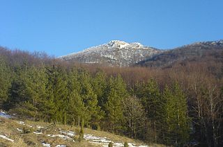
The Strážov Mountains are a mountain range in northwestern Slovakia, being part of Inner Western Carpathians, and of the Fatra-Tatra Area. They are situated between the towns of Trenčín, Považská Bystrica, Rajec, Prievidza and Bánovce nad Bebravou, bordering White Carpathians and the Váh river in the northwest and west, Javorníky in the north, Malá Fatra in the east, Vtáčnik and Nitra river in the south and Považský Inovec in the southwest. The highest mountain is Strážov

<span class="mw-page-title-main">Považský Inovec</span> Mountain range in Western Slovakia

Považský Inovec is a mountain range in western Slovakia, named after the Váh river. It is 48 km (30 mi) long and 15–25 km (9-16 mi) wide mountain range. It is situated from the city of Hlohovec, raising from the Danubian Hills, and slowly raising further north until nearly to the city of Trenčín where it borders the Strážov Mountains, where is also the highest hill of the entire mountain range, Inovec. The mountain range separates basins of the Váh and Nitra rivers.

<span class="mw-page-title-main">Fatra-Tatra Area</span>

The Fatra-Tatra Area or the Tatra-Fatra Belt of core mountains is a part of the Inner Western Carpathians, a subprovince of the Western Carpathians. Most of the area lies in Slovakia with small parts reaching into Austria and Poland. The highest summit of the whole Carpathians, the Gerlachovský štít at 2,655 m (8,711 ft), lies in the High Tatras range which belongs to this area.

<span class="mw-page-title-main">Pieniny Klippen Belt</span> Zone in the Western Carpathians, with a very complex geological structure

The Pieniny Klippen Belt is in geology a tectonically and orographically remarkable zone in the Western Carpathians, with a very complex geological structure. It is a narrow and extremely long north banded zone of extreme shortening and sub-vertical strike-slip fault zone, with complex geological history, where only fragments of individual strata and facies are preserved. The Pieniny Klippen Belt is considered one of the main tectonic sutures of the Carpathians and forms the boundary between the Outer and Central Western Carpathians.

<span class="mw-page-title-main">Geology of the Western Carpathians</span>

The Western Carpathians are an arc-shaped mountain range, the northern branch of the Alpine-Himalayan fold and thrust system called the Alpide belt, which evolved during the Alpine orogeny. In particular, their pre-Cenozoic evolution is very similar to that of the Eastern Alps, and they constitute a transition between the Eastern Alps and the Eastern Carpathians.

<span class="mw-page-title-main">Geology of the Pyrenees</span> European regional geology

The Pyrenees are a 430-kilometre-long, roughly east–west striking, intracontinental mountain chain that divide France, Spain, and Andorra. The belt has an extended, polycyclic geological evolution dating back to the Precambrian. The chain's present configuration is due to the collision between the microcontinent Iberia and the southwestern promontory of the European Plate. The two continents were approaching each other since the onset of the Upper Cretaceous (Albian/Cenomanian) about 100 million years ago and were consequently colliding during the Paleogene (Eocene/Oligocene) 55 to 25 million years ago. After its uplift, the chain experienced intense erosion and isostatic readjustments. A cross-section through the chain shows an asymmetric flower-like structure with steeper dips on the French side. The Pyrenees are not solely the result of compressional forces, but also show an important sinistral shearing.

<span class="mw-page-title-main">Milan Mišík</span>

Milan Mišík was Slovak geologist and university professor. He excelled particularly as an expert in microfacies analysis, stratigraphy, sedimentology, petrography of sedimentary rocks, but also in paleogeography, general and structural geology and tectonics. His best known scientific works were dealing with carbonate rocks and exotic conglomerates.

<span class="mw-page-title-main">Carpathian Flysch Belt</span> Tectonic zone in the Carpathian Mountains

The Carpathian Flysch Belt is an arcuate tectonic zone included in the megastructural elevation of the Carpathians on the external periphery of the mountain chain. Geomorphologically it is a portion of the Outer Carpathians. Geologically it is a thin-skinned thrust belt or accretionary wedge, formed by rootless nappes consisting of so-called flysch – alternating marine deposits of claystones, shales and sandstones which were detached from their substratum and moved tens of kilometers to the north (generally). The Flysch Belt is together with Neogene volcanic complexes the only extant tectonic zone along the whole Carpathian arc.

<span class="mw-page-title-main">Geology of Iran</span>

The main points that are discussed in the geology of Iran include the study of the geological and structural units or zones; stratigraphy; magmatism and igneous rocks; ophiolite series and ultramafic rocks; and orogenic events in Iran.

<span class="mw-page-title-main">Geology of Germany</span> Overview of the geology of Germany

The geology of Germany is heavily influenced by several phases of orogeny in the Paleozoic and the Cenozoic, by sedimentation in shelf seas and epicontinental seas and on plains in the Permian and Mesozoic as well as by the Quaternary glaciations.

The geology of Sicily records the collision of the Eurasian and the African plates during westward-dipping subduction of the African slab since late Oligocene. Major tectonic units are the Hyblean foreland, the Gela foredeep, the Apenninic-Maghrebian orogen, and the Calabrian Arc. The orogen represents a fold-thrust belt that folds Mesozoic carbonates, while a major volcanic unit is found in an eastern portion of the island. The collision of Africa and Eurasia is a retreating subduction system, such that the descending Africa is falling away from Eurasia, and Eurasia extends and fills the space as the African plate falls into the mantle, resulting in volcanic activity in Sicily and the formation of Tyrrhenian slab to the north.

Hungary is in the Pannonian Basin in Central Europe, is surrounded by the Carpathians, Alps and Dinarides, but for the most part dominated by lowlands. Sixty-eight percent of the country is lowlands below 200 meters altitude. Hilly terrain covers 30% of the country, while mountains cover only 2%. The entire Pannonian Basin is in the Danube watershed.

The geology of Georgia is the study of rocks, minerals, water, landforms and geologic history in Georgia. The country is dominated by the Caucasus Mountains at the junction of the Eurasian Plate and the Afro-Arabian Plate, and rock units from the Mesozoic and Cenozoic are particularly prevalent. For much of its geologic history, until the uplift of the Caucasus, Georgia was submerged by marine transgression events. Geologic research for 150 years by Georgian and Russian geologists has shed significant light on the region and since the 1970s has been augmented with the understanding of plate tectonics.

<span class="mw-page-title-main">Geology of Bosnia and Herzegovina</span>

The geology of Bosnia & Herzegovina is the study of rocks, minerals, water, landforms and geologic history in the country. The oldest rocks exposed at or near the surface date to the Paleozoic and the Precambrian geologic history of the region remains poorly understood. Complex assemblages of flysch, ophiolite, mélange and igneous plutons together with thick sedimentary units are a defining characteristic of the Dinaric Alps, also known as the Dinaride Mountains, which dominate much of the country's landscape.

<span class="mw-page-title-main">Geology of Uzbekistan</span> Geology of Uzbekistan, an west Asian nation

The geology of Uzbekistan consists of two microcontinents and the remnants of oceanic crust, which fused together into a tectonically complex but resource rich land mass during the Paleozoic, before becoming draped in thick, primarily marine sedimentary units.

The geology of Romania is structurally complex, with evidence of past crustal movements and the incorporation of different blocks or platforms to the edge of Europe, driving recent mountain building of the Carpathian Mountains. Romania is a country located at the crossroads of Central, Eastern, and Southeastern Europe. It borders the Black Sea to the southeast, Bulgaria to the south, Ukraine to the north, Hungary to the west, Serbia to the southwest, and Moldova to the east.

<span class="mw-page-title-main">Geology of Croatia</span> Overview of the geology of Croatia

The geology of Croatia has some Precambrian rocks mostly covered by younger sedimentary rocks and deformed or superimposed by tectonic activity.

The geology of Greece is highly structurally complex due to its position at the junction between the European and African tectonic plates.

The geology of Montenegro includes sedimentary and volcanic rocks from the Paleozoic through the Cenozoic, deposited atop poorly understood crystalline basement rock.

References

  1. Moores, E.M.; Fairbridge, Rhodes W. (1997). Encyclopedia of European & Asian Regional Geology. Springer. pp. 656–665.
  2. Plašienka, D., Grecula, P., Putiš, M., Kováč, M., a Hovorka, D., 1997: Evolution and structure of the Western Carpathians: An overview. In Grecula, M., Hovorka, D. a Putiš, M., Geological Evolution of the Western Carpathians. Mineralia Slovaca – Monograph, Bratislava, 1 – 24.
  3. Kováč, M., Plašienka, D., Soták, J., Vojtko, R., Oszcypko, N., Less, Gy., Cosovic, V., Fügenschuh, B. & Králiková, S., 2016: Paleogene paleogeography and basin evolution of the Western Carpathians, Northern Pannonian domain and adjoining areas. Global and Planetary Change 140, 9-27.
  4. 1 2 Kováč, M., 2000: Geodynamický, paleografický a štruktúrny vývoj karpatsko-panónskeho regiónu v miocéne: Nový pohľad na neogénne panvy Slovenska, Veda vydavateľstvo Slovenskej akadémie vied, Bratislava, 202 pp.
  5. Nemčok, M., Krzywiec, P., Wojtaszek, M., Ludhová, L., Klecker, R. A., Sercombe, W. J., Coward, M. P., 2006:Tertiary development of the Polish and Eastern Slovakian parts of the Carpathian accretionary wedge: insights from balanced cross sections. Geologica Carpathica, 57, 5, 355-370.
  6. Mišík M. 1997: The slovak part of the Pieniny Klippen Belt after the pioneering works of D.Andrusov. Geol. Carpath., 48, 4, 209–220.
  7. Plašienka, D., 2018: The Carpathian Klippen Belt and types of its klippen – an attempt at a genetic classification. Mineralia Slovaca, 50, 1, 1 - 24.
  8. Mišík, M. & Sýkora, M., 1981: Pieninský exotický chrbát rekonštruovaný z valúnov karbonátových hornín kriedových zlepencov bradlového pásma a manínskej jednotky. / Der pienínische exotische Riicken, rekonstruiert aus Geröôllen karbonatischer Gesteine kretazischer Konglomerate der Klippenzone und der Manín—Einheit. Západné Karpaty, sér. geológia 7, 7—111.
  9. Andrusov, D., Bystrický, J. & Fusán, O., 1973: Outline of the structure of the Western Carpathians. Guide book, X Congress CBGA, GÚDŠ, Bratislava, 44 pp.
  10. 1 2 Biely, A. (ed.) Bezák, V., Elečko, M., Kaličiak, M., Konečný, V., Lexa, J., Mello, J., Nemčok, J., Potfaj, M., Rakús, M., Vass, D., Vozár, J. & Vozárová, A., 1996: Geological map of Slovak Republic 1 : 500,000 / Geologická mapa Slovenskej republiky M = 1 : 500 000. MŽP SR, Geologická služba Slovenskej republiky. Bratislava.
  11. Kriváňová, K., Vojtko, R., Droppa, D.M., Gerátová, S., 2023: Deformation record and revised tectonic evolution of the Nízke Tatry Mts. in the Tatric – Veporic junction area: Insights from structural analysis. Geol. Carpathica, 74, 3, 197-210.
  12. 1 2 3 Plašienka, D. 2018: Continuity and episodicity in the early Alpine tectonic evolution of the Western Carpathians: How large-scale processes are expressed by the orogenic architecture and rock record data. Tectonics, 37, 2029–2079. https://doi.org/10.1029/2017TC004779
  13. 1 2 Hók, J., Pelech, O., Teťák, F., Németh, Z. & Nagy, A., 2019: Outline of the geology of Slovakia (W. Carpathians). Miner. Slovaca, 51, 1, 31 – 60.
  14. Kováč, P. & Havrila, M., 1998: Inner structure of the Hronicum. Slovak Geological Magazine, 4, 4, 275 – 280.
  15. Vozárová A. & Vozár J., 1981: Litostratigrafická charakteristika mladšieho paleozoika hronika. Mineralia slovaca, 13, 5, 385–403.
  16. Samuel, O., Salaj, J. & Began, A., 1980: Litostratigrafická charakteristika vrchnokriedových a paleogénnych sedimentov Myjavskej pahorkatiny. Západné Karpaty, Séria Geológia, 6, s. 81 – 111
  17. Mišík, M., Chlupáč, I. a Cicha, I., 1985: Historická a stratigrafická geológia. SPN, Bratislava, 541 s.
  18. Hók, J., Šujan, M., Šipka, F., 2014: Tektonické členenie Západných Karpát - prehľad názorov a nový prístup. Acta Geologica Slovaca, 6, 2, 135 – 143.
  19. Samuel, O., Borza, K. & Köhler, E., 1972: Microfauna and litostratigraphy of the Paleogene and adjacent Cretaceous of the middle Vah valley (West Carpathians). Bratislava, Geol. ústav. D. Štúra, 246 pp.
  20. Gross, P., 2008: Litostratigrafia Západných Karpát: Paleogén – Podtatranská skupina. Štátny geologický ústav Dionýza Štúra, Bratislava. 78.
  21. Pelech, O. & Olšavský, M., 2018: Post-early Eocene backthrusting in the northeastern Strážovské vrchy Mts. (Western Carpathians). Mineralia Slovaca, 50, 2, 147 – 156.
  22. Vass, D., Began, A., Gross, P., Kahan, Š., Krystek, I. Köhler, E., Lexa, J., Nemčok, J., Ružička, M. a Vaškovský, I., 1988: Regionálne geologické členenie Západných Karpát a severných výbežkov Panónskej panvy na území ČSSR. Mapa 1 : 500 000. Geologický ústav Dionýza Štúra, Bratislava.
  23. Konečný, V. Lexa, J., Šimon, L. a Dublan, L., 2001: Neogénny vulkanizmus stredného Slovenska. Mineralia Slovaca, 33, s. 159 – 178
  24. Rybár, S., Šarinová, K., Joirdan, F., Mayers, C., Sliva, Ľ., 2024: Middle Miocene volcanic flare up preceding and synchronous with the Langhian/Serravallian sea-level decline in the North Pannonian Basin: Insights from 40Ar/39Ar dating, geo-seismic analysis and 3D visualization of the subterranean Kráľová stratovolcano. Basin Research, 36, e12844, 1-31, https://doi.org/10.1111/bre.12844
  25. Pécskay Z., Lexa J., Szakács A., Seghedi I., Balogh, K., Konečný V., Zelenka T., Kovacs M., Poka, T., Fulop, A., Marton, E., Panaiotu, C., Cvetkovic, V., 2010: Geochronology of Neogene-Quaternary magmatism in the Carpathian arc and Intra-Carpathian area: a Review, Geol. Carpath., 2006, 57, 511-530.
  26. Lexa, J., Seghedi, I., Németh, K., Szakácz, A., Konečný, V., Pécskay, Z., Fülöp, M., 2010: Neogene-Quaternary Volcanic forms in the Carpathian-Pannonian Region: a review. Central European Journal of Geosciences, 2, 3, 207 – 270
  27. Kohút, M., Danišík, M., 2017: Rapid cooling and geospeedometry of granitic rocks exhumation within a volcanic arc: A case study from the Central Slovakian Neovolcanic Field (Western Carpathians). Island Arc, 26:e12201, https://doi.org/10.1111/iar.12201
  28. 1 2 3 4 5 Vaškovský, Imrich; Vaškovská, Eugenia (1981). "The development of the natural landscape in Slovakia during the Quaternary". Biuletyn Peryglacjalny . 28: 249–258.
  29. 1 2 Moores & Fairbridge 1997, p. 663.
  30. 1 2 Zuberec, J., Tréger, M., Lexa, J., Baláž, P., 2005: Nerastné suroviny Slovenska / Mineral resources of Slovakia. State Geological Institute of Dionýz Štúr, Bratislava, 350 pp.
  31. Kohút, M., Trubač, J., Novotný, L., Ackermann, L., Demko, R., Bartalský, B., Erban, V., 2013: Geology and Re–Os molybdenite geochronology of the Kurišková U–Mo deposit (Western Carpathians, Slovakia). Journal of Geosciences, 58, 271–282, https://doi.org/ 10.3190/jgeosci.150
  32. Moores & Fairbridge 1997, p. 664.