
Haycock Township is a township in Bucks County, Pennsylvania, United States. The population was 2,225 at the 2010 census.

Upper Black Eddy, locally referred to as UBE, is a village located in northern Bucks County, Pennsylvania, United States. The village is 58 miles (93 km) west-southwest of New York City and 45 miles (72 km) north of Philadelphia.

Ringing rocks, also known as sonorous rocks or lithophonic rocks, are rocks that resonate like a bell when struck. Examples include the Musical Stones of Skiddaw in the English Lake District; the stones in Ringing Rocks Park, in Upper Black Eddy, Bucks County, Pennsylvania; the Ringing Rocks of Kiandra, New South Wales; and the Bell Rock Range of Western Australia. Ringing rocks are used in idiophonic musical instruments called lithophones.

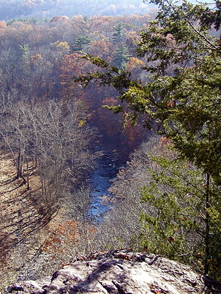
Tohickon Creek is a 29.5-mile-long (47.5 km) tributary of the Delaware River. Located entirely in Bucks County, in southeastern Pennsylvania, it rises in Springfield Township and has its confluence with the Delaware at Point Pleasant. It is dammed to form Lake Nockamixon.

Nockamixon State Park is a Pennsylvania state park on 5,283 acres (2,138 ha) in Bedminster and Haycock Townships in northern Bucks County, Pennsylvania, in the United States. The park is one of the most popular in southeastern Pennsylvania, with most tourists visiting in the summer months.

Sourland Mountain is a 17 miles (27 km) long ridge in central New Jersey, extending from the Delaware River at Lambertville to the western end of Hillsborough Township near the community of Neshanic, through Montgomery Township and into Hopewell Township in Mercer County. It comprises the largest contiguous forest in Central Jersey, nearly 90 square miles (233 km2) in area. The highest point is only 568 feet (173 m) above sea level, but the way it rises steeply from the surrounding farmland has earned it the title of 'mountain'. The ridge itself sits within a larger area of rough terrain called The Sourlands.
Ralph Stover State Park is a Pennsylvania state park on 45 acres (18 ha) in Plumstead and Tinicum Townships, Bucks County, Pennsylvania in the United States. It is a very popular destination for whitewater kayaking on Tohickon Creek and rock climbing on High Rocks. Ralph Stover State Park is two miles (3.2 km) north of Point Pleasant near Pennsylvania Route 32.

Cushetunk Mountain is a ring shaped mountain in the U.S. state of New Jersey, located in Readington and Clinton Township in Hunterdon County. The Lenape Native Americans called the mountain "Cushetunk" meaning "place of hogs" after the wild hogs found there. In the 1960s, the valley at the heart of the mountain was dammed and filled with water to create Round Valley Reservoir. Today, the mountain and its accompanying lake act as a vital water supply to Central New Jersey, while at the same time providing numerous recreational opportunities to the region.
The Gettysburg Formation is a mapped bedrock unit consisting primarily of sandstones, conglomerates, and shales.
Robin Run is a dammed headwater major tributary of the Delaware River with a drainage area of 22.69 square miles that is 1.69 miles north 1.69 miles north of Mill Creek's Confluence with the Neshaminy Creek on the border of Buckingham and Wrightstown Townships), The headwaters originate in Buckingham Township, Bucks County, Pennsylvania and the stream flows generally southeast to its confluence with Mill Creek in Wrightstown Township.
Deep Run is a tributary of the Tohickon Creek in Bedminster Township, Bucks County, Pennsylvania in the United States.
Mink Run is a tributary of the Tohickon Creek in Bedminster Township, Bucks County, Pennsylvania in the United States.
Haycock Creek is a tributary of the Tohickon Creek in Bucks County, Pennsylvania in the United States and is part of the Delaware River watershed.
Threemile Run is a tributary of the Tohickon Creek in Bucks County, Pennsylvania in the United States and is part of the Delaware River watershed.
Dimple Creek is a tributary of the Tohickon Creek in Haycock Township, Bucks County, Pennsylvania in the United States. It is part of the Delaware River watershed.
Tinicum Creek is a tributary of the Delaware River in Tinicum Township, Bucks County, Pennsylvania. It flows for 6.40 miles (10.30 km) from the confluence of its branches, Beaver Creek and Rapp Creek, before entering the river across from Marshall Island. Tinicum Creek and its two branches are part of the federally-designated Lower Delaware National Wild and Scenic River.
Beaver Creek is a tributary of Tinicum Creek in Bridgeton, Nockamixon, and Tinicum Townships in Bucks County, Pennsylvania, in the United States. The creek is part of the Delaware River watershed.
Rapp Creek is a tributary of Tinicum Creek in Nockamixon Township, Bucks County, Pennsylvania in the United States. Rapp Creek is part of the Delaware River watershed.
Falls Creek is a tributary of the Delaware River wholly contained in Bridgeton Township, Bucks County, Pennsylvania in the United States. The creek boasts the highest falls in Bucks County.
Gallows Run is a tributary of the Delaware River in Springfield and Nockamixon Townships, in Bucks County, Pennsylvania in the United States.


