
Montgomery County is the most populous county in the U.S. state of Maryland, located adjacent to Washington, D.C. As of the 2010 census, the county's population was 971,777, increasing by 8.1% to an estimated 1,050,688 in 2019. The county seat and largest municipality is Rockville, although the census-designated place of Germantown is the most populous city within the county. Montgomery County is included in the Washington–Arlington–Alexandria, DC–VA–MD–WV Metropolitan Statistical Area, which in turn forms part of the Baltimore–Washington Combined Statistical Area. Most of the county's residents live in unincorporated locales, of which the most urban are Silver Spring and Bethesda, although the incorporated cities of Rockville and Gaithersburg are also large population centers, as are many smaller but significant places.

Darnestown is a United States census-designated place (CDP) and an unincorporated area in Montgomery County, Maryland. It is 16.39 square miles with the Potomac River as its southern border and the Muddy Branch as much of its eastern border. Seneca Creek borders portions of its north and west sides. The Travilah, North Potomac, and Germantown census-designated places are adjacent to it, as is the city of Gaithersburg. Washington, D.C. is about 25 miles (40 km) away. The Darnestown CDP has a population of approximately 6,400, while the village of Darnestown is considerably smaller.

North Potomac is a census-designated place and unincorporated area in Montgomery County, Maryland, United States. It is located less than 5 miles (8.0 km) north of the Potomac River, and is about 20 miles (32 km) from Washington, D.C. It has a population of approximately 25,000.

The Patuxent River is a tributary of the Chesapeake Bay in the state of Maryland. There are three main river drainages for central Maryland: the Potomac River to the west passing through Washington, D.C., the Patapsco River to the northeast passing through Baltimore, and the Patuxent River between the two. The 908-square-mile (2,352 km2) Patuxent watershed had a rapidly growing population of 590,769 in 2000. It is the largest and longest river entirely within Maryland, and its watershed is the largest completely within the state.

The Anacostia River is a river in the Mid Atlantic region of the United States. It flows from Prince George's County in Maryland into Washington, D.C., where it joins with the Washington Channel to empty into the Potomac River at Buzzard Point. It is approximately 8.7 miles (14.0 km) long. The name "Anacostia" derives from the area's early history as Nacotchtank, a settlement of Necostan or Anacostan Native Americans on the banks of the Anacostia River.

Sligo Creek is a free-flowing tributary of the Northwest Branch of the Anacostia River in Maryland. The creek is approximately 9.1 miles (14.6 km) long, with a drainage area of about 11.6 square miles (30 km2).

Rock Creek is a free-flowing tributary of the Potomac River that empties into the Atlantic Ocean via the Chesapeake Bay. The 32.6-mile (52.5 km) creek drains about 76.5 square miles (198 km2). Its final quarter-mile is affected by tides.

Seneca Creek State Park is a public recreation area encompassing more than 6,300 acres (2,500 ha) along 14 miles of Seneca Creek in its run to the Potomac River in Montgomery County, Maryland. The park features facilities for boating and fishing as well as trails for hiking, cycling, and horseback riding. It is managed by the Maryland Department of Natural Resources.

The Washington Suburban Sanitary Commission (WSSC) is a bi-county political subdivision of the State of Maryland that provides safe drinking water and wastewater treatment for Montgomery and Prince George's Counties in Maryland except for a few cities in both counties that continue to operate their own water facilities.

Lake Needwood is a 75-acre (300,000 m2) reservoir in Derwood, Maryland, United States. Located east of Rockville, in the eastern part of Montgomery County, it is situated on Rock Creek. The lake was created by damming Rock Creek in 1965 with the goal of providing flood control and reducing soil erosion. Lake Needwood also protects the water quality of the creek by functioning as a retention basin to trap sediment from storm-water runoff.
Lake Bernard Frank, is a 54-acre (220,000 m2) reservoir on the North Branch of Rock Creek in Derwood, Maryland, U.S., just east of Rockville. In the late 1960s it was renamed after Bernard Frank, a wilderness activist and a co-founder of The Wilderness Society. The lake's boundaries are, approximately, Route 28, East Gude Drive, Avery Road, and Muncaster Mill Road. Lake Frank was created in 1966 as Lake Norbeck to aid in flood and sediment control, as well as to provide recreation. It has an earthen dam, installed in 1967, on its southern side. It was created as a sister lake to Lake Needwood. Lake Frank is owned by the Maryland-National Capital Park and Planning Commission (M–NCPPC).

Maryland Route 28 is a state highway in the U.S. state of Maryland. The state highway runs 37.38 miles (60.16 km) from U.S. Route 15 in Point of Rocks east to MD 182 in Norwood. The western portion of MD 28 is a rural highway connecting several villages in southern Frederick County and western Montgomery County. By contrast, the eastern portion of the state highway is a major east–west commuter route, particularly within Gaithersburg and Rockville.

Little Falls Branch, a 3.8-mile-long (6.1 km) tributary stream of the Potomac River, is located in Montgomery County, Maryland. In the 19th century, the stream was also called Powder Mill Branch. It drains portions of Bethesda, Somerset, Friendship Heights, and the District of Columbia, flows under the Chesapeake and Ohio Canal (C&O), and empties into the Potomac at Little Falls rapids, which marks the upper end of the tidal Potomac.

Watts Branch is a tributary stream of the Potomac River in Montgomery County, Maryland.

Rocky Gorge Reservoir is located on the Patuxent River in Howard County, Montgomery County and Prince George's County, Maryland between Laurel and Burtonsville, Maryland. The reservoir was created in 1952 by the construction of the T. Howard Duckett Dam on the Patuxent. The dam is visible from Interstate 95 near mile marker 34. Because of its close association with a dam by the name, the reservoir is sometimes called the T. Howard Duckett Reservoir. It has a surface area of 773 acres (3.13 km2). The reservoir is maintained as a drinking water source by the Washington Suburban Sanitary Commission (WSSC).
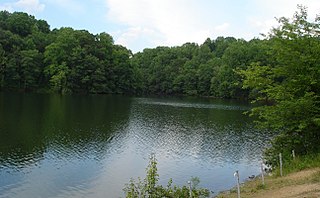
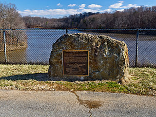
Triadelphia Reservoir is located on the Patuxent River, in Howard County and Montgomery County, Maryland near the town of Brookeville.

Maryland Route 119 is a state highway in the U.S. state of Maryland. Also known as Great Seneca Highway, the highway runs 7.47 miles (12.02 km) from MD 28 in Rockville north to Middlebrook Road in Germantown. MD 119 is a four- to six-lane divided highway that connects several residential and commercial neighborhoods in Rockville, Gaithersburg, and Germantown. Great Seneca Highway was planned by Montgomery County in the late 1960s as a local relief route for traffic on parallel Interstate 270 (I-270) between the three communities. By the early 1980s, the highway had become controversial because it was proposed to pass through Seneca Creek State Park. A coalition of civic and environmental groups unsuccessfully pursued litigation to stop the highway. The National Park Service refused permission for the county to build the highway in 1985 but reversed itself two years later, by which time the first segment of the highway in Germantown was nearing completion. The Rockville–Gaithersburg section was completed in 1989 and the controversial segment through the state park was finished in 1990. Almost all of Great Seneca Highway became MD 119 in 1999.

Little Seneca Creek is an 14.0-mile-long (22.5 km) stream in Montgomery County, Maryland, roughly 18 miles (29 km) northwest of Washington, D.C.

Tenmile Creek is a tributary stream of Little Seneca Creek in Montgomery County, Maryland.


