
Towson is an unincorporated community and a census-designated place in Baltimore County, Maryland, United States. The population was 55,197 as of the 2010 census. It is the county seat of Baltimore County and the second-most populous unincorporated county seat in the United States.

Towson University is a public university in Towson, Maryland. It is a part of the University System of Maryland. Founded in 1866 as Maryland's first training school for teachers, Towson University has evolved into a university with eight colleges and over 20,000 students. Towson is one of the largest public universities in Maryland and still produces the most teachers of any university in the state. Towson University is ranked as the 98th-best public university and 197th-best overall university nationally in the 2020 U.S. News & World Report rankings.
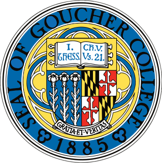
Goucher College is a private liberal arts college in Towson, Maryland. It was chartered in 1885 following a conference in Baltimore led by local leaders of the Methodist Episcopal Church, including John F. Goucher, the school's namesake. It was formerly a women's college before becoming coeducational in 1986. As of 2020, the school had around 1,480 undergraduates studying in 33 majors and six interdisciplinary fields and 700 graduate students. Goucher also grants professional certificates in areas including writing and education and offers a postbaccalaureate premedical program.

Maryland Route 45 is a state highway in the U.S. state of Maryland. Known for most of its length as York Road, the state highway runs 30.06 miles (48.38 km) from U.S. Route 1 and US 40 Truck in Baltimore north to the Pennsylvania state line in Maryland Line, where the highway continues as State Route 3001. MD 45 is the primary highway between Downtown Baltimore and Towson, the county seat of Baltimore County. North of Interstate 695, the state highway parallels I-83 and serves the suburban communities of Lutherville, Timonium, Cockeysville, and Hunt Valley. MD 45 also connects the northern Baltimore County communities of Hereford and Parkton. The state highway is maintained by the Maryland State Highway Administration in Baltimore County and by the Baltimore City Department of Transportation in the city, where the highway also follows Greenmount Avenue.

Johnny Unitas Stadium is a multi-purpose sports stadium in Towson, Maryland, United States. The home of several Towson University athletics teams, it is also known as Minnegan Field at Johnny Unitas Stadium or Unitas Stadium.

Towson High School is a high school in Baltimore County, Maryland, United States, founded in 1873. The school's current stone structure was built in 1949. Located in the northern Baltimore suburb of Towson and serving the surrounding communities of Towson, Lutherville, and Ruxton, it is part of the Baltimore County Public Schools system, the 25th largest school system in the nation as of 2005. Area middle schools that feed into Towson High are Dumbarton Middle School, Ridgely Middle School, and Loch Raven Technical Academy, although students from other areas attend the Law and Public Policy magnet school. In 2010, Towson was ranked No. 341 in Newsweek magazine's "America's Best High Schools: The List" annual national survey. In a Baltimore Style readership vote in 2018, Towson High School was named "Best Public High School" in the Baltimore area.
WMJF-CD, virtual channel 39, is a low-powered, Class A MeTV-affiliated television station serving Baltimore, Maryland, United States that is licensed to Towson. The station is owned by HME Equity Fund II, LLC. WMJF-CD's transmitter is located on Maryland Route 45 near the Towson Town Center mall. It is one of two MeTV outlets that serve the Baltimore market.

Maryland Route 146 is a state highway in the U.S. state of Maryland. The state highway runs 16.81 miles (27.05 km) from MD 45 in Towson north to MD 23 near Jarrettsville. MD 146 connects Towson with Loch Raven Reservoir, an impoundment of Gunpowder Falls. The state highway also serves the northern Baltimore County community of Jacksonville and Jarrettsville in western Harford County. MD 146 was constructed as two different state highways on either side of Loch Raven Reservoir. The section of the state highway in Towson was built in the 1910s and the portion through Jacksonville to Jarrettsville was constructed in the late 1920s and early 1930s. The gap in MD 146 through Loch Raven Reservoir was filled in two steps of maintenance swaps in the early 1960s and late 1970s.

Maryland Route 25, locally known for nearly its entire length as Falls Road, is a state highway in the U.S. state of Maryland. It begins north of downtown Baltimore, just north of Penn Station, and continues north through Baltimore County almost to the Pennsylvania state line. The road passes through the communities of Hampden, Medfield, Cross Keys, and Mount Washington in the city, and Brooklandville and Butler in Baltimore County. The entire length of MD 25 that uses Falls Road—and its locally maintained continuation north to Alesia—is a Maryland Scenic Byway, named the Falls Road Scenic Byway.

Rodgers Forge is a national historic district southwest of the unincorporated Towson area and county seat of Baltimore County, Maryland, United States, just north of the Baltimore City/County line. It is mostly a residential area, with rowhouses, apartments, single-family dwellings, and a new complex of luxury townhomes. The area also has a small amount of commercial development. It is just south of Towson University. 21212 is the postal code for Rodgers Forge.
Joppa Road is a county highway in the U.S. state of Maryland. The highway extends 14.3 miles (23.0 km) from Maryland Route 25 in Brooklandville east to MD 7 near White Marsh. Joppa Road has three main segments separated by very short breaks on its course through central and eastern Baltimore County. The central segment is a multi-lane highway from MD 45 and MD 146 in the county seat of Towson to U.S. Route 1 in Perry Hall. This highway is mostly a commercial strip and parallels Interstate 695 (I-695) through Towson, Parkville, and Carney. The western and eastern segments of Joppa Road are two-lane roads through mainly residential areas. The western segment connects Brooklandville and Towson via Riderwood. The eastern segment serves parts of Perry Hall and White Marsh.

Maryland Route 542 is a state highway in the U.S. state of Maryland. Known for most of its length as Loch Raven Boulevard, the state highway runs 6.33 miles (10.19 km) from MD 147 in Baltimore north to Interstate 695 (I-695) and Cromwell Bridge Road near Towson. MD 542 is a four-lane divided highway that connects portions of Northeast Baltimore with Towson and I-695. The state highway is maintained by the Maryland State Highway Administration in Baltimore County and the Baltimore City Department of Transportation in the city. MD 542 was constructed in the early to mid-1930s. The highway was expanded to a divided highway in Baltimore by 1950 and in Baltimore County in the mid- to late 1950s.

Lake Roland is a 100-acre (0.40 km2) defunct reservoir in Baltimore County, Maryland. It was named for Roland Run, a nearby stream that feeds the lake and eventually flows into Jones Falls. It runs southeast through the city center to the Northwest Branch of the Patapsco River and the Baltimore Harbor. It is located just north of the Baltimore city limits.
The Jones Falls is a 17.9-mile-long (28.8 km) stream in Maryland. It is impounded to create Lake Roland before running through the city of Baltimore and finally emptying into the Baltimore Inner Harbor.

Glen Arm is an unincorporated community in Baltimore County, Maryland, United States.
Back River is a tidal estuary in Baltimore County, Maryland, located about 2 miles (3 km) east of the city of Baltimore. The estuary extends from the community of Rosedale, southeast for about 8.8 miles (14.2 km) to the Chesapeake Bay. The watershed area is 39,075 acres (15,813 ha) and includes Essex Skypark Airport and the Back River Wastewater Treatment Plant.
The Herring Run is an 11.1-mile-long (17.9 km) tributary of the Back River located in Baltimore, Maryland.
Gwynns Falls is a 24.9-mile-long (40.1 km) stream located in Baltimore County and Baltimore City, Maryland. Its headwaters are located in Reisterstown in Baltimore County, and the stream flows southeast, entering the city of Baltimore and emptying into the Middle Branch of the Patapsco River. The Patapsco drains into the Chesapeake Bay. The watershed area of Gwynns Falls covers 66 square miles (170 km2), with 133 miles (214 km) of streams.
The Yellow Line is a mass transit line proposed by the Baltimore Regional Rail Plan in March 2002 for the Baltimore, Maryland area. It would begin at Columbia Town Center in Columbia, Maryland, and end in Hunt Valley, Maryland at Shawan Road.

The Baltimore Gneiss is a Precambrian geological formation in the Piedmont region of Maryland, Pennsylvania, and Delaware.
