Related Research Articles

A thunderstorm, also known as an electrical storm or a lightning storm, is a storm characterized by the presence of lightning and its acoustic effect on the Earth's atmosphere, known as thunder. Relatively weak thunderstorms are sometimes called thundershowers. Thunderstorms occur in a type of cloud known as a cumulonimbus. They are usually accompanied by strong winds and often produce heavy rain and sometimes snow, sleet, or hail, but some thunderstorms produce little precipitation or no precipitation at all. Thunderstorms may line up in a series or become a rainband, known as a squall line. Strong or severe thunderstorms include some of the most dangerous weather phenomena, including large hail, strong winds, and tornadoes. Some of the most persistent severe thunderstorms, known as supercells, rotate as do cyclones. While most thunderstorms move with the mean wind flow through the layer of the troposphere that they occupy, vertical wind shear sometimes causes a deviation in their course at a right angle to the wind shear direction.

A squall is a sudden, sharp increase in wind speed lasting minutes, as opposed to a wind gust, which lasts for only seconds. They are usually associated with active weather, such as rain showers, thunderstorms, or heavy snow. Squalls refer to the increase of the sustained winds over that time interval, as there may be higher gusts during a squall event. They usually occur in a region of strong sinking air or cooling in the mid-atmosphere. These force strong localized upward motions at the leading edge of the region of cooling, which then enhances local downward motions just in its wake.

Tetsuya Theodore Fujita was a Japanese-American meteorologist whose research primarily focused on severe weather. His research at the University of Chicago on severe thunderstorms, tornadoes, hurricanes, and typhoons revolutionized the knowledge of each. Although he is best known for creating the Fujita scale of tornado intensity and damage, he also discovered downbursts and microbursts, and was an instrumental figure in advancing modern understanding of many severe weather phenomena and how they affect people and communities, especially through his work exploring the relationship between wind speed and damage.

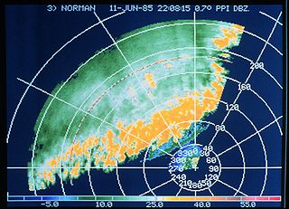
A squall line, or more accurately a quasi-linear convective system (QLCS), is a line of thunderstorms, often forming along or ahead of a cold front. In the early 20th century, the term was used as a synonym for cold front. Linear thunderstorm structures often contain heavy precipitation, hail, frequent lightning, strong straight-line winds, and occasionally tornadoes or waterspouts. Particularly strong straight-line winds can occur where the linear structure forms into the shape of a bow echo. Tornadoes can occur along waves within a line echo wave pattern (LEWP), where mesoscale low-pressure areas are present. Some bow echoes can grow to become derechos as they move swiftly across a large area. On the back edge of the rainband associated with mature squall lines, a wake low can be present, on very rare occasions associated with a heat burst.

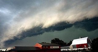
A wall cloud is a large, localized, persistent, and often abrupt lowering of cloud that develops beneath the surrounding base of a cumulonimbus cloud and from which tornadoes sometimes form. It is typically beneath the rain-free base (RFB) portion of a thunderstorm, and indicates the area of the strongest updraft within a storm. Rotating wall clouds are an indication of a mesocyclone in a thunderstorm; most strong tornadoes form from these. Many wall clouds do rotate; however, some do not.

A hook echo is a pendant or hook-shaped weather radar signature as part of some supercell thunderstorms. It is found in the lower portions of a storm as air and precipitation flow into a mesocyclone, resulting in a curved feature of reflectivity. The echo is produced by rain, hail, or even debris being wrapped around the supercell. It is one of the classic hallmarks of tornado-producing supercells. The National Weather Service may consider the presence of a hook echo coinciding with a tornado vortex signature as sufficient to justify issuing a tornado warning.
Keith Anthony Browning is a British meteorologist who worked at Imperial College London, the Met Office, and the University of Reading departments of meteorology. His work with Frank Ludlam on the supercell thunderstorm at Wokingham, UK in 1962 was the first detailed study of such a storm. His well regarded research covered many areas of mesoscale meteorology including developing the theory of the sting jet. Arguably his greatest talent is his intuitive understanding of complex three-dimensional meteorological processes which he has described more simply using conceptual models.

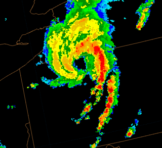
A rainband is a cloud and precipitation structure associated with an area of rainfall which is significantly elongated. Rainbands can be stratiform or convective, and are generated by differences in temperature. When noted on weather radar imagery, this precipitation elongation is referred to as banded structure. Rainbands within tropical cyclones are curved in orientation. Rainbands of tropical cyclones contain showers and thunderstorms that, together with the eyewall and the eye, constitute a hurricane or tropical storm. The extent of rainbands around a tropical cyclone can help determine the cyclone's intensity.

A mesoscale convective system (MCS) is a complex of thunderstorms that becomes organized on a scale larger than the individual thunderstorms but smaller than extratropical cyclones, and normally persists for several hours or more. A mesoscale convective system's overall cloud and precipitation pattern may be round or linear in shape, and include weather systems such as tropical cyclones, squall lines, lake-effect snow events, polar lows, and mesoscale convective complexes (MCCs), and generally forms near weather fronts. The type that forms during the warm season over land has been noted across North and South America, Europe, and Asia, with a maximum in activity noted during the late afternoon and evening hours.

The rear flank downdraft (RFD) is a region of dry air wrapping around the back of a mesocyclone in a supercell thunderstorm. These areas of descending air are thought to be essential in the production of many supercellular tornadoes. Large hail within the rear flank downdraft often shows up brightly as a hook on weather radar images, producing the characteristic hook echo, which often indicates the presence of a tornado.

The rear-inflow jet is a component of bow echoes in a mesoscale convective system that aids in creating a stronger cold pool and downdraft. The jet forms as a response to a convective circulation having upshear tilt and horizontal pressure gradients. The cold pool that comes from the outflow of a storm forms an area of high pressure at the surface. In response to the surface high and warmer temperatures aloft due to convection, a mid-level mesolow forms behind the leading edge of the storm.

In meteorology and climatology, a mesonet, portmanteau of mesoscale network, is a network of automated weather and, often also including environmental monitoring stations, designed to observe mesoscale meteorological phenomena and/or microclimates.

Outflow, in meteorology, is air that flows outwards from a storm system. It is associated with ridging, or anticyclonic flow. In the low levels of the troposphere, outflow radiates from thunderstorms in the form of a wedge of rain-cooled air, which is visible as a thin rope-like cloud on weather satellite imagery or a fine line on weather radar imagery. For observers on the ground, a thunderstorm outflow boundary often approaches in otherwise clear skies as a low, thick cloud that brings with it a gust front.

Atmospheric convection is the result of a parcel-environment instability, or temperature difference layer in the atmosphere. Different lapse rates within dry and moist air masses lead to instability. Mixing of air during the day which expands the height of the planetary boundary layer leads to increased winds, cumulus cloud development, and decreased surface dew points. Moist convection leads to thunderstorm development, which is often responsible for severe weather throughout the world. Special threats from thunderstorms include hail, downbursts, and tornadoes.
Misoscale is an unofficial scale of meteorological phenomena that ranges in size from 40 metres (100 ft) to about 4 kilometres (2 mi). This scale was proposed by Ted Fujita, the founder of the Fujita scale, to classify phenomenon of the order of the rotation within a thunderstorm, the scale of the funnel cloud or a tornado, and the size of the swath of destruction of a microburst. It is a subdivision of the microscale.
Teleconnection in atmospheric science refers to climate anomalies being related to each other at large distances. The most emblematic teleconnection is that linking sea-level pressure at Tahiti and Darwin, Australia, which defines the Southern Oscillation. Another well-known teleconnection links the sea-level pressure over Iceland with the one over the Azores, traditionally defining the North Atlantic Oscillation (NAO).

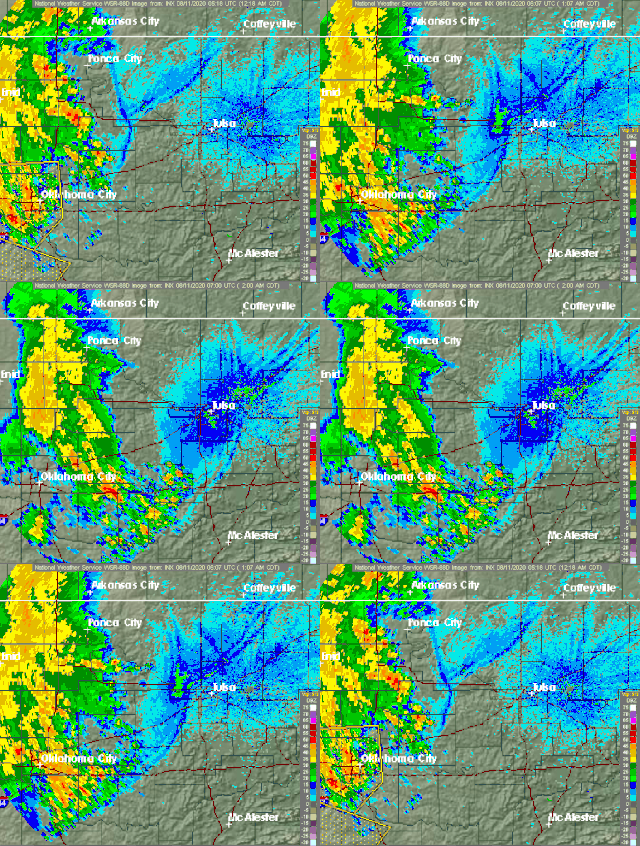
A wake low, or wake depression, is a mesoscale low-pressure area which trails the mesoscale high following a squall line. Due to the subsiding warm air associated with the system's formation, clearing skies are associated with the wake low. Once difficult to detect in surface weather observations due to their broad spacing, the formation of mesoscale weather station networks, or mesonets, has increased their detection. Severe weather, in the form of high winds, can be generated by the wake low when the pressure difference between the mesohigh preceding it and the wake low is intense enough. When the squall line is in the process of decay, heat bursts can be generated near the wake low. Once new thunderstorm activity along the squall line concludes, the wake low associated with it weakens in tandem.

Inflow is the flow of a fluid into a large collection of that fluid. Within meteorology, inflow normally refers to the influx of warmth and moisture from air within the Earth's atmosphere into storm systems. Extratropical cyclones are fed by inflow focused along their cold front and warm fronts. Tropical cyclones require a large inflow of warmth and moisture from warm oceans in order to develop significantly, mainly within the lowest 1 kilometre (0.62 mi) of the atmosphere. Once the flow of warm and moist air is cut off from thunderstorms and their associated tornadoes, normally by the thunderstorm's own rain-cooled outflow boundary, the storms begin to dissipate. Rear inflow jets behind squall lines act to erode the broad rain shield behind the squall line, and accelerate its forward motion.
Hydrometeor loading is the induced drag effects on the atmosphere from a falling hydrometeor. When falling at terminal velocity, the value of this drag is equal to grh, where g is the acceleration due to gravity and rh is the mixing ratio of the hydrometeors. Hydrometeor loading has a net-negative effect on the atmospheric buoyancy equations. As the hydrometeor falls toward the surface, the surrounding air provides resistance against the acceleration due to gravity, and the air in the vicinity of the hydrometeor becomes denser. The increased weight of the atmosphere can support a present downdraft or even cause a downdraft to occur. Hydrometeor loading can also lead to increased high pressure inside of a mesohigh in a thunderstorm.

Project NIMROD was a meteorological field study of severe thunderstorms and their damaging winds conducted by the National Center for Atmospheric Research (NCAR). It took place in the Greater Chicago area from May 15 to June 30, 1978. Data collected was from single cell thunderstorms as well as mesoscale convective systems, such as bow echoes. Using Doppler weather radars and damage clues on the ground, the team studied mesocyclones, downbursts and gust fronts. NIMROD was the first time that microbursts, very localized strong downdrafts under thunderstorms, were detected; this helped improve airport and public safety by the development of systems like the Terminal Doppler Weather Radar and the Low-level windshear alert system.
References
- ↑ Markowski, Paul; Yvette Richardson (2010). Mesoscale Meteorology in Midlatitudes. West Sussex, UK: John Wiley & Sons, Ltd. p. 140. ISBN 978-0-470-74213-6.
- ↑ "Mesohigh". National Weather Service Glossary. National Weather Service. Retrieved 13 October 2011.
- ↑ Fujita, Tetsuya (November 1955). "Results of Detailed Synoptic Studies of Squall Lines". Tellus. 7 (4): 405–436. doi:10.1111/j.2153-3490.1955.tb01181.x.
- ↑ Johnson, Richard H. (January 2001). "Surface Mesohighs and Mesolows" (PDF). Bulletin of the American Meteorological Society. 82 (1): 13–31. Bibcode:2001BAMS...82...13J. doi:10.1175/1520-0477(2001)082<0013:smam>2.3.co;2 . Retrieved 14 October 2011.
- ↑ Fujita, Tetsuya (August 1959). "Precipitation and Cold Air Production in Mesoscale Thunderstorm Systems". Journal of Meteorology. 16 (4): 454–466. Bibcode:1959JAtS...16..454F. doi: 10.1175/1520-0469(1959)016<0454:PACAPI>2.0.CO;2 .
- ↑ Johnson, Richard H.; Paul J. Hamilton (July 1988). "The Relationship of Surface Pressure Features to the Precipitation and Airflow Structure of an Intense Midlatitude Squall Line". Monthly Weather Review. 116 (7): 1446. Bibcode:1988MWRv..116.1444J. doi: 10.1175/1520-0493(1988)116<1444:TROSPF>2.0.CO;2 .
- ↑ Sanders, Frederick; Kerry A. Emanuel (February 1977). "The Momentum Budget and Temporal Evolution of a Mesoscale Convective System". Journal of the Atmospheric Sciences. 34 (2): 322–330. Bibcode:1977JAtS...34..322S. doi: 10.1175/1520-0469(1977)034<0322:TMBATE>2.0.CO;2 .
- ↑ Johnson, Richard H. (January 2001). "Surface Mesohighs and Mesolows" (PDF). Bulletin of the American Meteorological Society. 82 (1): 19–20. Bibcode:2001BAMS...82...13J. doi:10.1175/1520-0477(2001)082<0013:smam>2.3.co;2 . Retrieved 14 October 2011.
