
The Royal Borough of Greenwich is a London borough in southeast Greater London, England. The London Borough of Greenwich was formed in 1965 by the London Government Act 1963. The new borough covered the former area of the Metropolitan Borough of Greenwich and part of the Metropolitan Borough of Woolwich to the east. The local council is Greenwich London Borough Council which meets in Woolwich Town Hall. The council's offices are also based in Woolwich, the main urban centre in the borough.

Plumstead is an area in southeast London, within the Royal Borough of Greenwich, England. It is located east of Woolwich.

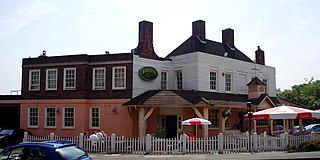
Woolwich is a town in southeast London, England, within the Royal Borough of Greenwich.

Charlton is an area of southeast London, England, in the Royal Borough of Greenwich. It is east of Greenwich and west of Woolwich, on the south bank of the River Thames, 7.2 miles (11.6 km) southeast of Charing Cross. An ancient parish in the county of Kent, it became part of the metropolitan area of London in 1855 and is home to Charlton Athletic F.C. and Charlton House.

Shooter's Hill is a district in South East London within the Royal Borough of Greenwich. It borders the London Borough of Bexley. It lies north of Eltham and south of Woolwich. With a height of 132 metres (433 ft), it is the highest point in the Borough of Greenwich and one of the highest points in Greater London. Shooter's Hill also gives its name to the A road which passes through east to west and is part of the A207 road, the A2 road, and also Watling Street.

Eltham is a district of southeast London, England, within the Royal Borough of Greenwich. It is 8.7 miles (14.0 km) east-southeast of Charing Cross, and is identified in the London Plan as one of 35 major centres in Greater London. The three wards of Eltham North, South and West have a total population of 35,459. 88,000 people live in Eltham.

Oxleas Wood is one of the few remaining areas of ancient deciduous forest in Eltham in the Royal Borough of Greenwich, in southeast London. Some parts date back over 8,000 years to the end of the last ice age, the Younger Dryas. It is part of a larger continuous area of woodland and parkland on the south side of Shooter's Hill: other parts are Jack Wood, Castle Wood, Oxleas Meadows, Falconwood Field, Eltham Common and Eltham Park North. Eltham Park North includes the ancient Shepherdleas Wood.
Falconwood is an area of south east London within both the London Boroughs of Bexley and Greenwich. It is north east of Eltham and south west of Welling.

Woolwich Common is a common in Woolwich in southeast London, England. It is partly used as military land and partly as an urban park. Woolwich Common is a conservation area. It is part of the South East London Green Chain. It is also the name of a street on the east side of the common, as well as an electoral ward of the Royal Borough of Greenwich. The population of the ward at the 2011 Census was 17,499.

Eltham is a constituency created in 1983 and represented in the House of Commons of the UK Parliament since 1997 by Clive Efford of the Labour Party.

Greenwich and Woolwich is a constituency represented in the House of Commons of the UK Parliament since 2015 by Matthew Pennycook of the Labour Party.
Woolwich was a borough constituency represented in the House of Commons of the Parliament of the United Kingdom from 1885 to 1918 and from 1983 to 1997. It centred on Woolwich, now in the Royal Borough of Greenwich in south-east London.

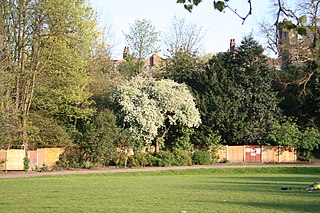
Plumstead Common is a common and urban park in Plumstead in the Royal Borough of Greenwich (SE18), south-east London. It is part of the South East London Green Chain.

The South East London Green Chain, also known as the Green Chain Walk, is a linked system of open spaces between the River Thames and Crystal Palace Park in London, England. In 1977 four London boroughs and the Greater London Council created this Green Chain of 300 open spaces to protect them from building activity. The four London boroughs are Bexley, Bromley, Lewisham and Greenwich. More recently it has been extended to include sections in Southwark. Many parts of the system are also part of the Capital Ring route.
Maryon Park is an urban public park located in Charlton in the Royal Borough of Greenwich. It is situated on the A206 south of the Thames Barrier. There is access from Woolwich Road, Charlton Lane and Thorntree Road. It is part of the Maryon Wilson Park and Gilbert's Pit Local Nature Reserve.
William Barefoot was a notable local politician in south-east London during the early part of the 20th century.

Charlton Riverside, previously known as New Charlton, is the area along the south bank of the river Thames at Charlton, London, which forms part of the Royal Borough of Greenwich. It was formerly a primarily industrial zone, known for the glass and rope making industries, but is now an area of regeneration.

Woolwich, also known as Woolwich St Mary, was an ancient parish containing the town of Woolwich on the south bank of the Thames and North Woolwich on the north bank. The parish was governed by its vestry from the 16th century to 1852, based in the Church of St Mary until 1842, after which in the purpose-built Woolwich Town Hall. The parish adopted the Public Health Act 1848 and was governed by the Woolwich Local Board of Health from 1852. When the parish became part of the district of the Metropolitan Board of Works in 1855 the local board was treated as if it were an incorporated vestry. It was in the county of Kent until it was transferred to London in 1889. In 1900 it was amalgamated with other parishes to form the Metropolitan Borough of Woolwich and had only nominal existence until it was abolished as a civil parish in 1930. Since 1965 it has been split between the Royal Borough of Greenwich and the London Borough of Newham.

Eltham Common is a park and area of common land in the Royal Borough of Greenwich in south-east London. Forming an approximate triangle between Well Hall Road and Shooter's Hill, it is part of a larger continuous area of woodland and parkland on the south side of Shooter's Hill: other parts are Jack Wood, Castle Wood, Oxleas Meadows, Falconwood Field, Oxleas Wood and Eltham Park North.


