Crooked Billet

Last updated

Crooked Billet
Crooked Billet, Wimbledon. - geograph.org.uk - 19649.jpg
Greater London UK location map 2.svg
Red pog.svg
Crooked Billet
Location within Greater London
London borough
Ceremonial county Greater London
Region
Country England
Sovereign state United Kingdom
Post town London
Postcode district SW19
Dialling code 020
Police Metropolitan
Fire London
Ambulance London
UK Parliament
  • Wimbledon
London Assembly
List of places
UK
England
London
51°25′17″N00°13′39″W / 51.42139°N 0.22750°W / 51.42139; -0.22750

Crooked Billet, also known as Shepherd's Hatch Gate, [lower-alpha 1] is a hamlet which forms part of Wimbledon Common and incorporates its own commons. The district encompasses a small area in southwest London, England, in the London Borough of Merton. The area is regarded as a popular greenspot and an adjunct to events in Wimbledon.

Contents

History

Crooked Billet is a small corner of Wimbledon Common with a green, housing mainly in the form of houses, and two public houses. [2] [3] Contrasting with adjoining developed environs, it has maintained its core "identity as a semi-rural enclave". Formerly, it encompassed grazing land, cottages and farm buildings; surviving parts hark back to at least the 17th century. Currently, the public houses host various events, and the Wimbledon Morrismen perform there. A 1617 survey calls it "Shepherd's Hatch Gate" which refers to gates for grazing livestock. [1] A cottage was occupied by Richard Atkins who cultivated one of the fields south of the Ridgway. [1] [4]

It is a small, rather obscure area [1] [5] on the southern edge of Wimbledon Common. One theory is that it is named after the Crooked Billet pub [6] [lower-alpha 2] which was first mentioned in 1509. [1] Both the pub and the area are well regarded. [10] [11] [12] [13] Along with the Hand in Hand pub, it faces onto a small triangular green. Nearby can be found King's College School. [lower-alpha 3] Eagle House and Wimbledon House are also in the vicinity. [15]

Sign for the Crooked Billet, Crooked Billet, SW19 - geograph.org.uk - 897784.jpg

After his son died in the Great Plague of London, Robert Pennington, a friend of Charles II, built Southside House (on nearby Woodhayes Road) as a safe haven for his family. [6]

In the 1770s, the "Cinque Cottages" were built on the green, perhaps as an illegal encroachment. [6]

In the 1820s, Gothic House (later renamed Gothic Lodge) was home to novelist Captain Frederick Marryat. In 1874 it became the home of engineer Sir William Preece [lower-alpha 4] who permitted use of his garden by Guglielmo Marconi to position a radio transmitter "used to send some of the earliest telegraph messages". It was the first house in London with a telephone and London's first house with electricity for illumination, boiling a kettle and ironing. [1]

In the 1860s Earl Spencer was Lord of the Manor, and owner of Wimbledon Common. His stated intent to enclose the common land before selling it for building development led to the passage of the Wimbledon and Putney Commons Act of 1871. [16] Consequently, the land is preserved as a commons and saved "for the public in perpetuity". A Board of Conservators manages the property. [1]

In 1872, Sir Henry Peek of Wimbledon House, Parkside, constructed the "Cinque Cottages" which displaced the earlier cottages. The deed of trust provides for the beneficiaries to be "poor men of good character in needy circumstances" 54 years old or older who resided within one of 40 Surrey parishes. Peek played a signal role in passing the Commons Act. [lower-alpha 5] He was a Member of Parliament for East Surrey from 1868 [1] until 1884. [17]

In 1888 Young's Brewery leased the Crooked Billet pub, and bought the freehold in 1928. In 1974 Young's purchased the Hand in Hand. After the pubs were enlarged and refurbished, they were sold in 2006. [18] [19] The pubs are separated from the green. In Wright's Alley, Shire horses historically pulled brewer's drays delivering ale to customers. [1]

Notable Resident

Imogen Hassall (1942-1980)

See also

Notes

  1. Occasionally and erroneously called "Cromwell's Half Acre." [1]
  2. Quite apart from the location or the present pub, "Crooked Billet" was (and is) a very common pub and inn name. In its most generic form, it refers to a bent staff or branch that has fallen from a tree [7] or ready to be split. [8] There were at least five around London in the 18th century — which then arguably carried a connotation disparaging the presumed clientelle. [9]
  3. The origin of the name is disputed. [1] [14]
  4. Sir William was the premier campaigner for electric street lighting in Wimbledon. His son, Arthur Preece, opened the town's first electricity power station in 1899. [1]
  5. Sir Henry was a son of the founder of biscuit maker Peek Frean & Co. [1]

Related Research Articles

<span class="mw-page-title-main">Mortlake</span> Human settlement in England

Mortlake is a suburban district of the London Borough of Richmond upon Thames on the south bank of the River Thames between Kew and Barnes. Historically it was part of Surrey and until 1965 was in the Municipal Borough of Barnes. For many centuries it had village status and extended far to the south, to include East Sheen and part of what is now Richmond Park. Its Stuart and Georgian history was economically one of malting, brewing, farming, watermen and the Mortlake Tapestry Works (1617–1704), Britain's most important producer. A London landmark, the former Mortlake Brewery or Stag Brewery, is on the edge of Mortlake.

<span class="mw-page-title-main">Penge</span> Suburb of south-east London

Penge is a suburb of South East London, England, now in the London Borough of Bromley, 3.5 miles (5.6 km) west of Bromley, 3.7 miles (6.0 km) north east of Croydon and 7.1 miles (11.4 km) south east of Charing Cross.

Putney is an affluent district of south London, England, in the London Borough of Wandsworth, five miles southwest of Charing Cross. The area is identified in the London Plan as one of 35 major centres in Greater London.

<span class="mw-page-title-main">Roehampton</span> District in south-west London, England

Roehampton is an area in southwest London, in the Putney SW15 postal district, and takes up a far western strip, running north to south, in the London Borough of Wandsworth. It contains a number of large council house estates and is home to the University of Roehampton.

<span class="mw-page-title-main">Wandsworth</span> District of London, England

Wandsworth Town is a district of south London, within the London Borough of Wandsworth 4.2 miles (6.8 km) southwest of Charing Cross. The area is identified in the London Plan as one of 35 major centres in Greater London.

<span class="mw-page-title-main">Wimbledon, London</span> Suburb of London, England

Wimbledon is a district and town of south-west London, England, 7.0 miles (11.3 km) southwest of the centre of London at Charing Cross; it is the main commercial centre of the London Borough of Merton. Wimbledon had a population of 68,187 in 2011 which includes the electoral wards of Abbey, Wimbledon Town and Dundonald, Hillside, Wandle, Village, Raynes Park and Wimbledon Park.

<span class="mw-page-title-main">Prestwood</span> Human settlement in England

Prestwood is a village in Buckinghamshire, England. It is located in the Chiltern Hills, about two miles west of Great Missenden and six miles north of High Wycombe.

<span class="mw-page-title-main">Wimbledon Common</span> Large open space in Wimbledon, southwest London, England

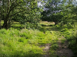
Wimbledon Common is a large open space in Wimbledon, southwest London. There are three named areas: Wimbledon Common, Putney Heath, and Putney Lower Common, which together are managed under the name Wimbledon and Putney Commons totalling 460 hectares. Putney Lower Common is set apart from the rest of the Common by a minimum of 1 mile of the built-up western end of Putney.

<span class="mw-page-title-main">Southfields</span> Human settlement in England

Southfields is a district of inner London located within the London Borough of Wandsworth, England, 5.6 miles (9 km) south-west of Charing Cross. Southfields is mainly residential, historically a part of Wandsworth itself, and is divided between the SW18 and SW19 postcode areas.

<span class="mw-page-title-main">Kingston Vale</span> District in Kingston upon Thames, London

Kingston Vale with Kingston Hill is a district in the Royal Borough of Kingston upon Thames in south-west London. It is a residential area between Richmond Park, the much smaller Putney Vale, Wimbledon Common, Coombe/Coombe Hill and the Norbiton part of the very old borough. The main road is the A308 which is a through route for traffic passing to and from Kingston Hill to the A3 trunk road. Many of the branch roads are cul-de-sacs. It includes, toward the east and in the Vale, the only part of Kingston which drains eastward, that is, into Beverley Brook. The hill expanse, shared with Coombe and a golf course, has a hotel, some tall blocks overlooking Kingston, the edge of Kingston Hospital, the main campus of Kingston University London and faint remnants of dense woodland.

<span class="mw-page-title-main">Elstead</span> Village in Surrey, England

Elstead is a civil parish in Surrey, England with shops, houses and cottages spanning the north and south sides of the River Wey; development is concentrated on two roads that meet at a central green. It includes Pot Common its southern neighbourhood. Hamlets in the parish, marginally separated from the village centre, are Charleshill and Elstead Common, both rich in woodland. Elstead lies between Farnham and Godalming on the B3001 road about 2.2 miles (3.6 km) west of the A3 Milford interchange.

Putney Lower Common is an open parkland space in the London Borough of Wandsworth between the town centres of Putney and Barnes. It is part of Wimbledon and Putney Commons, lying 1.5 miles from the rest of the common area.

<span class="mw-page-title-main">Putney Vale</span> Community in Wandsworth, London, England

Putney Vale is a small community in south west London. It lies between Richmond Park and Wimbledon Common, to the east of Beverley Brook and Kingston Vale. Its main features are a housing estate, a superstore and a large cemetery. The A3 dual carriageway runs through it.

<span class="mw-page-title-main">Wimbledon Windmill</span> Windmill in London, England

Wimbledon Windmill is a Grade II* listed windmill situated on Wimbledon Common in the London Borough of Merton, in the west of South London, and is preserved as a museum.

<span class="mw-page-title-main">Southborough, Bromley</span> Human settlement in England

Southborough is an area of South East London, within the London Borough of Bromley, Greater London. Prior to 1965 it was within the historic county of Kent. It is located south of Bickley and Bromley, east of Bromley Common, north of Locksbottom, and west of Petts Wood.

<span class="mw-page-title-main">E. J. May</span>

Edward John May (1853–1941) was an English architect.

<span class="mw-page-title-main">Stamford House, Wimbledon</span> House in Wimbledon, London

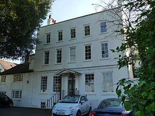
Stamford House is a Grade II listed house on the west side of Wimbledon Common, Wimbledon, London, built in about 1720.

<span class="mw-page-title-main">West Side House, Wimbledon</span>

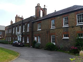
West Side House is a Grade II listed house on the west side of Wimbledon Common, Wimbledon, London, built in about 1760 or earlier.

<span class="mw-page-title-main">Crooked Billet, Wimbledon</span>

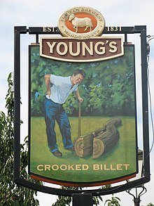
The Crooked Billet is a pub at 14–15 Crooked Billet, facing onto Wimbledon Common, Wimbledon, London. The building dates from the early 18th century and became the Crooked Billet during the 1750s. The district of Wimbledon called Crooked Billet may have taken its name from the pub.

References

Citations

  1. 1 2 3 4 5 6 7 8 9 10 11 12 Matthews, Tony (6 January 2009). "Crooked Billet". London Gardens On Line. London Parks and Gardens Trust. Archived from the original on 7 January 2019. Retrieved 7 January 2019. ...the first mention of a brewery and inn occurs in 1509 and the name was given to a small row of cottages, although 1776 is the first authenticated date of an alehouse here. The site has been referred to erroneously as Cromwell's Half Acre after local legend had it that the site was occupied in 1513 by Walter Cromwell, father of Thomas Cromwell the Chancellor of Henry VIII. Walter was a 'smith and armourer, a brewer and hostelry keeper' but his 'half acre' is now believed to have been elsewhere across Wimbledon Common.
  2. Loobey & Every 1995, pp. 8, 50.
  3. Milward 1989, pp. 81–83.
  4. "The Treswell Survey" . Retrieved 23 February 2019.
  5. Jane, Fred T. (April 1894). "The Romance of a London Omnibus". The English Illustrated Magazine, London (127): 691–699 via ProQuest.(subscription required)
  6. 1 2 3 "Crooked Billet, Merton". Hidden London. Retrieved 4 September 2009.
  7. "Crooked Billet". Best Pubs In London. Londonist . Retrieved 9 January 2019.
  8. Baden-Powell, Baden Henry (1 January 1893). Forest Law: A Course of Lectures on the Principles of Civil and Criminal Law and on the Law of the Forest, Chiefly Based on the Laws in Force in British India, Addressed to the Forest Students at the Royal College of Engineering, Coopers' Hill. Bradbury, Agnew, & Company. p. 329.
  9. Hitchcock 2004.
  10. "Food and Drink, London, 11 Best Pubs in London". The Resident. 1 July 2018. Retrieved 10 January 2019.
  11. Spranklen, Annabelle (30 June 2018). "Vogue's Insider Guide To Wimbledon". Vogue magazine . Retrieved 10 January 2019. There's more to Wimbledon than the two-week tennis tournament that takes over our screens every year. This leafy south west London district, with its famous SW19 postcode, is just 30 minutes outside of the city smog and a melting pot of hotspots worth a visit - including an idyllic stretch known as Wimbledon Village that borders the common. Here are seven little-known local secrets to make the most of while you're visiting.
  12. Embley, Jochan (2 July 2018). "Wimbledon tennis: An SW19 area guide, from main attractions to nightlife". Evening Standard . Retrieved 10 January 2019. Wimbledon is known for one thing above all: tennis. Every July, SW19 is transformed into a hub of activity as fans from all over the world arrive to watch the annual Championships. ... the south-west London neighbourhood is a relaxed, family-friendly area characterised by upmarket, leafy suburbs and green spaces. Its centre is packed with pubs, restaurants and coffee shops.
  13. Brennan, Ailis (2 July 2018). "Wimbledon Tennis in London: Where to Eat and drink". Evening Standard. Retrieved 10 January 2019. If you've been inspired to get to grips with the grass but don't feel quite like expending Grand Slam-level energy, then a recline on Wimbledon Common should do the trick. You'll find the Crooked Billet on the corner of the green spot, and with the tennis on the TV, it's the perfect spot for checking the scores over a Pimms.
  14. "Crooked Billet (also known as Shepherd's Hatch Gate". London Parks and Gardens Trust, parksandgardens.org. Retrieved 1 January 2019.
  15. Surrey Archaeological Society (1891). Surrey Archaeological Collections: Relating to the History and Antiquities of the County. Vol. 10. Bofworth & Sons. p. 160.
  16. "The Wimbledon and Putney Commons Act, 1871" (PDF). Wimbledon and Putney Commons. Retrieved 9 January 2019.
  17. Craig 1989, pp. 465, 467.
  18. Osbourne 1991.
  19. Whichelow 1998, pp. 2, 15.

Sources