Boston Manor Park

Last updated

Boston Manor Park
Trees in Boston Manor Park (02).jpg
Trees in Boston Manor Park to the southeast of the Manor House
Boston Manor Park
Typepublic park
Location London, England
Coordinates 51°29′28″N0°19′12″W / 51.491°N 0.32°W / 51.491; -0.32
Area11.36 hectares (28 acres)
Created1924 (1924)
Operated byLondon Borough of Hounslow
Open8am-dusk
StatusOpen year round
Website hounslow.gov.uk

Boston Manor Park is a large public park in the London Borough of Hounslow. A combination of woodland and open space, with an area adjoining the Grand Union Canal, it was created in 1924 from part of the historic estate of the 17th-century stately home Boston Manor House.

Contents

History of the park

The Boston Manor estate is thought to date back to at least 1163 and had a series of influential owners. At one time, it was part of the estate of royal financier Thomas Gresham, who also owned neighbouring Osterley Park. [1] The house that survives in the centre of the park dates from 1623. Just under a century later, the grounds were described as comprising: "gardens, walls, walks, courts, 5 fish ponds . . . Plantation and nursery computed to be 3 acres . . . Whole being well wooded and watered." [1] In 1670, the estate was sold for just over £5,000 to the Clitherow family, and it remained in their ownership for the succeeding 250 years. [1]

In the late 18th century, some land was sold to enable construction of the Grand Junction Canal (later to become a section of the Grand Union Canal), with Clitherow Lock – then the second lock from the Thames – being built on the estate. [1] By the late 19th century, this part of London had become urbanised and increasingly shabby, but the estate remained a rural island – containing fine views, historic trees, roses and kitchen garden. [1]

Estate dispersal and park opening

In 1918, Colonel Stacey Clitherow had decided to sell the Boston Manor estate. Estate agent's particulars described a property containing glasshouses for growing melons and cucumbers, grapevines, and a 200-yard herbaceous border. The house did not reach its reserve price so, in 1923, Colonel Clitherow sold the manor and fifty acres to Brentford Urban District Council. [1] Some land was developed as housing and the park was opened to the public on 11 September 1924. [1]

An ornamental lake with island, dating from the era when this was a grand estate, stands close to Boston Manor House Boston park lake 2895.jpg
An ornamental lake with island, dating from the era when this was a grand estate, stands close to Boston Manor House

Park layout

Comprising an area of 11.36 hectares (28 acres) surrounding the manor house, the park is accessed from Boston Manor Road on the eastern perimeter. [2] The construction of the M4 motorway in 1964-5 was the biggest alteration to the park landscape, dissecting the park from north-west to south-east perimeters. [1] The Grand Union Canal and River Brent run along the western perimeter, the canal taking in what is now known as Clitheroes or Clitheroe's Lock 99. [3] [4]

The M4 cuts through the park Underside of the Chiswick Flyover in Boston Manor Park (01).jpg
The M4 cuts through the park

Features of interest

The canalside is a designated Nature Conservation Area. [1] Notable trees include fine old cedars, some of which may date back to 18th-century plantings by the Clitherow family. [1] A large ornamental pond is to the north of the manor house and part of the original garden wall remains. [1] Thames Rivers Trust has undertaken work at the stepped weir at the park to assist the migration of elver, installing an 'elver pass' in 2012. [5]

Recent developments

Recent works to the park include the creation of a wildflower meadow in 2006 and the restoration of the walled garden. General upgrades have included replanting of shrubs, trees and herbaceous borders. The park first won a Green Flag Award in 2005. [1]

Activities in the park

The park is under the overall management of London Borough of Hounslow and includes three tennis courts, a basketball court and children's play area. [2] The manor house is open for tours and special events. [6] The Brentford Festival was an annual event held in the park between 2005 and 2012, before moving to Blondin Park. [7]

Related Research Articles

<span class="mw-page-title-main">Hounslow</span> Town in the west of London, England

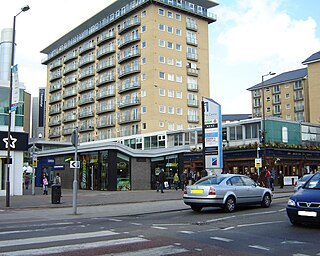
Hounslow is a large suburban district of West London, England, 10+34 miles west-southwest of Charing Cross. It is the administrative centre of the London Borough of Hounslow, and is identified in the London Plan as one of the 14 metropolitan centres in Greater London.

<span class="mw-page-title-main">Brentford</span> Suburb of West London

Brentford is a suburban town in West London, England and part of the London Borough of Hounslow. It lies at the confluence of the River Brent and the Thames, 8 miles (13 km) west of Charing Cross.

<span class="mw-page-title-main">Chiswick</span> Riverside district of London, England

Chiswick is a district in the London Borough of Hounslow, West London, England. It contains Hogarth's House, the former residence of the 18th-century English artist William Hogarth; Chiswick House, a neo-Palladian villa regarded as one of the finest in England; and Fuller's Brewery, London's largest and oldest brewery. In a meander of the River Thames used for competitive and recreational rowing, with several rowing clubs on the river bank, the finishing post for the Boat Race is just downstream of Chiswick Bridge.

<span class="mw-page-title-main">Cowley, London</span> Suburban village in the United Kingdom

Cowley is a village contiguous with the town of Uxbridge in the London Borough of Hillingdon. A largely suburban village with 16 listed buildings, Cowley is 15.4 miles (24.8 km) west of Charing Cross, bordered to the west by Uxbridge Moor in the Green Belt and the River Colne, forming the border with Buckinghamshire. Cowley was an ancient parish in the historic county of Middlesex.

<span class="mw-page-title-main">London Borough of Hounslow</span> London borough in United Kingdom

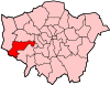
The London Borough of Hounslow is a London borough in west London, England, forming part of Outer London. It was created in 1965 when three smaller borough councils amalgamated under the London Government Act 1963. It is governed by Hounslow London Borough Council.

<span class="mw-page-title-main">Feltham</span> Suburb of West London

Feltham is a town in West London, England, 13 miles (21 km) from Charing Cross. Historically part of Middlesex, it became part of the London Borough of Hounslow in 1965. The parliamentary constituency of Feltham and Heston has been held by Labour Party MPs since 1992. In 2011, the population of the combined census area of Feltham, Bedfont and Hanworth was 63,368.

<span class="mw-page-title-main">Hampton, London</span> Suburb of Greater London, England

Hampton is a suburb of Greater London on the north bank of the River Thames, in the London Borough of Richmond upon Thames, England, and the historic county of Middlesex. Hampton is bounded by Bushy Park to the east, the suburbs of Hampton Hill and Fulwell to the north, green belt to the west, and the Thames to the south.

<span class="mw-page-title-main">Isleworth</span> Suburb of West London

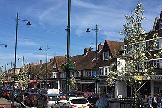
Isleworth is a suburban town located within the London Borough of Hounslow in West London, England. It lies immediately east of the town of Hounslow and west of the River Thames and its tributary the River Crane. Isleworth's original area of settlement, alongside the Thames, is known as 'Old Isleworth'. The north-west corner of the town, bordering on Osterley to the north and Lampton to the west, is known as 'Spring Grove'.

<span class="mw-page-title-main">St Margarets, London</span> Human settlement in England

St Margarets is an affluent suburb and neighbourhood in the London Borough of Richmond upon Thames, about 9 miles (14 km) west-southwest of central London. It is bounded by the Thames Tideway to the north-east, and the River Crane to the north-west and north where the land tapers between these rivers. Land and buildings closer to Richmond Bridge than the eponymous railway station are, traditionally distinctly, known as East Twickenham. Both places go by their post town and traditional parish, Twickenham quite often; in the 19th century the south of St Margarets was marked on maps as Twickenham Park.

<span class="mw-page-title-main">Boston Manor tube station</span> London Underground station

Boston Manor is a London Underground station at the boundary of the boroughs of Hounslow and Ealing. The station is situated on the Heathrow branch of the Piccadilly line, between Osterley and Northfields stations, in Travelcard Zone 4.

<span class="mw-page-title-main">Whitton, London</span> Human settlement in England

Whitton is an area of the London Borough of Richmond upon Thames, England. Historically, it was the north-western part of Twickenham manor, bounded by the River Crane and the Duke of Northumberland's River.

<span class="mw-page-title-main">River Crane, London</span> River in England

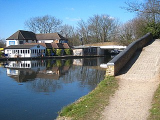
The River Crane, a tributary of the River Thames, runs 8.5 miles (13.6 km) in West London, England. It forms the lower course of Yeading Brook. It adjoins or passes through three London boroughs: Hillingdon, Hounslow and Richmond upon Thames, in the historic county of Middlesex. The drainage basin is heavily urbanised but many of the Hayes to Whitton flood-meadows have been conserved, forming a narrow, green vale, opening out to what remains of Hounslow Heath in the centre – a near-continuous belt of semi-natural habitat.

<span class="mw-page-title-main">Norwood Green</span> Human settlement in England

Norwood Green is a place in the London Borough of Ealing in London, England, that forms the southern part of Southall. It is a suburban development centred 10.7 miles (17.2 km) west of Charing Cross and 4 miles (6.4 km) ENE of Heathrow Airport.

<span class="mw-page-title-main">Parks and open spaces in the London Borough of Hounslow</span>

The London Borough of Hounslow is a peripheral London borough in the south-west of the conurbation; as such part of the Metropolitan Green Belt lies within its boundaries. It has one of London's largest Nature reserves as well as many smaller gardens and sports grounds. The major areas are:

<span class="mw-page-title-main">Parks and open spaces in the London Borough of Ealing</span>

The London Borough of Ealing, one of the outer London boroughs although not on the periphery, has over 100 parks and open spaces within its boundaries. These include allotments, cemeteries, playgrounds, and golf courses in addition to the larger open spaces such as nature conservation areas.

<span class="mw-page-title-main">Gunnersbury Park</span> Human settlement in England

Gunnersbury Park is a park between Acton, Brentford, Chiswick and Ealing, West London, England. Purchased for the nation from the Rothschild family, it was opened to the public by Neville Chamberlain, then Minister of Health, on 21 May 1926. The park is currently jointly managed by Hounslow and Ealing borough councils. A major restoration project funded by the Heritage Lottery Fund was completed in 2018. The park and garden is Grade II listed.

<span class="mw-page-title-main">Boston Manor House</span> Historic house museum

Boston Manor House is an English Jacobean manor house built in 1622 with internal alterations, intensively restored in later centuries. It was the manor house of one of the early medieval-founded manors in Middlesex. Since 1965 the manor's small part of the parish of Hanwell has been part of the London Borough of Hounslow in west London. Boston Manor Park is the publicly owned green space, including a lake, which adjoins the house.

<span class="mw-page-title-main">Dukes Meadows</span> Riverside park in Chiswick, London

Dukes Meadows is a riverside park in Chiswick, London. The land was bought by the council in 1923, and the park was opened in 1926. It is cared for by the Dukes Meadows Trust. The area is home to the Chiswick Farmers' Market, which helps to pay for the park's maintenance. From 2023 the Dukes Meadows Footbridge forms part of the Thames Path.

<span class="mw-page-title-main">Chiswick Mall</span> Waterfront street in Chiswick, west London

Chiswick Mall is a waterfront street on the north bank of the river Thames in the oldest part of Chiswick in West London, with a row of large houses from the Georgian and Victorian eras overlooking the street on the north side, and their gardens on the other side of the street beside the river and Chiswick Eyot.

References

  1. 1 2 3 4 5 6 7 8 9 10 11 12 "Boston Manor Park". londongardensonline.org. London Gardens Online. Retrieved 6 October 2014.
  2. 1 2 "Boston Manor Park". hounslow.info. London Borough of Hounslow. Archived from the original on 9 October 2014. Retrieved 6 October 2014.
  3. "Is this the right way to Braunston". grandunioncanalwalk.co.uk. Grand Union Canal Walk. Retrieved 6 October 2014.
  4. "In your area". canalrivertrust.org.uk. Canal & River Trust. Retrieved 6 October 2014.
  5. "Boston Manor Weir Completion Report". thamesriverstrust.org.uk. Thames Rivers Trust. Archived from the original on 22 October 2014. Retrieved 6 October 2014.
  6. "Boston Manor House". hounslow.info. London Borough of Hounslow. Archived from the original on 9 October 2014. Retrieved 6 October 2014.
  7. "Brentford Festival". brentfordfestival.org.uk. Brentford Festival. Archived from the original on 9 October 2014. Retrieved 6 October 2014.