Sandy Spring, Maryland

Last updated

Sandy Spring
Montgomery County Maryland Incorporated and Unincorporated areas Ashton-Sandy Spring Highlighted.svg
Location in the U.S. state of Maryland
Coordinates: 39°08′58.3″N77°01′34.42″W / 39.149528°N 77.0262278°W / 39.149528; -77.0262278
Country Flag of the United States.svg United States of America
State Flag of Maryland.svg  Maryland
County Flag of Montgomery County, Maryland.svg Montgomery
Settledca. 1715 [1]
Time zone UTC-5 (EST)
  Summer (DST) UTC-4 (EDT)
ZIP code
20860
Area codes 301, 240

Sandy Spring is an unincorporated community in Montgomery County, Maryland, United States. [2]

Contents

Geography

Sandy Spring's boundaries are roughly defined as Brooke Road and Dr. Bird Road to the north and west, Ednor Road to the south, and New Hampshire Avenue to the east. [3]

The United States Census Bureau combines Sandy Spring with the nearby community of Ashton to form the census-designated place of Ashton-Sandy Spring, [3] and all census data are tabulated for this combined entity.

History

Sandy Spring Friends Meeting House SandySpringFriendsMeetingHouse SW.jpg
Sandy Spring Friends Meeting House
Chronology of the Sandy Spring Friends Meeting House Sandy Spring Friends Meeting House history.jpg
Chronology of the Sandy Spring Friends Meeting House

The community was founded by Quakers who arrived in the early 18th century [3] searching for land where they could grow tobacco and corn.

One of the very early land owners in the Sandy Spring area was Richard Snowden, who patented (purchased) the 1,000 acres (4 km2) "Snowden's Manor" in 1715. [1] Snowden gradually enlarged his property with additional land purchases over the next few decades until it was surveyed at over 9,000 acres (36 km2) as "Snowden's Manor Enlarged" in 1743.

Another important early landowner, Major John Bradford, had patented over 2,000 acres (8 km2) in the Sandy Spring area, including "Charley Forest" in 1716, [1] "Charley Forest Enlarged", "Higham", and "Discovery." Bradford sold off large parts of these properties, but Snowden's son-in-law, James Brooke, later bought up the original Charley Forest land as well as other land in the area, eventually owning over 22,000 acres (90 km2) by the 1760s. [4]

The Quakers built their current brick meeting house in 1817, replacing a 1770 frame meeting house. Quakers first began worshiping in the area circa 1753. [1] [5] [6] The site is near a fresh-water spring that gave its name to the community. [3] The location of this meeting house in the village of Sandy Spring helped to define the geographic extent of the greater Sandy Spring neighborhood of the time, comprising those areas from which members of the Meeting could travel to and from the meeting house by horse or carriage in one day, arriving home before sunset. The greater Sandy Spring neighborhood thus includes the current communities of Brookeville, Olney, Norbeck, Ednor, Brighton, and other communities within a six-mile radius of the meeting house. [7]

In the late 19th century the community started a local school called the Sherwood Academy. This school was turned over to the Government of Montgomery County in 1906 to become Sherwood High School, the county's third public high school. A Quaker school, Sandy Spring Friends School, was established in 1961. In 1967 a Quaker retirement community, Friends House, was founded next to the school. The Sandy Spring Library opened behind the Sandy Spring Store in 1842. [1] The Farmer's Club of Sandy Spring was established in 1844 to discuss preferable methods of farming. [1]

A 1901 Department of Labor study documented hundreds of residents who trace their lineage 125 years to free black families. [8]

Benjamin Hallowell

Benjamin Hallowell (educator) (1799-1887) was a prominent Quaker in 19th century Sandy Spring. As an educator, he taught at Fair Hill in Olney, then taught in Virginia. He lived at Rockland in Olney. His farm is now the Hallowell housing development. He briefly served as the first president of the Maryland Agricultural College (later to become the University of Maryland.) He was integral in forming the Sandy Spring Farmer's Club and the Mutual Fire Insurance Company. [9]

Dr. Bird

Dr Jacob Wheeler Bird was born in Anne Arundel County in 1885. [10] He attended St. John's College in Annapolis, and he earned his medical degree from the University of Maryland, Baltimore in 1907. [10]

In 1909, Dr. Bird moved to Sandy Spring to set up his medical practice on the road now named for him, Dr. Bird Road. [10] He also established the first hospital located in Montgomery County, now called Montgomery General Hospital. [10]

During his fifty-year medical career, Dr. Bird made house calls to his patients, at first in a horse-drawn buggy and later an automobile. [10] He founded Montgomery General Hospital in February 1920.

Dr. Bird and his wife died in an automobile accident in Alabama on October 25, 1959. [10]

Sandy Spring Museum

The sign for the Sandy Spring Museum in Sandy Spring, Maryland as photographed in September 2020. Sandy Spring Museum Sign in Sandy Spring MD.jpg
The sign for the Sandy Spring Museum in Sandy Spring, Maryland as photographed in September 2020.

An insurance salesman and auctioneer named Delmas Wood started the Sandy Spring Museum in 1980 because he thought Sandy Spring's history was gradually being lost as older residents died. [11] Wood wanted a place to preserve antique furniture, farm equipment, photographs, paintings, and documents of the Sandy Spring area. [12] Florence Virginia Barrett Lehman also helped found the museum. [13]

The museum was originally located in the basement of a Sandy Spring National Bank branch in Olney. [14] In October 1986, [15] it moved to Tall Timbers, a brick four-story Colonial house that had been the home of Gladys Brooke Tumbleson, who had died earlier that year. [11] Tumbleson descended from the Brooke family, for which nearby Brookeville was named. [11] Tumbleson sold the building to the museum for less than market value. [11]

Helen Bentley donated 7.5 acres (30,000 m2) of land on Bentley Road in Sandy Spring to the museum in 1994. [12] The museum's new building on opened in 1997, providing more room for the museum's exhibits. [14]

In 2007, an addition opened, providing a research library and a collections storage facility for the museum. [16]

Related Research Articles

<span class="mw-page-title-main">Olney, Maryland</span> Census-designated place in Maryland, United States

Olney is a U.S. census-designated place and an unincorporated area in Montgomery County, Maryland. It is located in the north central part of the county, ten miles (16 km) north of Washington, D.C.

<span class="mw-page-title-main">Brookeville, Maryland</span> Town in Maryland, United States

Brookeville is a town in Montgomery County, Maryland, located 20 km (12 mi) north of Washington, D.C., and 2 km (1.2 mi) north of Olney. Brookeville was settled by Quakers late in the 18th century and was formally incorporated as a town in 1808. Historically part of the local agricultural industry, Brookeville is now at the northern edge of the densely developed Washington suburbs. The population was 166 at the 2020 census.

<span class="mw-page-title-main">Burtonsville, Maryland</span> Census-designated place in Maryland

Burtonsville is a census-designated place and an unincorporated area in Montgomery County, Maryland, United States. It is situated in the northeast corner of Montgomery County, right on the border of both Howard and Prince George's counties. It is considered a suburban town in the Washington D.C. Metro Area.

<span class="mw-page-title-main">Colesville, Maryland</span> Census-designated place in Maryland, United States

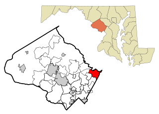
Colesville is a census-designated place and an unincorporated area in Montgomery County, Maryland, United States. It had a population of 15,421 as of the 2020 census.

<span class="mw-page-title-main">Glenmont, Maryland</span> Census-designated place in Maryland, United States

Glenmont is an unincorporated community and census-designated place in Montgomery County, Maryland, United States. The United States Census Bureau had combined Glenmont with nearby Wheaton to create the census-designated place of Wheaton-Glenmont, from 2000 to 2010. It had a population of 16,710 in 2020.

<span class="mw-page-title-main">Maryland Route 108</span> State highway in Maryland, US

Maryland Route 108 is a state highway in the U.S. state of Maryland. The highway runs 34.23 miles (55.09 km) from MD 27 in Damascus east to MD 175 in Columbia. MD 108 is an S-shaped highway that winds through the northern Montgomery County and central Howard County. The highway connects the Montgomery County communities of Laytonsville, Olney, Sandy Spring, and Ashton with the Howard County villages of Highland and Clarksville. MD 108 serves as the northern edge of Columbia and connects several of the planned community's suburban villages.

<span class="mw-page-title-main">Maryland Route 97</span> State highway in Carroll, Howard, and Montgomery counties, Maryland, US

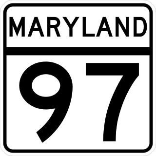
Maryland Route 97 (MD 97) is a state highway in the U.S. state of Maryland. The route runs 55.27 mi (88.95 km) from U.S. Route 29 (US 29) in Silver Spring, Montgomery County, north to the Pennsylvania border in Carroll County, where the road continues into that state as Pennsylvania Route 97 (PA 97). Throughout most of Montgomery County, MD 97 is known as Georgia Avenue, which continues south from the southern terminus along US 29 into Washington, D.C. It is a suburban four- to six-lane divided highway from Silver Spring north to Olney. From here, the route continues as a rural two-lane undivided road north through Brookeville and into Howard County. MD 97 continues through Carroll County where it passes through the county seat of Westminster. The route intersects many major roads, including Interstate 495 north of Silver Spring, MD 28 and MD 200 in Norbeck, I-70/US 40 near Cooksville, MD 26 in Dorsey Crossroads, and MD 27, MD 32, and MD 140 in the Westminster area.

<span class="mw-page-title-main">Maryland Route 650</span> Highway in Maryland, United States

Maryland Route 650 is a state highway in the U.S. state of Maryland. Known as New Hampshire Avenue for most of its length, the state highway runs 25.89 mi (41.67 km) from Eastern Avenue at the Washington, D.C. border north to MD 108 in Etchison. MD 650 serves as a major north-south commuter route in northwestern Prince George's County and eastern Montgomery County, connecting the District of Columbia with the residential suburbs of Takoma Park, Langley Park, Adelphi, Hillandale, White Oak, and Colesville. By contrast, the part of MD 650 north of Spencerville is a quiet rural road connecting several small communities along the northeastern fringe of Montgomery County.

Norbeck is the area of Montgomery County, Maryland, United States, around Norbeck Road east of Georgia Avenue to Layhill Road. Shortly before the Civil War, free blacks founded Norbeck.

<span class="mw-page-title-main">Triadelphia Reservoir</span> Reservoir in near Brookeville, Maryland

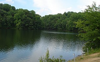
Triadelphia Reservoir is located on the Patuxent River, in Howard County and Montgomery County, Maryland near the town of Brookeville.

<span class="mw-page-title-main">Maryland Route 182</span> State highway in Montgomery County, Maryland

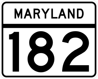
Maryland Route 182 is a state highway in the U.S. state of Maryland. Known for most of its length as Layhill Road, the highway runs 6.54 miles (10.53 km) from MD 97 in Glenmont north to MD 108 in Olney. MD 182 connects the northeastern Montgomery County communities of Glenmont, Layhill, Norwood, Sandy Spring, and Olney. The highway was constructed in the early 1920s. MD 182 was expanded to a four-lane divided highway from Glenmont to the site of its interchange with MD 200 in the late 1980s and early 1990s.

<span class="mw-page-title-main">Clifton (Ednor, Maryland)</span> Historic house in Maryland, United States

Clifton is a historic home located at Ednor, Montgomery County, Maryland, United States. It is a 1+12-story gambrel-roofed brick structure with a lower north wing, also with a gambrel roof. Outbuildings on the property include a wood-frame shed and a guest house or cottage. It is one of the few extant mid-18th-century buildings in Montgomery County and is associated with the local Quaker community, which by 1753 had been organized into the Sandy Spring Meeting of Friends.

<span class="mw-page-title-main">Sandy Spring Friends Meetinghouse</span> Historic church in Maryland, United States

The Sandy Spring Friends Meetinghouse is a historic building located at Sandy Spring, Montgomery County, Maryland. It is a large, Flemish bond brick, Federal-style Quaker Meeting House built in 1817. The meetinghouse is on two acres deeded by James Brooke in the 1750s, for the use of the Quaker Meeting. Nearby is the cemetery where he and many of his descendants were buried.

<span class="mw-page-title-main">Caleb Bentley</span> American silversmith and postmaster (1762-1851)

Caleb Bentley (1762–1851) was an American silversmith, shopkeeper, and first postmaster in Brookeville, Maryland. Bentley was born in Chester County, Pennsylvania in 1762.

<span class="mw-page-title-main">Brookeville Academy</span> School in Brookeville, Maryland, USA

The Brookeville Academy is located in the heart of the Historic District in Brookeville, Maryland, a town located twenty miles (32 km) north of Washington, D.C., and two miles (3.2 km) north of Olney in northeastern Montgomery County, Maryland. It was built in 1810 as one of the first private schools in Montgomery County, Maryland. Now, fully restored, it serves as a unique community center suitable for meetings, social and cultural events. It is located in the Brookeville Historic District, which served as the "Capital for a Day" in 1814 when President Madison had to flee the White House during the British Invasion of the War of 1812.

Richard Snowden (1688–1763) was the grandson of Richard Snowden Sr (1640–1711), one of Maryland's early colonists, who arrived in 1658. By Articles of Agreement dated July 5, 1705, Snowden and four other partners – Joseph Cowman, Edmund Jenings, John Galloway, and John Prichard – founded the Patuxent Iron Works on the site of Maryland's oldest iron forge. Together they founded one of Maryland's first industries, and settled the land now known as Laurel and Sandy Spring, Maryland.

<span class="mw-page-title-main">Craig Zucker</span> Maryland politician

Craig Jason Zucker is an American politician who serves in the Maryland Senate from the 14th Legislative District. The district includes parts or all of Silver Spring, Calverton, Colesville, Cloverly, Fairland, Burtonsville, Spencerville, Olney, Brookeville, Ashton, Sandy Spring, Brinklow, Laytonsville, Sunshine, Goshen, and Damascus in Montgomery County. He was elected to the Maryland House of Delegates on November 2, 2010, and sworn in on January 12, 2011, then re-elected in 2014 to his second-four-year term. On February 4, 2016, he was sworn into the Maryland State Senate following the retirement of Senator Karen S. Montgomery.

<span class="mw-page-title-main">Norwood, Maryland</span> Unincorporated area in Montgomery County, Maryland, United States

Norwood is an unincorporated community in Montgomery County, Maryland, United States, located at the intersection of Layhill Road, Norwood Road, and Ednor Road, two miles from the Intercounty Connector (ICC).

Isaac Briggs was an American engineer, surveyor and manufacturer. He lived much of his adult life with his family in Brookeville, Maryland.

<span class="mw-page-title-main">Sandy Spring Museum</span> 501(c)(3) nonprofit history museum in Maryland, U.S.

Sandy Spring Museum was founded as a local history museum, preserving the history of the surrounding area of Sandy Spring, MD. Today, by supporting community-driven cultural arts and educational programs, they gather community to build a sense of place and belonging.

References

  1. 1 2 3 4 5 6 Thruston, Lucy Meacham (December 24, 1905). "Notable Neighborhood: The History And Traditions Of Sandy Spring". The Baltimore Sun. p. 8. ProQuest   537095830.
  2. U.S. Geological Survey Geographic Names Information System: Sandy Spring, Maryland
  3. 1 2 3 4 Glaros, Tony (October 4, 2014). "Where We Live: Sandy Spring, Md., is where FDR and Herbert Hoover played". The Washington Post. p. RE3.
  4. Eldon, Hiebert Ray; MacMaster, Richard K. (1976). A Grateful Remembrance: The Story of Montgomery County, Maryland. Rockville, Maryland: Montgomery County Government and the Montgomery County Historical Society.
  5. Moore, Brook. "Sandy Spring Friends Meeting House National Register of Historic Places Inventory - Nomination Form". National Archives Catalog. United States Department of the Interior National Park Service. p. 2. Retrieved March 12, 2021.
  6. Trieschmann, Laura. "Sandy Spring Historic District Determination of Eligibility Form" (PDF). Maryland Inventory of Historic Properties. Maryland Historical Trust. p. 2. Retrieved March 12, 2021.
  7. Canby, Thomas Y. and Elie S. Rogers (1979). Sandy Spring Legacy. Sandy Spring: Sandy Spring Museum.
  8. "THE Negroes of Sandy Spring". The Baltimore Sun. February 15, 1901. p. 4. ProQuest   536271700.
  9. Canby, Thomas Y. and Elie S. Rogers (1979). Sandy Spring Legacy. Sandy Spring: Sandy Spring Museum.
  10. 1 2 3 4 5 6 Andersen, Patricia Abelard (Winter 2011), "Automobiles in Early Twentieth Century Montgomery County", The Montgomery County Story, vol. 54, no. 2, p. 18
  11. 1 2 3 4 Meyer, Eugene L. (October 10, 1985). "Museum and Residents Bear Witness To Quaker Tradition of Sandy Spring". The Washington Post. p. MD1.
  12. 1 2 Bernstein, Adam (August 24, 2000). "A Window Into Town's Past". The Washington Post. p. M21.
  13. "Florence Lehman, a former Herald reporter, at 84" (obituary). Boston Herald. March 4, 1996.
  14. 1 2 Ruben, Barbara (September 8, 2001). "Town's Quaker Roots A Calming Influence". The Washington Post. p. J1.
  15. Kessler, Pamela (June 6, 1986). "Maryland Museum Guide". The Washington Post. p. M14.
  16. "Our Story". Sandy Spring Museum. Retrieved October 28, 2015.