
Montgomery County is the most populous county in the U.S. state of Maryland. As of the 2020 census, the county's population was 1,062,061, increasing by 9.3% from 2010. The county seat is Rockville and Germantown is the most populous place in the county. The county is adjoined to Washington, D.C., the nation's capital, and is part of the Washington metropolitan area and the Washington–Baltimore combined statistical area. Most of the county's residents live in Silver Spring, Bethesda, Germantown, and the incorporated cities of Rockville and Gaithersburg.

Carroll County is located in the U.S. state of Maryland. As of the 2020 census, the population was 172,891. Its county seat is Westminster.

Glen Burnie is an unincorporated town and census-designated place (CDP) in Anne Arundel County, Maryland, United States. It is a suburb of Baltimore. The population was 72,891 at the 2020 census.

Eldersburg is an unincorporated community and census-designated place (CDP) in Carroll County, Maryland, United States. The population was 30,531 at the 2010 census.

Westminster is a city in and the county seat of Carroll County, Maryland, United States. The city's population was 19,960 at the 2020 census. Westminster is an outlying community in the Baltimore metropolitan area, which is part of the greater Washington–Baltimore combined statistical area.

Brookmont is a census-designated place and unincorporated area in Montgomery County, Maryland, United States. As of the 2020 census, it had a population of 3,751. Brookmont is often considered part of neighboring Bethesda because it falls within Bethesda's 20816 zip code.

Chevy Chase Village is an incorporated municipality in Montgomery County, Maryland, United States, bordering Washington, D.C. The population was 2,049 as of the 2020 census. The town was the wealthiest in Maryland as of 2017, with a median income of over $250,000, the highest income bracket listed by the census bureau, and a median home value of $1,823,800.

Glen Echo is a town in Montgomery County, Maryland, United States, that was chartered in 1904. The population was 279 at the 2020 census.

Kemp Mill is a census-designated place and an unincorporated census area in Montgomery County, Maryland, United States. The population was 13,378 at the 2020 census.

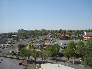
Montgomery Village is a census-designated place (CDP) in Montgomery County, Maryland, United States, and a northern suburb of Washington, D.C. It is a large, planned suburban community, developed in the late 1960s and 1970s just outside Gaithersburg's city limits. Montgomery Village's population was 34,893 at the time of the 2020 U.S. Census, and it is a part of the Washington metropolitan area.

North Bethesda is an unincorporated, census-designated place (CDP) in Montgomery County, Maryland, United States, located just north-west of the U.S. capital of Washington, D.C. It had a population of 50,094 as of the 2020 census. Among its neighborhoods, the centrally-located, urbanizing district of White Flint is the commercial and residential hub of North Bethesda. The Pike & Rose development and the Pike District is an initiative of Montgomery County to brand and market this region as "North Bethesda's Urban Core". The WMATA North Bethesda metro station and Grosvenor-Strathmore metro station serve the region.

Leisure World is a census-designated place and unincorporated area in Montgomery County, Maryland, United States. It is an age-restricted, gated development primarily inhabited by retirees. As of the 2020 census it had a population of 9,215. Leisure World was known as the Rossmoor census-designated place for the 2000 census.

Somerset is an incorporated town in Montgomery County, Maryland, United States, located near the border with Washington, D.C. The population was 1,187 at the 2020 census.

Washington Grove is a town in Montgomery County, Maryland, United States. The population was 505 at the 2020 census. The Washington Grove Historic District was listed on the National Register of Historic Places in 1980.
New Carrollton is a city located in central Prince George's County, Maryland, United States. As of the 2020 census, the population was 13,715. New Carrollton is located 10 miles (16 km) east of central Washington, D.C.

Woodmore is an unincorporated area and census-designated place in Prince George's County, Maryland, United States. Per the 2020 census, the population was 4,513. The CDP is located within the boundaries of Route 193 to the west, Church Road to the east, Route 214 to the south and Route 50 to the north. Woodmore Road runs east and west through the center. It contains a large gated community and country club, developments of Woodmore Meadows, and Woodmore South on the south side, as well as various other custom built homes and farmland.
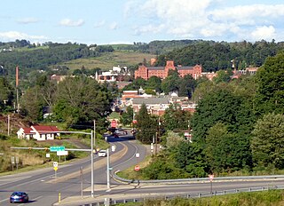
Mansfield is a borough located in east-central Tioga County, Pennsylvania, United States, in the Tioga River valley. It is situated at the intersection of U.S. Route 6 and U.S. Business Route 15, about 36 miles (58 km) southwest of Elmira, New York.

Calverton is an unincorporated area and census-designated place located on the boundary between Montgomery and Prince George's counties, Maryland, in the United States. At the 2020 census, it had a population of 17,316.

2390788

Derwood is an unincorporated area and census-designated place in east-central Montgomery County, Maryland, United States. It lies just north of Rockville, southeast of Gaithersburg, southwest of Olney, and northwest of the greater Silver Spring area. Derwood was originally "Deer Park" and was then "Deer Wood" before getting its current name.

