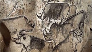
In the history of art, prehistoric art is all art produced in preliterate, prehistorical cultures beginning somewhere in very late geological history, and generally continuing until that culture either develops writing or other methods of record-keeping, or makes significant contact with another culture that has, and that makes some record of major historical events. At this point ancient art begins, for the older literate cultures. The end-date for what is covered by the term thus varies greatly between different parts of the world.
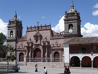
Ayacucho is the capital city of Ayacucho Region and of Huamanga Province, Ayacucho Region, Peru.

Arequipa is a department and region in southwestern Peru. It is the sixth largest department in Peru, after Puno, Cuzco, Madre de Dios, Ucayali, and Loreto, its sixth most populous department, and its eleventh least densely populated department. It is bordered by the departments of Ica, Ayacucho, Apurímac and Cusco in the north, the Department of Puno in the east, the Department of Moquegua in the south, and the Pacific Ocean in the west. Its capital, also called Arequipa, is Peru's second-largest city.

La Libertad is a region in northwestern Peru. Formerly it was known as the Department of La Libertad. It is bordered by the Lambayeque, Cajamarca and Amazonas regions on the north, the San Martín Region on the east, the Ancash and Huánuco regions on the south and the Pacific Ocean on the west. Its capital is Trujillo, which is the nation's third biggest city. The region's main port is Salaverry, one of Peru's largest ports. The name of the region is Spanish for "freedom" or "liberty"; it was named in honor of the Intendancy of Trujillo's proclaiming independence from Spain in 1820 and fighting for that. It is the ninth smallest department in Peru, but it is also its second-most populous department after Piura and its second-most densely populated department after Lambayeque.

The Wari were a Middle Horizon civilization that flourished in the south-central Andes and coastal area of modern-day Peru, from about 500 to 1000 AD.
The Chachapoyas, also called the "Warriors of the Clouds", was a culture of the Andes living in the cloud forests of the southern part of the Department of Amazonas of present-day Peru. The Inca Empire conquered their civilization shortly before the Spanish conquest in the 16th century. At the time of the arrival of the conquistadors, the Chachapoyas were one of the many nations ruled by the Incas, although their incorporation had been difficult due to their constant resistance to Inca troops.

The Paracas culture was an Andean society existing between approximately 800 BCE and 100 BCE, with an extensive knowledge of irrigation and water management and that made significant contributions in the textile arts. It was located in what today is the Ica Region of Peru. Most information about the lives of the Paracas people comes from excavations at the large seaside Paracas site on the Paracas Peninsula, first formally investigated in the 1920s by Peruvian archaeologist Julio Tello.
The Santa Valley is an inter-andean valley in the Ancash Region in the north-central highlands of Peru. Due to its location between two mountain ranges, it is known as Callejón de Huaylas, the Alley of Huaylas, whereas "Huaylas" refers to the territorial division's name during the Viceroyalty of Peru.

The Huaraz Province is one of twenty provinces of the Ancash Region in Peru. It was created on August 5, 1857 during the presidency of Ramón Castilla. Geographically, the province is located over the Callejón de Huaylas and the western slopes of the Cordillera Negra.

Schinus molle is an evergreen tree that grows to 15 meters. It is native to an area from the Peruvian Andes to southern Brazil. The bright pink fruits of Schinus molle are often sold as "pink peppercorns" although S. molle is unrelated to black pepper. The word molle in Schinus molle comes from mulli, the Quechua word for the tree. The tree is host to the pepper-tree moth, Bombycomorpha bifascia.

Chincheros Province is the smallest of seven provinces of the Apurímac Region in Peru. The capital of the province is the city of Chincheros.

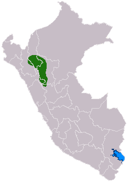
The Wari Empire or Huari Empire was a political formation that emerged around 600 AD (CE) in Peru's Ayacucho Basin and grew to cover much of coastal and highland Peru. The empire lasted for about 500 years, until 1100 CE. It existed during the same era as the Tiwanaku culture, and at one time, was thought to have been derived from it. In 2008, archeologists found a precolumbian city, the Northern Wari ruins near modern Chiclayo. The find was the first extensive settlement related to the Wari culture discovered that far north.

The Andean textile tradition once spanned from the Pre-Columbian to the Colonial era throughout the western coast of South America, but was mainly concentrated in Peru. The arid desert conditions along the coast of Peru have allowed for the preservation of these dyed textiles, which can date to 6000 years old. Many of the surviving textile samples were from funerary bundles, however, these textiles also encompassed a variety of functions. These functions included the use of woven textiles for ceremonial clothing or cloth armor as well as knotted fibers for record-keeping. The textile arts were instrumental in political negotiations, and were used as diplomatic tools that were exchanged between groups. Textiles were also used to communicate wealth, social status, and regional affiliation with others. The cultural emphasis on the textile arts was often based on the believed spiritual and metaphysical qualities of the origins of materials used, as well as cosmological and symbolic messages within the visual appearance of the textiles. Traditionally, the thread used for textiles was spun from indigenous cotton plants, as well as alpaca and llama wool.
Huancarqui District is one of fourteen districts of the Castilla Province in the Department of Arequipa in Peru.
The Cerro Pátapo ruins or Northern Wari ruins are the remains of an entire precolumbian city relatively near the site of present-day Chiclayo, Peru. The ruins are primarily of the Wari (Huari) culture, which flourished from 350 CE to 1000 CE in the area along the coast and reaching to the highlands. These northern Wari ruins are distinguished from the Wari ruins in the Ayacucho Region to the south.

The Andean civilizations were South American complex societies of many indigenous people. They stretched down the spine of the Andes for 4,000 km (2,500 mi) from southern Colombia, to Ecuador and Peru, including the deserts of coastal Peru, to north Chile and northwest Argentina. Archaeologists believe that Andean civilizations first developed on the narrow coastal plain of the Pacific Ocean. The Caral or Norte Chico civilization of coastal Peru is the oldest known civilization in the Americas, dating back to 3500 BCE. Andean civilization is one of the six "pristine" civilizations of the world, created independently and without influence by other civilizations.
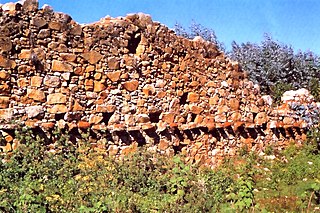
Viracochapampa, Huiracochapampa, or Wiracochapampa is an archaeological site with the remains of a building complex of ancient Peru of pre-Inca times. It was one of the administrative centers of the Wari culture. Viracochapampa is located about 3.5 km north of Huamachuco in the region of La Libertad at an elevation of 3,070 metres (10,072 ft).

Osmore River system flows northeast to southwest in the Moquegua Region of southern coastal Peru. The river has its origin in the snow peaks of the Chuqi Ananta and Arundane mountains, at an elevation of 5,100 metres (16,700 ft) above sea level. It changes names as it descends from the Andes: From its origin it is called the Moquegua, then Osmore in the middle valley as Rio Coscori and Rio Tumilaca including where the river disappears into subterranean channels, and further down in the lower reaches as Rio Ilo.
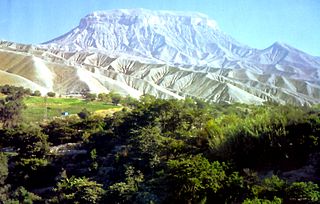
Cerro Baúl is an ancient political outpost and ceremonial center settlement in Peru established by the pre-Incan empire called the Wari. Cerro Baúl is a terraced mountain, 2000 feet above its surroundings, with a settlement on the cliff tops themselves and in the immediate surroundings. Among other finds are the remnants of a brewery and large buildings that may have been used for ceremonial feasting. There is evidence of damage that has been interpreted as a careful and deliberate destruction, by the city's own people, of several buildings prior to the mesa's being vacated.

The Chiribaya culture flourished near the coast of southern Peru and adjacent Chile from 700 CE until Spanish settlement in the late 16th century. The classic phase of the Chiribaya culture was from 1000 CE until 1360 CE. The Chiribaya culture consisted of both maritime settlements along 220 kilometres (140 mi) of the Pacific Ocean coast and agricultural settlements inland in valleys of the Osmore and Tambo rivers in Peru and the Lluta river and Azapa Valley in Chile.

