Ancash is a department and region in northern Peru. It is bordered by the departments of La Libertad on the north, Huánuco and Pasco on the east, Lima on the south, and the Pacific Ocean on the west. Its capital is the city of Huaraz, and its largest city and port is Chimbote. The name of the region originates from the Quechua word anqash, from anqas ('blue') or from anka ('eagle').

Antonio Raymondi is a province of the Ancash Region in Peru. It is located along the central eastern edge of the Ancash Region, bordering the Huánuco Region.

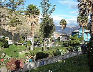
The Huaraz Province is one of twenty provinces of the Ancash Region in Peru. It was created on August 5, 1857 during the presidency of Ramón Castilla. Geographically, the province is located over the Callejón de Huaylas and the western slopes of the Cordillera Negra.

The Huari Province is one of twenty provinces of the Ancash Region in Peru. Its seat is Huari.
The Sihuas Province is one of twenty provinces of the Ancash Region in Peru.This province was created by Law nº 13485, dated at January 9 of 1961, when was president of Perou: Manuel Prado. It is bordered by provinces of Huaylas and Corongo on the west, Pallasca Province on the north, La Libertad Region on the east, and Pomabamba Province on the south.
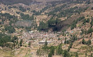
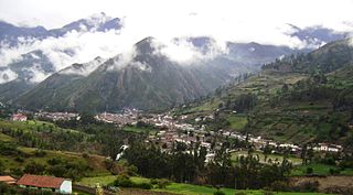
Huari is one of the 16 districts that integrates the Peruvian province of Huari in the Ancash region. The district consists of the city of Huari, 15 small villages and 22 annexes.
Cajay District is one of sixteen districts of the Huari Province in Peru.

Chavín de Huántar District is one of sixteen districts of the province Huari in Peru.
Huacachi District is one of sixteen districts of the province Huari Province in the Ancash Region of Peru.
Huachis District is one of sixteen districts of the Huari Province in the Ancash Region in Peru.
San Marcos District is one of sixteen districts of the Huari Province in Peru.

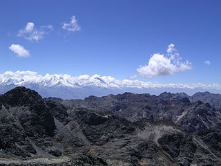
Contrahierbas, also called Yanarraju or Ruricocha, is a mountain in the Cordillera Blanca in the Andes of Peru, about 5,954 metres (19,534 ft) high. It is situated in the Ancash Region in the provinces Asunción, Carhuaz and Yungay. Contrahierbas is located inside Huascarán National Park, northeast of Hualcán.

Yanamarey or Yanaraju is a mountain in the Cordillera Blanca in the Andes of Peru, about 5,237 metres (17,182 ft) high. It is located between Recuay and Huari provinces, in Ancash. Yanamaray lies east of Pucaraju and northeast of Lake Querococha, between Matashcu in the north and Cahuish in the south.

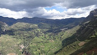
Markahirka or Marka Hirka is an archaeological site with cave paintings and stone tombs (chullpa) on a mountain of the same name in Peru. It is located in the Ancash Region, Huari Province, in the districts of Cajay and Masin. It is situated at a height of 3,580 metres (11,745 ft). Markahirka is also a good viewpoint with views into the Puchka valley (Puchca) and to the towns of Huari (Wari) and Huachis (Wachis).

Carhuascancha or Tumarinaraju is a mountain in the Cordillera Blanca in the Andes of Peru with an elevation of 5,648 metres (18,530 ft) or 5,668 metres (18,596 ft) above sea level. It is situated in the Ancash Region, Huari Province, Huantar District, and in the Huaraz Province, Huaraz District. Carhuascancha lies north-west of Huantsán.
Paccharaju is a mountain of 5,744 m (18,845 ft) of elevation in the Cordillera Blanca in the Andes of Peru. In other maps it is shown as comprising two peaks: Rocotuyo of 5,749 m (18,862 ft) and Rayococha of 5,460 m (17,913 ft). It is located between the provinces of Asunción Province and Carhuaz, in Ancash; southwest of mount Tarush Kancha, inside Huascarán National Park.
Arteza is a mountain in the Cordillera Blanca in the Andes of Peru, about 5,000 metres (16,404 ft) high. It is situated in the Ancash Region, Huari Province, Huantar District. Arteza lies at the Qarwakancha valley, southeast of Andavite and Cayesh and northeast of Qarwakancha and Maparaju.

Cahuish is a mountain in the Cordillera Blanca in the Andes of Peru, about 4,900 metres (16,076 ft) high. It is situated in the Ancash Region, Huari Province, Chavin de Huantar District, and in the Recuay Province, Ticapampa District. Cahuish lies southwest of the mountain and the archaeological site of Waraqayuq and southeast of Yanamarey.
Yanaqucha is a mountain at a small lake of that name in the eastern extensions of the Cordillera Blanca in the Andes of Peru which reaches a height of approximately 4,600 m (15,092 ft). It is located in the Ancash Region, Huari Province, San Marcos District.
Jatunjirca is a mountain in the eastern part of the Cordillera Blanca in the Andes of Peru which reaches a height of approximately 3,800 m (12,500 ft). It is located in the Ancash Region, Huari Province, Huari District, southwest of Huari and west of the village of Yacya.
