
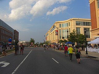
Elkridge is an unincorporated community and census-designated place (CDP) in Howard County, Maryland, United States. The population was 15,593 at the 2010 census. Founded early in the 18th century, Elkridge is located at the confluence of three counties, the other two being Anne Arundel and Baltimore counties.

Cedar Mill is a suburb in the Portland, Oregon metropolitan area of the United States; it is a census-designated place and an unincorporated community in Washington County, north of U.S. Route 26 and west of the Willamette Stone. It received its name from a sawmill on Cedar Mill Creek, which cut Western Redcedars that were once the dominant tree in the area. The mill's pond was near the intersection of 119th and Cornell Road, and could still be seen into the 1960s, although the mill itself had ceased operating in 1891. The name was established in 1874 with the opening of a U.S. post office named Cedar Mill. As of the 2010 census, the community population was 14,546.

Jessup is an unincorporated community and census-designated place in Howard and Anne Arundel counties, about 15 miles (24 km) southwest of Baltimore, Maryland, United States. The population was 7,137 at the 2010 census.

Guilford is an unincorporated community located in Howard County in the state of Maryland. The location is named after the Guilford Mill. Guilford is near Kings Contrivance, one of the nine "villages" of Columbia.

Savage is an unincorporated community and census-designated place located in Howard County, Maryland, United States, approximately 18 miles (29 km) south of Baltimore and 21 miles (34 km) north of Washington, D.C. It is situated close to the city of Laurel and to the planned community of Columbia. As of the 2010 census it had a population of 7,054. The former mill town is a registered historic place, and has many original buildings preserved within and around the Savage Mill Historic District.

Oak Lawn is a neighborhood in Dallas, Texas (USA), defined in Dallas City Ordinance 21859 as Planned Development District No. 193, the Oak Lawn Special Purpose District. The unofficial boundaries are Turtle Creek Boulevard, Central Expressway, the City of Highland Park, Inwood Road, and Harry Hines Boulevard. It is over 12 square miles (31 km2) in area. Officially it is bounded by the City of Highland Park, the North Central Expressway, Stemmons Freeway, Woodall Rodgers Freeway, and other roads. The district is within the boundary defined by the City of Dallas law, excluding any existing planned development districts within.

Maryland Route 175 is a state highway in the U.S. state of Maryland. The highway runs 17.01 miles (27.37 km) from Little Patuxent Parkway in Columbia east to MD 3 in Millersville. MD 175 is a major highway through the large unincorporated community of Columbia; the highway connects U.S. Route 29 next to Columbia Town Center with Interstate 95 (I-95) and an industrial area on the eastern side of Howard County. MD 175 also connects Fort Meade with Jessup and Odenton in western Anne Arundel County, where it links MD 295 and MD 32 with the eastern part of the U.S. Army base.

Spurrier's Tavern was a well-known tavern and horse-changing depot which stood by the main road between Baltimore and Washington, D.C. from 1771 to 1835 near what is now Jessup, Maryland. George Washington visited the tavern several times during his presidency. After an 1835 fire, the building was repaired for residence by the family of its owner, who died there in 1852. It was demolished sometime thereafter.

The Maryland House of Correction, nicknamed "The Cut" or "The House", was a Maryland Department of Corrections state maximum security prison in an unincorporated area in Maryland. The prison opened in 1879 and became infamous for the high levels of violence that took place inside its walls. The state, under Governor Martin O'Malley, closed the prison in March 2007.
Fulton is a census-designated place located in southern Howard County, Maryland, United States. As of the 2010 census it had a population of 2,049.
The Howard County Police Department (HCPD) is the primary law enforcement agency servicing 304,580 (2013) persons within the 254 square miles (660 km2) of Howard County, Maryland.

Trinity Church is a historic Episcopal church located at Elkridge, Howard County, Maryland. The post road site was also known as Waterloo, Pierceland, Jessop and Jessup throughout the years.

The Savage Mill Historic District is a national historic district located at Savage, Howard County, Maryland. The district comprises the industrial complex of Savage Mill and the village of workers' housing to the north of the complex.
The Middle Patuxent Environmental Area (MPEA) is a 1,021-acre (4.13 km2) wildlife area in Clarksville, Maryland and operated by the Howard County Department of Recreation and Parks. It is located next to the River Hill village in the town of Columbia, Maryland, in the United States. The MPEA was created in 1996 for educational, research, and recreational purposes.

Sabina Mattfeldt is a neighborhood in the North District of Baltimore, located beside the Jones Falls, between the neighborhoods of Mount Washington (west) and Poplar Hill (east). Its name comes from the two streets, Sabina Avenue and Mattfeldt Avenue, where most of the neighborhood's homes are located.

Mt. Moriah Lodge No. 7, is a historic building located in Jessup, Maryland. It is a two-story lodge constructed in the late 19th century.
Oak Hill is a historic manor located at Jessup, Maryland, United States.

Asbury Methodist Episcopal Church, is a historic African American Church located in Jessup, Maryland.


