
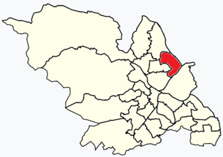
Wincobank shown in Sheffield

Wincobank (grid reference SK377910 ) is an Iron Age hill fort near Wincobank in Sheffield, England.
Wincobank (grid reference SK377910 ) is an Iron Age hill fort near Wincobank in Sheffield, England.

The fort stands on an isolated sandstone hill that forms the northern side of the river valley of the River Don. [1]
The fort site is an oval-shaped earthwork that covers about 1 ha (2.5 acres). [1] A ditch, which was originally between 1.5 m (4 ft 11 in) and 2 m (6 ft 7 in), surround the entire the fort. A counterscarp consisting of a rubble core was created from material excavated when digging the ditch. The outward side of the earthen rampart was reinforced with stone facings held together with timbers. These timbers show signs of being vitrified, the charring indicates they were subjected to intense heat (ie burning). [1] Maybe as a result of inter-tribal conflict in the late Iron Age. [1] Material taken from a drainage ditch dug through the north east rampart of the fort in 1979 was radiocarbon dated to c. 500 BC. [2]
Breaks in the rampart on the north-east and south-west sides were once considered to be the fort's original entrances; this conclusion is now considered incorrect. The real entrance is on the south-east ramparts where the bank turn inwards slightly at this point. A mound set close to the rampart is thought to be the site of a watch tower. [1]
Early antiquarians thought the Romans built the fort. Archaeologists now think it was constructed by the Celtic Brigantes tribe. Some historians suggest that this fort was part of a 1st-century defensive line built by the Brigantes attempting to halt the northward expansion by the Romans. [3] This defensive line is suggested to have included hill forts at Carl Wark and Scholes Coppice, and an ancient dyke called Roman Rig that runs from the fort northeast to Mexborough. [4]
The hill was first recorded in 1442 as Wincowe and appears to be derived from Wineca, an Anglo-Saxon personal name and the Old Norse word haugr meaning a mound or hill and so meaning Wineca’s hill. [5]
During the defence of Sheffield in the Second World War, an anti-aircraft gun and searchlight emplacement was built adjacent to the south-west corner of the fort. [1]

Maiden Castle is an Iron Age hillfort 1.6 mi (2.6 km) southwest of Dorchester, in the English county of Dorset. Hill forts were fortified hill-top settlements constructed across Britain during the Iron Age.

Uffington Castle is an early Iron Age univallate hillfort in Oxfordshire, England. It covers about 32,000 square metres and is surrounded by two earth banks separated by a ditch with an entrance in the western end. A second entrance in the eastern end was apparently blocked up a few centuries after it was built. The original defensive ditch was V-shaped with a small box rampart in front and a larger one behind it. Timber posts stood on the ramparts. Later the ditch was deepened and the extra material dumped on top of the ramparts to increase their size. A parapet wall of sarsen stones lined the top of the innermost rampart. It is very close to the Uffington White Horse on White Horse Hill.

Danebury is an Iron Age hillfort in Hampshire, England, about 19 kilometres (12 mi) north-west of Winchester. The site, covering 5 hectares, was excavated by Barry Cunliffe in the 1970s. Danebury is considered a type-site for hill forts, and was important in developing the understanding of hillforts, as very few others have been so intensively excavated.
Shiregreen and Brightside ward—which includes the districts of Brightside, Shiregreen, and Wincobank—is one of the 28 electoral wards in City of Sheffield, England. It is located in the northern part of the city and covers an area of 6.5 km2. The population of this ward in 2011 was 20,826 people in 8,696 households. It is one of the wards making up the Sheffield Brightside parliamentary constituency.

Fort Nelson, in the civil parish of Boarhunt in the English county of Hampshire, is one of five defensive forts built on the summit of Portsdown Hill in the 1860s, overlooking the important naval base of Portsmouth. It is now part of the Royal Armouries, housing their collection of artillery, and a Grade I Listed Building.

Chanctonbury Ring is a prehistoric hill fort atop Chanctonbury Hill on the South Downs, on the border of the civil parishes of Washington and Wiston in the English county of West Sussex. A ridgeway, now part of the South Downs Way, runs along the hill. It forms part of an ensemble of associated historical features created over a span of more than 2,000 years, including round barrows dating from the Bronze Age to the Saxon periods and dykes dating from the Iron Age and Roman periods.

Carl Wark is a rocky promontory on Hathersage Moor in the Peak District National Park, just inside the boundary of Sheffield, England. The promontory is faced by vertical cliffs on all but one side, which is protected by a prehistoric embankment. The cliffs and embankment form an enclosure that has been interpreted as an Iron Age hill fort, though the date of construction and purpose of the fortifications remains unknown. The site is a scheduled monument.

The Roman Rig is the name given to a series of earthworks in the north of Rotherham in South Yorkshire, England. They are believed to originally have formed a single Dyke running from near Wincobank in Sheffield to Mexborough. Its purpose and date of construction are unknown. Formerly thought to have been a Roman road, modern archaeologists think that it was built either in the 1st century AD by the Brigantian tribes as a defence against the Roman invasion of Britain, or after the 5th century to defend the kingdom of Elmet from the Angles.

Flaxley is a small settlement and former civil parish, now in the parish of Blaisdon, in the Forest of Dean, Gloucestershire, England. It is located in between the larger villages of Westbury-on-Severn and Mitcheldean. In 1931 the parish had a population of 87.

Castleshaw Roman fort was a castellum in the Roman province of Britannia. Although there is no evidence to substantiate the claim, it has been suggested that Castleshaw Roman fort is the site of Rigodunum, a Brigantian settlement. The remains of the fort are located on Castle Hill on the eastern side of Castleshaw Valley at the foot of Standedge but overlooking the valley. The hill is on the edge of Castleshaw in Greater Manchester. The fort was constructed in c. AD 79, but fell out of use at some time during the 90s. It was replaced by a smaller fortlet, built in c. 105, around which a civilian settlement grew. It may have served as a logistical and administrative centre, although it was abandoned in the 120s.
Berry Mound is an Iron Age hill fort in the Bromsgrove district of Worcestershire, near Shirley, West Midlands, on the outskirts of Birmingham. It has been dated to the 1st or 2nd century BC.

Buckland Rings is the site of an Iron Age hill fort in the town of Lymington, Hampshire. Today, the mounds and dykes around the outside which once constituted its defences are still clearly visible, although the outer bank lies under the road on the west side, and on the south-east it is nearly ploughed-out. Excavations of the inner and middle ramparts in 1935 revealed that they were of wall-and-fill construction, retained at the front by upright timber beams and walls of cut and laid turf. The entrance, which lies on the east side, was also excavated revealing a long entrance passage and the postholes for a pair of stout gateposts. The site was bought by Hampshire County Council in 1989 to ensure its preservation, and it is open to the public from the A337 road onto which part of it faces.

Blewburton Hill is the site of an Iron Age hillfort located in Oxfordshire, in the southeast of England. It was a univallate hillfort. The area is mostly farmland with some small areas of wooded copse to the south and the northeast. The hill fort may have been occupied from the 4th century BC to the 1st century BC, and replaced a small settlement surrounded by a stockade, which is estimated to have been built in the 5th or 6th century BC.

Cholesbury Camp is a large and well-preserved Iron Age hill fort on the northern edge of the village of Cholesbury in Buckinghamshire, England. It is roughly oval-shaped and covers an area, including ramparts, of 15 acres (6.1 ha), and measures approximately 310 m (1,020 ft) north-east to south-west by 230 m (750 ft) north-west to south-east. The interior is a fairly level plateau which has been in agricultural use since the medieval period. The hill fort is now a scheduled ancient monument.

Bratton Castle is a bivallate Iron Age built hill fort on Bratton Down, at the western edge of the Salisbury Plain escarpment. The hill fort comprises two circuits of ditch and bank which together enclose a pentagonal area of 9.3 hectares.

Cornish promontory forts, commonly known in Cornwall as cliff castles, are coastal equivalents of the hill forts and Cornish "rounds" found on Cornish hilltops and slopes. Similar coastal forts are found on the north–west European seaboard, in Normandy, Brittany and around the coastlines of the British Isles, especially in Wales, Scotland and Ireland. Many are known in southwest England, particularly in Cornwall and its neighbouring county, Devon. Two have been identified immediately west of Cornwall, in the Isles of Scilly.

Torberry Hill is an Iron Age hillfort in the county of West Sussex, in southern England. It is a Scheduled Ancient Monument, with a list entry identification number of 1015966. The hill fort is located within the parish of Harting, within the South Downs National Park. The hill includes the remains of an Early Iron Age univallate hill fort, a Middle Iron Age promontory fort and a post-medieval post mill. The hill is a chalk spur projecting northwards from the South Downs.

Caesar's Camp is an Iron Age hill fort straddling the border of the counties of Surrey and Hampshire in southern England. The fort straddles the borough of Waverley in Surrey and the borough of Rushmoor and the district of Hart, both in Hampshire. Caesar's Camp is a Scheduled Ancient Monument with a list entry identification number of 1007895. It lies approximately 3 kilometres (1.9 mi) north of the town of Farnham, and a similar distance west of Aldershot. The hillfort lies entirely within the Bourley and Long Valley Site of Special Scientific Interest. Caesar's Camp is a multivallate hillfort, a fort with multiple defensive rings, occupying an irregular promontory, with an entrance on the south side. The site has been much disturbed by military activity, especially at the southeast corner. The remains of the hillfort are considered to be of national importance.

The Bulwarks, Porthkerry is a promontory fort in Rhoose, Vale of Glamorgan, on the southern coast of Wales overlooking the Bristol Channel. It probably dates to the Iron Age and continued to be occupied during the Roman period in Britain. The ramparts and ditches along the west side are well preserved, but the fortifications are heavily overgrown.
Beacon Hill, also known as Harting Beacon, is a hillfort on the South Downs, in the county of West Sussex in southern England. The hillfort is located in the parish of Elsted and Treyford, in Chichester District. It is a Scheduled Ancient Monument with a list entry identification number of 1015915. The hilltop enclosure is dated to the Late Bronze Age, from the 8th to 6th centuries BC. The hillfort defences were renewed during the Late Iron Age.