Samuel Butler was an English poet and satirist. He is remembered now chiefly for a long satirical poem titled Hudibras.

Shelsley Walsh is a small village and civil parish in Worcestershire, England, on the western side of the River Teme. For administrative purposes it is presently located in the Teme Valley ward of the county’s Malvern Hills district. In the 2011 Census there was an estimated population of 28 people in 12 households. The site has been farmed since Anglo Saxon times and there are also vestiges of former industry, but it is now best known for its association with the Shelsley Walsh Speed Hill Climb.

The area now known as Worcestershire has had human presence for over half a million years. Interrupted by two ice ages, Worcestershire has had continuous settlement since roughly 10,000 years ago. In the Iron Age, the area was dominated by a series of hill forts, and the beginnings of industrial activity including pottery and salt mining can be found. It seems to have been relatively unimportant during the Roman era, with the exception of the salt workings.

Kempsey is a village and civil parish in the Malvern Hills District in the county of Worcestershire, England. It is bounded by the River Severn on the west, and the A38 main road runs through it and is about 3 miles (5 km) south of Worcester. The village has a long history. Its name is derived from the Saxon "Kemys' Eye", or the island of Kemys. Kemys was a Saxon chief, whose island lay between marshes and the River Severn. One of the roads in Kempsey, Lyf's Lane, is named after another Saxon chief. The village was recorded in the 11th century Domesday Book as having a value of £7.
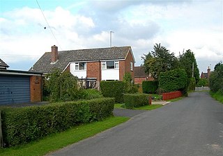
White Ladies Aston is a village in the Wychavon local government district of Worcestershire, England, United Kingdom, and also lends its name to the civil parish in which the village is located. The village is located to the east of the A44 which started as a Saltway linking Droitwich to Oxford. To the south is Pershore and five miles west is Worcester. The parish is bound to the east by the Bow Brook. The parish, according to the 2011 census, has 87 households with 220 residents.
Worcestershire was a county constituency of the House of Commons of the Parliament of England then of the Parliament of Great Britain from 1707 to 1800 and of the Parliament of the United Kingdom from 1801 to 1832. It was represented until 1832 by two Members of Parliament traditionally referred to as Knights of the Shire. It was split then into two two-member divisions, for Parliamentary purposes, Worcestershire Eastern and Worcestershire Western constituencies.

Hagley is a large village and civil parish in Worcestershire, England. It is on the boundary of the West Midlands and Worcestershire counties between the Metropolitan Borough of Dudley and Kidderminster. Its estimated population was 7,162 in 2019.
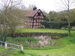
Little Witley is a village and civil parish in the Malvern Hills District in the county of Worcestershire, England.

British Camp is an Iron Age hill fort located at the top of Herefordshire Beacon in the Malvern Hills. The hill fort is protected as a Scheduled Ancient Monument and is owned and maintained by Malvern Hills Conservators. The fort is thought to have been first constructed in the 2nd century BC. A Norman castle was built on the site.
Grafton Flyford is a village about 6 miles (9.7 km) east of Worcester, in Worcestershire, England.

Hallow is a village and civil parish beside the River Severn, about 2 miles (3.2 km) north-west of Worcester in Worcestershire. The village is on the A443 road that links Worcester with Holt Heath.
Croft Ambrey is an Iron Age hill fort in Herefordshire, England.

Strensham is a village in the Wychavon district of Worcestershire. In the 2001 census, the civil parish of Strensham had a population of 314 across 127 households. Since 1991, the population has risen 28.7% from 244 residents.

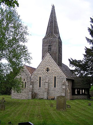
St John the Baptist's Church is a redundant Anglican church in the village of Strensham, Worcestershire, England. It is recorded in the National Heritage List for England as a designated Grade I listed building, and is under the care of the Churches Conservation Trust. Clifton-Taylor includes the church in his list of 'best' English parish churches.

Treadway Russell Nash was an English clergyman, now known as an early historian of Worcestershire and the author of Collections for the History of Worcestershire, an important source document for Worcestershire county histories. He was a fellow of the Society of Antiquaries of London.

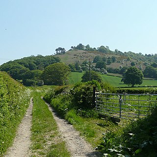
Woodbury Hill is a hill near the village of Great Witley, about 5 miles (8 km) south-west of Stourport-on-Severn in Worcestershire, England. It is the site of an Iron Age hillfort.

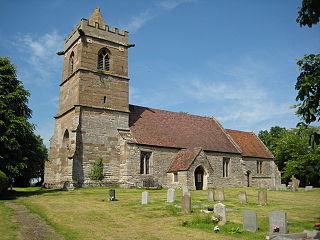
The Church of St John the Baptist, Bromsgrove is a Grade I listed parish church in the Church of England in Bromsgrove.

Evenlode is a village and civil parish in the Cotswold District of eastern Gloucestershire in England.

Staunton on Arrow is a village and civil parish in the county of Herefordshire, England. The village is 17 miles (27 km) north-west of Hereford and 8 miles (13 km) to the west of Leominster. Within the parish is the site of the Iron Age hill fort of Wapley Hill.

Chaceley or Chaseley is a village and civil parish 8 miles (13 km) north of Gloucester, in the Tewkesbury district, in the county of Gloucestershire, England. In 2011 the parish had a population of 125. The parish touches Deerhurst, Eldersfield, Forthampton, Tewkesbury and Tirley.