Hancock County is a county located in the U.S. state of Maine. As of the 2020 census, the population was 55,478. Its county seat is Ellsworth. The county was incorporated on June 25, 1789, and named for John Hancock, the first governor of the Commonwealth of Massachusetts.

Blaine is a town in Aroostook County, Maine, United States. The population was 667 at the 2020 census. It was known as Alva prior to incorporation in 1874, when it was renamed in honor of James G. Blaine, then Speaker of the U.S. House of Representatives. According to local history, Blaine offered to donate a large bell for the tower of the town's new meeting hall, if the citizens would rename the town after him. The town's name was changed, but Blaine never donated a bell. The building still stands on the north end of town, on Route 1.

St. Francis is a town in Aroostook County, Maine, United States on the Canada–United States border at the junction of the St. Francis River and the Saint John River. The population was 438 at the 2020 census. First settled by English speakers from southern Maine, the original population has been supplanted by French-speaking Acadians.
Aurora is a town in Hancock County, Maine, United States. The town was named for the goddess of dawn. The population was 93 at the 2020 census.
Dedham is a town in Hancock County, Maine, United States. The population was 1,648 at the 2020 census. The town includes the site of a Cold War airplane crash on Bald Mountain.

Lamoine is a town in Hancock County, Maine, United States. The town was named after an early resident, Andre LeMoyne. The spelling shifted slightly over the years. "Le moine" is French for "the monk." The population was 1,720 at the 2020 census.
Mariaville is a town in Hancock County, Maine, United States. The population was 472 at the 2020 census.

Penobscot is a town in Hancock County, Maine, United States. The Bagaduce River flows through the town. The population was 1,136 at the 2020 census.
Surry is a town in Hancock County, Maine, United States. The population was 1,632 at the 2020 census.

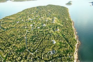
Tremont is a town in Hancock County, Maine, United States. It is located on the southwestern side of Mount Desert Island, known to locals as "the quiet side."
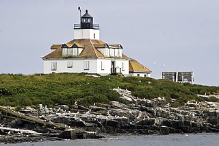
Winter Harbor is a town on the Schoodic Peninsula in Hancock County, Maine, United States. The population was 461 at the 2020 census. The town is located just outside the Schoodic Peninsula portion of Acadia National Park and is due east of the town of Bar Harbor and Ellsworth. Winter Harbor was once the location of a US Naval Station, NSGA-WH, which closed in the mid-2000s, and is now home to the Schoodic Institute’s Education and Research Center.

Monmouth is a town in Kennebec County, Maine, United States. Monmouth is included in the Lewiston-Auburn, Maine metropolitan New England city and town area. The population was 4,066 at the 2022 census.

Mount Vernon is a town in Kennebec County, Maine, United States. The population was 1,721 at the 2020 census. Mount Vernon is included in the Augusta, Maine micropolitan New England City and Town Area. A popular recreation spot in central Maine, the northern area of Mount Vernon is part of the Belgrade Lakes Region, while the southern area is part of the Winthrop Lakes Region.

Smithfield is a town in Somerset County, Maine, United States. The population was 925 at the 2020 census. The town was incorporated on February 29, 1840, making it the only town in Maine incorporated on Leap Day. The town was named after the Rev. Henry Smith, an early settler.

Freedom is a town in Waldo County, Maine, United States. The population was 711 at the 2020 census. Freedom is a residential and recreational area.

Waite is a town in Washington County, Maine, United States. The town was named after Benjamin Waite, a lumberman and businessman from Calais, Maine. The population was 66 at the 2020 census.
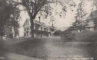
Lebanon is a town in York County, Maine, United States. The population was 6,469 at the 2020 census. Lebanon includes the villages of Center Lebanon, West Lebanon, North Lebanon, South Lebanon, and East Lebanon. It is the westernmost town in Maine. Lebanon is part of the Portland–South Portland–Biddeford, Maine metropolitan statistical area.
East Hancock is an unorganized territory in Hancock County, Maine, United States. The population was 85 at the 2020 census.
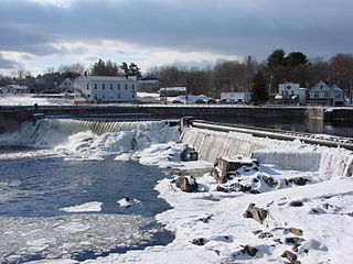
Anson is a town in Somerset County, Maine, United States. The population was 2,291 at the time of the 2020 census. It includes the villages of Anson and North Anson.
Hartland is a town in Somerset County, Maine, United States. The population was 1,705 at the 2020 census.


