Brooklin, Maine

Last updated

Brooklin, Maine
View at Brooklin, ME.jpg
Center Harbor in 1909
USA Maine location map.svg
Red pog.svg
Brooklin
Usa edcp location map.svg
Red pog.svg
Brooklin
Coordinates: 44°16′31″N68°33′34″W / 44.27528°N 68.55944°W / 44.27528; -68.55944
Country United States
State Maine
County Hancock
Incorporated 1849
VillagesBrooklin
Haven
Naskeag
North Brooklin
West Brooklin
Area
[1]
  Total41.18 sq mi (106.66 km2)
  Land17.92 sq mi (46.41 km2)
  Water23.26 sq mi (60.24 km2)
Elevation
33 ft (10 m)
Population
 (2020)
  Total827
  Density46/sq mi (17.8/km2)
Time zone UTC-5 (Eastern (EST))
  Summer (DST) UTC-4 (EDT)
ZIP code
04616
Area code 207
FIPS code 23-07800
GNIS feature ID0582370

Brooklin is a town in Hancock County, Maine, United States. The population was 827 at the 2020 census. [2]

Contents

History

Brooklin was originally part the larger town of Sedgwick. Brooklin broke off and formed its own town in 1849. A few weeks later, the name was changed to Brooklin, after the brook line which separated it from Sedgwick. Using pogie oil as a fertilizer, the difficult soil was made productive, and hay became the principal crop. With excellent harbors, however, the main occupations were fishing and seafaring. By 1859, when the population was 1,002, it also had five boot and shoemaking factories, as well as two barrel manufacturers. [3] By 1886, the town was noted for producing smoked herring in considerable quantities. Canning lobster had also become an important business. [4]

Geography

According to the United States Census Bureau, the town has a total area of 41.18 square miles (106.66 km2), of which 17.92 square miles (46.41 km2) is land and 23.26 square miles (60.24 km2) is water. [1] Brooklin is situated on the Benjamin River overlooking Jericho Bay.

The town is crossed by Maine State Route 175.

Demographics

Historical population
CensusPop.Note
1850 1,002
1860 1,0434.1%
1870 966−7.4%
1880 9771.1%
1890 1,0467.1%
1900 936−10.5%
1910 9360.0%
1920 856−8.5%
1930 782−8.6%
1940 656−16.1%
1950 546−16.8%
1960 525−3.8%
1970 59813.9%
1980 6193.5%
1990 78526.8%
2000 8417.1%
2010 824−2.0%
2020 8270.4%
U.S. Decennial Census [5]

2010 census

As of the census [6] of 2010, there were 824 people, 397 households, and 238 families living in the town. The population density was 46.0 inhabitants per square mile (17.8/km2). There were 874 housing units at an average density of 48.8 per square mile (18.8/km2). The racial makeup of the town was 97.9% White, 1.0% Asian, 0.4% from other races, and 0.7% from two or more races. Hispanic or Latino of any race were 0.5% of the population.

There were 397 households, of which 19.1% had children under the age of 18 living with them, 52.6% were married couples living together, 4.8% had a female householder with no husband present, 2.5% had a male householder with no wife present, and 40.1% were non-families. 33.8% of all households were made up of individuals, and 14.6% had someone living alone who was 65 years of age or older. The average household size was 2.08 and the average family size was 2.63.

The median age in the town was 52.9 years. 17.2% of residents were under the age of 18; 4.8% were between the ages of 18 and 24; 16.4% were from 25 to 44; 35.4% were from 45 to 64; and 26.1% were 65 years of age or older. The gender makeup of the town was 48.3% male and 51.7% female.

2000 census

As of the census [7] of 2000, there were 841 people, 371 households, and 244 families living in the town. The population density was 46.8 inhabitants per square mile (18.1/km2). There were 697 housing units at an average density of 38.8 per square mile (15.0/km2). The racial makeup of the town was 98.45% White, 0.12% African American, 0.12% Native American, 0.59% Asian, 0.36% from other races, and 0.36% from two or more races. Hispanic or Latino of any race were 0.95% of the population.

There were 371 households, out of which 26.4% had children under the age of 18 living with them, 56.9% were married couples living together, 6.2% had a female householder with no husband present, and 34.2% were non-families. 29.1% of all households were made up of individuals, and 14.6% had someone living alone who was 65 years of age or older. The average household size was 2.27 and the average family size was 2.79.

In the town, the population was spread out, with 21.5% under the age of 18, 4.2% from 18 to 24, 22.9% from 25 to 44, 33.1% from 45 to 64, and 18.3% who were 65 years of age or older. The median age was 46 years. For every 100 females, there were 94.7 males. For every 100 females age 18 and over, there were 90.2 males.

The median income for a household in the town was $36,786, and the median income for a family was $46,591. Males had a median income of $30,250 versus $23,750 for females. The per capita income for the town was $21,704. About 6.9% of families and 12.7% of the population were below the poverty line, including 21.3% of those under age 18 and 9.3% of those age 65 or over.

Archaeology

An 11th-century Norse coin was (allegedly [8] ) found in Brooklin at the site of an excavation of a Native American trading center. If true this would be the only physical evidence of Nordic settlers having entered the area of what is now the United States. If not an outright hoax, it is also possible that the coin was brought to the site not directly by Vikings, but rather through trading.

National Historic Sites

Notable people

Rockbound Chapel, completed in 1902 Rockbound Chapel.jpg
Rockbound Chapel, completed in 1902

Related Research Articles

<span class="mw-page-title-main">Hancock County, Maine</span> County in Maine, United States

Hancock County is a county located in the U.S. state of Maine. As of the 2020 census, the population was 55,478. Its county seat is Ellsworth. The county was incorporated on June 25, 1789, and named for John Hancock, the first governor of the Commonwealth of Massachusetts.

<span class="mw-page-title-main">Sedgwick, Maine</span> Town in the state of Maine, United States

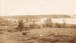
Sedgwick is a town in Hancock County, Maine, United States. The population was 1,202 at the 2020 census. The town includes the village of Sargentville.

<span class="mw-page-title-main">Belgrade, Maine</span> Town in the state of Maine, United States

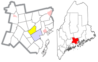
Belgrade is a town in Kennebec County, Maine, United States. Its population was 3,250 at the 2020 census. However, its population approximately doubles during the summer months as part-year residents return to seasonal camps on the shores of Great Pond, Long Pond and Messalonskee Lake. Belgrade includes the villages of North Belgrade, Belgrade Depot and Belgrade Lakes. It is included in the Augusta, Maine micropolitan New England City and Town Area.

<span class="mw-page-title-main">Manchester, Maine</span> Town in Maine, United States

Manchester is a town in Kennebec County, Maine, United States, located at 44.33°N 69.87°W. The population was 2,456 at the 2020 census. The southern part of the town bordering Cobbosseecontee Lake is a popular recreation spot in central Maine, and part of the Winthrop Lakes Region. Manchester is included in the Augusta, Maine micropolitan and included in the Lewiston-Auburn, Maine metropolitan New England City and Town Area.

<span class="mw-page-title-main">Monmouth, Maine</span> Town in the state of Maine, United States

Monmouth is a town in Kennebec County, Maine, United States. Monmouth is included in the Lewiston-Auburn, Maine metropolitan New England city and town area. The population was 4,066 at the 2022 census.

<span class="mw-page-title-main">Rome, Maine</span> Town in the state of Maine, United States

Rome is a town in Kennebec County, Maine, United States. The population was 1,148 at the 2020 census. It is part of the Belgrade Lakes resort area, and is included in the Augusta, Maine, micropolitan New England City and Town Area.

<span class="mw-page-title-main">Cushing, Maine</span> Town in the state of Maine, United States

Cushing is a town in Knox County, Maine, United States. The population was 1,502 at the 2020 census. A favorite of artists for its unspoiled natural setting, Cushing includes the villages of North Cushing, Cushing, South Cushing, and Pleasant Point.

<span class="mw-page-title-main">Canton, Maine</span> Town in the state of Maine, United States

Canton is a town in Oxford County, Maine, United States. Canton is included in the Lewiston-Auburn, Maine metropolitan New England city and town area. The population was 1,125 at the 2020 census. Located beside Lake Anasagunticook, Canton is a summer recreational area.

Otisfield is a town in Oxford County, Maine, United States. Otisfield is included in the Lewiston-Auburn, Maine metropolitan New England city and town area. The population was 1,853 at the 2020 census. Otisfield is a summer recreation area and home to Seeds of Peace Camp and Camp Arcadia.

<span class="mw-page-title-main">Paris, Maine</span> Town in Maine, United States

Paris is a town in and the county seat of Oxford County, Maine, United States. Paris is included in the Lewiston-Auburn, Maine metropolitan New England City and town area. The population was 5,179 at the 2020 census. The census-designated place of South Paris is located within the town. Because the U.S. Post Office refers to the entire town as South Paris, the town as a whole is commonly referred to as South Paris. The main exception is the area known as Paris Hill, which is a scenic historic district popular with tourists. On May 30, 2019, the town declared itself to be a second amendment sanctuary.

<span class="mw-page-title-main">Roxbury, Maine</span> Town in the state of Maine, United States

Roxbury is a town in Oxford County, Maine, United States. The population was 361 at the 2020 census. Ellis Pond is popular with recreational fishermen.

Sweden is a town in Oxford County, Maine, United States. The population was 406 at the 2020 census. Set among hills, forests and ponds, Sweden includes the village of East Sweden.

<span class="mw-page-title-main">Parkman, Maine</span> Town in the state of Maine, United States

Parkman is a town in Piscataquis County, Maine, United States. The population was 747 at the 2020 census.

<span class="mw-page-title-main">Bowdoin, Maine</span> Town in the state of Maine, United States

Bowdoin is a town in Sagadahoc County, Maine, United States. Bowdoin is included in the Lewiston-Auburn, Maine metropolitan New England city and town area. The population was 3,136 at the 2020 census. Bowdoin is 31 land miles north of Portland, and 21 land miles south of Augusta.

Moose River is a town in Somerset County, Maine, United States. The population was 188 at the 2020 census. It was first settled by Capt. Samuel Holden who in 1820 opened an inn as a stop for cattle drivers en route from Boston to Quebec.

<span class="mw-page-title-main">Prospect, Maine</span> Town in the state of Maine, United States

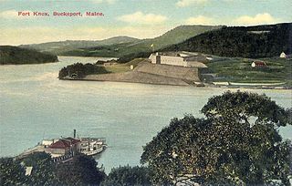
Prospect is a town in Waldo County, Maine, United States. The population was 698 at the 2020 census.

<span class="mw-page-title-main">Waldo, Maine</span> Town in the state of Maine, United States

Waldo is a town in Waldo County, Maine, United States. The population was 795 at the 2020 census. It is the home town of Heather Hemmens, who is known for her role on Hellcats.

<span class="mw-page-title-main">Harrington, Maine</span> Town in the state of Maine, United States

Harrington is a town in Washington County, Maine, United States. The population was 962 at the 2020 census. Harrington is an old seafaring and shipbuilding village.

<span class="mw-page-title-main">Lyman, Maine</span> Town in the state of Maine, United States

Lyman is a town in York County, Maine, United States. The population was 4,525 at the 2020 census. It is part of the Portland–South Portland–Biddeford, Maine metropolitan statistical area. Lyman, together with Alfred, is home to Massabesic Experimental Forest.

<span class="mw-page-title-main">Blue Hill, Maine</span> Town in the state of Maine, United States

Blue Hill is a town in Hancock County, Maine, United States, located on Blue Hill Bay. The population was 2,792 at the 2020 census. It is home to the Blue Hill Public Library, Blue Hill Memorial Hospital, George Stevens Academy, the Blue Hill Harbor School, The Bay School, New Surry Theatre, Kneisel Hall, Bagaduce Music Lending Library, the Kollegewidgwok Yacht Club, the Shaw Institute and the Blue Hill Country Club. The town also hosts the annual Blue Hill Fair.

References

  1. 1 2 "US Gazetteer files 2010". United States Census Bureau . Retrieved December 16, 2012.
  2. "Census - Geography Profile: Brooklin town, Hancock County, Maine" . Retrieved January 23, 2022.
  3. Coolidge, Austin J.; John B. Mansfield (1859). A History and Description of New England. Boston, Massachusetts: A.J. Coolidge. pp.  72–73. coolidge mansfield history description new england 1859.
  4. Varney, George J. (1886), Gazetteer of the state of Maine. Brooklin, Boston: Russell, archived from the original on March 3, 2016, retrieved March 4, 2010
  5. "Census of Population and Housing". Census.gov. Retrieved June 4, 2015.
  6. "U.S. Census website". United States Census Bureau . Retrieved December 16, 2012.
  7. "U.S. Census website". United States Census Bureau . Retrieved January 31, 2008.
  8. Norse Penny Archived February 6, 2009, at the Wayback Machine - Carpenter, Edmund.
  9. Aton, James (1994). John Wesley Powell. Boise State University. p. 30. ISBN   9780884301134.

Further reading

44°15′58″N68°34′09″W / 44.26611°N 68.56917°W / 44.26611; -68.56917