Anawalt, West Virginia

Last updated

Anawalt, West Virginia
Anawalt, West Virginia.jpg
Jenkinjones Road in Anawalt
McDowell County West Virginia Incorporated and Unincorporated areas Anawalt Highlighted.svg
Location of Anawalt in McDowell County, West Virginia.
USA West Virginia location map.svg
Red pog.svg
Anawalt, West Virginia
Usa edcp location map.svg
Red pog.svg
Anawalt, West Virginia
Coordinates: 37°20′11″N81°26′26″W / 37.33639°N 81.44056°W / 37.33639; -81.44056
Country United States
State West Virginia
County McDowell
Area
[1]
  Total0.57 sq mi (1.49 km2)
  Land0.57 sq mi (1.49 km2)
  Water0.00 sq mi (0.00 km2)
Elevation
[2]
1,680 ft (510 m)
Population
 (2020) [3]
  Total186
  Estimate 
(2021) [3]
179
  Density311.30/sq mi (120.12/km2)
Time zone UTC-5 (Eastern (EST))
  Summer (DST) UTC-4 (EDT)
ZIP code
24808
Area code 304
FIPS code 54-01780 [4]
GNIS feature ID2390703 [2]

Anawalt is a town in McDowell County, West Virginia, United States. At one time it was known as Jeanette. [2] It is named in honor of James White Anawalt, who was then manager of Union Supply Company, a subsidiary of the United States Steel Company. [5] The population was 186 at the 2020 census. [3] Coal mining was the town's chief industry.

Contents

Geography

According to the United States Census Bureau, the town has a total area of 0.57 square miles (1.48 km2), all land. [6]

Demographics

Historical population
CensusPop.Note
1950 1,383
1960 1,062−23.2%
1970 801−24.6%
1980 652−18.6%
1990 329−49.5%
2000 272−17.3%
2010 226−16.9%
2020 186−17.7%
2021 (est.)179 [3] −3.8%
U.S. Decennial Census [7]
2015 Estimate [8]
Anawalt Volunteer Fire Department Anawalt WV VFD.jpg
Anawalt Volunteer Fire Department

2010 census

At the 2010 census there were 226 people, 91 households, and 62 families living in the town. The population density was 396.5 inhabitants per square mile (153.1/km2). There were 135 housing units at an average density of 236.8 per square mile (91.4/km2). The racial makeup of the town was 88.9% White, 9.3% African American, and 1.8% from two or more races. Hispanic or Latino of any race were 0.4%. [9]

Of the 91 households 31.9% had children under the age of 18 living with them, 41.8% were married couples living together, 19.8% had a female householder with no husband present, 6.6% had a male householder with no wife present, and 31.9% were non-families. 29.7% of households were one person and 15.4% were one person aged 65 or older. The average household size was 2.48 and the average family size was 2.97.

The median age in the town was 44.3 years. 20.4% of residents were under the age of 18; 8.9% were between the ages of 18 and 24; 23% were from 25 to 44; 32.4% were from 45 to 64; and 15.5% were 65 or older. The gender makeup of the town was 47.8% male and 52.2% female.

2000 census

At the 2000 census there were 272 people, 114 households, and 77 families living in the town. The population density was 418.4 inhabitants per square mile (161.5/km2). There were 148 housing units at an average density of 227.7 per square mile (87.9/km2). The racial makeup of the town was 90.44% White, 9.19% African American, and 0.37% from two or more races. [4] Of the 114 households 25.4% had children under the age of 18 living with them, 50.0% were married couples living together, 12.3% had a female householder with no husband present, and 31.6% were non-families. 28.9% of households were one person and 18.4% were one person aged 65 or older. The average household size was 2.39 and the average family size was 2.91.

The age distribution was 21.0% under the age of 18, 7.4% from 18 to 24, 28.7% from 25 to 44, 26.8% from 45 to 64, and 16.2% 65 or older. The median age was 42 years. For every 100 females, there were 83.8 males. For every 100 females age 18 and over, there were 83.8 males.

The median household income was $13,333 and the median family income was $17,321. Males had a median income of $30,938 versus $14,375 for females. The per capita income for the town was $8,953. About 37.3% of families and 37.0% of the population were below the poverty line, including 35.6% of those under the age of eighteen and 28.3% of those sixty five or over.

Related Research Articles

<span class="mw-page-title-main">Paragon, Indiana</span> Town in Indiana, United States

Paragon is a town in Ray Township, Morgan County, in the U.S. state of Indiana. The population was 556 at the 2020 census, down from 659 in 2010.

<span class="mw-page-title-main">Bancroft, Maine</span> Unorganized territory in Maine, United States

Bancroft is a township in Aroostook County, Maine, United States. The population was 57 at the 2020 census. On July 1, 2015 the town voted to deorganize and become part of the unorganized territory of South Aroostook.

<span class="mw-page-title-main">Hersey, Maine</span> Town in the state of Maine, United States

Hersey is a town in Aroostook County, Maine, United States. The population was 73 at the 2020 census.

<span class="mw-page-title-main">Island Falls, Maine</span> Town in the state of Maine, United States

Island Falls is a town in Aroostook County, Maine, United States. The population was 758 at the 2020 census. The primary village of Island Falls in the town is situated at a falls in the West Branch Mattawamkeag River.

<span class="mw-page-title-main">St. Francis, Maine</span> Town in the state of Maine, United States

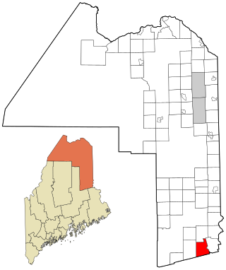
St. Francis is a town in Aroostook County, Maine, United States on the Canada–United States border at the junction of the St. Francis River and the Saint John River. The population was 438 at the 2020 census. First settled by English speakers from southern Maine, the original population has been supplanted by French-speaking Acadians.

<span class="mw-page-title-main">Westfield, Maine</span> Town in the state of Maine, United States

Westfield is a town in Aroostook County, Maine, United States. The population was 455 at the 2020 census.

Carrabassett Valley is a town in Franklin County, Maine, United States. The population was 673 at the 2020 census.

<span class="mw-page-title-main">Chesterville, Maine</span> Town in Maine, United States

Chesterville is a town in Franklin County, Maine, United States. The population was 1,328 at the 2020 census.

Lowell is a town in Penobscot County, Maine, United States. The population was 368 at the 2020 census.

<span class="mw-page-title-main">Smithfield, Maine</span> Town in the state of Maine, United States

Smithfield is a town in Somerset County, Maine, United States. The population was 925 at the 2020 census. The town was incorporated on February 29, 1840, making it the only town in Maine incorporated on Leap Day. The town was named after the Rev. Henry Smith, an early settler.

<span class="mw-page-title-main">Burnham, Maine</span> Town in the state of Maine, United States

Burnham is a town in Waldo County, Maine, United States. The population was 1,096 at the 2020 census.

<span class="mw-page-title-main">Waite, Maine</span> Town in the state of Maine, United States

Waite is a town in Washington County, Maine, United States. The town was named after Benjamin Waite, a lumberman and businessman from Calais, Maine. The population was 66 at the 2020 census.

<span class="mw-page-title-main">Lewis and Clark Village, Missouri</span> Village in Missouri, United States

Lewis and Clark Village is a village in Buchanan County, Missouri, United States. The population was 96 at the 2020 census. It is part of the St. Joseph, MO–KS Metropolitan Statistical Area.

<span class="mw-page-title-main">Junior, West Virginia</span> Town in West Virginia, United States

Junior is a town in Barbour County, West Virginia, United States, situated along the Tygart Valley River. The population was 384 at the 2020 census.

<span class="mw-page-title-main">Leon, West Virginia</span> Town in West Virginia, United States

Leon is a town in Mason County, West Virginia, United States, situated along the Kanawha River. The population was 137 at the 2020 census. It is part of the Point Pleasant, WV–OH Micropolitan Statistical Area.

<span class="mw-page-title-main">Davy, West Virginia</span> Town in West Virginia, United States

Davy is a town in McDowell County, West Virginia, United States. The population was 420 at the 2010 census. Founded in 1873, the town was originally called Hallsville but the name would change to Davy by 1901. Davy was officially incorporated in 1948. It is a mostly residential community in a coal mining district along the main line of the Norfolk Southern Railway.

<span class="mw-page-title-main">Peterstown, West Virginia</span> Town in West Virginia, United States

Peterstown is a town in Monroe County, West Virginia, United States. The population was 456 at the 2020 census.

<span class="mw-page-title-main">Newburg, West Virginia</span> Town in West Virginia, United States

Newburg is a town in western Preston County, West Virginia, United States. The population was 275 at the 2020 census. It is part of the Morgantown metropolitan area.

<span class="mw-page-title-main">Montrose, West Virginia</span> Town in West Virginia, United States

Montrose is a town in Randolph County, West Virginia, United States. The population was 141 at the 2020 census.

<span class="mw-page-title-main">Hambleton, West Virginia</span> Town in West Virginia, United States

Hambleton is a town in Tucker County, West Virginia, United States. The population was 216 at the 2020 census. Hambleton was established in 1889, but not incorporated until 1905. It was named by then United States Senator Stephen B. Elkins in honor of a stockholder by this name in the West Virginia Central Railroad Company. The town was previously known as Hulings.

References

  1. "2019 U.S. Gazetteer Files". United States Census Bureau. Retrieved August 7, 2020.
  2. 1 2 3 U.S. Geological Survey Geographic Names Information System: Anawalt, West Virginia
  3. 1 2 3 4 "City and Town Population Totals: 2020-2021". Census.gov. US Census Bureau. Retrieved July 3, 2022.
  4. 1 2 "U.S. Census website". United States Census Bureau . Retrieved January 31, 2008.
  5. Wakefield, John Anwalt (1935). History and Genealogy of the Anawalts and Cognate Families. Winnetka, Illinois.{{cite book}}: CS1 maint: location missing publisher (link)
  6. "US Gazetteer files 2010". United States Census Bureau. Archived from the original on January 25, 2012. Retrieved January 24, 2013.
  7. "U.S. Decennial Census". Census.gov. Retrieved June 11, 2013.
  8. "Population Estimates". United States Census Bureau. Archived from the original on October 19, 2016. Retrieved May 23, 2016.
  9. "U.S. Census website". United States Census Bureau . Retrieved January 24, 2013.