Davis, West Virginia

Last updated

Davis, West Virginia
Davis, West Virginia 2020.jpg
William Avenue (Route 32) in Davis in 2020
Logo of Davis, West Virginia.png
Wordmark of Davis, West Virginia.svg
Tucker County West Virginia Incorporated and Unincorporated areas Davis Highlighted.svg
Location of Davis in Tucker County, West Virginia
Coordinates: 39°7′52″N79°27′59″W / 39.13111°N 79.46639°W / 39.13111; -79.46639
Country United States
State West Virginia
County Tucker
Area
[1]
  Total1.83 sq mi (4.74 km2)
  Land1.83 sq mi (4.74 km2)
  Water0.00 sq mi (0.00 km2)
Elevation
3,100 ft (945 m)
Population
 (2020) [2]
  Total595
  Estimate 
(2021) [2]
588
  Density344.62/sq mi (133.06/km2)
Time zone UTC-5 (Eastern (EST))
  Summer (DST) UTC-4 (EDT)
ZIP code
26260
Area code 304
FIPS code 54-20428 [3]
GNIS feature ID1550876 [4]
Website https://daviswv.us/

Davis is a town in Tucker County, West Virginia, United States, situated along the Blackwater River. [5] The population was 595 at the 2020 census. [2]

Contents

History

NRHP-listed National Bank of Davis in 2020 National Bank of Davis 2020.jpg
NRHP-listed National Bank of Davis in 2020

Davis was named either for Senator Henry Gassaway Davis, [6] or for his family generally. [7]

The Herman August Meyer House was listed on the National Register of Historic Places in 2010. [8]

Geography

Davis is located at 39°07′52″N79°27′59″W / 39.131110°N 79.466318°W / 39.131110; -79.466318 (39.131110, -79.466318). [9] It is located in the northern portion of Canaan Valley, West Virginia near the Canaan Valley State Resort Park, and is partially surrounded by the Monongahela National Forest, including scenic Blackwater Falls.

At an elevation of 3,520 feet, Davis has the highest elevation of any West Virginia town. According to the United States Census Bureau, the town has a total area of 1.83 square miles (4.74 km2), all land. [10]

Mountain biking

The area surrounding Davis is renowned for its mountain biking trails and bike culture. The most notable trails include the Plantation Trail, Hoo Doo Hustle and Moon Rocks. Many more miles of trails are also easily accessible at nearby Blackwater Falls State Park. The area also hosts several mountain bike races each year. One of these races, the Revenge of the Rattlesnake, is considered one of the toughest bike races in the country.

Demographics

Historical population
CensusPop.Note
1890 918
1900 2,391160.5%
1910 2,6159.4%
1920 2,491−4.7%
1930 1,656−33.5%
1940 1,454−12.2%
1950 1,271−12.6%
1960 898−29.3%
1970 868−3.3%
1980 97912.8%
1990 799−18.4%
2000 624−21.9%
2010 6605.8%
2020 595−9.8%
2021 (est.)588 [2] −1.2%
U.S. Decennial Census [11]

2010 census

At the 2010 census there were 660 people, 305 households, and 173 families living in the town. The population density was 360.7 inhabitants per square mile (139.3/km2). There were 425 housing units at an average density of 232.2 per square mile (89.7/km2). The racial makeup of the town was 98.0% White, 0.5% Native American, 0.5% from other races, and 1.1% from two or more races. Hispanic or Latino people of any race were 0.9%. [12]

Of the 305 households 20.0% had children under the age of 18 living with them, 43.6% were married couples living together, 9.2% had a female householder with no husband present, 3.9% had a male householder with no wife present, and 43.3% were non-families. 37.4% of households were one person and 15.4% were one person aged 65 or older. The average household size was 2.16 and the average family size was 2.82.

The median age in the town was 46.1 years. 17.7% of residents were under the age of 18; 6.8% were between the ages of 18 and 24; 24.1% were from 25 to 44; 34.9% were from 45 to 64; and 16.5% were 65 or older. The gender makeup of the town was 47.0% male and 53.0% female.

2000 census

At the 2000 census there were 624 people, 290 households, and 176 families living in the town. The population density was 546.0 inhabitants per square mile (211.3/km2). There were 380 housing units at an average density of 332.5 per square mile (128.7/km2). The racial makeup of the town was 97.92% White, 0.16% Native American, and 1.92% from two or more races. Hispanic or Latino people of any race were 0.32%. [3]

Of the 290 households 26.2% had children under the age of 18 living with them, 44.5% were married couples living together, 11.7% had a female householder with no husband present, and 39.3% were non-families. 36.9% of households were one person and 20.0% were one person aged 65 or older. The average household size was 2.15 and the average family size was 2.76.

The age distribution was 22.0% under the age of 18, 6.1% from 18 to 24, 26.6% from 25 to 44, 23.4% from 45 to 64, and 22.0% 65 or older. The median age was 42 years. For every 100 females, there were 84.6 males. For every 100 females age 18 and over, there were 88.0 males.

The median household income was $25,221 and the median family income was $31,333. Males had a median income of $21,607 versus $17,250 for females. The per capita income for the town was $22,399. About 14.6% of families and 14.6% of the population were below the poverty line, including 19.4% of those under age 18 and 10.9% of those age 65 or over.

Climate

According to the Köppen Climate Classification system, Davis has a warm-summer humid continental climate, abbreviated "Dfb" on climate maps.

Climate data for Davis, West Virginia, 1991–2020 normals, extremes 2002–present
MonthJanFebMarAprMayJunJulAugSepOctNovDecYear
Record high °F (°C)62
(17)
71
(22)
74
(23)
84
(29)
83
(28)
89
(32)
89
(32)
84
(29)
84
(29)
80
(27)
72
(22)
64
(18)
89
(32)
Mean maximum °F (°C)55.5
(13.1)
56.1
(13.4)
66.4
(19.1)
76.7
(24.8)
79.9
(26.6)
81.9
(27.7)
83.3
(28.5)
81.1
(27.3)
80.5
(26.9)
74.7
(23.7)
67.3
(19.6)
58.1
(14.5)
84.3
(29.1)
Mean daily maximum °F (°C)31.9
(−0.1)
34.9
(1.6)
42.9
(6.1)
55.8
(13.2)
64.4
(18.0)
71.5
(21.9)
75.3
(24.1)
73.6
(23.1)
68.1
(20.1)
57.3
(14.1)
45.7
(7.6)
36.4
(2.4)
54.8
(12.7)
Daily mean °F (°C)23.9
(−4.5)
26.2
(−3.2)
33.5
(0.8)
45.0
(7.2)
54.6
(12.6)
62.2
(16.8)
66.0
(18.9)
64.4
(18.0)
58.8
(14.9)
47.8
(8.8)
37.2
(2.9)
28.8
(−1.8)
45.7
(7.6)
Mean daily minimum °F (°C)15.9
(−8.9)
17.5
(−8.1)
24.0
(−4.4)
34.3
(1.3)
44.9
(7.2)
52.8
(11.6)
56.6
(13.7)
55.2
(12.9)
49.5
(9.7)
38.4
(3.6)
28.7
(−1.8)
21.2
(−6.0)
36.6
(2.6)
Mean minimum °F (°C)−5.6
(−20.9)
−4.8
(−20.4)
4.4
(−15.3)
18.3
(−7.6)
28.9
(−1.7)
39.8
(4.3)
46.1
(7.8)
45.7
(7.6)
37.9
(3.3)
24.3
(−4.3)
12.1
(−11.1)
3.8
(−15.7)
−8.6
(−22.6)
Record low °F (°C)−18
(−28)
−15
(−26)
−9
(−23)
5
(−15)
19
(−7)
32
(0)
40
(4)
41
(5)
32
(0)
20
(−7)
0
(−18)
−15
(−26)
−18
(−28)
Average precipitation inches (mm)6.20
(157)
5.28
(134)
5.90
(150)
5.31
(135)
5.70
(145)
6.21
(158)
6.27
(159)
4.49
(114)
4.07
(103)
4.09
(104)
4.12
(105)
5.52
(140)
63.16
(1,604)
Average snowfall inches (cm)45.0
(114)
43.1
(109)
26.0
(66)
10.6
(27)
0.5
(1.3)
0.0
(0.0)
0.0
(0.0)
0.0
(0.0)
0.0
(0.0)
5.5
(14)
11.2
(28)
28.3
(72)
170.2
(431.3)
Average extreme snow depth inches (cm)15.7
(40)
17.9
(45)
13.9
(35)
5.7
(14)
0.3
(0.76)
0.0
(0.0)
0.0
(0.0)
0.0
(0.0)
0.0
(0.0)
4.7
(12)
7.0
(18)
9.9
(25)
20.6
(52)
Average precipitation days (≥ 0.01 in)22.619.818.216.317.415.315.213.910.914.214.319.5197.6
Average snowy days (≥ 0.1 in)16.414.89.73.70.60.00.00.00.01.65.812.164.7
Source 1: NOAA [13]
Source 2: National Weather Service (mean maxima/minima, snow depth 20062020) [14]

Notable people

Related Research Articles

<span class="mw-page-title-main">Blackwater, Arizona</span> CDP in Pinal County, Arizona

Blackwater is a native village and census-designated place (CDP) on the Gila River Reservation in Pinal County, Arizona, United States. The population was 1,062 at the 2010 census, up from 504 in 2000.

<span class="mw-page-title-main">Junior, West Virginia</span> Town in West Virginia, United States

Junior is a town in Barbour County, West Virginia, United States, situated along the Tygart Valley River. The population was 384 at the 2020 census.

<span class="mw-page-title-main">Fayetteville, West Virginia</span> Town in West Virginia, United States

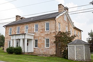
Fayetteville is a town in and the county seat of Fayette County, West Virginia, United States. The population was 2,887 at the 2020 census.

<span class="mw-page-title-main">West Milford, West Virginia</span> Town in West Virginia, United States

West Milford is a town in Harrison County, West Virginia, United States. The population was 452 at the 2020 census.

<span class="mw-page-title-main">Jane Lew, West Virginia</span> Town in West Virginia, United States

Jane Lew is a town in Lewis County, West Virginia, United States. The population was 409 at the time of the 2020 census.

<span class="mw-page-title-main">White Hall, West Virginia</span> Town in West Virginia, United States

White Hall is a town in Marion County, West Virginia, United States. The population was 706 at the 2020 census. Incorporated in 1989, White Hall is adjacent to the county seat, Fairmont, and is part of the Fairmont, West Virginia, Micropolitan Statistical Area. White Hall has many different stores and restaurants.

<span class="mw-page-title-main">Worthington, West Virginia</span> Town in West Virginia, United States

Worthington is a town in Marion County, West Virginia, United States. The population was 158 at the 2010 census. Worthington was incorporated in 1893 and named for Colonel George Worthington, an early settler. U.S. Route 19 passes through the town.

<span class="mw-page-title-main">Bramwell, West Virginia</span> Town in West Virginia, United States

Bramwell is a town in Mercer County, West Virginia, United States, along the Bluestone River. The population was 277 at the 2020 census. It is part of the Bluefield, WV-VA micropolitan area which has a population of 107,578.

<span class="mw-page-title-main">Peterstown, West Virginia</span> Town in West Virginia, United States

Peterstown is a town in Monroe County, West Virginia, United States. The population was 456 at the 2020 census.

<span class="mw-page-title-main">West Liberty, West Virginia</span> Town in West Virginia, United States

West Liberty is a town in Ohio County, West Virginia, United States. The population was 1,557 at the 2020 census. It is part of the Wheeling metropolitan area.

<span class="mw-page-title-main">Albright, West Virginia</span> Town in West Virginia, United States

Albright is a town in central Preston County, West Virginia, United States, along the Cheat River. The population was 260 at the 2020 census. A former coal town, it is part of the Morgantown metropolitan area.

<span class="mw-page-title-main">Brandonville, West Virginia</span> Town in West Virginia, United States

Brandonville is a town in northern Preston County, West Virginia, United States. The population was 136 at the 2020 census. It is part of the Morgantown metropolitan area.

<span class="mw-page-title-main">Newburg, West Virginia</span> Town in West Virginia, United States

Newburg is a town in western Preston County, West Virginia, United States. The population was 275 at the 2020 census. It is part of the Morgantown metropolitan area.

<span class="mw-page-title-main">Lester, West Virginia</span> Town in West Virginia, United States

Lester is a town in Raleigh County, West Virginia, United States. The population was 337 at the 2020 census. The community was named after Champ Lester, a local pioneer.

<span class="mw-page-title-main">Mabscott, West Virginia</span> Town in West Virginia, United States

Mabscott is a town in Raleigh County, West Virginia, United States. The population was 1,333 at the 2020 census. The town's name is a contraction of the name Mabel Scott, wife of local coal operator Cyrus H. Scott.

<span class="mw-page-title-main">Sophia, West Virginia</span> Town in West Virginia, United States

Sophia is a town in Raleigh County, West Virginia, United States. It was incorporated in 1912. The population was 1,124 at the 2020 census.

<span class="mw-page-title-main">Hendricks, West Virginia</span> Town in West Virginia, United States

Hendricks is a town in Tucker County, West Virginia, United States. The population was 226 at the 2020 census. The Blackwater River and the Dry Fork join at Hendricks to form the Black Fork, a principal tributary of the Cheat River.

<span class="mw-page-title-main">Thomas, West Virginia</span> City in West Virginia, United States

Thomas is a city and former coal town in Tucker County, West Virginia, United States. The population was 623 at the 2020 census.

<span class="mw-page-title-main">Pine Grove, West Virginia</span> Town in West Virginia, United States

Pine Grove is a town in Wetzel County, West Virginia, United States. The population was 363 at the 2020 census. The community was named for a grove of pine trees near the original town site.

<span class="mw-page-title-main">North Hills, West Virginia</span> Town in West Virginia, United States

North Hills is a town in Wood County, West Virginia, United States. It is a suburb of Parkersburg. The population was 837 at the 2020 census. North Hills was incorporated on February 15, 1979.

References

  1. "2019 U.S. Gazetteer Files". United States Census Bureau. Retrieved August 7, 2020.
  2. 1 2 3 4 "City and Town Population Totals: 2020-2021". Census.gov. US Census Bureau. Retrieved July 3, 2022.
  3. 1 2 "U.S. Census website". United States Census Bureau . Retrieved January 31, 2008.
  4. "US Board on Geographic Names". United States Geological Survey. October 25, 2007. Retrieved January 31, 2008.
  5. West Virginia Atlas & Gazetteer. Yarmouth, Me.: DeLorme. 1997. p. 38. ISBN   0-89933-246-3.
  6. Gannett, Henry (1905). The Origin of Certain Place Names in the United States. Govt. Print. Off. pp.  101.
  7. Kenny, Hamill (1945). West Virginia Place Names: Their Origin and Meaning, Including the Nomenclature of the Streams and Mountains. Piedmont, WV: The Place Name Press. p. 200.
  8. "National Register of Historic Places Listings". Weekly List of Actions Taken on Properties: 7/12/10 through 7/16/10. National Park Service. July 23, 2010.
  9. "US Gazetteer files: 2010, 2000, and 1990". United States Census Bureau. February 12, 2011. Retrieved April 23, 2011.
  10. "US Gazetteer files 2010". United States Census Bureau. Archived from the original on January 25, 2012. Retrieved January 24, 2013.
  11. "Census of Population and Housing". Census.gov. Retrieved June 4, 2015.
  12. "U.S. Census website". United States Census Bureau . Retrieved January 24, 2013.
  13. "U.S. Climate Normals Quick Access – Station: Davis 3SE, WV". National Oceanic and Atmospheric Administration. Retrieved October 14, 2023.
  14. "NOAA Online Weather Data – NWS Pittsburgh". National Weather Service. Retrieved October 14, 2023.