Beckett Ridge, Ohio

Last updated

Beckett Ridge, Ohio
OHMap-doton-Beckett Ridge.png
Location of Beckett Ridge, Ohio
Coordinates: 39°20′57″N84°26′20″W / 39.34917°N 84.43889°W / 39.34917; -84.43889
Country United States
State Ohio
County Butler
Area
[1]
  Total4.80 sq mi (12.44 km2)
  Land4.80 sq mi (12.44 km2)
  Water0.00 sq mi (0.00 km2)
Elevation
[2]
817 ft (249 m)
Population
 (2020)
  Total9,192
  Density1,914.20/sq mi (739.14/km2)
Time zone UTC-5 (Eastern (EST))
  Summer (DST) UTC-4 (EDT)
ZIP code
45069 [3]
Area code(s) 283 and 513
FIPS code 39-04840 [4]
GNIS feature ID1867445 [2]

Beckett Ridge is a census-designated place (CDP) in West Chester Township, Butler County, Ohio, United States. The population was 9,192 at the 2020 census.

Contents

History

Beckett Ridge began as a planned community in the 1970s. Beckett Ridge occupies an area once operated as a farm by the Beckett family. Beckett Ridge was developed by Gary L. Schottenstein, chairman and CEO of Schottenstein Real Estate Group. It was the largest planned unit development in Ohio at the time. [5]

Geography

Beckett Ridge is located in southeastern Butler County, in the west-central part of West Chester Township at 39°20′57″N84°26′20″W / 39.34917°N 84.43889°W / 39.34917; -84.43889 (39.349272, -84.438855). [6] It is centered on the Beckett Ridge Golf Club, occupying high ground to the north of the valley of Mill Creek.

Interstate 75 cuts across the southeast corner of the CDP, with the closest access from Exit 19 (Union Centre Boulevard). State Route 747 forms the western edge of the CDP, leading south into Glendale and north towards Middletown.

According to the United States Census Bureau, the CDP has a total area of 4.8 square miles (12.4 km2), all land. [7]

Demographics

Historical population
CensusPop.Note
2020 9,192
U.S. Decennial Census [8]

As of the census [4] of 2000, there were 8,663 people, 3,107 households, and 2,420 families residing in the CDP. The population density was 1,780.9 people per square mile (687.6 people/km2). There were 3,222 housing units at an average density of 662.4 per square mile (255.8/km2). The racial makeup of the CDP was 88.27% White, 4.83% African American, 0.18% Native American, 5.53% Asian, 0.01% Pacific Islander, 0.28% from other races, and 0.90% from two or more races. Hispanic or Latino of any race were 1.63% of the population.

There were 3,107 households, out of which 43.8% had children under the age of 18 living with them, 69.2% were married couples living together, 6.5% had a female householder with no husband present, and 22.1% were non-families. 17.8% of all households were made up of individuals, and 3.3% had someone living alone who was 65 years of age or older. The average household size was 2.79 and the average family size was 3.21.

In the CDP, the population was spread out, with 30.4% under the age of 18, 5.9% from 18 to 24, 34.6% from 25 to 44, 23.9% from 45 to 64, and 5.2% who were 65 years of age or older. The median age was 35 years. For every 100 females, there were 99.0 males. For every 100 females age 18 and over, there were 96.3 males.

The median income for a household in the CDP was $80,090, and the median income for a family was $90,758. Males had a median income of $61,008 versus $38,933 for females. The per capita income for the CDP was $33,835. About 1.3% of families and 1.5% of the population were below the poverty line, including 2.2% of those under age 18 and none of those age 65 or over.

Related Research Articles

<span class="mw-page-title-main">Millville, Ohio</span> Village in Ohio, United States

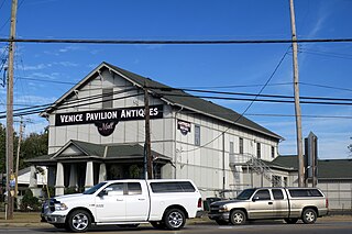
Millville is a village in Butler County, Ohio, United States. The population was 634 at the 2020 census. Millville sits between Oxford, Ohio and Cincinnati, Ohio along U.S. Route 27.

<span class="mw-page-title-main">Olde West Chester, Ohio</span> Census-designated place in Ohio, United States

Olde West Chester is a census-designated place (CDP) in West Chester Township, Butler County, Ohio, United States. The population was 201 at the 2020 census.

<span class="mw-page-title-main">Ross, Ohio</span> Census-designated place in Ohio, United States

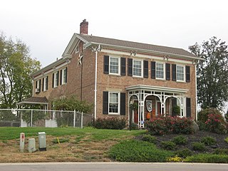
Ross is a census-designated place (CDP) in Ross Township, Butler County, Ohio, United States. The population was 3,478 at the 2020 census. Ross sits along U.S. Route 27 between Cincinnati, Ohio and Oxford, Ohio. Ross is part of the Cincinnati metropolitan area.

<span class="mw-page-title-main">Somerville, Ohio</span> Census-designated place in Ohio, United States

Somerville is a census-designated place (CDP) and former village in Milford Township, Butler County, Ohio, United States. The population was 258 at the 2020 census.

<span class="mw-page-title-main">South Middletown, Ohio</span> Former CDP in Ohio, United States

South Middletown is a former census-designated place (CDP) in Lemon Township, Butler County, Ohio, United States. The population was 264 at the 2000 census. The area of South Middletown is now within the city limits of Middletown.

<span class="mw-page-title-main">Trenton, Ohio</span> City in Ohio, United States

Trenton is a city in northeastern Butler County, Ohio, United States, west of Middletown. The population was 13,021 at the 2020 census. It is part of the Cincinnati metropolitan area.

<span class="mw-page-title-main">Mount Carmel, Ohio</span> Census-designated place in Ohio, United States

Mount Carmel is a census-designated place (CDP) in Clermont County, Ohio, United States. The population was 4,828 at the 2020 census.

<span class="mw-page-title-main">Mount Repose, Ohio</span> Census-designated place in Ohio, United States

Mount Repose is a census-designated place (CDP) in Miami Township, Clermont County, Ohio, United States. The population was 4,648 at the 2020 census.

<span class="mw-page-title-main">Summerside, Ohio</span> Census-designated place in Ohio, United States

Summerside is a census-designated place (CDP) in Union Township, Clermont County, Ohio, United States. Its population was 4,941 as of the 2020 census.

<span class="mw-page-title-main">Covedale, Ohio</span> Census-designated place in Ohio, United States

Covedale is a census-designated place (CDP) in Green Township, Hamilton County, Ohio, United States. The population was 6,472 at the 2020 census. The CDP represents the part of the former village of Covedale that was not annexed by the city of Cincinnati in the 1890s.

<span class="mw-page-title-main">Dillonvale, Hamilton County, Ohio</span> Census-designated place in Ohio, United States

Dillonvale is a census-designated place (CDP) in Sycamore Township, Hamilton County, Ohio, United States. The population was 3,436 at the 2020 census.

<span class="mw-page-title-main">Grandview, Hamilton County, Ohio</span> Census-designated place in Ohio, United States

Grandview is a census-designated place (CDP) in Hamilton County, Ohio, United States. The population was 1,312 at the 2020 census.

<span class="mw-page-title-main">Kenwood, Ohio</span> Census-designated place in Ohio, United States

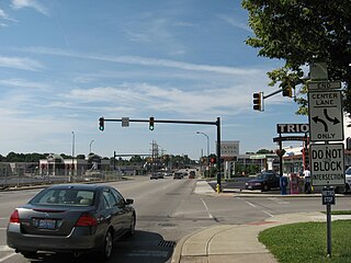
Kenwood is a census-designated place (CDP) in Sycamore Township, Hamilton County, Ohio, United States. The population was 7,570 at the 2020 census. It is a major shopping destination for the Cincinnati area, featuring properties such as Kenwood Towne Centre and The Kenwood Collection.

<span class="mw-page-title-main">White Oak, Ohio</span> Census-designated place in Ohio, United States

White Oak is a census-designated place (CDP) in Hamilton County, Ohio, United States. It is seven miles northwest of Cincinnati. The population was 19,541 at the 2020 census. White Oak is situated in both Green Township and Colerain Township.

<span class="mw-page-title-main">Harbor Hills, Ohio</span> Census-designated place in Ohio, United States

Harbor Hills is a census-designated place (CDP) in southern Licking County, Ohio, United States. The population was 1,565 at the 2020 census.

<span class="mw-page-title-main">Drexel, Ohio</span> CDP in Ohio, United States

Drexel is a census-designated place (CDP) in Jefferson Township, Montgomery County, Ohio, United States. The population was 1,693 at the 2020 census. Informally, the Drexel designation also applies to the neighboring portion of Trotwood.

Shiloh is a census-designated place (CDP) in Harrison Township in Montgomery County, Ohio, United States. It was delineated as a census-designated place at the 2000 census, at which time its population was 11,272. It was not delineated as a CDP at the 2010 census. It is located directly north of the city of Dayton and is part of the Dayton Metropolitan Statistical Area.

<span class="mw-page-title-main">Landen, Ohio</span> CDP in Ohio, United States

Landen is a census-designated place (CDP) in Deerfield Township, Warren County, Ohio, United States. The population was 6,995 at the 2020 census. It is located around Columbia Road and Montgomery Road in the southeastern part of the township. It surrounds Twenty Mile Stand and near Fosters.

<span class="mw-page-title-main">College Corner, Ohio</span> Village in Ohio, United States

College Corner is a village in Butler and Preble counties in the southwestern part of the U.S. state of Ohio, 5 miles (8 km) northwest of Oxford. The population was 387 at the 2020 census. The village lies on the state line with Indiana, where it borders the town of West College Corner. The public school, part of the Union County–College Corner Joint School District, is bisected by the state line and is operated jointly with Indiana authorities.

<span class="mw-page-title-main">Loveland Park, Ohio</span> Census-designated place in Ohio, United States

Loveland Park is a census-designated place (CDP) located in Symmes Township, Hamilton County and Deerfield Township, Warren County, in the southwestern part of the U.S. state of Ohio. The CDP is named after the city of Loveland. The population was 1,737 at the 2020 census.

References

  1. "ArcGIS REST Services Directory". United States Census Bureau. Retrieved September 20, 2022.
  2. 1 2 "US Board on Geographic Names". United States Geological Survey. October 25, 2007. Retrieved January 31, 2008.
  3. "Beckett Ridge OH ZIP Code". zipdatamaps.com. 2023. Retrieved June 16, 2023.
  4. 1 2 "U.S. Census website". United States Census Bureau . Retrieved January 31, 2008.
  5. "Beckett Ridge". Beckett Ridge Homeowner's Association. Retrieved April 1, 2014.
  6. "US Gazetteer files: 2010, 2000, and 1990". United States Census Bureau. February 12, 2011. Retrieved April 23, 2011.
  7. "Geographic Identifiers: 2010 Demographic Profile Data (G001): Beckett Ridge CDP, Ohio". U.S. Census Bureau, American Factfinder. Archived from the original on February 12, 2020. Retrieved February 21, 2014.
  8. "Census of Population and Housing". Census.gov. Retrieved June 4, 2016.

Further reading