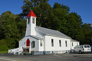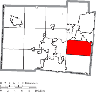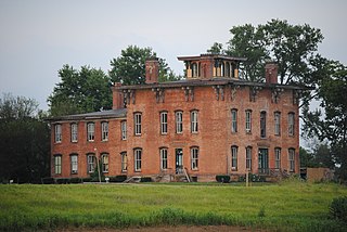
Columbia Township is one of the twelve townships of Hamilton County, Ohio, United States. The 2010 census found 4,532 people in the township. Originally one of Ohio's largest townships by area at its inception in 1791, it gradually shrank to one of the smallest by the early 1950s.

Harrison Township is one of the twelve townships of Hamilton County, Ohio, United States. The 2010 census found 13,934 people in the township.

Harlan Township, one of the eleven townships of Warren County, Ohio, United States, and the last to be formed in that county, is located in the southeast corner of the county. The 2000 census found 3,627 inhabitants, up from 3,268 in 1990; of this total, 3,240 lived in the unincorporated portions of the township.

Lemon Township is one of thirteen townships in Butler County, Ohio, United States. Located in the northeastern part of the county, it includes most of the city of Monroe. It had a population of 13,875 at the 2010 census. It is the only Lemon Township statewide.

Madison Township is one of thirteen townships in Butler County, Ohio, United States. Located in northeastern Butler County just west of Middletown, it had a population of 8,448 people as of the 2010 census, down from 8,611 in 2000. While it surrounds the city of Trenton, the city is no longer part of the township. It is named for James Madison, president of the United States at the time of its creation in 1810, and is one of twenty Madison Townships statewide.

Liberty Township is an affluent suburb of Cincinnati located in Butler County, Ohio. It is one of thirteen townships in Butler County, Ohio, United States. It is located on the east-central part of the county, just south of the city of Monroe. With an area of about 29 square miles (75 km2) it is smallest of the thirteen townships but one of the fastest growing areas in southwest Ohio, having a population of 37,259 at the 2010 census, up from 22,819 in 2000 and just 9,249 in 1990. It was named for Liberty, Pennsylvania, at the suggestion of John Morrow, a resident in the township at the time of its formation in 1803 who was the brother of Ohio Governor Jeremiah Morrow, after his hometown. The first settler was John Nelson, who arrived in 1796, seven years before Ohio became a state. It is one of 25 Liberty Townships statewide.

Fairfield Township, one of thirteen townships in Butler County, Ohio, United States, is located in the south central portion of the county. It had a population of 21,373 at the 2010 census, up from 15,571 in 2000, but down sharply from 49,353 in 1990 because of the withdrawal of the city of Fairfield in 1994 and annexations from Fairfield and Hamilton. Before annexations by the cities of Hamilton and Fairfield, it had an area of about 50 square miles (130 km2).

St. Clair Township, one of thirteen townships in Butler County, Ohio, United States, consists of three disconnected pieces located along the Great Miami River in central Butler County. It had a population of 6,908 at the 2010 census, down from 7,336 in 2000. Exclusive of the village of New Miami and the southern part of the village of Seven Mile, which lie within its borders, the unincorporated portion of St. Clair Township had 4,404 inhabitants in 2010.

Oxford Township, also known as the College Township, is one of thirteen townships in the county and is located in the northwestern corner of Butler County, Ohio, United States, where it meets Preble County, Ohio, and Union County, Indiana. The city of Oxford and Miami University are located here. The U.S. Census Bureau counted 23,661 inhabitants in 2010, down from 24,133 in 2000. Excluding the city of Oxford and the village of College Corner there are 2,099 residents of the unincorporated portion of Oxford Township. It comprises one full survey township in the Congress Lands and is 36.9 square miles (95.6 km2) in area.

Ross Township, one of thirteen townships in the county, is located in south-central Butler County, Ohio, United States, southwest of the city of Hamilton. The population was 8,355 at the 2010 census, up from 6,448 in 2000; 7,830 of this total lived in the unincorporated portions of the township in 2010. It originally comprised twenty-seven whole and seven fractional sections in the Congress Lands.

Wayne Township, one of thirteen townships in the county, is located in north-central Butler County, Ohio, United States between Trenton and Oxford. It had a total population of 4,443 at the 2010 census, up from 4,252 in 2000. Exclusive of the two incorporated villages in the township, Jacksonburg and Seven Mile, Wayne Township had a population of 3,884 in 2010. It has an area of 36.6 square miles (94.9 km2), comprising one whole survey township in the Congress Lands.

Milford Township, one of thirteen townships in the county, is located in north-central Butler County, Ohio, United States, between Oxford and Middletown. The township had a population of 3,550 at the 2010 census, up from 3,254 in 2000. Excluding the now-defunct village of Somerville, 3,269 people lived in the unincorporated part of the township.

Morgan Township, one of thirteen townships in the county, is located in the southwestern corner of Butler County, Ohio, United States, on the state line with Indiana. It had a population of 5,515 at the 2010 census, up from 5,328 in 2000. There are no incorporated places in the township. Unincorporated places there include Alert, Okeana, Macedonia, and Shandon. It comprised one full survey township in the first range of the Congress Lands and has an area of 36.8 square miles (95.3 km2).

Hanover Township, one of thirteen townships in the county, is located in west-central Butler County, Ohio, United States, midway between Hamilton and Oxford. It had a population of 8,311 as of the 2010 census, up from 7,878 in 2000. It is named for Hanover County, Virginia, where the early settlers originated. Statewide, other Hanover Townships are located in Ashland, Columbiana, and Licking counties.

Richland Township is one of the thirteen townships of Clinton County, Ohio, United States. The 2010 census reported 3,573 people living in the township, 1,009 of whom lived in the unincorporated portions of the township.

Milford Township is one of the twelve townships of Defiance County, Ohio, United States. The 2010 census found 1,081 people in the township.

Jefferson Township is one of the twelve townships of Preble County, Ohio, United States. The 2010 census found 3,309 people in the township, 1,680 of whom lived in the unincorporated portions of the township. The Jefferson community is served by National Trail High School and the National Trail Local School district. Interstate 70 runs along the southern part of the township.

Cass Township is one of the twenty-five townships of Muskingum County, Ohio, United States. The 2000 census found 1,492 people in the township, 1,419 of whom lived in the unincorporated portions of the township.

Hanover Township is one of the eighteen townships of Columbiana County, Ohio, United States. The 2010 census reported 3,704 people living in the township, 3,296 of whom were in the unincorporated portions of the township.

Hamilton Township is one of the seventeen townships of Franklin County, Ohio, United States. The 2010 census found 8,260 people in the township, 4,438 of whom lived in the unincorporated portions of the township.


