Somerville, Ohio

Last updated

Somerville, Ohio
OHMap-doton-Somerville.png
Location of Somerville, Ohio
Map of Butler County Ohio Highlighting Somerville Village.png
Location of Somerville in Butler County
Coordinates: 39°33′50″N84°38′20″W / 39.56389°N 84.63889°W / 39.56389; -84.63889
Country United States
State Ohio
County Butler
Township Milford Township
Incorporated1832
DissolvedMarch 15, 2016
Area
[1]
  Total0.27 sq mi (0.69 km2)
  Land0.26 sq mi (0.68 km2)
  Water0.00 sq mi (0.01 km2)
Elevation
[2]
768 ft (234 m)
Population
 (2020)
  Total258
  Density977.27/sq mi (377.52/km2)
Time zone UTC-5 (Eastern (EST))
  Summer (DST) UTC-4 (EDT)
ZIP code
45064
Area code 513
FIPS code 39-72998 [3]
GNIS feature ID2785016 [2]

Somerville is a census-designated place (CDP) and former village in Milford Township, Butler County, Ohio, United States. The population was 258 at the 2020 census.

Contents

Geography

According to the United States Census Bureau, the village had a total area of 0.25 square miles (0.65 km2), all land. [4]

History

Somerville was incorporated as a village in 1832. On March 15, 2016, Somerville residents voted 52% to 48% to dissolve the village into Milford Township, after its entire council faced term limits or resigned. [5] [6]

Demographics

Historical population
CensusPop.Note
1860 385
1870 3891.0%
1880 370−4.9%
1890 330−10.8%
1900 300−9.1%
1910 34916.3%
1920 305−12.6%
1930 35115.1%
1940 3592.3%
1950 3836.7%
1960 47824.8%
1970 388−18.8%
1980 357−8.0%
1990 279−21.8%
2000 2945.4%
2010 281−4.4%
2020 258−8.2%
U.S. Decennial Census [7]

2010 census

As of the census [8] of 2010, there were 281 people, 96 households, and 74 families living in the village. The population density was 1,124.0 inhabitants per square mile (434.0/km2). There were 106 housing units at an average density of 424.0 per square mile (163.7/km2). The racial makeup of the village was 98.2% White and 1.8% from two or more races.

There were 96 households, of which 34.4% had children under the age of 18 living with them, 58.3% were married couples living together, 10.4% had a female householder with no husband present, 8.3% had a male householder with no wife present, and 22.9% were non-families. 19.8% of all households were made up of individuals, and 4.1% had someone living alone who was 65 years of age or older. The average household size was 2.93 and the average family size was 3.34.

The median age in the village was 37.8 years. 24.9% of residents were under the age of 18; 8.1% were between the ages of 18 and 24; 23.1% were from 25 to 44; 31.2% were from 45 to 64; and 12.5% were 65 years of age or older. The gender makeup of the village was 53.0% male and 47.0% female.

2000 census

As of the census [3] of 2000, there were 294 people, 106 households, and 85 families living in the village. The population density was 1,014.4 inhabitants per square mile (391.7/km2). There were 110 housing units at an average density of 379.5 per square mile (146.5/km2). The racial makeup of the village was 99.66% White, and 0.34% Asian.

There were 106 households, out of which 33.0% had children under the age of 18 living with them, 62.3% were married couples living together, 13.2% had a female householder with no husband present, and 18.9% were non-families. 16.0% of all households were made up of individuals, and 9.4% had someone living alone who was 65 years of age or older. The average household size was 2.77 and the average family size was 2.99.

In the village the population was spread out, with 26.5% under the age of 18, 7.5% from 18 to 24, 28.2% from 25 to 44, 24.5% from 45 to 64, and 13.3% who were 65 years of age or older. The median age was 35 years. For every 100 females, there were 101.4 males. For every 100 females age 18 and over, there were 92.9 males.

The median income for a household in the village was $32,857, and the median income for a family was $34,583. Males had a median income of $34,167 versus $18,594 for females. The per capita income for the village was $13,892. About 5.9% of families and 10.3% of the population were below the poverty line, including 10.2% of those under the age of eighteen and 5.3% of those 65 or over.

Related Research Articles

<span class="mw-page-title-main">Richland County, Ohio</span> County in Ohio, United States

Richland County is a county located in the U.S. state of Ohio. As of the 2020 census, the population was 124,936. Its county seat is Mansfield. The county was created in 1808 and later organized in 1813. It is named for the fertile soil found there.

<span class="mw-page-title-main">Somerville, Indiana</span> Town in Indiana, United States

Somerville is a town in Barton Township, Gibson County, Indiana, United States. The population was 293 at the 2010 census, making it the third-smallest community in the county.

<span class="mw-page-title-main">Jacksonburg, Ohio</span> Village in Ohio, United States

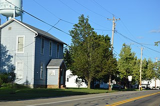
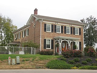
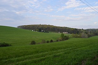
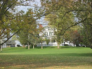
Jacksonburg is a small village in Butler County, Ohio, United States. The population was 55 at the 2020 census.

<span class="mw-page-title-main">Millville, Ohio</span> Village in Ohio, United States

Millville is a village in Butler County, Ohio, United States. The population was 634 at the 2020 census. Millville sits between Oxford, Ohio and Cincinnati, Ohio along U.S. Route 27.

<span class="mw-page-title-main">New Miami, Ohio</span> Village in Ohio, United States

New Miami is a village in St. Clair Township, located in central Butler County in the southwestern part of the U.S. state of Ohio. The population was 2,217 at the 2020 census.

<span class="mw-page-title-main">Trenton, Ohio</span> City in Ohio, United States

Trenton is a city in northeastern Butler County, Ohio, United States, west of Middletown. The population was 13,021 at the 2020 census. It is part of the Cincinnati metropolitan area.

<span class="mw-page-title-main">New Weston, Ohio</span> Village in Ohio, United States

New Weston is a village in Darke County, Ohio, United States. The population was 124 at the 2020 census.

<span class="mw-page-title-main">Addyston, Ohio</span> Village in Ohio, United States

Addyston is a village in Miami Township, Hamilton County, Ohio, United States. Located along the Ohio River, it is a western suburb of the neighboring city of Cincinnati. The population was 927 at the 2020 census.

<span class="mw-page-title-main">Butlerville, Ohio</span> Village in Ohio, United States

Butlerville is a village in central Harlan Township, Warren County, Ohio, United States, located in the southwestern part of the state. The population was 155 at the 2020 census.

<span class="mw-page-title-main">Harveysburg, Ohio</span> Village in Ohio, United States

Harveysburg is a village in Massie Township, Warren County, Ohio, United States. The population was 554 at the 2020 census. It is best known as the home of the Ohio Renaissance Festival.

<span class="mw-page-title-main">Pleasant Plain, Ohio</span> Village in Ohio, United States

Pleasant Plain is a village in Harlan Township, Warren County, Ohio, United States. The population was 129 at the 2020 census.

<span class="mw-page-title-main">Bloomdale, Ohio</span> Village in Ohio, United States

Bloomdale is a village in Wood County, Ohio, United States. The population was 665 at the 2020 census.

<span class="mw-page-title-main">Clay Township, Butler County, Pennsylvania</span> Township in Pennsylvania, United States

Clay Township is a township in Butler County, Pennsylvania, United States. The population was 2,547 at the 2020 census.

<span class="mw-page-title-main">Clinton Township, Butler County, Pennsylvania</span> Township in Pennsylvania, United States

Clinton Township is a township in Butler County, Pennsylvania, United States. The population was 2,913 at the 2020 census. For generations, it was home to a U.S. Steel plant.

<span class="mw-page-title-main">Concord Township, Butler County, Pennsylvania</span> Township in Pennsylvania, United States

Concord Township is a township in Butler County, Pennsylvania, United States. The population was 1,411 at the 2020 census.

<span class="mw-page-title-main">Donegal Township, Butler County, Pennsylvania</span> Township in Pennsylvania, United States

Donegal Township is a township in Butler County, Pennsylvania, United States. The population was 1,821 at the 2020 census.

<span class="mw-page-title-main">Sardinia, Ohio</span> Village in Ohio, United States

Sardinia is a village in Brown and Highland counties in the U.S. state of Ohio. The population was 1,083 at the 2020 census.

<span class="mw-page-title-main">College Corner, Ohio</span> Village in Ohio, United States

College Corner is a village in Butler and Preble counties in the southwestern part of the U.S. state of Ohio, 5 miles (8 km) northwest of Oxford. The population was 387 at the 2020 census. The village lies on the state line with Indiana, where it borders the town of West College Corner. The public school, part of the Union County–College Corner Joint School District, is bisected by the state line and is operated jointly with Indiana authorities.

<span class="mw-page-title-main">Monroe, Ohio</span> City in Ohio, United States

Monroe is a city in east central Butler and west central Warren counties in the southwestern part of the U.S. state of Ohio. The population was 15,412 at the 2020 census. Monroe is a part of the Cincinnati metropolitan area.

<span class="mw-page-title-main">Buckeye Lake, Ohio</span> Village in Ohio, United States

Buckeye Lake is a village in Fairfield and Licking counties in the U.S. state of Ohio. The population was 2,520 at the 2020 census. It is named for Buckeye Lake, a large lake along which the village is built.

References

  1. "ArcGIS REST Services Directory". United States Census Bureau. Retrieved September 20, 2022.
  2. 1 2 U.S. Geological Survey Geographic Names Information System: Somerville, Ohio
  3. 1 2 "U.S. Census website". United States Census Bureau . Retrieved January 31, 2008.
  4. "US Gazetteer files 2010". United States Census Bureau. Archived from the original on July 2, 2012. Retrieved January 6, 2013.
  5. Pitman, Michael D. (December 16, 2015). "Village of Somerville may soon cease to exist". Hamilton, Ohio: JournalNews . Retrieved December 19, 2015.
  6. "Somerville residents vote on dissolving village". WLWT . March 9, 2016. Retrieved March 15, 2016.
  7. "Census of Population and Housing". Census.gov. Retrieved June 4, 2015.
  8. "U.S. Census website". United States Census Bureau . Retrieved January 6, 2013.

Further reading