Millville, Ohio

Last updated

Millville, Ohio
Liberty Street, Millville.jpg
Liberty Street
Motto(s): 
"Small Town, Big Community!"
OHMap-doton-Millville.png
Location of Millville, Ohio
Map of Butler County Ohio Highlighting Millville Village.png
Location of Millville in Butler County
Coordinates: 39°23′33″N84°39′10″W / 39.39250°N 84.65278°W / 39.39250; -84.65278
Country United States
State Ohio
County Butler
Government
  MayorCurt Pennington [1]
Area
[2]
  Total0.58 sq mi (1.51 km2)
  Land0.58 sq mi (1.51 km2)
  Water0.00 sq mi (0.00 km2)
Elevation
[3]
620 ft (190 m)
Population
 (2020)
  Total634
  Density1,087.48/sq mi (419.65/km2)
Time zone UTC-5 (Eastern (EST))
  Summer (DST) UTC-4 (EDT)
ZIP code
45013
Area code 513
FIPS code 39-50540 [4]
GNIS feature ID2399364 [3]

Millville is a village in Butler County, Ohio, United States. The population was 634 at the 2020 census. Millville sits between Oxford, Ohio and Cincinnati, Ohio along U.S. Route 27.

Contents

Millville is part of Greater Cincinnati, just west of Hamilton, Ohio.

History

The village was established in 1815 by Joseph Van Horn, who opened a grist mill there about 1805. [5]

Approximately 5.5 miles to the north is the historic Presbyterian cemetery that includes graves of early pioneers including some who served in the revolutionary war. There are many graves of families with the name Ross, the name of nearby town Ross, Ohio.

Notable people

Major League Baseball's first commissioner, Kenesaw Mountain Landis, was born in Millville.

Geography

According to the United States Census Bureau, the village has a total area of 0.58 square miles (1.50 km2), all land. [6]

Demographics

Historical population
CensusPop.Note
1880 250
1930 301
1940 33511.3%
1950 45836.7%
1960 67647.6%
1970 6973.1%
1980 80916.1%
1990 755−6.7%
2000 8178.2%
2010 708−13.3%
2020 634−10.5%
U.S. Decennial Census [7]

2010 census

As of the census [8] of 2010, there were 708 people, 269 households, and 197 families living in the village. The population density was 1,220.7 inhabitants per square mile (471.3/km2). There were 298 housing units at an average density of 513.8 per square mile (198.4/km2). The racial makeup of the village was 97.5% White, 0.1% African American, 0.1% Native American, 0.8% Asian, 0.4% from other races, and 1.0% from two or more races. Hispanic or Latino of any race were 0.3% of the population.

There were 269 households, of which 36.4% had children under the age of 18 living with them, 53.2% were married couples living together, 13.4% had a female householder with no husband present, 6.7% had a male householder with no wife present, and 26.8% were non-families. 23.0% of all households were made up of individuals, and 10.7% had someone living alone who was 65 years of age or older. The average household size was 2.63 and the average family size was 3.03.

The median age in the village was 38.9 years. 23% of residents were under the age of 18; 11.4% were between the ages of 18 and 24; 24.3% were from 25 to 44; 27.4% were from 45 to 64; and 14% were 65 years of age or older. The gender makeup of the village was 48.2% male and 51.8% female.

2000 census

As of the census [4] of 2000, there were 817 people, 312 households, and 247 families living in the village. The population density was 1,382.8 inhabitants per square mile (533.9/km2). There were 330 housing units at an average density of 558.6 per square mile (215.7/km2). The racial makeup of the village was 98.29% White, 0.61% African American, 0.12% Native American, 0.12% Asian, 0.37% from other races, and 0.49% from two or more races.

There were 312 households, out of which 35.6% had children under the age of 18 living with them, 59.6% were married couples living together, 15.1% had a female householder with no husband present, and 20.8% were non-families. 17.6% of all households were made up of individuals, and 6.7% had someone living alone who was 65 years of age or older. The average household size was 2.62 and the average family size was 2.93.

In the village, the population was spread out, with 25.6% under the age of 18, 6.7% from 18 to 24, 30.5% from 25 to 44, 25.8% from 45 to 64, and 11.4% who were 65 years of age or older. The median age was 37 years. For every 100 females there were 87.8 males. For every 100 females age 18 and over, there were 89.4 males.

The median income for a household in the village was $45,341, and the median income for a family was $45,972. Males had a median income of $39,306 versus $25,208 for females. The per capita income for the village was $18,835. About 6.5% of families and 7.0% of the population were below the poverty line, including 9.9% of those under age 18 and 11.0% of those age 65 or over.

Education

The village of Millville and surrounding Ross Township is served by the Ross Local School District and Ross High School. The athletic teams at Ross are known as the Rams and compete in the Southwest Ohio Conference (SWOC).

Schools

Related Research Articles

<span class="mw-page-title-main">Millville, Iowa</span> Unincorporated in Iowa, United States

Millville is an unincorporated town and former city in Clayton County, Iowa, United States. The population was 30 at the 2010 census, up from 23 in the 2000 census, before it became unincorporated.

<span class="mw-page-title-main">Jacksonburg, Ohio</span> Village in Ohio, United States

Jacksonburg is a small village in Butler County, Ohio, United States. The population was 55 at the 2020 census.

<span class="mw-page-title-main">New Miami, Ohio</span> Village in Ohio, United States

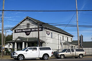
New Miami is a village in St. Clair Township, located in central Butler County in the southwestern part of the U.S. state of Ohio. The population was 2,217 at the 2020 census.

<span class="mw-page-title-main">Ross, Ohio</span> Census-designated place in Ohio, United States

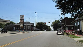
Ross is a census-designated place (CDP) in Ross Township, Butler County, Ohio, United States. The population was 3,478 at the 2020 census. Ross sits along U.S. Route 27 between Cincinnati, Ohio and Oxford, Ohio. Ross is part of the Cincinnati metropolitan area.

<span class="mw-page-title-main">Somerville, Ohio</span> Census-designated place in Ohio, United States

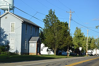
Somerville is a census-designated place (CDP) and former village in Milford Township, Butler County, Ohio, United States. The population was 258 at the 2020 census.

<span class="mw-page-title-main">Warsaw, Ohio</span> Village in Ohio, United States

Warsaw is a village in Coshocton County, Ohio, United States, along the Walhonding River. The population was 624 at the 2020 census.

<span class="mw-page-title-main">Rossburg, Ohio</span> Village in Ohio, United States

Rossburg is a village in Darke County, Ohio, United States. The population was 159 at the 2020 census.

<span class="mw-page-title-main">Jamestown, Ohio</span> Village in Ohio, United States

Jamestown is a village in Greene County, Ohio, United States. The population was 2,052 at the 2020 census.

<span class="mw-page-title-main">Addyston, Ohio</span> Village in Ohio, United States

Addyston is a village in Miami Township, Hamilton County, Ohio, United States. Located along the Ohio River, it is a western suburb of the neighboring city of Cincinnati. The population was 927 at the 2020 census.

<span class="mw-page-title-main">Evendale, Ohio</span> Village in Ohio, United States

Evendale is a village in Hamilton County, Ohio, United States, within the Cincinnati metropolitan area. The population was 2,669 at the 2020 census.

<span class="mw-page-title-main">Springdale, Ohio</span> City in Ohio, United States

Springdale is a city in Hamilton County, Ohio, United States. It is a suburb of Cincinnati. The population was 11,007 at the 2020 census.

<span class="mw-page-title-main">Montezuma, Ohio</span> Village in Ohio, United States

Montezuma is a village in Mercer County, Ohio, United States. The population was 152 at the 2020 census.

<span class="mw-page-title-main">Chesterville, Ohio</span> Village in Ohio, United States

Chesterville is a village in Morrow County, Ohio, United States, along the Kokosing River. The population was 191 at the 2020 census. Chesterville is southeast of Mount Gilead, the county seat.

<span class="mw-page-title-main">Adelphi, Ohio</span> Village in Ohio, United States

Adelphi is a village in Ross County, Ohio, United States. The population was 322 at the 2020 census.

<span class="mw-page-title-main">Clarksburg, Ohio</span> Village in Ohio, United States

Clarksburg is a village in Ross County, Ohio, United States. The population was 409 at the 2020 census.

<span class="mw-page-title-main">Frankfort, Ohio</span> Village in Ohio, United States

Frankfort is a village in Ross County, Ohio, United States, along the North Fork of Paint Creek. The village is located in Concord Township. The population was 1,084 at the 2020 census.

<span class="mw-page-title-main">Kingston, Ohio</span> Village in Ohio, United States

Kingston is a village in Ross County, Ohio, United States. The population was 1,262 at the 2020 census.

<span class="mw-page-title-main">Tuscarawas, Ohio</span> Village in Ohio, United States

Tuscarawas, originally Trenton, is a village in Tuscarawas County, Ohio, United States. The population was 1,035 at the 2020 census.

<span class="mw-page-title-main">Macksburg, Ohio</span> Village in Ohio, United States

Macksburg is a village in Washington County, Ohio, United States, along the West Fork of Duck Creek. The population was 120 at the 2020 census. The village is about 28 miles (45 km) south of Cambridge, Ohio.

<span class="mw-page-title-main">College Corner, Ohio</span> Village in Ohio, United States

College Corner is a village in Butler and Preble counties in the southwestern part of the U.S. state of Ohio, 5 miles (8 km) northwest of Oxford. The population was 387 at the 2020 census. The village lies on the state line with Indiana, where it borders the town of West College Corner. The public school, part of the Union County–College Corner Joint School District, is bisected by the state line and is operated jointly with Indiana authorities.

References

  1. "Election Night Results". Butler County Board of Elections. Retrieved November 25, 2023.
  2. "ArcGIS REST Services Directory". United States Census Bureau. Retrieved September 20, 2022.
  3. 1 2 U.S. Geological Survey Geographic Names Information System: Millville, Ohio
  4. 1 2 "U.S. Census website". United States Census Bureau . Retrieved January 31, 2008.
  5. Bartlow, Bert Surene (1905). Centennial History of Butler County, Ohio. B. F. Bowen. p. 346.
  6. "US Gazetteer files 2010". United States Census Bureau. Archived from the original on January 25, 2012. Retrieved January 6, 2013.
  7. "Census of Population and Housing". Census.gov. Retrieved June 4, 2015.
  8. "U.S. Census website". United States Census Bureau . Retrieved January 6, 2013.

Further reading