Fairview, Monmouth County, New Jersey

Last updated

Fairview, New Jersey
Fairview, Monmouth, NJ.jpg
Looking south along Route 35
Fairview cdp nj 025.png
Map of Fairview CDP in Monmouth County. Inset: Location of Monmouth County in New Jersey.
Location map of Monmouth County, New Jersey.svg
Red pog.svg
Fairview
Location in Monmouth County
USA New Jersey relief location map.svg
Red pog.svg
Fairview
Location in New Jersey
Usa edcp relief location map.png
Red pog.svg
Fairview
Location in the United States
Coordinates: 40°21′55″N74°04′50″W / 40.365312°N 74.080588°W / 40.365312; -74.080588
Country Flag of the United States.svg  United States
State Flag of New Jersey.svg  New Jersey
County Monmouth
Township Middletown
Area
[1]
  Total1.289 sq mi (3.337 km2)
  Land1.280 sq mi (3.314 km2)
  Water0.009 sq mi (0.023 km2)  0.69%
Elevation
[2]
46 ft (14 m)
Population
  Total3,731
  Density2,900/sq mi (1,100/km2)
Time zone UTC−05:00 (Eastern (EST))
  Summer (DST) UTC−04:00 (Eastern (EDT))
Area code(s) 732/848
FIPS code 34-22740 [1] [4] [5]
GNIS feature ID02389068 [1] [6]

Fairview is an unincorporated community and census-designated place (CDP) [7] located within Middletown Township, in Monmouth County, in the U.S. state of New Jersey. [8] [9] As of the 2010 United States Census, the CDP's population was 3,806. [10]

Contents

Geography

According to the United States Census Bureau, the CDP had a total area of 1.289 square miles (3.337 km2), including 1.280 square miles (3.314 km2) of land and 0.009 square miles (0.023 km2) of water (0.69%). [1] [11]

Demographics

Historical population
CensusPop.Note
1990 3,853
2000 3,9422.3%
2010 3,806−3.5%
2020 3,731−2.0%
Population sources:
1990-2010 [8] 2000 [12]
2010 [10] 2020 [3]

2010 census

The 2010 United States census counted 3,806 people, 1,317 households, and 1,083 families in the CDP. The population density was 2,974.5 per square mile (1,148.5/km2). There were 1,346 housing units at an average density of 1,051.9 per square mile (406.1/km2). The racial makeup was 95.27% (3,626) White, 0.84% (32) Black or African American, 0.00% (0) Native American, 1.23% (47) Asian, 0.05% (2) Pacific Islander, 1.26% (48) from other races, and 1.34% (51) from two or more races. Hispanic or Latino of any race were 5.47% (208) of the population. [10]

Of the 1,317 households, 39.3% had children under the age of 18; 70.2% were married couples living together; 7.2% had a female householder with no husband present and 17.8% were non-families. Of all households, 14.3% were made up of individuals and 6.5% had someone living alone who was 65 years of age or older. The average household size was 2.89 and the average family size was 3.22. [10]

26.2% of the population were under the age of 18, 6.0% from 18 to 24, 25.0% from 25 to 44, 31.8% from 45 to 64, and 10.9% who were 65 years of age or older. The median age was 40.9 years. For every 100 females, the population had 100.1 males. For every 100 females ages 18 and older there were 96.6 males. [10]

2000 census

At the 2000 United States Census [4] there were 3,942 people, 1,331 households and 1,095 families living in the CDP. The population density was 3,067.7 inhabitants per square mile (1,184.4/km2). There were 1,344 housing units at an average density of 1,045.9 per square mile (403.8/km2). The racial makeup of the CDP was 95.92% White, 0.56% African American, 1.98% Asian, 0.03% Pacific Islander, 0.46% from other races, and 1.07% from two or more races. Hispanic or Latino of any race were 4.06% of the population. [12]

There were 1,331 households, of which 42.5% had children under the age of 18 living with them, 71.5% were married couples living together, 7.7% had a female householder with no husband present, and 17.7% were non-families. 14.0% of all households were made up of individuals, and 6.2% had someone living alone who was 65 years of age or older. The average household size was 2.96 and the average family size was 3.29. [12]

The age distribution was 27.6% under the age of 18, 6.3% from 18 to 24, 31.3% from 25 to 44, 25.0% from 45 to 64, and 9.9% who were 65 years of age or older. The median age was 37 years. For every 100 females, there were 99.9 males. For every 100 females age 18 and over, there were 96.9 males. [12]

The median household income was $81,733, and the median family income was $85,993. Males had a median income of $65,986 versus $31,510 for females. The per capita income was $29,914. About 1.8% of families and 1.8% of the population were below the poverty line, including 2.3% of those under age 18 and 1.3% of those age 65 or over. [12]

Transportation

New Jersey Transit offers local bus service on the 834 route. [13] New Jersey Route 35 is a major highway in Fairview linking the CDP to Red Bank and Keyport.

Related Research Articles

<span class="mw-page-title-main">Fairview, California</span> CDP in California, United States

Fairview is a census-designated place (CDP) in Alameda County, California, United States. It borders on the city of Hayward and the census-designated place of Castro Valley. The population was 11,341 at the 2020 census.

<span class="mw-page-title-main">Concordia, New Jersey</span> Populated place in Middlesex County, New Jersey, US

Concordia is an unincorporated community and census-designated place (CDP) located within Monroe Township, in Middlesex County, in the U.S. state of New Jersey. The CDP is oriented around the age restricted gated community of Concordia. As of the 2010 United States Census, the CDP's population was 3,092.

<span class="mw-page-title-main">Monmouth Junction, New Jersey</span> Populated place in Middlesex County, New Jersey, US

Monmouth Junction is an unincorporated community and census designated place (CDP) located within South Brunswick, in Middlesex County, in the U.S. state of New Jersey. As of the 2010 United States Census, the CDP's population was 2,887.

<span class="mw-page-title-main">Plainsboro Center, New Jersey</span> Populated place in Middlesex County, New Jersey, US

Plainsboro Center is an unincorporated community and census-designated place (CDP) located within Plainsboro Township, in Middlesex County, in the U.S. state of New Jersey. As of the 2010 United States Census, the CDP's population was 2,712.

<span class="mw-page-title-main">East Freehold, New Jersey</span> Populated place in Monmouth County, New Jersey, US

East Freehold is an unincorporated community and census-designated place (CDP) located within Freehold Township, in Monmouth County, in the U.S. state of New Jersey. As of the 2010 United States Census, the CDP's population was 4,894.

<span class="mw-page-title-main">Lincroft, New Jersey</span> Census-designated place in New Jersey, United States

Lincroft is an unincorporated community and census-designated place (CDP) within Middletown Township, in Monmouth County, in the U.S. state of New Jersey. As of the 2020 United States census, the CDP had a population of 7,060, teflecting a 15.1% increase from the 6,135 residents enumerated at the 2010 U.S. Census, in turn a decline of 120 residents (-1.9%) from the 6,255 counted in the 2000 U.S. Census.

<span class="mw-page-title-main">Morganville, New Jersey</span> Populated place in Monmouth County, New Jersey, US

Morganville is an unincorporated community and census-designated place (CDP) within Marlboro Township, in Monmouth County, New Jersey. As of the 2010 United States Census, the CDP's population was 5,040.

<span class="mw-page-title-main">Navesink, New Jersey</span> Populated place in Monmouth County, New Jersey, US

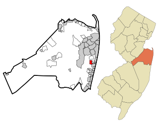
Navesink is an unincorporated community and census-designated place (CDP) located on the northernmost stretch of the Jersey Shore in Middletown Township in Monmouth County, in the U.S. state of New Jersey. As of the 2020 United States census, the CDP's population was 2,004, reflecting a decrease of 16 (-0.8%) from thd 2,020 residents enumerated at the 2010 U.S. census.

<span class="mw-page-title-main">North Middletown, New Jersey</span> Populated place in Monmouth County, New Jersey, US

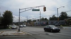
North Middletown is an unincorporated community and census-designated place (CDP) within Middletown Township, in Monmouth County, in the U.S. state of New Jersey. As of the 2010 United States Census, the CDP's population was 3,295.

<span class="mw-page-title-main">Oakhurst, New Jersey</span> Place in Monmouth County, New Jersey, United States

Oakhurst is an unincorporated community and census-designated place (CDP) within Ocean Township, in Monmouth County, in the U.S. state of New Jersey. As of the 2010 United States Census, the CDP's population was 3,995.

<span class="mw-page-title-main">Port Monmouth, New Jersey</span> Populated place in Monmouth County, New Jersey, US

Port Monmouth is an unincorporated community and census-designated place (CDP) within Middletown Township, in Monmouth County, in the U.S. state of New Jersey. At the 2010 census, the CDP's population was 3,818.

<span class="mw-page-title-main">Shark River Hills, New Jersey</span> Populated place in Monmouth County, New Jersey, US

Shark River Hills is an unincorporated community and census-designated place (CDP) within Neptune Township, in Monmouth County, in the U.S. state of New Jersey. As of the 2010 United States Census, the CDP's population was 3,697.

<span class="mw-page-title-main">Wanamassa, New Jersey</span> Populated place in Monmouth County, New Jersey, US

Wanamassa is an unincorporated community and census-designated place (CDP) within Ocean Township, in Monmouth County, in the U.S. state of New Jersey. As of the 2010 United States Census, the CDP's population was 4,532. The community was named for Wanamassa, a Native American leader of the 17th century.

<span class="mw-page-title-main">West Belmar, New Jersey</span> Populated place in Monmouth County, New Jersey, US

West Belmar is an unincorporated community and census-designated place (CDP) within Wall Township, in Monmouth County, in the U.S. state of New Jersey. At the 2010 census, the CDP's population was 2,493.

<span class="mw-page-title-main">Allenwood, New Jersey</span> Populated place in Monmouth County, New Jersey, US

Allenwood is an unincorporated community and census-designated place (CDP) located within Wall Township, in Monmouth County, in the U.S. state of New Jersey. As of the 2010 United States Census, the CDP's population was 925.

<span class="mw-page-title-main">Belford, New Jersey</span> Populated place in Monmouth County, New Jersey, US

Belford is an unincorporated community and census-designated place (CDP) located within Middletown Township, in Monmouth County, in the U.S. state of New Jersey. As of the 2010 United States census, the CDP's population was 1,768.

<span class="mw-page-title-main">Strathmore, New Jersey</span> Populated place in Monmouth County, New Jersey, US

Strathmore is an unincorporated community and census-designated place (CDP) within Aberdeen Township, in Monmouth County, in the U.S. state of New Jersey. At the 2010 census, the CDP's population was 7,258.

<span class="mw-page-title-main">Yorketown, New Jersey</span> Populated place in Monmouth County, New Jersey, US

Yorketown is an unincorporated community and census-designated place (CDP) within Manalapan Township, in Monmouth County, in the U.S. state of New Jersey. At the 2020 census, the CDP's population was 6,739.

<span class="mw-page-title-main">Ramtown, New Jersey</span> Populated place in Monmouth County, New Jersey, US

Ramtown is a census-designated place and unincorporated community located within Howell Township, in Monmouth County, in the U.S. state of New Jersey. As of the 2010 United States Census, the CDP's population was 6,242.

<span class="mw-page-title-main">Robertsville, New Jersey</span> Populated place in Monmouth County, New Jersey, US

Robertsville is a census-designated place and unincorporated community located within Marlboro Township, in Monmouth County, in the U.S. state of New Jersey. At the 2010 census, the CDP's population was 11,297.

References

  1. 1 2 3 4 Gazetteer of New Jersey Places, United States Census Bureau. Accessed July 21, 2016.
  2. U.S. Geological Survey Geographic Names Information System: Fairview Census Designated Place, Geographic Names Information System. Accessed August 7, 2012.
  3. 1 2 Census Data Explorer: Fairview CDP, New Jersey, United States Census Bureau. Accessed June 15, 2023.
  4. 1 2 U.S. Census website, United States Census Bureau. Accessed September 4, 2014.
  5. Geographic Codes Lookup for New Jersey, Missouri Census Data Center. Accessed June 9, 2023.
  6. US Board on Geographic Names, United States Geological Survey. Accessed September 4, 2014.
  7. State of New Jersey Census Designated Places - BVP20 - Data as of January 1, 2020, United States Census Bureau. Accessed December 1, 2022.
  8. 1 2 New Jersey: 2010 - Population and Housing Unit Counts - 2010 Census of Population and Housing (CPH-2-32), United States Census Bureau, August 2012. Accessed December 16, 2012.
  9. GCT-PH1 - Population, Housing Units, Area, and Density: 2010 - County -- County Subdivision and Place from the 2010 Census Summary File 1 for Monmouth County, New Jersey Archived 2020-02-12 at archive.today , United States Census Bureau. Accessed December 16, 2012.
  10. 1 2 3 4 5 DP-1 - Profile of General Population and Housing Characteristics: 2010 Demographic Profile Data for Fairview CDP, New Jersey Archived 2020-02-12 at archive.today , United States Census Bureau. Accessed August 7, 2012.
  11. US Gazetteer files: 2010, 2000, and 1990, United States Census Bureau. Accessed September 4, 2014.
  12. 1 2 3 4 5 DP-1 - Profile of General Demographic Characteristics: 2000 from the Census 2000 Summary File 1 (SF 1) 100-Percent Data for Fairview, Monmouth County CDP, New Jersey Archived 2020-02-12 at archive.today , United States Census Bureau. Accessed December 16, 2012.
  13. Monmouth County Bus / Rail Connections, New Jersey Transit, backed up by the Internet Archive as of July 26, 2010. Accessed August 7, 2012.