Colts Neck Township is a township in Monmouth County, New Jersey, United States. It is located in the New York Metropolitan Area. As of the 2020 United States census, the township's population was 9,957, a decrease of 185 (−1.8%) from the 2010 census count of 10,142, which in turn reflected a decline of 2,189 (−17.8%) from the 12,331 counted in the 2000 census.

Englishtown is a borough in Monmouth County, in the U.S. state of New Jersey. The community is nestled within the Raritan Valley region. As of the 2010 United States census, the borough's population was 1,847, reflecting an increase of 83 (+4.7%) from the 1,764 counted in the 2000 Census, which had in turn increased by 496 (+39.1%) from the 1,268 counted in the 1990 Census.

Farmingdale is a borough in Monmouth County, in the U.S. state of New Jersey. As of the 2010 United States Census, the borough's population was 1,329, reflecting a decline of 258 (−16.3%) from the 1,587 counted in the 2000 Census, which had in turn increased by 125 (+8.5%) from the 1,462 counted in the 1990 Census.

Freehold is a borough and the county seat of Monmouth County, in the U.S. state of New Jersey. Known for its Victorian era homes and rich colonial history, the borough is located in the Raritan Valley region within the New York Metropolitan Area, located about 33 miles (53 km) from Manhattan and 17 miles (27 km) from Staten Island. The borough has grown to become a commuter town of New York City. As of the 2020 United States census, the borough's population was 12,538, an increase of 486 (+4.0%) from the 2010 census count of 12,052, which in turn reflected an increase of 1,076 (+9.8%) from the 10,976 counted at the 2000 census.

Freehold Township is a township in Monmouth County, in the U.S. state of New Jersey. Located in Central New Jersey and crisscrossed by several major highways, the township is known for being the regional commercial hub for Monmouth County and as a suburban bedroom community of New York City, located within the Raritan Valley region of the much larger New York Metropolitan Area. The township is located roughly 38 miles (61 km) away from Manhattan and about 20 miles (32 km) away from Staten Island. As of the 2020 United States census, the township's population was 35,369, a decrease of 815 (−2.3%) from the 2010 census count of 36,184, which in turn reflected an increase of 4,647 (+14.7%) from the 31,537 counted in the 2000 census.
Manalapan Township is a township in Monmouth County, in the U.S. state of New Jersey. The township is centrally located within the Raritan Valley region and is a part of the New York Metropolitan Area. As of the 2020 United States census, the township's population was 40,905, its highest decennial count ever and an increase of 2,033 (+5.2%) from the 2010 census count of 38,872, which in turn reflected an increase of 5,449 (+16.3%) from the 33,423 counted in the 2000 census.
Millstone Township is a township in Monmouth County, in the U.S. state of New Jersey. The Township is located within the Raritan Valley region and is a part of the New York metropolitan area. As of the 2020 United States census, the township's population was 10,376, a decrease of 190 (−1.8%) from the 2010 census count of 10,566, which in turn reflected an increase of 1,596 (+17.8%) from the 8,970 counted in the 2000 census.

West Freehold is an unincorporated community and census-designated place (CDP) within Freehold Township, in Monmouth County, New Jersey, United States. As of the 2010 United States Census, the CDP's population was 13,613. Due to the community's close proximity to the Battle of Monmouth, West Freehold is home to several important historical structures, which have been preserved in the 'West Freehold Village Historic District'. The historically preserved Monmouth Battlefield, along with the historic villages of Clarksburg, Englishtown, Smithburg and Tennent are a short distance away.

Clarksburg is an unincorporated community located within Millstone Township in Monmouth County, New Jersey, United States. The area is served as United States Postal Service ZIP code 08510.
Freehold High School is a four-year public high school serving students in ninth through twelfth grades, located within Freehold Borough, New Jersey, United States, operating as one of the six secondary schools of the Freehold Regional High School District. Established in 1923, the school serves students from all of Freehold Borough and from portions of Freehold Township. Freehold High School is the home of the Medical Sciences Learning Center, the Computer Science Academy and the Culinary Arts/Hospitality Management Academy. The school has been accredited by the Middle States Association of Colleges and Schools Commission on Elementary and Secondary Schools since 1928.

Adelphia is an unincorporated community located within the northern section of Howell Township in Monmouth County, New Jersey, United States. The area is served as United States Postal Service ZIP code 07710. The community borders Freehold Township.

County Route 522 is a county highway in the U.S. state of New Jersey. The highway extends 21 miles (34 km) from Route 27 in South Brunswick Township to Main Street in Freehold Borough.

Millhurst is an unincorporated community located within Manalapan Township in Monmouth County, New Jersey, United States. Route 33 and County Route 527 pass through the center of Millhurst. Much of the area consists of businesses along the aforementioned arterial roads with the Millhurst Mill at the CR 527 crossing of Manalapan Brook. The mill is a former grist mill built in the 1700s, rebuilt in the 1800s as a more efficient mill, and turned into a family business by Bernard Hochberg in 1925.

Smithburg is an unincorporated community located where the municipal boundaries of Freehold, Manalapan and Millstone townships intersect in Monmouth County, New Jersey, United States. County Route 527 and Monmouth Road pass through the center of the quaint village of Smithburg.

Prospertown is an unincorporated community located within the New Jersey townships of Jackson and Plumsted in Ocean County and Upper Freehold in Monmouth County. The community is home to Prospertown Lake and is adjacent to Six Flags Great Adventure, both located on County Route 537. The center of the community is located at the intersection of CR 537, Hawkin Road, and Emleys Hill Road. Most of the area consists of pine forests but there are some homes along the roads in the area.

Charleston Springs is an unincorporated community located within Millstone Township in Monmouth County, in the U.S. state of New Jersey. Stage Coach Road, also designated County Route 524, is the main road that runs through the settlement, with Ely Harmony Road as the intersecting road defining the locality. The Manalapan Brook runs to the west of the center of Charleston Springs and CR 537 runs to the south of the area. The Monmouth County-owned Charleston Springs Golf Course is located one mile (1.6 km) northeast of the center of Charleston Springs on CR 527.

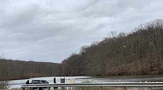
Freewood Acres is an unincorporated community located within Howell Township in Monmouth County, New Jersey, United States. The area is made up of mostly single-story homes arranged along a street grid in the northern reaches of the Pine Barrens. U.S. Route 9 runs through the center of the community just north of its interchange with Interstate 195. The Land O'Pines Elementary School and Manasquan Reservoir County Park exist to the east of the community. It became the center of the Kalmyk American community in the latter part of the 20th century.

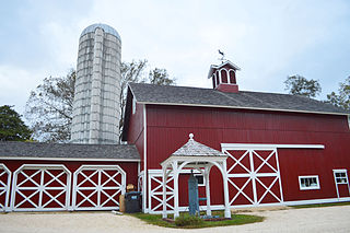
Red Valley is an unincorporated community located within Upper Freehold Township in Monmouth County, New Jersey, United States. The settlement is located at the intersection of County Route 526 and Red Valley Road (south) and Yellow Meetinghouse Road (north) near the township's eastern border with Millstone Township. Except for some single-family houses located along the roads in the area, the area is primarily made up of farmland.

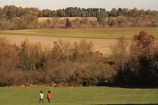
West Farms is an unincorporated community located within Howell Township in Monmouth County, New Jersey, United States. The settlement is centered on the intersection of West Farms Road and Casino Drive, located to the west of Farmingdale and to the north of the Manasquan Reservoir. It was once home Jewish farmers who settled there in the early 20th century. The rural area is mostly made up of wooded areas with some houses and churches dotted along the two aforementioned roads. Numerous small farms are also located throughout the area.
Carl Raymond Woodward was an American educator and college administrator who served from 1951 to 1958 as the first president of the University of Rhode Island.


