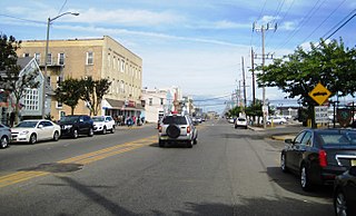
Route 36 is a state highway in Monmouth County, New Jersey, United States. The 24.40-mile (39.27 km) long route, shaped as a backwards C, begins at an intersection with the Garden State Parkway and County Route 51 on the border of Tinton Falls and Eatontown and runs east to Long Branch. From Long Branch, the route follows the Atlantic Ocean north to Sea Bright and turns west, running to the south of the Raritan Bay. Route 36 ends in Keyport at an interchange with the Garden State Parkway and Route 35. It varies in width from a six-lane divided highway to a two-lane undivided road. The route is signed east–west between Eatontown and Long Branch and north–south between Long Branch and Keyport.

Fair Haven is a borough in Monmouth County, New Jersey, along the Navesink River and is part of the New York Metropolitan Area. Fair Haven is located on the Rumson peninsula and is bordered by Red Bank and Little Silver to the west. As of the 2010 United States Census, the borough's population was 6,121, reflecting an increase of 184 (+3.1%) from the 5,937 counted in the 2000 Census, which had in turn increased by 667 (+12.7%) from the 5,270 counted in the 1990 Census.

Rumson is a borough in Monmouth County, New Jersey, United States, and is part of the New York Metropolitan Area. As of the 2010 census, the borough's population was 7,122, reflecting a decline of 15 (−0.2%) from 7,137 in 2000, which had in turn increased by 436 (+6.5%) from 6,701 in 1990.
Sea Bright is a borough in Monmouth County, New Jersey, United States. As of the 2010 United States Census, the borough's population was 1,412, reflecting a decline of 406 (-22.3%) from the 1,818 counted in the 2000 Census, which had in turn increased by 125 (+7.4%) from the 1,693 counted in the 1990 Census.
Route 147 is a 4.20-mile (6.76 km) state highway located in Cape May County in New Jersey, United States. It is a short connector between U.S. Route 9 in Middle Township and North Wildwood at New York Avenue. West of U.S. Route 9, the road continues to Route 47 as County Route 618 ; this route along with Route 147 provides an alternate route to The Wildwoods from Route 47. East of New York Avenue, the route continues south through The Wildwoods as County Route 621. The route passes through mostly marshland along its journey, intersecting the Garden State Parkway at a partial interchange and County Route 619.

Harmony is an unincorporated community located within Jackson Township, in Ocean County, New Jersey, United States.
The Rumson-Fair Haven Regional High School is a regional, four-year comprehensive public high school and school district in the eastern United States, serving students in ninth through twelfth grades from the suburban communities of Fair Haven and Rumson, which are situated on a peninsula bounded by the Navesink and Shrewsbury Rivers and the Atlantic Ocean, in northern Monmouth County, New Jersey. The school has been accredited by the Middle States Association of Colleges and Schools Commission on Elementary and Secondary Schools since 1940.
The Fair Haven Public Schools is a comprehensive community public school district that serves students in pre-kindergarten through eighth grade from Fair Haven, in Monmouth County, New Jersey, United States.
Wayside is an unincorporated community located along the border of Tinton Falls Borough and Ocean Township in Monmouth County, New Jersey, United States. The community is largely residential though some churches, parks, and schools are located in the area. The main arterial roads in the community are Hope Road, Wayside Road, and West Park Avenue. Access to New Jersey Route 18 is available via nearby interchanges with Deal Road, West Park Avenue, and Wayside Road; the Garden State Parkway's exit 105 is also located north of Wayside. The building that once housed the 16-lane Wayside Bowl-O-Drome is still in use, now as an office building.
The Rumson School District is a community public school district that serves students in pre-kindergarten through eighth grade from the Borough of Rumson, in Monmouth County, New Jersey, United States.
County Route 520 is a county highway in the U.S. state of New Jersey. County Route 520 is a major road across Monmouth County connecting the county's central towns to the Jersey Shore at Sea Bright. The highway extends 22.39 miles (36.03 km) from Englishtown Road in Old Bridge Township to Ocean Avenue in Sea Bright.

Locust is an unincorporated community located within Middletown Township in Monmouth County, New Jersey, United States. It is situated along the north banks of the Navesink River and Claypit Creek. The area consists of mostly medium-to-large sized houses throughout the hilly terrain of this part of the township. The Oceanic Bridge connects Locust with Rumson to the south.

Toms River is a township in Ocean County, New Jersey, United States. Its mainland portion is also a census-designated place of the same name, which serves as the county seat of Ocean County. Formerly known as the Township of Dover, in 2006 voters approved a change of the official name to the Township of Toms River, adopting the name of the largest unincorporated community within the township. Located at the heart of the Jersey Shore region, the township is a bedroom suburb of New York City in the New York metropolitan area and a regional commercial hub in central New Jersey.

River Plaza is an unincorporated community located within Middletown Township in Monmouth County, New Jersey, United States. It is adjacent to the Navesink River and Shadow Lake.

Holmeson is an unincorporated community located within Millstone Township in Monmouth County, New Jersey, United States. As it is located along County Route 537 through which the Monmouth–Ocean county line runs down the center, portions of the community are also located in Jackson Township. Owing to its location near Interstate 195 and Six Flags Great Adventure, the community is mostly made up of gas stations, restaurants, and small businesses though the Jackson Premium Outlets occupies land just south of the community.

West Allenhurst is an unincorporated community located within Ocean Township in Monmouth County, New Jersey, United States. The area is served as United States Postal Service ZIP code 07711. As of the 2000 United States Census, the population for ZIP Code Tabulation Area 07711 was 1,934. West Allenhurst is bordered by Allenhurst to the east, Deal to the northeast, and Interlaken to the south. Major arterial roads in the community are the east-west Corlies Avenue and the north-south Monmouth Road.

Prospertown is an unincorporated community located within the New Jersey townships of Jackson and Plumsted in Ocean County and Upper Freehold in Monmouth County. The community is home to Prospertown Lake and is adjacent to Six Flags Great Adventure, both located on County Route 537. The center of the community is located at the intersection of CR 537, Hawkin Road, and Emleys Hill Road. Most of the area consists of pine forests but there are some homes along the roads in the area.

Breton Woods is an unincorporated community located within Brick Township, in Ocean County, New Jersey, United States. The community is located near the Metedeconk River and is bisected by Mantoloking Road. Except for commercial businesses located along Mantoloking Road, the area was made up of bungalows dotting the small roads throughout the area until people started selling their houses and buyers started building bigger houses.

Galilee is an unincorporated community located within Monmouth Beach in Monmouth County, New Jersey, United States. The area is named for the Biblical city of Galilee and was founded as a fishing village. Located at the northern extent of Monmouth Beach, it is located along the peninsula where it begins to greatly narrow between the Shrewsbury River and the Atlantic Ocean. Single family homes typically make up the ocean side of the peninsula while condominiums and a marina are located on the river side. The Sea Bright–Monmouth Beach Seawall passes through the community and continues to neighboring Sea Bright.

Normandie is an unincorporated community located within Sea Bright in Monmouth County, New Jersey, United States. The community is one of the four main built-up areas of Sea Bright and is a former stop on the New Jersey Southern Railroad. It is located along Route 36 between the CR 520 drawbridge to Rumson and Sandy Hook on a narrow strip of land between the Shrewsbury River and the Atlantic Ocean. The Sea Bright–Monmouth Beach Seawall passes through the neighborhood and Navesink Beach.


