Sandoval County, New Mexico

Last updated

Sandoval County
Sandoval County New Mexico Court House.jpg
Sandoval County Courthouse in Bernalillo
Sandoval County nm seal.jpg
Map of New Mexico highlighting Sandoval County.svg
Location within the U.S. state of New Mexico
New Mexico in United States.svg
New Mexico's location within the U.S.
Coordinates: 35°41′N106°51′W / 35.69°N 106.85°W / 35.69; -106.85
CountryFlag of the United States.svg United States
StateFlag of New Mexico.svg  New Mexico
Founded1903
Named for Sandoval family
Seat Bernalillo
Largest city Rio Rancho
Area
  Total3,716 sq mi (9,620 km2)
  Land3,711 sq mi (9,610 km2)
  Water5.3 sq mi (14 km2)  0.1%
Population
 (2020)
  Total148,834
  Density35/sq mi (14/km2)
Time zone UTC−7 (Mountain)
  Summer (DST) UTC−6 (MDT)
Congressional districts 1st, 3rd
Website www.sandovalcountynm.gov

Sandoval County (Spanish : Condado de Sandoval) is located in the U.S. state of New Mexico. As of the 2020 census, the population was 148,834, making it the fourth-most populous county in New Mexico. The county seat is Bernalillo. [1]

Contents

Sandoval County is part of the Albuquerque metropolitan area.

History

Sandoval County was created in 1903 from the northern part of Bernalillo County. Its name comes from one of the large land-holding Spanish families in the area. The original county seat was Corrales, but it was moved to Bernalillo in 1905. [2]

Mormon Battalion Monument (New Mexico) is in the county.

Geography

According to the U.S. Census Bureau, the county has a total area of 3,716 square miles (9,620 km2), of which 3,711 square miles (9,610 km2) is land and 5.3 square miles (14 km2) (0.1%) is water. [3] The highest point in the county is the summit of Redondo Peak, at 11,254 feet (3,430 m).

A relatively small portion of the county exists as a geographically separate exclave between Los Alamos County and Santa Fe County. This came about when Los Alamos County was created; the land that became the exclave would have been part of Los Alamos but was excluded owing to its sacred status among the local Indians. Rather than be ceded to neighboring Santa Fe (or Los Alamos) it has remained part of Sandoval.

Adjacent counties

Native American Reservations

Northside of Jemez Pueblo, New Mexico, 1915 Northside of Jemez Pueblo, New Mexico, 1915.jpg
Northside of Jemez Pueblo, New Mexico, 1915

Sandoval County has 12 Indian reservations and two joint-use areas lying within its borders. This is the second highest number of reservations of any county in the United States (after San Diego County, California, which has 18 reservations.) Riverside County, California also has 12 reservations, but no joint-use areas.

National protected areas

Demographics

Historical population
CensusPop.Note
1910 8,579
1920 8,8633.3%
1930 11,14425.7%
1940 13,89824.7%
1950 12,438−10.5%
1960 14,20114.2%
1970 17,49223.2%
1980 34,79998.9%
1990 63,31982.0%
2000 89,90842.0%
2010 131,56146.3%
2020 148,83413.1%
U.S. Decennial Census [4]
1790–1960 [5] 1900–1990 [6]
1990–2000 [7] 2010–2016 [8]

2000 census

As of the 2000 census, [9] there were 89,908 people, 31,411 households, and 23,621 families living in the county. The population density was 24 people per square mile (9.3 people/km2). There were 34,866 housing units at an average density of 9 per square mile (3.5/km2). The racial makeup of the county was 65.08% White, 16.28% Native American, 1.71% Black or African American, 0.99% Asian, 0.11% Pacific Islander, 12.37% from other races, and 3.47% from two or more races. 29.40% of the population were Hispanic or Latino of any race.

There were 31,411 households, out of which 38.60% had children under the age of 18 living with them, 57.70% were married couples living together, 12.20% had a female householder with no husband present, and 24.80% were non-families. 19.90% of all households were made up of individuals, and 6.90% had someone living alone who was 65 years of age or older. The average household size was 2.84 and the average family size was 3.29.

In the county, the population was spread out, with 29.60% under the age of 18, 7.50% from 18 to 24, 30.10% from 25 to 44, 22.20% from 45 to 64, and 10.60% who were 65 years of age or older. The median age was 35 years. For every 100 females there were 95.20 males. For every 100 females age 18 and over, there were 91.70 males.

The median income for a household in the county was $44,949, and the median income for a family was $48,984. Males had a median income of $36,791 versus $26,565 for females. The per capita income for the county was $19,174. About 9.00% of families and 12.10% of the population were below the poverty line, including 15.60% of those under age 18 and 9.20% of those age 65 or over.

2010 census

As of the 2010 census, there were 131,561 people, 47,602 households, and 34,548 families living in the county. [10] The population density was 35.5 inhabitants per square mile (13.7/km2). There were 52,287 housing units at an average density of 14.1 per square mile (5.4/km2). [11] The racial makeup of the county was 68.0% white, 12.9% American Indian, 2.1% black or African American, 1.5% Asian, 0.1% Pacific islander, 11.5% from other races, and 3.9% from two or more races. Those of Hispanic or Latino origin made up 35.1% of the population. [10] In terms of ancestry, 13.2% were German, 9.3% were Irish, 8.7% were English, and 3.3% were American. [12]

Of the 47,602 households, 37.6% had children under the age of 18 living with them, 53.9% were married couples living together, 12.5% had a female householder with no husband present, 27.4% were non-families, and 22.0% of all households were made up of individuals. The average household size was 2.75 and the average family size was 3.22. The median age was 37.9 years. [10]

The median income for a household in the county was $57,158 and the median income for a family was $65,906. Males had a median income of $48,967 versus $35,101 for females. The per capita income for the county was $25,979. About 8.3% of families and 11.4% of the population were below the poverty line, including 14.0% of those under age 18 and 10.8% of those age 65 or over. [13]

Communities

City

Town

Villages

Census-designated places

Unincorporated community

Politics

Since New Mexico obtained statehood in 1912, Sandoval county has been remarkably accurate in predicting the winner of each presidential race. The only elections where Sandoval County failed to back the overall winner were in 1912 (Theodore Roosevelt won the state on the Bull Moose ticket), 1944, 1968, and 2016. Hillary Clinton won a plurality, but not majority, of votes in Sandoval county in 2016 due to Gary Johnson (who previously served as Governor of New Mexico) winning an abnormally high number of votes that election.

United States presidential election results for Sandoval County, New Mexico [14]
Year Republican Democratic Third party
No.%No.%No.%
2020 34,17444.64%40,58853.01%1,8002.35%
2016 25,90541.99%27,70744.91%8,07813.09%
2012 24,38745.10%27,23650.36%2,4554.54%
2008 25,19342.97%32,66955.72%7681.31%
2004 22,62850.80%21,42148.09%4921.10%
2000 15,42348.57%14,89946.92%1,4334.51%
1996 11,01541.65%13,08149.46%2,3528.89%
1992 8,49136.02%10,95146.45%4,13217.53%
1988 9,41149.50%9,33249.09%2681.41%
1984 9,00555.43%7,08043.58%1610.99%
1980 6,76253.74%4,74037.67%1,0808.58%
1976 4,11044.34%5,07254.72%870.94%
1972 3,50750.25%3,29347.18%1792.56%
1968 1,95941.43%2,60955.18%1603.38%
1964 1,07724.37%3,33275.38%110.25%
1960 1,44735.13%2,67264.87%00.00%
1956 1,97955.68%1,57444.29%10.03%
1952 1,79552.06%1,64747.77%60.17%
1948 1,67547.33%1,85152.30%130.37%
1944 1,43951.48%1,35448.44%20.07%
1940 1,99049.12%2,06050.85%10.02%
1936 1,80046.18%2,09453.72%40.10%
1932 1,56246.24%1,80853.52%80.24%
1928 1,70059.44%1,15940.52%10.03%
1924 1,58758.52%1,09640.41%291.07%
1920 1,19457.46%88442.54%00.00%
1916 61145.43%73454.57%00.00%
1912 21122.93%12613.70%58363.37%

Education

School districts include: [15]

Bureau of Indian Education (BIE) schools include:

See also

Related Research Articles

<span class="mw-page-title-main">Santa Fe County, New Mexico</span> County in New Mexico, United States

Santa Fe County is located in the U.S. state of New Mexico. As of the 2020 census, the population was 154,823, making it New Mexico's third-most populous county, after Bernalillo County and Doña Ana County. Its county seat is Santa Fe, the state capital.

<span class="mw-page-title-main">Rio Arriba County, New Mexico</span> County in New Mexico, United States

Rio Arriba County is a county in the U.S. state of New Mexico. As of the 2020 census, the population was 40,363. Its county seat is Tierra Amarilla. Its northern border is the Colorado state line.

<span class="mw-page-title-main">Los Alamos County, New Mexico</span> County in New Mexico, United States

Los Alamos County is a county in the U.S. state of New Mexico. As of the 2020 census, the population was 19,419. The smallest county by area in the state, Los Alamos County was formerly administered exclusively by the U.S. federal government during the Manhattan Project, but it now has equal status to New Mexico's other counties. The county has two census-designated places: Los Alamos and White Rock.

<span class="mw-page-title-main">Bernalillo County, New Mexico</span> County in New Mexico, United States

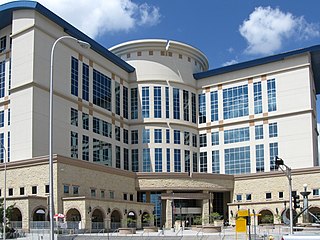
Bernalillo County is the most populous county in the U.S. state of New Mexico. As of the 2020 census, the population was 676,444. The county seat, Albuquerque, is the most populous city in New Mexico.

<span class="mw-page-title-main">White Rock, New Mexico</span> Census-designated place in New Mexico, United States

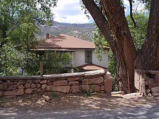
White Rock is an unincorporated community and census-designated place (CDP) in Los Alamos County, New Mexico. It is one of two major population centers in the county; the other is Los Alamos. The population was 5,725 at the 2010 census. It is largely a bedroom community for employees of Los Alamos National Laboratory and their families. Access to White Rock from the town of Los Alamos and other cities and towns in New Mexico is via New Mexico State Road 4, which forms the northwestern boundary of the community. Administratively, White Rock is a neighborhood of Los Alamos; locals refer to Los Alamos as "the Townsite," or "the Hill".

<span class="mw-page-title-main">Bernalillo, New Mexico</span> Town in New Mexico, United States

Bernalillo is a town in and the county seat of Sandoval County, New Mexico, United States. As of the 2020 census, the town population was 8,977.

<span class="mw-page-title-main">Cochiti, New Mexico</span> CDP in New Mexico, United States

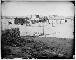
Cochiti is a census-designated place (CDP) in Sandoval County, New Mexico, United States. A historic pueblo of the Cochiti people, one of the Keresan Nations, it is part of the Albuquerque Metropolitan Statistical Area. The population was 528 at the 2010 census. Located 22 miles (35 km) southwest of Santa Fe, the community is listed as a historic district on the National Register of Historic Places.

<span class="mw-page-title-main">Jemez Springs, New Mexico</span> Village in Sandoval County, New Mexico, United States

Jemez Springs is a village in Sandoval County, New Mexico, United States. The population was 250 at the 2010 census. Named for the nearby Pueblo of Jemez, the village is the site of Jemez State Monument and the headquarters of the Jemez Ranger District. The village and nearby locations in the Jemez Valley are the site of hot springs and several religious retreats.

<span class="mw-page-title-main">Peña Blanca, New Mexico</span> CDP in New Mexico, United States

Peña Blanca is a census-designated place (CDP) in Sandoval County, New Mexico. As of the 2000 census, the CDP population was 661. It is part of the Albuquerque Metropolitan Statistical Area.

<span class="mw-page-title-main">Pueblo of Sandia Village, New Mexico</span> Village in Sandoval County, New Mexico, US

Pueblo of Sandia Village is a census-designated place (CDP) in Sandoval County, New Mexico, United States. The population was 344 at the 2000 census. It is part of the Albuquerque Metropolitan Statistical Area.

<span class="mw-page-title-main">San Felipe Pueblo, New Mexico</span> CDP in New Mexico, United States

San Felipe Pueblo is a census-designated place (CDP) in Sandoval County, New Mexico, United States, and is located 10 miles (16 km) north of Bernalillo. As of the 2000 census, the CDP population was 2,080. It is part of the Albuquerque Metropolitan Statistical Area.

<span class="mw-page-title-main">San Ysidro, Sandoval County, New Mexico</span> Village in Sandoval County, New Mexico, United States

San Ysidro is a village in Sandoval County, New Mexico, United States. The population was 193 at the 2010 census. It is part of the Albuquerque Metropolitan Statistical Area.

<span class="mw-page-title-main">Santa Ana Pueblo, New Mexico</span> CDP in New Mexico, United States

Santa Ana Pueblo is a census-designated place (CDP) in Sandoval County, New Mexico, United States. As of the 2000 census, the CDP had a total population of 479. It is part of the Albuquerque Metropolitan Statistical Area. The Pueblo, named Tamaya in Keres, administers a total reservation land of 73,000 acres (295 km2) in the Rio Grande valley and is composed of Native Americans who speak an eastern dialect of the Keresan languages.

<span class="mw-page-title-main">Zia Pueblo, New Mexico</span> CDP in New Mexico, United States

Zia Pueblo is a census-designated place (CDP) in Sandoval County, New Mexico, United States. The population was 646 at the 2000 census, with 310 males and 336 females. The pueblo after which the CDP is named is included within the CDP; it is listed on the National Register of Historic Places.

<span class="mw-page-title-main">Agua Fria, New Mexico</span> CDP in New Mexico, United States

Agua Fria is a census-designated place (CDP) in Santa Fe County, New Mexico, United States. It is part of the Santa Fe, New Mexico Metropolitan Statistical Area. The population was 2,800 at the 2010 census. Agua Fria Village is a "Traditional Historic Community" (THC) as designated by the Santa Fe Board of County Commissioners in 1995 and subsequent Santa Fe County Ordinance #1996-16, as allowed by State Statute.

<span class="mw-page-title-main">Edgewood, New Mexico</span> Town in New Mexico, United States

Edgewood is a town in Santa Fe County, New Mexico, United States. Through annexations, its town boundaries now extend into Bernalillo and Sandoval counties. It is part of the Albuquerque–Santa Fe–Las Vegas combined statistical area.

<span class="mw-page-title-main">Pojoaque, New Mexico</span> CDP in New Mexico, United States

Pojoaque, Po’su wae geh, which translates to “water gathering place”, is a census-designated place (CDP) in Santa Fe County, New Mexico, United States. It is part of the Santa Fe, New Mexico Metropolitan Statistical Area. The population was 1,907 at the 2010 census. Pojoaque Pueblo, a neighboring community, is an Indian reservation, and the town of Pojoaque is a collection of communities near the pueblo with people from various ethnic backgrounds. The area of Pojoaque includes the neighborhoods of Cuyamungue, Jacona, Jaconita, Nambé and El Rancho.

<span class="mw-page-title-main">Albuquerque–Santa Fe–Los Alamos combined statistical area</span> Combined statistical area in New Mexico, United States

The Albuquerque–Santa Fe–Los Alamos combined statistical area is made up of eight counties in north central New Mexico. The combined statistical area consists of the Albuquerque and Santa Fe metropolitan statistical areas, and the Las Vegas, Los Alamos, and Española micropolitan statistical areas. The 2013 delineations included the Grants micropolitan statistical area, but it was removed in the 2018 revisions. As of the 2020 census, the CSA had a population of 1,162,523. Roughly 56% of New Mexico's residents live in this area. Prior to the 2013 redefinitions, the CSA consisted only of the Santa Fe metropolitan statistical area and the Española micropolitan statistical area. The total land area of the Albuquerque–Santa Fe–Las Vegas combined statistical area in the 2013 definition is 26,421 sq mi (68,430 km2).

<span class="mw-page-title-main">Albuquerque metropolitan area</span> Metropolitan area in central New Mexico

The Albuquerque Metropolitan Statistical Area, sometimes referred to as Tiguex, is a metropolitan area in central New Mexico centered on the city of Albuquerque. The metro comprises four counties: Bernalillo, Sandoval, Torrance, and Valencia. As of the 2010 United States Census, the MSA had a population of 887,077. The population is estimated to be 923,630 as of July 1, 2020, making Greater Albuquerque the 61st-largest MSA in the nation. The Albuquerque MSA forms a part of the larger Albuquerque–Santa Fe–Las Vegas combined statistical area with a 2020 estimated population of 1,165,181, ranked 49th-largest in the country.

<span class="mw-page-title-main">Jemez Pueblo, New Mexico</span> CDP in New Mexico, United States

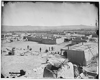
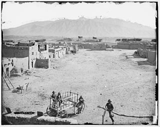
Jemez Pueblo is a census-designated place (CDP) in Sandoval County, New Mexico, United States. The population was 1,788 at the 2010 census. It is part of the Albuquerque Metropolitan Statistical Area.

References

  1. "Find a County". National Association of Counties. Retrieved June 7, 2011.
  2. "Bernalillo is now the county seat". Santa Fe New Mexican. May 8, 1905. p. 8. Retrieved April 28, 2017 via Library of Congress.
  3. "2010 Census Gazetteer Files". United States Census Bureau. August 22, 2012. Archived from the original on January 1, 2015. Retrieved January 2, 2015.
  4. "U.S. Decennial Census". United States Census Bureau. Retrieved January 2, 2015.
  5. "Historical Census Browser". University of Virginia Library. Retrieved January 2, 2015.
  6. "Population of Counties by Decennial Census: 1900 to 1990". United States Census Bureau. Retrieved January 2, 2015.
  7. "Census 2000 PHC-T-4. Ranking Tables for Counties: 1990 and 2000" (PDF). United States Census Bureau. Archived (PDF) from the original on March 27, 2010. Retrieved January 2, 2015.
  8. "State & County QuickFacts". United States Census Bureau. Retrieved September 30, 2013.
  9. "U.S. Census website". United States Census Bureau . Retrieved January 31, 2008.
  10. 1 2 3 "DP-1 Profile of General Population and Housing Characteristics: 2010 Demographic Profile Data". United States Census Bureau. Archived from the original on February 13, 2020. Retrieved January 24, 2016.
  11. "Population, Housing Units, Area, and Density: 2010 - County". United States Census Bureau. Archived from the original on February 13, 2020. Retrieved January 24, 2016.
  12. "DP02 SELECTED SOCIAL CHARACTERISTICS IN THE UNITED STATES – 2006-2010 American Community Survey 5-Year Estimates". United States Census Bureau. Archived from the original on February 13, 2020. Retrieved January 24, 2016.
  13. "DP03 SELECTED ECONOMIC CHARACTERISTICS – 2006-2010 American Community Survey 5-Year Estimates". United States Census Bureau. Archived from the original on February 13, 2020. Retrieved January 24, 2016.
  14. Leip, David. "Dave Leip's Atlas of U.S. Presidential Elections". uselectionatlas.org. Retrieved April 2, 2018.
  15. "2020 CENSUS - SCHOOL DISTRICT REFERENCE MAP: Sandoval County, NM" (PDF). U.S. Census Bureau. Archived (PDF) from the original on January 10, 2022. Retrieved July 12, 2022. - Text list

35°41′N106°51′W / 35.69°N 106.85°W / 35.69; -106.85