Related Research Articles

Maryland is a state in the Mid-Atlantic region of the United States. The state borders Virginia to its south, West Virginia to its west, Pennsylvania to its north, Delaware to its east, the Atlantic Ocean, and the national capital of Washington, D.C. With a total land area of 12,407 square miles (32,130 km2), Maryland is the ninth-smallest state by land area, and its population of 6,177,224 ranks it the 18th-most populous state and the fifth-most densely populated. Maryland's most populous city is Baltimore, and the capital is Annapolis. Occasional nicknames include Old Line State, the Free State, and the Chesapeake Bay State. It is named after Henrietta Maria, the French-born queen of England, Scotland, and Ireland during the 17th century.
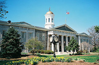
Baltimore County is the third-most populous county in the U.S. state of Maryland. It is part of the Baltimore metropolitan area.
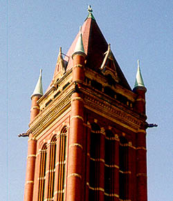
Allegany County is located in the northwestern part of the U.S. state of Maryland. As of the 2020 census, the population was 68,106. Its county seat is Cumberland. The name Allegany may come from a local Lenape word, welhik hane or oolikhanna, which means 'best flowing river of the hills' or 'beautiful stream'. A number of counties and a river in the Appalachian region of the U.S. are named Allegany, Allegheny, or Alleghany. Allegany County is part of the Cumberland metropolitan area. It is a part of the Western Maryland "panhandle".

Anne Arundel County, also notated as AA or A.A. County, is located in the U.S. state of Maryland. As of the 2020 United States census, its population was 588,261, an increase of just under 10% since 2010. Its county seat is Annapolis, which is also the capital of the state. The county is named for Anne Arundell, Lady Baltimore, a member of the ancient family of Arundells in Cornwall, England, and the wife of Cecilius Calvert, 2nd Baron Baltimore (1605–1675), founder and first lord proprietor of the colony Province of Maryland.

Cecil County is a county located in the U.S. state of Maryland at the northeastern corner of the state, bordering both Pennsylvania and Delaware. As of the 2020 census, the population was 103,725. The county seat is Elkton.

Harford County is located in the U.S. state of Maryland. As of the 2020 census, the population was 260,924. Its county seat is Bel Air. Harford County is included in the Baltimore-Columbia-Towson, MD Metropolitan Statistical Area, which is also included in the Washington-Baltimore-Arlington, DC-MD-VA-WV-PA Combined Statistical Area.

Linthicum is a census-designated place (CDP) and unincorporated community in Anne Arundel County, Maryland, United States. The population was 10,324 at the 2010 census. It is located directly north of Baltimore–Washington International Thurgood Marshall Airport (BWI).

Arbutus is an unincorporated community and a census-designated place in Baltimore County, Maryland, United States. The population was 20,483 at the 2010 census. The census area also contains the communities of Halethorpe and Relay, in which all three names were used during the 1960 census when the area had a population of 22,402.

Middle River is an unincorporated community and census-designated place in Baltimore County, Maryland, United States. The population was 33,203 at the 2020 census. A Middle River Train Station first appeared on the 1877 G.M. Hopkins & Co Baltimore County Map and by 1898 had a designated Post Office and modest street grid. The town expanded during the 1930s and 1940s and established the "Aero Acres" housing community which borders the railroad tracks and Martin Blvd. to serve as housing for people working at the Martin Aerospace Company. For this development, the architecture firm of Skidmore, Owings & Merrill designed gable-roofed Cape Cod houses with dimensions of 24 feet by 28 feet, featuring large commercial-style windows in their principal rooms. In 1941 a total of 600 homes were built at Aero Acres using this design from Cemento .[2]

Aberdeen is a city located in Harford County, Maryland, United States, 26 miles (42 km) northeast of Baltimore. The population was 16,254 at the 2020 United States Census. Aberdeen is the largest municipality in Harford County.
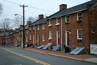
Oella is a mill town on the Patapsco River in western Baltimore County, Maryland, United States, located between Catonsville and Ellicott City. It is a 19th-century village of millworkers' homes.
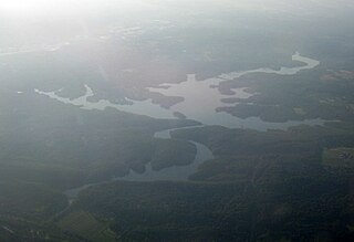
The Gunpowder River is a 6.8-mile-long (10.9 km) tidal inlet on the western side of the Chesapeake Bay in Maryland, United States. It is formed by the joining of two freshwater rivers, Gunpowder Falls and Little Gunpowder Falls.

Baltimore Highlands is a census-designated place (CDP) in Baltimore County, Maryland, United States, directly south of the city of Baltimore. The population was 7,019 at the 2010 census. At the 2000 census and earlier, the area was delineated as part of the Lansdowne-Baltimore Highlands CDP.
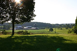
Lisbon is a census-designated place located in western Howard County in the state of Maryland, United States, located roughly between Baltimore and Frederick and north of Washington, D.C. It is contained in an area of roughly one square mile. Lisbon is located along Interstate 70 and Maryland Route 144 and is home to the first roundabout in Maryland. It first appeared as a CDP in the 2020 Census with a population of 282.

Galesville is an unincorporated town and census-designated place (CDP) in Anne Arundel County, Maryland, United States. As of the 2010 census, it had a population of 685.

The following outline is provided as an overview of and topical guide to the U.S. state of Maryland:

Gwynns Falls is a 24.9-mile-long (40.1 km) stream located in Baltimore County and Baltimore City, Maryland. Its headwaters are located in Reisterstown in Baltimore County, and the stream flows southeast, entering the city of Baltimore and emptying into the Middle Branch of the Patapsco River. The Patapsco drains into the Chesapeake Bay. The watershed area of Gwynns Falls covers 66 square miles (170 km2), with 133 miles (214 km) of streams.

Baltimore is the most populous city in the U.S. state of Maryland. With a population of 585,708 at the 2020 census, it is the 30th-most populous city in the United States. Baltimore was designated an independent city by the Constitution of Maryland in 1851, and is currently the most populous independent city in the nation. As of the 2020 census, the population of the Baltimore metropolitan area was estimated to be 2,838,327, making it the 20th-largest metropolitan area in the country. When combined with the larger Washington metropolitan area, the Washington–Baltimore combined statistical area (CSA) has a 2020 U.S. census population of 9,973,383, the third-largest in the country.
Frog Mortar Creek is a tidal creek in Baltimore County, Maryland. The creek empties into the Middle River and surrounds the northeast and southeast sides of Martin State Airport.
Botterill is an unincorporated community in Howard County, Maryland, United States. A postal office operated from 15 July 1891 to 31 March 1896.
References
- ↑ "Bird River". Geographic Names Information System . United States Geological Survey, United States Department of the Interior . Retrieved June 9, 2011.
- ↑ "Bird River Watershed". Baltimore County. Retrieved June 9, 2011.